Black Loch

Lake, Pool, Pond, Freshwater Marsh in Shetland

Scotland

Black Loch

Frozen Sand Water The loch is frozen and covered in snow, but I'm not sure what the lines on the snow were caused by - possibly they are tracks left by sheep taking a short cut across the ice.
Frozen Sand Water Credit: Mike Pennington

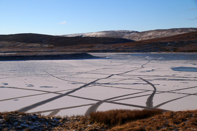
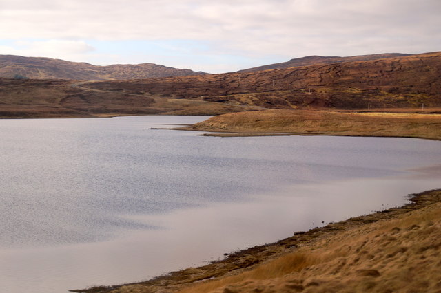
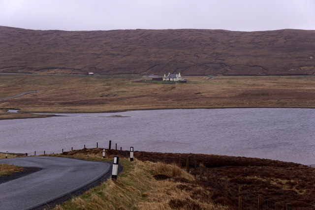
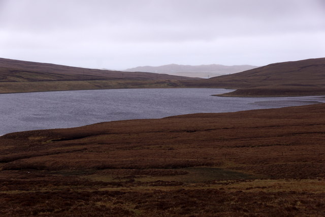
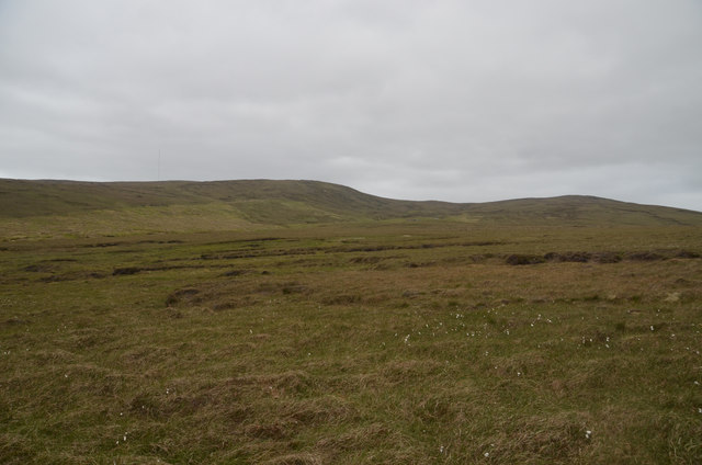
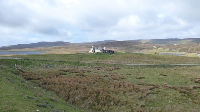
Black Loch is a picturesque freshwater loch situated in the remote and scenic region of Shetland, an archipelago in Scotland. Covering an area of approximately 3 hectares, it is surrounded by rolling green hills and stunning natural beauty. The loch is a popular destination for nature enthusiasts and photographers due to its tranquil atmosphere and diverse flora and fauna.

The water in Black Loch is remarkably clear and its depth varies, with some areas reaching up to 10 meters. The loch is fed by natural springs and streams that flow from the surrounding hills. As a result, the water remains cool and refreshing throughout the year.

The shores of Black Loch are predominantly rocky, providing an ideal habitat for various species of plants and animals. The area surrounding the loch is rich in vegetation, including heather, grasses, and mosses. This lush vegetation offers a sanctuary for numerous bird species, such as the red-throated diver, whooper swan, and goldeneye.

The loch is also home to a variety of fish, including brown trout and pike, making it a popular spot for anglers. Fishing in the loch is regulated to ensure sustainability and conservation of the fish population.

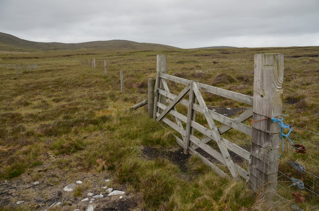
Visitors to Black Loch can enjoy a range of recreational activities, including fishing, bird watching, and hiking. The loch offers a peaceful and serene environment, making it an ideal place for relaxation and connecting with nature.

In conclusion, Black Loch in Shetland is a stunning freshwater loch surrounded by picturesque landscapes and abundant wildlife. Offering a range of recreational opportunities, it is a must-visit destination for nature lovers and those seeking tranquility in the heart of Scotland.

If you have any feedback on the listing, please let us know in the comments section below.

Black Loch Images

Images are sourced within 2km of 60.28387/-1.23118 or Grid Reference HU4255. Thanks to Geograph Open Source API. All images are credited.

Frozen Sand Water The loch is frozen and covered in snow, but I'm not sure what the lines on the snow were caused by - possibly they are tracks left by sheep taking a short cut across the ice.
Frozen Sand Water
The loch is frozen and covered in snow, but I'm not sure what the lines on the snow were caused by - possibly they are tracks left by sheep taking a short cut across the ice.
Sand Water The largest of the many Sand waters in Shetland.
Sand Water
The largest of the many Sand waters in Shetland.
Petta Dale on misty day The lichen-covered peat hags give this valley a distinctive appearance.
Petta Dale on misty day
The lichen-covered peat hags give this valley a distinctive appearance.
Sand Water, Tingwall
Moorland at Flamister, Shetland
Moorland Gateway near Flamister, South Nesting, Shetland
Croft at Flamister Croft and outbuildings at Flamister.
Croft at Flamister
Croft and outbuildings at Flamister.
Sheepfold and Dipper Sheepfold shown on OS Maps with more modern sheep dipper built onto it. Croft of Flamister in background.
Sheepfold and Dipper
Sheepfold shown on OS Maps with more modern sheep dipper built onto it. Croft of Flamister in background.
Peat Hags on Dud of Flamister Large volumes of peat have been lost here with grasses beginning to recolonize the stony till underneath. The Loch of Girlsta can be seen in the background.
Peat Hags on Dud of Flamister
Large volumes of peat have been lost here with grasses beginning to recolonize the stony till underneath. The Loch of Girlsta can be seen in the background.
Viking Energy mast One of Viking Energy's masts that dot the central mainland of Shetland.
Viking Energy mast
One of Viking Energy's masts that dot the central mainland of Shetland.
Sandwater On Whiteness.
The B9075 skirts Sand Water on the right heading for Lamba Scord and Weisdale.
Sandwater
On Whiteness. The B9075 skirts Sand Water on the right heading for Lamba Scord and Weisdale.
Antenna, Lamba Scord Communications antenna on the moorland in the Upper Kergord area.
Antenna, Lamba Scord
Communications antenna on the moorland in the Upper Kergord area.
Moorland near Catfirth A small section of the old (pre-1970s) road is just visible below the peat.
Moorland near Catfirth
A small section of the old (pre-1970s) road is just visible below the peat.
Northbound A970 near Catfirth The A970 runs for 71 miles across most of the length of the "Mainland" in the Shetland Islands. It is a good-quality single-carriageway road for most of its route. Travelling from south to north, the road begins at Grutness near Sumburgh Airport and winds around the many hills and inlets passing close to a number of small villages without going through any large ones before Lerwick. After looping around Lerwick, a short spur runs to Scalloway whilst the main route continues northwards towards Brae where it crosses the narrow isthmus of Mavis Grind. At Sandy Lochs the road splits and a four-mile spur goes through Urafirth to Hillswick. The main route continuing to the right towards its northern terminus at Isbister. This last part of the route tends to be narrower with passing places.

<span class="nowrap"><a title="https://www.sabre-roads.org.uk/wiki/index.php?title=A970" rel="nofollow ugc noopener" href="https://www.sabre-roads.org.uk/wiki/index.php?title=A970">Link</a><img style="margin-left:2px;" alt="External link" title="External link - shift click to open in new window" src="https://s1.geograph.org.uk/img/external.png" width="10" height="10"/></span>  SABRE
Northbound A970 near Catfirth
The A970 runs for 71 miles across most of the length of the "Mainland" in the Shetland Islands. It is a good-quality single-carriageway road for most of its route. Travelling from south to north, the road begins at Grutness near Sumburgh Airport and winds around the many hills and inlets passing close to a number of small villages without going through any large ones before Lerwick. After looping around Lerwick, a short spur runs to Scalloway whilst the main route continues northwards towards Brae where it crosses the narrow isthmus of Mavis Grind. At Sandy Lochs the road splits and a four-mile spur goes through Urafirth to Hillswick. The main route continuing to the right towards its northern terminus at Isbister. This last part of the route tends to be narrower with passing places. LinkExternal link SABRE
Southbound A970 near Catfirth The A970 runs for 71 miles across most of the length of the "Mainland" in the Shetland Islands. It is a good-quality single-carriageway road for most of its route. Travelling from south to north, the road begins at Grutness near Sumburgh Airport and winds around the many hills and inlets passing close to a number of small villages without going through any large ones before Lerwick. After looping around Lerwick, a short spur runs to Scalloway whilst the main route continues northwards towards Brae where it crosses the narrow isthmus of Mavis Grind. At Sandy Lochs the road splits and a four-mile spur goes through Urafirth to Hillswick. The main route continuing to the right towards its northern terminus at Isbister. This last part of the route tends to be narrower with passing places.

<span class="nowrap"><a title="https://www.sabre-roads.org.uk/wiki/index.php?title=A970" rel="nofollow ugc noopener" href="https://www.sabre-roads.org.uk/wiki/index.php?title=A970">Link</a><img style="margin-left:2px;" alt="External link" title="External link - shift click to open in new window" src="https://s1.geograph.org.uk/img/external.png" width="10" height="10"/></span>  SABRE
Southbound A970 near Catfirth
The A970 runs for 71 miles across most of the length of the "Mainland" in the Shetland Islands. It is a good-quality single-carriageway road for most of its route. Travelling from south to north, the road begins at Grutness near Sumburgh Airport and winds around the many hills and inlets passing close to a number of small villages without going through any large ones before Lerwick. After looping around Lerwick, a short spur runs to Scalloway whilst the main route continues northwards towards Brae where it crosses the narrow isthmus of Mavis Grind. At Sandy Lochs the road splits and a four-mile spur goes through Urafirth to Hillswick. The main route continuing to the right towards its northern terminus at Isbister. This last part of the route tends to be narrower with passing places. LinkExternal link SABRE
The Halfway House, Sandwater This isolated house is situated just by the junction of the B9075 with A970 at Sand Water, roughly halfway along the road from Lerwick to Voe. Known locally as the 'Half Way House', it was featured in series 3 of the TV detective series Shetland.
The Halfway House, Sandwater
This isolated house is situated just by the junction of the B9075 with A970 at Sand Water, roughly halfway along the road from Lerwick to Voe. Known locally as the 'Half Way House', it was featured in series 3 of the TV detective series Shetland.
Northbound A970 near Sandwater Junction The A970 runs for 71 miles across most of the length of the "Mainland" in the Shetland Islands. It is a good-quality single-carriageway road for most of its route. Travelling from south to north, the road begins at Grutness near Sumburgh Airport and winds around the many hills and inlets passing close to a number of small villages without going through any large ones before Lerwick. After looping around Lerwick, a short spur runs to Scalloway whilst the main route continues northwards towards Brae where it crosses the narrow isthmus of Mavis Grind. At Sandy Lochs the road splits and a four-mile spur goes through Urafirth to Hillswick. The main route continuing to the right towards its northern terminus at Isbister. This last part of the route tends to be narrower with passing places.

<span class="nowrap"><a title="https://www.sabre-roads.org.uk/wiki/index.php?title=A970" rel="nofollow ugc noopener" href="https://www.sabre-roads.org.uk/wiki/index.php?title=A970">Link</a><img style="margin-left:2px;" alt="External link" title="External link - shift click to open in new window" src="https://s1.geograph.org.uk/img/external.png" width="10" height="10"/></span>  SABRE
Northbound A970 near Sandwater Junction
The A970 runs for 71 miles across most of the length of the "Mainland" in the Shetland Islands. It is a good-quality single-carriageway road for most of its route. Travelling from south to north, the road begins at Grutness near Sumburgh Airport and winds around the many hills and inlets passing close to a number of small villages without going through any large ones before Lerwick. After looping around Lerwick, a short spur runs to Scalloway whilst the main route continues northwards towards Brae where it crosses the narrow isthmus of Mavis Grind. At Sandy Lochs the road splits and a four-mile spur goes through Urafirth to Hillswick. The main route continuing to the right towards its northern terminus at Isbister. This last part of the route tends to be narrower with passing places. LinkExternal link SABRE
Show me another place!

Black Loch is located at Grid Ref: HU4255 (Lat: 60.28387, Lng: -1.23118)

Unitary Authority: Shetland Islands

Police Authority: Highlands and Islands

What 3 Words

///landlords.fancied.standing. Near Aith, Shetland Islands

Nearby Locations

Crooka Dale Black Loch

Related Wikis

Central Mainland

The Central Mainland of the Shetland Islands is the part of the Mainland, the largest of the Shetland Islands, Scotland. It is located between Hellister...

Geopark Shetland

Geopark Shetland is the name used by the Geopark formally established in September 2009 on its entry into the European Geoparks Network. The Geopark extends...

Viking Wind Farm

Viking Wind Farm is a large on-shore wind farm under construction in the Shetland Islands which is being developed by Viking Energy, a partnership between...

RAF Catfirth

RAF Catfirth was a First World War seaplane base located on the island of Mainland in the Shetland Islands, Scotland. The base was under the control of...

Nearby Amenities

Located within 500m of 60.28387,-1.23118
Power: pole
Lat/Long: 60.2847351/-1.2395229
Power: pole
Lat/Long: 60.2854584/-1.2396535
Construction Power: generator
Generator Method: wind_turbine
Generator Output Electricity: 4.2 MW
Generator Source: wind
Generator Type: horizontal_axis
Manufacturer: Vestas
Model: V117-4.2 MW
Model Wikidata: Q117805651
Power: generator
Lat/Long: 60.2862165/-1.2348032
Construction Power: generator
Generator Method: wind_turbine
Generator Output Electricity: 4.2 MW
Generator Source: wind
Generator Type: horizontal_axis
Manufacturer: Vestas
Model: V117-4.2 MW
Model Wikidata: Q117805651
Power: generator
Lat/Long: 60.283084/-1.2302864
The data included in this document is from www.openstreetmap.org. The data is made available under ODbL.

Have you been to Black Loch?

Leave your review of Black Loch below (or comments, questions and feedback).