Stockton Reservoir
Lake, Pool, Pond, Freshwater Marsh in Warwickshire Stratford-on-Avon
England
Stockton Reservoir
The requested URL returned error: 429 Too Many Requests
If you have any feedback on the listing, please let us know in the comments section below.
Stockton Reservoir Images
Images are sourced within 2km of 52.276923/-1.378493 or Grid Reference SP4264. Thanks to Geograph Open Source API. All images are credited.


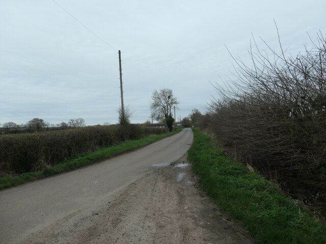
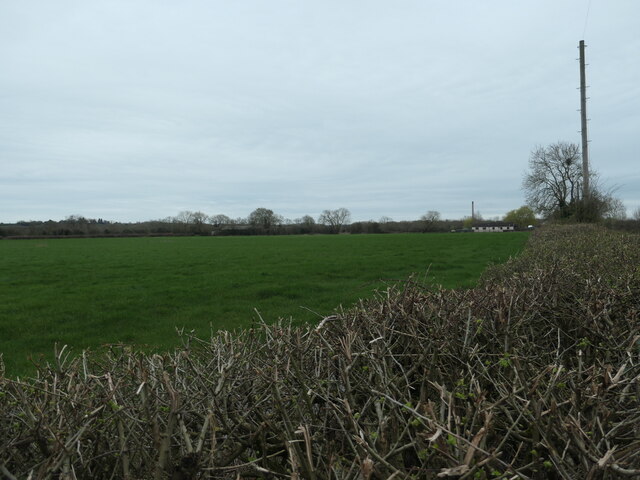
![Boundary hedge, east of Collingham Lane The hedge stretching away from the photographer is not just a field boundary. It also marks the boundary between two unitary authorities - Rugby on this side [north] and Stratford upon Avon on the far side [south]. Both districts are in Warwickshire.](https://s2.geograph.org.uk/geophotos/07/73/00/7730054_ae46fdad.jpg)
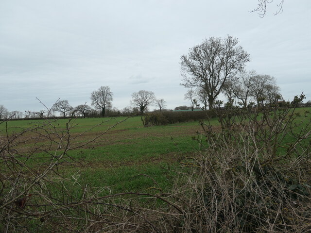
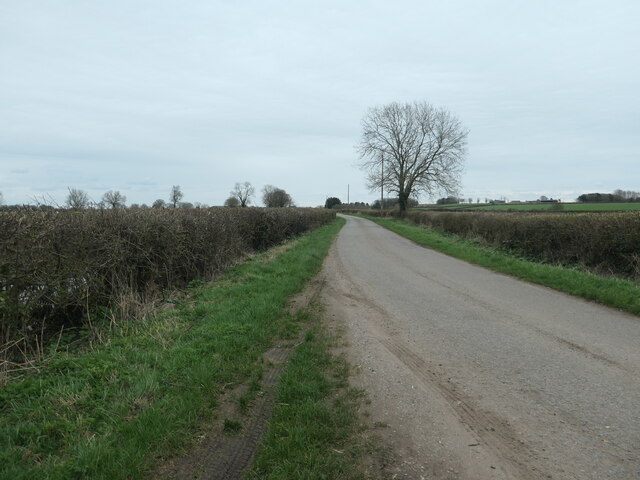
![Boundary hedge, west of Collingham Lane The hedge stretching away from the photographer is not just a field boundary. It also marks the boundary between two unitary authorities - Rugby on this side [north] and Stratford upon Avon on the far side [south]. Both districts are in Warwickshire.](https://s2.geograph.org.uk/geophotos/07/73/00/7730062_039881f7.jpg)
Stockton Reservoir is located at Grid Ref: SP4264 (Lat: 52.276923, Lng: -1.378493)
Administrative County: Warwickshire
District: Stratford-on-Avon
Police Authority: Warwickshire
What 3 Words
///class.held.eradicate. Near Long Itchington, Warwickshire
Nearby Locations
Related Wikis

Southam and Long Itchington railway station
Southam and Long Itchington railway station was a railway station on the Weedon to Leamington Spa branch line that served the town of Southam and the village...

Long Itchington
Long Itchington is a large village and civil parish in Warwickshire, England, which at the 2011 Census had a population of 2,013. The village is named...
Stockton, Warwickshire
Stockton is a village and civil parish in the Stratford-on-Avon district of Warwickshire, England, with a population of 1,505 at the 2021 Census. It is...

Napton and Stockton railway station
Napton and Stockton railway station was a railway station on the London and North Western Railway branch line between Weedon and Leamington Spa. The station...
Nearby Amenities
Located within 500m of 52.276923,-1.378493Have you been to Stockton Reservoir?
Leave your review of Stockton Reservoir below (or comments, questions and feedback).