McGregor's Pond

Lake, Pool, Pond, Freshwater Marsh in Derbyshire Chesterfield

England

McGregor's Pond

Chesterfield Roundabout Main road in Chesterfield.
Chesterfield Roundabout Credit: Wayland Smith

McGregor's Pond, located in Derbyshire, England, is a picturesque freshwater pond nestled amidst the rolling hills and lush greenery of the countryside. Spread over an area of approximately 2 acres, the pond is a popular destination for locals and tourists alike, seeking tranquility and natural beauty.

The pond, also known as McGregor's Lake or McGregor's Pool, is surrounded by a diverse range of vegetation, including reeds, water lilies, and various types of aquatic plants, which provide a habitat for a rich assortment of wildlife. It is home to numerous species of fish, such as common carp, roach, and perch, making it a favored spot for fishing enthusiasts.

The calm, crystal-clear waters of McGregor's Pond offer a serene environment for recreational activities like boating and kayaking. Visitors can rent boats or bring their own to explore the pond's gentle currents and admire the surrounding scenery. The pond's shallow edges also make it suitable for swimming, particularly on warm summer days.

In addition to its recreational offerings, McGregor's Pond plays an essential role in the local ecosystem. It serves as a freshwater marsh, providing a habitat for various bird species, including ducks, swans, and herons. Birdwatchers often flock to the pond to observe these magnificent creatures in their natural habitat.

McGregor's Pond is easily accessible, with parking facilities available nearby. It offers a tranquil escape from the bustling city life, providing visitors with an opportunity to connect with nature and enjoy the peaceful ambiance of the Derbyshire countryside.

If you have any feedback on the listing, please let us know in the comments section below.

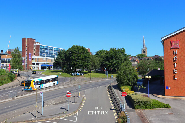
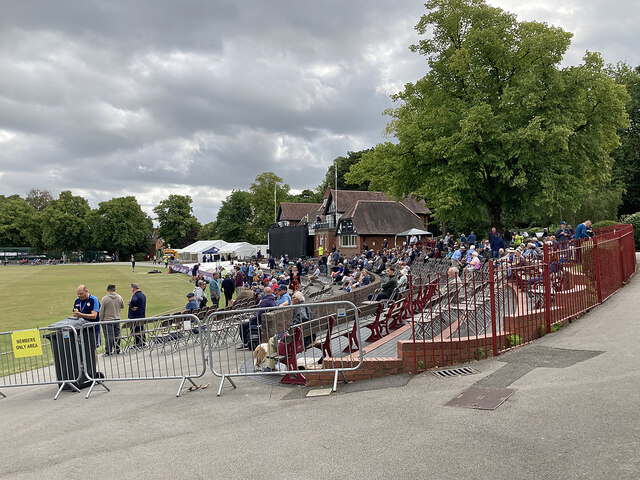
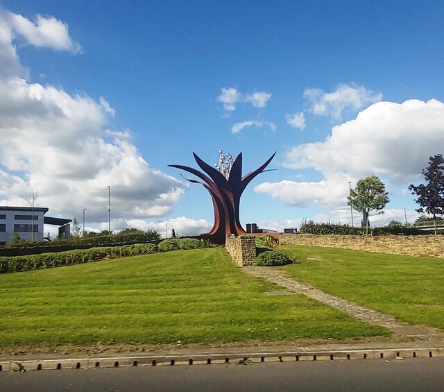
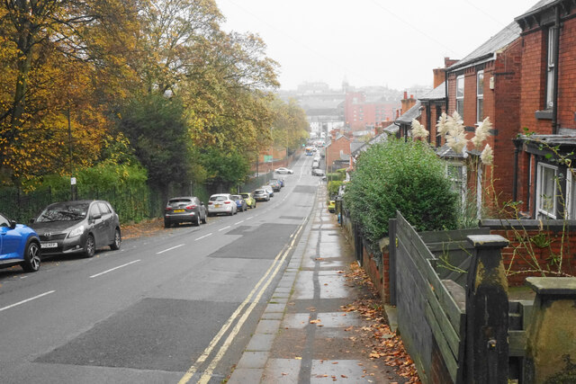
McGregor's Pond Images

Images are sourced within 2km of 53.215651/-1.4228166 or Grid Reference SK3868. Thanks to Geograph Open Source API. All images are credited.

Chesterfield Roundabout Main road in Chesterfield.
Chesterfield Roundabout
Main road in Chesterfield.
Cricket at Queen's Park: members' enclosure Twenty minutes before the One Day Cup match between Derbyshire and Yorkshire began there was already a good crowd at one of the country's most delightful grounds. This is the members' enclosure next to the fine Victorian pavilion. A pitch of variable bounce, though, was not to the liking of batters, and Yorkshire won a tense, low-scoring encounter by the narrowest of margins: Derbyshire 109, Yorkshire 110 for 9.
Cricket at Queen's Park: members' enclosure
Twenty minutes before the One Day Cup match between Derbyshire and Yorkshire began there was already a good crowd at one of the country's most delightful grounds. This is the members' enclosure next to the fine Victorian pavilion. A pitch of variable bounce, though, was not to the liking of batters, and Yorkshire won a tense, low-scoring encounter by the narrowest of margins: Derbyshire 109, Yorkshire 110 for 9.
Horns Bridge Roundabout - Chesterfield
Park Road Heading towards the centre of Chesterfield on a misty autumn day. Queen's Park is on the left and the dip is the valley of the River Hipper.
Park Road
Heading towards the centre of Chesterfield on a misty autumn day. Queen's Park is on the left and the dip is the valley of the River Hipper.
The end of Matlock Road The A632 take a left turn here, though there are not many signs to tell you. The entrance to Chesterfield Golf Club is on the right.
The end of Matlock Road
The A632 take a left turn here, though there are not many signs to tell you. The entrance to Chesterfield Golf Club is on the right.
Churchyard of All Saints, Wingerworth
Lych gate at All Saints, Wingerworth The church is Grade I listed but the lych gate does not appear to have historical significance.
Lych gate at All Saints, Wingerworth
The church is Grade I listed but the lych gate does not appear to have historical significance.
Longedge Lane Almost the highest point in the village.
Longedge Lane
Almost the highest point in the village.
All Saints Church, Wingerworth The church is Grade I listed, with the oldest part dating from the 12th Century. It has had additions at numerous times since, including the extension seen here which was built in 1964.
All Saints Church, Wingerworth
The church is Grade I listed, with the oldest part dating from the 12th Century. It has had additions at numerous times since, including the extension seen here which was built in 1964.
Hunloke Arms A part of Wingerworth on the A61. Most of it is to the west. This was a wet day.
Hunloke Arms
A part of Wingerworth on the A61. Most of it is to the west. This was a wet day.
Hornbeam Drive A new road providing access to The Avenue, a large new housing development on a brown field site, a former coking plant. It is viewed in rain.
Hornbeam Drive
A new road providing access to The Avenue, a large new housing development on a brown field site, a former coking plant. It is viewed in rain.
Path down to the River Rother Some flood alleviation works have been undertaken in the valley.
Path down to the River Rother
Some flood alleviation works have been undertaken in the valley.
River Rother near Wingerworth Flood alleviation works have been undertaken, linked to remediation of the nearby former Avenue coking works.
River Rother near Wingerworth
Flood alleviation works have been undertaken, linked to remediation of the nearby former Avenue coking works.
Path to Wingerworth The path has to cross the valley of the River Rother.
Path to Wingerworth
The path has to cross the valley of the River Rother.
River Rother near Wingerworth The river is flowing under the Midland Main Line.
River Rother near Wingerworth
The river is flowing under the Midland Main Line.
River Rother near Wingerworth Meandering through farmland and scrub in the bottom of the valley.
River Rother near Wingerworth
Meandering through farmland and scrub in the bottom of the valley.
Prepared field above the River Rother Hasland Cemetery is seen further up the hill. Falling rain is also visible.
Prepared field above the River Rother
Hasland Cemetery is seen further up the hill. Falling rain is also visible.
Bridge over the River Rother An established farm track in the Avenue valley.
Bridge over the River Rother
An established farm track in the Avenue valley.
Show me another place!

McGregor's Pond is located at Grid Ref: SK3868 (Lat: 53.215651, Lng: -1.4228166)

Administrative County: Derbyshire

District: Chesterfield

Police Authority: Derbyshire

What 3 Words

///deflection.reef.thinks. Near Wingerworth, Derbyshire

Related Wikis

Birdholme

Birdholme is a suburb of the town of Chesterfield, Derbyshire, England. To its south is Wingerworth, to its north is the town centre, to its west is Boythorpe...

St Paul's Church, Hasland

St Paul's Church, Hasland is a Grade II listed parish church in the Church of England: 150  in Hasland, Derbyshire. == History == The church was built...

Outwood Academy Hasland Hall

Outwood Academy Hasland Hall (formerly Hasland Hall Community School) is a co-educational secondary school situated in Hasland, a village in Chesterfield...

Hasland

Hasland is a suburb of Chesterfield in the Borough of Chesterfield in Derbyshire, England. Hasland is located south of Spital, east of Birdholme and north...

All Saints' Church, Wingerworth

All Saints’ Church, Wingerworth is a Grade I listed parish church in the Church of England in Wingerworth, Derbyshire. == History == The church dates from...
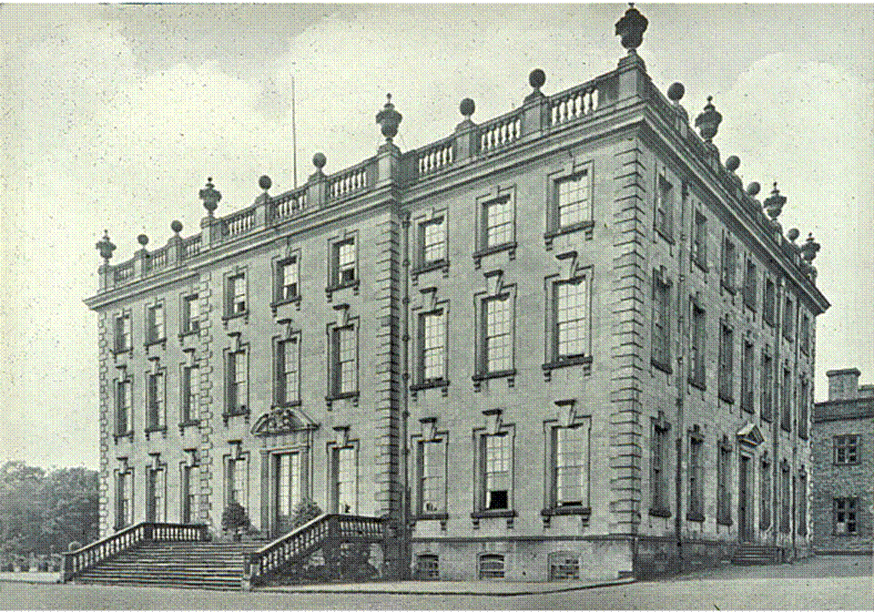
Wingerworth Hall

Wingerworth Hall, demolished 1927, was the ancestral home of the Hunloke family in the village of Wingerworth, Derbyshire, England. It was built on an...

Boythorpe

Boythorpe is a small suburb to the south-west of Chesterfield town centre in Derbyshire, England. It also borders Birdholme to its east, and Walton to...
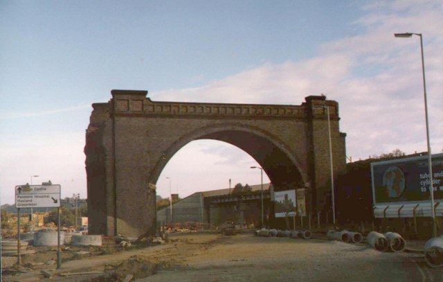
Horns Bridge

Horns Bridge is a small area on the southeastern edge of Chesterfield, Derbyshire, England which was remarkable at one time for its congested intersection...

Nearby Amenities

Located within 500m of 53.215651,-1.4228166
Note: 30 mph speed limit sign northbound
Lat/Long: 53.2156096/-1.4275952
Barrier: motorcycle_barrier
Lat/Long: 53.2138529/-1.4173747
Barrier: stile
Lat/Long: 53.2167849/-1.4162213
Ele: 99.3812256
Lat/Long: 53.2155027/-1.4160274
Post Box
Collection Times: Mo-Fr 09:00, Sa 07:00
Ele: 95.7763672
Operator: Royal Mail
Operator Wikidata: Q638098
Post Box Type: wall
Ref: S40 242
Royal Cypher: EIIR
Royal Cypher Wikidata: Q33102113
Lat/Long: 53.2171089/-1.4283381
Turning Circle
Lat/Long: 53.2188811/-1.4264543
Bus Stop
Bus: yes
Ele: 78.4727783
Naptan AtcoCode: 1000DBSL2543
Naptan NaptanCode: dbsgjmtj
Public Transport: platform
Shelter: no
Lat/Long: 53.219924/-1.4232209
Bus Stop
Langfield Avenue
Bus: yes
Ele: 93
Naptan AtcoCode: 1000DBLL3030
Naptan NaptanCode: dbsgjwdg
Public Transport: platform
Shelter: yes
Tactile Paving: no
Lat/Long: 53.2171032/-1.4294139
Bus Stop
Langer Lane
Bus: yes
Ele: 92
Public Transport: platform
Shelter: no
Tactile Paving: no
Lat/Long: 53.2178125/-1.42814
Bus Stop
Langer Lane, Derby Road
Bus: yes
Ele: 93
Naptan AtcoCode: 1000DBLL2928
Naptan NaptanCode: dbsgjwda
Public Transport: platform
Shelter: no
Tactile Paving: no
Lat/Long: 53.2171467/-1.428776
Crossing
Crossing: unmarked
Crossing Island: yes
Crossing Markings: no
Tactile Paving: yes
Lat/Long: 53.2173009/-1.4283343
Bus Stop
Langer Lane
Bus: yes
Departures Board: realtime
Public Transport: platform
Shelter: yes
Tactile Paving: no
Lat/Long: 53.2164904/-1.428054
Wolseley
Brand: Wolseley
Brand Wikidata: Q8030423
Shop: trade
Trade: plumbing
Website: https://www.wolseley.co.uk/branch/chesterfield/
Lat/Long: 53.2198071/-1.4229435
Wolseley
Brand: Wolseley
Brand Wikidata: Q8030423
Shop: trade
Trade: plumbing
Lat/Long: 53.2198038/-1.4231205
Trim Centre
Shop: car_parts
Lat/Long: 53.2198649/-1.4244133
ATI Tyres
Shop: tyres
Lat/Long: 53.2198617/-1.4243007
Rachel Skeemer
Craft: counsellor
Source: survey
Lat/Long: 53.2185049/-1.4282197
Barrier: horse_stile
Lat/Long: 53.2138618/-1.4173865
Generator Method: photovoltaic
Generator Output Electricity: yes
Generator Source: solar
Generator Type: solar_photovoltaic_panel
Location: roof
Power: generator
Lat/Long: 53.2168974/-1.4162385
Generator Method: photovoltaic
Generator Output Electricity: yes
Generator Source: solar
Generator Type: solar_photovoltaic_panel
Location: roof
Power: generator
Lat/Long: 53.217323/-1.4175099
Generator Method: photovoltaic
Generator Output Electricity: yes
Generator Source: solar
Generator Type: solar_photovoltaic_panel
Location: roof
Power: generator
Lat/Long: 53.2176699/-1.4173141
Generator Method: photovoltaic
Generator Output Electricity: yes
Generator Source: solar
Generator Type: solar_photovoltaic_panel
Location: roof
Power: generator
Lat/Long: 53.2179028/-1.4177755
Generator Method: photovoltaic
Generator Output Electricity: yes
Generator Source: solar
Generator Type: solar_photovoltaic_panel
Location: roof
Power: generator
Lat/Long: 53.2179349/-1.4175743
Generator Method: photovoltaic
Generator Output Electricity: yes
Generator Source: solar
Generator Type: solar_photovoltaic_panel
Location: roof
Power: generator
Lat/Long: 53.2179703/-1.4173946
Generator Method: photovoltaic
Generator Output Electricity: yes
Generator Source: solar
Generator Type: solar_photovoltaic_panel
Location: roof
Power: generator
Lat/Long: 53.2176844/-1.4161769
Crossing
Crossing: unmarked
Crossing Island: yes
Crossing Markings: no
Tactile Paving: yes
Lat/Long: 53.2171335/-1.428165
Generator Method: photovoltaic
Generator Output Electricity: yes
Generator Source: solar
Generator Type: solar_photovoltaic_panel
Location: roof
Power: generator
Lat/Long: 53.2180484/-1.4170707
Generator Method: photovoltaic
Generator Output Electricity: yes
Generator Source: solar
Generator Type: solar_photovoltaic_panel
Location: roof
Power: generator
Lat/Long: 53.218437/-1.417465
Generator Method: photovoltaic
Generator Output Electricity: yes
Generator Source: solar
Generator Type: solar_photovoltaic_panel
Location: roof
Power: generator
Lat/Long: 53.2188193/-1.4193452
Generator Method: photovoltaic
Generator Output Electricity: yes
Generator Source: solar
Generator Type: solar_photovoltaic_panel
Location: roof
Power: generator
Lat/Long: 53.219545/-1.4195137
Generator Method: photovoltaic
Generator Output Electricity: yes
Generator Source: solar
Generator Type: solar_photovoltaic_panel
Location: roof
Power: generator
Lat/Long: 53.2195353/-1.4195807
Direction: 190
Generator Method: photovoltaic
Generator Output Electricity: yes
Generator Solar Modules: 120
Generator Source: solar
Generator Type: solar_photovoltaic_panel
Location: roof
Power: generator
Lat/Long: 53.2185612/-1.4277506
Direction: SSE
Generator Method: photovoltaic
Generator Output Electricity: yes
Generator Solar Modules: 12
Generator Source: solar
Generator Type: solar_photovoltaic_panel
Location: roof
Power: generator
Lat/Long: 53.2167666/-1.4298492
Bus Stop
Birdholme Farm
Naptan AtcoCode: 1000DBDR6448
Naptan NaptanCode: dbsjagpw
Public Transport: platform
Lat/Long: 53.2124395/-1.4263304
Traffic Calming: hump
Lat/Long: 53.2159313/-1.4288476
Bench
Lat/Long: 53.2173154/-1.4179652
Bench
Lat/Long: 53.2192526/-1.4187524
Bus Stop
Bus: yes
Naptan AtcoCode: 1000DBSL2709
Naptan NaptanCode: dbsgjmtm
Public Transport: platform
Lat/Long: 53.2200821/-1.4225927
Location Transition: yes
Power: pole
Lat/Long: 53.2152929/-1.4279088
Power: pole
Lat/Long: 53.2151644/-1.4289174
Power: pole
Lat/Long: 53.2150472/-1.4298803
The data included in this document is from www.openstreetmap.org. The data is made available under ODbL.

Have you been to McGregor's Pond?

Leave your review of McGregor's Pond below (or comments, questions and feedback).