Stubbs Pool Fish Pond

Lake, Pool, Pond, Freshwater Marsh in Warwickshire Nuneaton and Bedworth

England

Stubbs Pool Fish Pond

Site of former Stanley's Brickworks This picture was taken from the top of a mound at the bottom of Cambridge Drive, looking north-west towards Montana Walk. This landscaped green stretch of mounds and hollows, surrounded by housing developments dating from the 1980s-90s, is what has become of the land formerly occupied by Stanley's brickworks, whose factory was a little further to the east, just south of Croft School.
Site of former Stanley's Brickworks Credit: Steve Courtney

Stubbs Pool Fish Pond is a well-known freshwater feature located in Warwickshire, England. It is a popular destination for both locals and tourists due to its picturesque setting and diverse range of aquatic life.

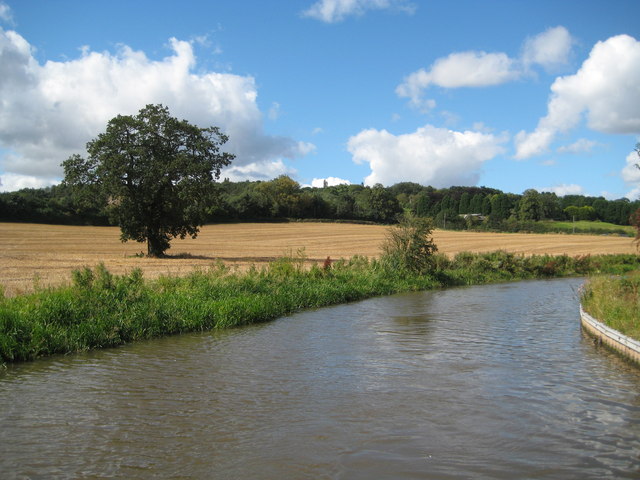
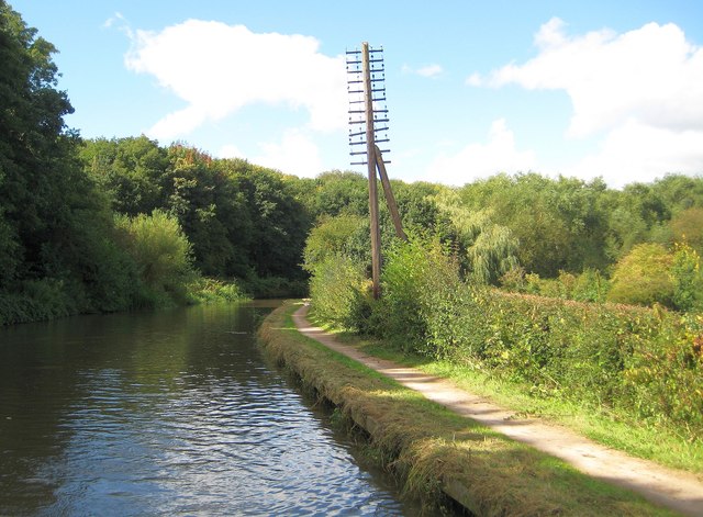
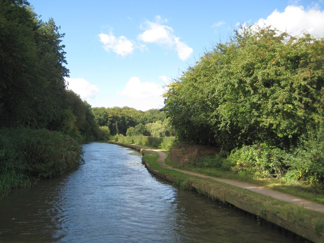
Covering an area of approximately 2 acres, Stubbs Pool Fish Pond is classified as a lake, pool, pond, and freshwater marsh, as it exhibits characteristics of all four water bodies. It is situated within a lush natural landscape, surrounded by dense vegetation, creating a serene and tranquil atmosphere.

The pond is primarily fed by natural springs and rainfall, ensuring a constant supply of fresh water. Its depth varies from shallow areas, perfect for wading and birdwatching, to deeper sections that support a thriving fish population. The pond's water quality is excellent, making it an ideal habitat for a wide variety of fish species, including carp, roach, perch, and tench.

In addition to its diverse fish population, Stubbs Pool Fish Pond also provides a habitat for numerous waterfowl species such as ducks, swans, and herons. The surrounding marshland offers a haven for wetland plants and attracts various insects and amphibians.

Visitors to Stubbs Pool Fish Pond can enjoy fishing, birdwatching, and peaceful walks along the water's edge. The pond is equipped with fishing platforms and benches, providing convenient spots for anglers and those who simply wish to observe the abundant wildlife.

In summary, Stubbs Pool Fish Pond is a charming freshwater feature nestled in the heart of Warwickshire. With its diverse aquatic life, stunning natural surroundings, and recreational activities, it offers a delightful experience for nature enthusiasts and those seeking a tranquil escape.

If you have any feedback on the listing, please let us know in the comments section below.

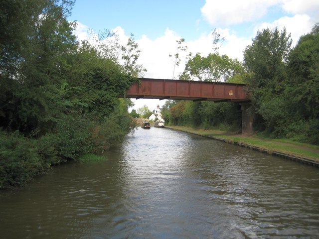
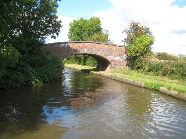
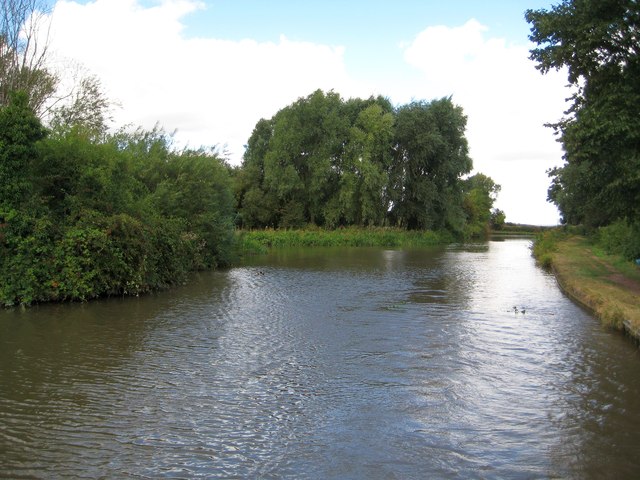
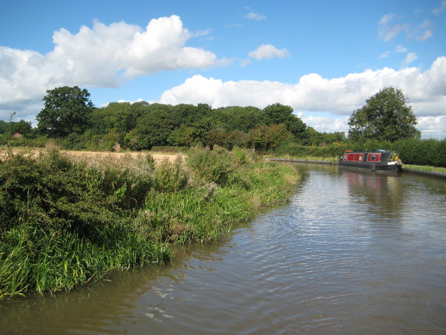
Stubbs Pool Fish Pond Images

Images are sourced within 2km of 52.534338/-1.5040987 or Grid Reference SP3393. Thanks to Geograph Open Source API. All images are credited.

Site of former Stanley's Brickworks This picture was taken from the top of a mound at the bottom of Cambridge Drive, looking north-west towards Montana Walk. This landscaped green stretch of mounds and hollows, surrounded by housing developments dating from the 1980s-90s, is what has become of the land formerly occupied by Stanley's brickworks, whose factory was a little further to the east, just south of Croft School.
Site of former Stanley's Brickworks
This picture was taken from the top of a mound at the bottom of Cambridge Drive, looking north-west towards Montana Walk. This landscaped green stretch of mounds and hollows, surrounded by housing developments dating from the 1980s-90s, is what has become of the land formerly occupied by Stanley's brickworks, whose factory was a little further to the east, just south of Croft School.
Costcutters, Whittleford Road, Whittleford
Kingswood Road, Whittleford
Croft Road bridges the Coventry Canal
Croft Road from the canal bridge
Manor Court Road
Manor Court Road
Wash Lane Bridge over the Coventry Canal, Nuneaton Wash Lane Bridge, carries the B4102 over the Coventry Canal to the east of Nuneaton Town Centre; it's designated number is 21 and an iron plate above the centre of the bridge arch carries that number.
Wash Lane Bridge over the Coventry Canal, Nuneaton
Wash Lane Bridge, carries the B4102 over the Coventry Canal to the east of Nuneaton Town Centre; it's designated number is 21 and an iron plate above the centre of the bridge arch carries that number.
Boatyard beside Coventry Canal The boatyard adjacent to the main line of the Coventry Canal is north-west of the town centre of Nuneaton. The image was recorded from bridge No. 27, 'Wood Bridge'. The boats tied up there are all narrow boats; barges would be wider and wouldn't fit the narrow canal anyway.
Boatyard beside Coventry Canal
The boatyard adjacent to the main line of the Coventry Canal is north-west of the town centre of Nuneaton. The image was recorded from bridge No. 27, 'Wood Bridge'. The boats tied up there are all narrow boats; barges would be wider and wouldn't fit the narrow canal anyway.
Farmland near Caldecote
Farmland in the Anker Valley
Coventry Canal: Former Hartshill Quarries railway bridge Granite was quarried at Hartshill. This railway bridge is not shown on the 1903 Ordnance Survey map but was present in the 1914 edition. By the time that the 1959 edition was published the railway itself had evidently been lifted, so the bridge has already survived without the railway for approximately the same amount of time that it did have one.
Coventry Canal: Former Hartshill Quarries railway bridge
Granite was quarried at Hartshill. This railway bridge is not shown on the 1903 Ordnance Survey map but was present in the 1914 edition. By the time that the 1959 edition was published the railway itself had evidently been lifted, so the bridge has already survived without the railway for approximately the same amount of time that it did have one.
Coventry Canal: Bridge Number 28: White House Farm Bridge This bridge is another farmers' bridge and very similar in style to <a href="https://www.geograph.org.uk/photo/3144685">SP3295 : Coventry Canal: Bridge Number 33: Stoneleigh Glebe Farm Bridge</a> which is a Listed Structure whereas this one is not.
Coventry Canal: Bridge Number 28: White House Farm Bridge
This bridge is another farmers' bridge and very similar in style to SP3295 : Coventry Canal: Bridge Number 33: Stoneleigh Glebe Farm Bridge which is a Listed Structure whereas this one is not.
Coventry Canal: Hartshill winding hole This is an unintended and poor quality copy of Roger's <a href="https://www.geograph.org.uk/photo/2141416">SP3494 : Coventry Canal north-west of Nuneaton, Warwickshire</a> the duplication being remarkable since both were evidently taken from the stern of a moving boat! Roger's fine description tells you all you need to know.
Coventry Canal: Hartshill winding hole
This is an unintended and poor quality copy of Roger's SP3494 : Coventry Canal north-west of Nuneaton, Warwickshire the duplication being remarkable since both were evidently taken from the stern of a moving boat! Roger's fine description tells you all you need to know.
Coventry Canal: Reach east of Caldecote Hill (1) Although some areas close to the canal through here were subject to quarrying some views retain their agricultural nature.
Coventry Canal: Reach east of Caldecote Hill (1)
Although some areas close to the canal through here were subject to quarrying some views retain their agricultural nature.
Coventry Canal: Reach east of Caldecote Hill (2) The solitary oak tree would be the last remnant of an old hedgerow that has been grubbed out.
Coventry Canal: Reach east of Caldecote Hill (2)
The solitary oak tree would be the last remnant of an old hedgerow that has been grubbed out.
Coventry Canal: Reach north of Judkins Granite Quarry The telegraph pole is a once common but now an historical oddity and seems to have been overlooked when all the rest in the line were taken down.
Coventry Canal: Reach north of Judkins Granite Quarry
The telegraph pole is a once common but now an historical oddity and seems to have been overlooked when all the rest in the line were taken down.
Coventry Canal: Site of former Bridge Number 25 Bridge Number 25 was once a farmers' bridge enabling access between the fields on either side of the canal. However with the development of Judkins Quarry to the south, left side, the fields on that side were lost and the bridge lost its purpose. The arch was subsequently demolished and only the abutments and narrowing of the canal remain.
Coventry Canal: Site of former Bridge Number 25
Bridge Number 25 was once a farmers' bridge enabling access between the fields on either side of the canal. However with the development of Judkins Quarry to the south, left side, the fields on that side were lost and the bridge lost its purpose. The arch was subsequently demolished and only the abutments and narrowing of the canal remain.
Coventry Canal: Reach north of Nuneaton Bridge Number 24 and the Canal Cottage are in the distance.
Coventry Canal: Reach north of Nuneaton
Bridge Number 24 and the Canal Cottage are in the distance.
Show me another place!

Stubbs Pool Fish Pond is located at Grid Ref: SP3393 (Lat: 52.534338, Lng: -1.5040987)

Administrative County: Warwickshire

District: Nuneaton and Bedworth

Police Authority: Warwickshire

What 3 Words

///nurse.rank.palm. Near Hartshill, Warwickshire

Nearby Locations

Stubbs Pool Fish Pond

Related Wikis

Camp Hill, Nuneaton

Camp Hill is a suburb of the town of Nuneaton in Warwickshire located around 1.5 miles (2.4 km) north-west of the town centre. It is also a ward of Nuneaton...

St Anne's, Chapel End, Nuneaton

The Roman Catholic parish of St Anne, Nuneaton, in Warwickshire, England, serves the western side of Nuneaton and outlying villages towards Coleshill....

Whittleford Park

Whittleford Park is a 43 hectare greenspace located between Stockingford and Camp Hill in Nuneaton, Warwickshire. Although its development as a public...

Jee's Harts Hill Granite and Brick Company's works railways

Jee's Harts Hill Granite and Brick Company's works railways consisted of a narrow gauge light railway and a standard gauge works railway at Hartshill station...

Nearby Amenities

Located within 500m of 52.534338,-1.5040987
Mini Roundabout
Lat/Long: 52.5317129/-1.5056487
Bus Stop
Mancetter Road
Bench: no
Bus: yes
Naptan AtcoCode: 4200F127611
Naptan Bearing: E
Naptan CommonName: Mancetter Road
Naptan Crossing: Mancetter Road
Naptan Indicator: Adj
Naptan NaptanCode: warawtmw
Naptan PlusbusZoneRef: NNTN
Naptan Street: Camp Hill Road
Naptan Verified: no
Public Transport: platform
Shelter: no
Source: naptan_import
Lat/Long: 52.5354925/-1.5000756
Bus Stop
Walnut Close
Bus: yes
Naptan AtcoCode: 4200F129801
Naptan Bearing: NW
Naptan CommonName: Walnut Close
Naptan Indicator: Adj
Naptan NaptanCode: warapgpj
Naptan PlusbusZoneRef: NNTN
Naptan Street: Tuttle Hill
Naptan Verified: no
Public Transport: platform
Source: naptan_import
Lat/Long: 52.5342838/-1.4969396
Bus Stop
Walnut Close
Bus: yes
Naptan AtcoCode: 4200F129802
Naptan Bearing: SE
Naptan CommonName: Walnut Close
Naptan Indicator: Opp
Naptan NaptanCode: warapgpm
Naptan PlusbusZoneRef: NNTN
Naptan Street: Tuttle Hill
Naptan Verified: no
Public Transport: platform
Source: naptan_import
Lat/Long: 52.5343911/-1.4968742
Bus Stop
Tuttle Hill
Bench: no
Bus: yes
Naptan AtcoCode: 4200F129901
Naptan Bearing: W
Naptan CommonName: Tuttle Hill
Naptan Indicator: Nr
Naptan NaptanCode: warapgtg
Naptan PlusbusZoneRef: NNTN
Naptan Street: Camp Hill Road
Naptan Verified: no
Public Transport: platform
Shelter: no
Source: naptan_import
Lat/Long: 52.5353308/-1.5001069
Bus Stop
Arlon Avenue
Bench: yes
Bus: yes
Naptan AtcoCode: 4200F130001
Naptan Bearing: W
Naptan CommonName: Arlon Avenue
Naptan Crossing: Arlon Avenue
Naptan Indicator: Opp
Naptan NaptanCode: warapgwa
Naptan PlusbusZoneRef: NNTN
Naptan Street: Camp Hill Road
Naptan Verified: no
Public Transport: platform
Shelter: yes
Source: naptan_import
Lat/Long: 52.535715/-1.5038179
Bus Stop
Camp Hill Drive
Bench: no
Bus: yes
Naptan AtcoCode: 4200F130002
Naptan Bearing: E
Naptan CommonName: Camp Hill Drive
Naptan Crossing: Camp Hill Drive
Naptan Indicator: Opp
Naptan NaptanCode: warapgwd
Naptan PlusbusZoneRef: NNTN
Naptan Street: Camp Hill Road
Naptan Verified: no
Public Transport: platform
Shelter: no
Source: naptan_import
Lat/Long: 52.5357512/-1.5026992
Bus Stop
Craddock Drive
Bench: no
Bus: yes
Naptan AtcoCode: 4200F130101
Naptan Bearing: W
Naptan CommonName: Craddock Drive
Naptan Crossing: Craddock Drive
Naptan Indicator: Adj
Naptan NaptanCode: warapjad
Naptan PlusbusZoneRef: NNTN
Naptan Street: Camp Hill Road
Naptan Verified: no
Public Transport: platform
Shelter: no
Source: naptan_import
Lat/Long: 52.5363251/-1.5099885
Bus Stop
Craddock Drive
Bench: no
Bus: yes
Naptan AtcoCode: 4200F130102
Naptan Bearing: E
Naptan CommonName: Craddock Drive
Naptan Crossing: Craddock Drive
Naptan Indicator: Opp
Naptan NaptanCode: warapjag
Naptan PlusbusZoneRef: NNTN
Naptan Street: Camp Hill Road
Naptan Verified: no
Public Transport: platform
Shelter: no
Source: naptan_import
Lat/Long: 52.5363459/-1.5091107
Bus Stop
Drayton Way
Bench: yes
Bus: yes
Naptan AtcoCode: 4200F133001
Naptan Bearing: S
Naptan CommonName: Drayton Way
Naptan Indicator: Opp
Naptan NaptanCode: warawdwa
Naptan PlusbusZoneRef: NNTN
Naptan Street: Craddock Drive
Naptan Verified: no
Public Transport: platform
Shelter: yes
Source: naptan_import
Lat/Long: 52.5352719/-1.5096759
Bus Stop
Drayton Way
Bench: yes
Bus: yes
Naptan AtcoCode: 4200F133002
Naptan Bearing: N
Naptan CommonName: Drayton Way
Naptan Indicator: Adj
Naptan NaptanCode: warawdwd
Naptan PlusbusZoneRef: NNTN
Naptan Street: Craddock Drive
Naptan Verified: no
Public Transport: platform
Shelter: yes
Source: naptan_import
Lat/Long: 52.535219/-1.5099271
Bus Stop
Green Lane
Bench: yes
Bus: yes
Naptan AtcoCode: 4200F133101
Naptan Bearing: S
Naptan CommonName: Green Lane
Naptan Indicator: Nr
Naptan NaptanCode: warawdwp
Naptan PlusbusZoneRef: NNTN
Naptan Street: Ramsden Avenue
Naptan Verified: no
Public Transport: platform
Shelter: yes
Source: naptan_import
Lat/Long: 52.5345892/-1.507649
Bus Stop
Green Lane
Bench: yes
Bus: yes
Naptan AtcoCode: 4200F133102
Naptan Bearing: N
Naptan CommonName: Green Lane
Naptan Indicator: Nr
Naptan NaptanCode: warawdwt
Naptan PlusbusZoneRef: NNTN
Naptan Street: Ramsden Avenue
Naptan Verified: no
Public Transport: platform
Shelter: yes
Source: naptan_import
Lat/Long: 52.5344464/-1.5079012
Bus Stop
Cedar Road
Bench: yes
Bus: yes
Naptan AtcoCode: 4200F133201
Naptan Bearing: S
Naptan CommonName: Cedar Road
Naptan Crossing: Cedar Road
Naptan Indicator: Nr
Naptan NaptanCode: warawgaj
Naptan PlusbusZoneRef: NNTN
Naptan Street: Ramsden Avenue
Naptan Verified: no
Public Transport: platform
Shelter: yes
Source: naptan_import
Lat/Long: 52.5319718/-1.5056005
Bus Stop
Tudor Road
Bench: yes
Bus: yes
Naptan AtcoCode: 4200F133202
Naptan Bearing: N
Naptan CommonName: Tudor Road
Naptan Crossing: Tudor Road
Naptan Indicator: Adj
Naptan NaptanCode: warawgam
Naptan PlusbusZoneRef: NNTN
Naptan Street: Ramsden Avenue
Naptan Verified: no
Public Transport: platform
Shelter: yes
Source: naptan_import
Lat/Long: 52.5324205/-1.5062715
Bus Stop
Beechwood Road
Bench: yes
Bus: yes
Naptan AtcoCode: 4200F133301
Naptan Bearing: SE
Naptan CommonName: Beechwood Road
Naptan Crossing: Beechwood Road
Naptan Indicator: Opp
Naptan NaptanCode: warawgat
Naptan PlusbusZoneRef: NNTN
Naptan Street: Cedar Road
Public Transport: platform
Shelter: yes
Source: naptan_import
Lat/Long: 52.5318857/-1.5026585
Bus Stop
Beechwood Road
Bench: yes
Bus: yes
Naptan AtcoCode: 4200F133302
Naptan Bearing: NW
Naptan CommonName: Beechwood Road
Naptan Crossing: Beechwood Road
Naptan Indicator: Adj
Naptan NaptanCode: warawgaw
Naptan PlusbusZoneRef: NNTN
Naptan Street: Cedar Road
Public Transport: platform
Shelter: yes
Source: naptan_import
Lat/Long: 52.5319082/-1.5029181
Bus Stop
Laburnum Grove
Bench: yes
Bus: yes
Naptan AtcoCode: 4200F133401
Naptan Bearing: E
Naptan CommonName: Laburnum Grove
Naptan Crossing: Laburnum Grove
Naptan Indicator: Opp
Naptan NaptanCode: warawgda
Naptan PlusbusZoneRef: NNTN
Naptan Street: Cedar Road
Naptan Verified: no
Public Transport: platform
Shelter: yes
Source: naptan_import
Lat/Long: 52.5309981/-1.4996832
Bus Stop
Laburnum Grove
Bench: no
Bus: yes
Naptan AtcoCode: 4200F133402
Naptan Bearing: W
Naptan CommonName: Laburnum Grove
Naptan Crossing: Laburnum Grove
Naptan Indicator: Adj
Naptan NaptanCode: warawgdg
Naptan PlusbusZoneRef: NNTN
Naptan Street: Cedar Road
Naptan Verified: no
Public Transport: platform
Shelter: no
Source: naptan_import
Lat/Long: 52.5310371/-1.5002379
Mini Roundabout
Source: bing
Lat/Long: 52.5363422/-1.5095798
Turning Circle
Lat/Long: 52.5312459/-1.5031773
Traffic Signals
Source: bing
Lat/Long: 52.5343442/-1.4973143
Traffic Signals
Source: bing
Lat/Long: 52.5343499/-1.4969684
Traffic Signals
Source: bing
Lat/Long: 52.5345658/-1.4974063
Bus Stop
Bus: yes
Public Transport: platform
Shelter: yes
Source: Warwicks Aerial Imagery OGL v2
Lat/Long: 52.5329861/-1.5004827
Bus Stop
Bus: yes
Public Transport: platform
Shelter: yes
Source: Warwicks Aerial Imagery OGL v2
Lat/Long: 52.5330774/-1.5008503
Bus Stop
Bus: yes
Public Transport: platform
Shelter: yes
Source: Warwicks Aerial Imagery OGL v2
Lat/Long: 52.5337944/-1.4993698
Bus Stop
Bus: yes
Public Transport: platform
Shelter: yes
Source: Warwicks Aerial Imagery OGL v2
Lat/Long: 52.533897/-1.4988504
Give Way
Source: Warwicks CC Aerial Imagery 2013
Lat/Long: 52.5353782/-1.4988399
Give Way
Source: Warwicks CC Aerial Imagery 2013
Lat/Long: 52.535432/-1.4990129
Crossing
Crossing: traffic_signals
Source: Warwicks CC Aerial Imagery 2013
Lat/Long: 52.5356914/-1.5024864
Man Made: tower
Source: Warwicks Aerial Imagery OGL v2
Tower Type: communication
Lat/Long: 52.5371573/-1.4986695
Post Office
Camp Hill Post Office
Addr City: Nuneaton
Addr Place: Camp Hill
Addr Postcode: CV10 9FB
Addr Street: Unit 5 Copperbeech Road
Fixme: verify by survey
Opening Hours: Mo-Sa 09:00-21:00; Su 10:00-20:00
Ref Pol Id: 136218
Source: pol_branch_list_2018-02
Lat/Long: 52.5310229/-1.5059776
Measured Mile Marker Post
Information: guidepost
Tourism: information
Lat/Long: 52.535174/-1.5054801
Stubbs Pool Marker
Information: guidepost
Tourism: information
Lat/Long: 52.5352712/-1.5052854
Co-op Food
Brand: Co-op Food
Brand Wikidata: Q3277439
Brand Wikipedia: en:Co-op Food
Operator: Heart of England Co-operative Society
Operator Wikidata: Q5692254
Shop: supermarket
Lat/Long: 52.5313826/-1.5060748
Ladbrokes
Brand: Ladbrokes
Brand Wikidata: Q1799875
Brand Wikipedia: en:Ladbrokes Coral
Shop: bookmaker
Lat/Long: 52.5310505/-1.5056514
Cafe
Copper beech cafe
Lat/Long: 52.5311044/-1.5057077
Hairess Hairdressing
Shop: hairdresser
Lat/Long: 52.5312121/-1.5058633
Pharmacy
Boots
Brand: Boots
Brand Wikidata: Q6123139
Brand Wikipedia: en:Boots UK
Dispensing: yes
Healthcare: pharmacy
Operator: Boots
Website: https://www.boots.com/stores/1429-nuneaton-camphill-cv10-9fb
Lat/Long: 52.5311729/-1.5061798
Fast Food
Seven Fish & Chips
Lat/Long: 52.5311125/-1.5060725
Noexit: yes
Lat/Long: 52.5374619/-1.5001591
Generator Method: photovoltaic
Generator Output Electricity: yes
Generator Source: solar
Generator Type: solar_photovoltaic_panel
Location: roof
Power: generator
Lat/Long: 52.5312804/-1.500535
Generator Method: photovoltaic
Generator Output Electricity: yes
Generator Source: solar
Generator Type: solar_photovoltaic_panel
Location: roof
Power: generator
Lat/Long: 52.5311646/-1.4999583
Generator Method: photovoltaic
Generator Output Electricity: yes
Generator Source: solar
Generator Type: solar_photovoltaic_panel
Location: roof
Power: generator
Lat/Long: 52.5308317/-1.4997223
Generator Method: photovoltaic
Generator Output Electricity: yes
Generator Source: solar
Generator Type: solar_photovoltaic_panel
Location: roof
Power: generator
Lat/Long: 52.530897/-1.5002963
Generator Method: photovoltaic
Generator Output Electricity: yes
Generator Source: solar
Generator Type: solar_photovoltaic_panel
Location: roof
Power: generator
Lat/Long: 52.5309166/-1.5003929
Generator Method: photovoltaic
Generator Output Electricity: yes
Generator Source: solar
Generator Type: solar_photovoltaic_panel
Location: roof
Power: generator
Lat/Long: 52.530928/-1.5004572
Generator Method: photovoltaic
Generator Output Electricity: yes
Generator Source: solar
Generator Type: solar_photovoltaic_panel
Location: roof
Power: generator
Lat/Long: 52.5311679/-1.5091422
Generator Method: photovoltaic
Generator Output Electricity: yes
Generator Source: solar
Generator Type: solar_photovoltaic_panel
Location: roof
Power: generator
Lat/Long: 52.5340933/-1.5097457
Generator Method: photovoltaic
Generator Output Electricity: yes
Generator Source: solar
Generator Type: solar_photovoltaic_panel
Location: roof
Power: generator
Lat/Long: 52.5342304/-1.5092549
Generator Method: photovoltaic
Generator Output Electricity: yes
Generator Source: solar
Generator Type: solar_photovoltaic_panel
Location: roof
Power: generator
Lat/Long: 52.5337099/-1.4984134
Generator Method: photovoltaic
Generator Output Electricity: yes
Generator Source: solar
Generator Type: solar_photovoltaic_panel
Location: roof
Power: generator
Lat/Long: 52.5353317/-1.500999
Generator Method: photovoltaic
Generator Output Electricity: yes
Generator Source: solar
Generator Type: solar_photovoltaic_panel
Location: roof
Power: generator
Lat/Long: 52.5379763/-1.5022758
Generator Method: photovoltaic
Generator Output Electricity: yes
Generator Source: solar
Generator Type: solar_photovoltaic_panel
Location: roof
Power: generator
Lat/Long: 52.5378621/-1.5031609
Generator Method: photovoltaic
Generator Output Electricity: yes
Generator Source: solar
Generator Type: solar_photovoltaic_panel
Location: roof
Power: generator
Lat/Long: 52.5381476/-1.5033165
Generator Method: photovoltaic
Generator Output Electricity: yes
Generator Source: solar
Generator Type: solar_photovoltaic_panel
Location: roof
Power: generator
Lat/Long: 52.5375831/-1.506511
Generator Method: photovoltaic
Generator Output Electricity: yes
Generator Source: solar
Generator Type: solar_photovoltaic_panel
Location: roof
Power: generator
Lat/Long: 52.5365014/-1.5091905
Generator Method: photovoltaic
Generator Output Electricity: yes
Generator Source: solar
Generator Type: solar_photovoltaic_panel
Location: roof
Power: generator
Lat/Long: 52.5361491/-1.5104806
Generator Method: photovoltaic
Generator Output Electricity: yes
Generator Source: solar
Generator Type: solar_photovoltaic_panel
Location: roof
Power: generator
Lat/Long: 52.5301578/-1.5026647
Generator Method: photovoltaic
Generator Output Electricity: yes
Generator Source: solar
Generator Type: solar_photovoltaic_panel
Location: roof
Power: generator
Lat/Long: 52.5317063/-1.5089572
Generator Method: photovoltaic
Generator Output Electricity: yes
Generator Source: solar
Generator Type: solar_photovoltaic_panel
Location: roof
Power: generator
Lat/Long: 52.531225/-1.5052128
Generator Method: photovoltaic
Generator Output Electricity: yes
Generator Source: solar
Generator Type: solar_photovoltaic_panel
Location: roof
Power: generator
Lat/Long: 52.5321583/-1.5041748
Generator Method: photovoltaic
Generator Output Electricity: yes
Generator Source: solar
Generator Type: solar_photovoltaic_panel
Location: roof
Power: generator
Lat/Long: 52.5321403/-1.5040863
Generator Method: photovoltaic
Generator Output Electricity: yes
Generator Source: solar
Generator Type: solar_photovoltaic_panel
Location: roof
Power: generator
Lat/Long: 52.5316688/-1.505253
Generator Method: photovoltaic
Generator Output Electricity: yes
Generator Source: solar
Generator Type: solar_photovoltaic_panel
Location: roof
Power: generator
Lat/Long: 52.5321681/-1.5061636
Generator Method: photovoltaic
Generator Output Electricity: yes
Generator Source: solar
Generator Type: solar_photovoltaic_panel
Location: roof
Power: generator
Lat/Long: 52.5321615/-1.5060791
Generator Method: photovoltaic
Generator Output Electricity: yes
Generator Source: solar
Generator Type: solar_photovoltaic_panel
Location: roof
Power: generator
Lat/Long: 52.5340387/-1.5011841
Generator Method: photovoltaic
Generator Output Electricity: yes
Generator Source: solar
Generator Type: solar_photovoltaic_panel
Location: roof
Power: generator
Lat/Long: 52.5355519/-1.5043263
Generator Method: photovoltaic
Generator Output Electricity: yes
Generator Source: solar
Generator Type: solar_photovoltaic_panel
Location: roof
Power: generator
Lat/Long: 52.5379428/-1.5055762
Generator Method: photovoltaic
Generator Output Electricity: yes
Generator Source: solar
Generator Type: solar_photovoltaic_panel
Location: roof
Power: generator
Lat/Long: 52.5378645/-1.5064292
Social Facility
The CHESS Centre, Nuneaton Foodbank
Addr City: Nuneaton
Addr Housenumber: 460
Addr Postcode: CV10 9DN
Addr Street: Cedar Road
Email: info@nuneaton.foodbank.org.uk
Foodbank: Nuneaton
Foodbank Url: https://www.givefood.org.uk/needs/at/nuneaton/
Network: Trussell Trust
Parliamentary Constituency: Nuneaton
Phone: 07842074987
Social Facility: food_bank
Social Facility For: underprivileged
Source: give_food
Url: https://www.givefood.org.uk/needs/at/nuneaton/the-chess-centre/
Lat/Long: 52.5311727/-1.5066236
Budgens
Addr Housenumber: 359
Addr Postcode: CV10 0JU
Addr Street: Camphill Road
Brand: Budgens
Brand Wikidata: Q4985016
Opening Hours: Mo-Sa 07:00-22:00; Su 08:00-22:00
Shop: convenience
Website: https://www.budgens.co.uk/our-stores/camphill
Lat/Long: 52.5353137/-1.5019606
The data included in this document is from www.openstreetmap.org. The data is made available under ODbL.

Have you been to Stubbs Pool Fish Pond?

Leave your review of Stubbs Pool Fish Pond below (or comments, questions and feedback).