Litla Waters

Lake, Pool, Pond, Freshwater Marsh in Shetland

Scotland

Litla Waters

Johnnie Mann's Loch I wonder who Johnnie Mann was?
Johnnie Mann's Loch Credit: David Purchase

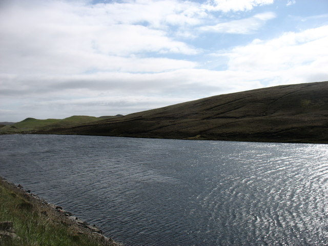
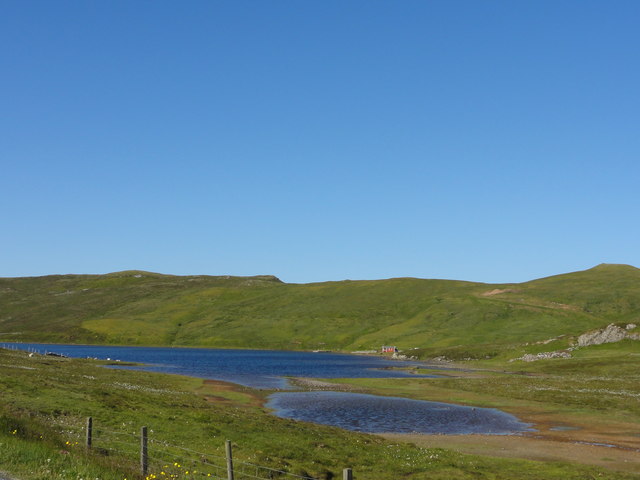
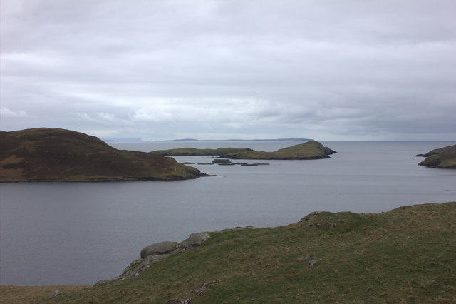
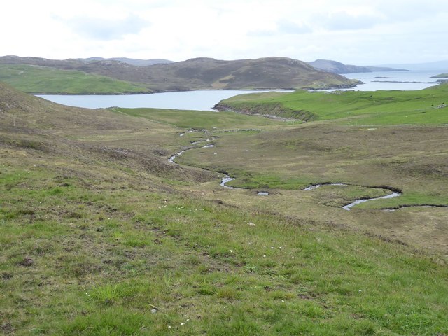
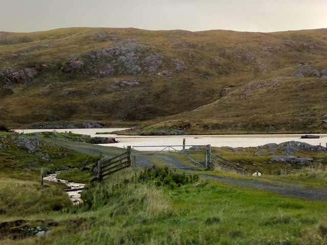
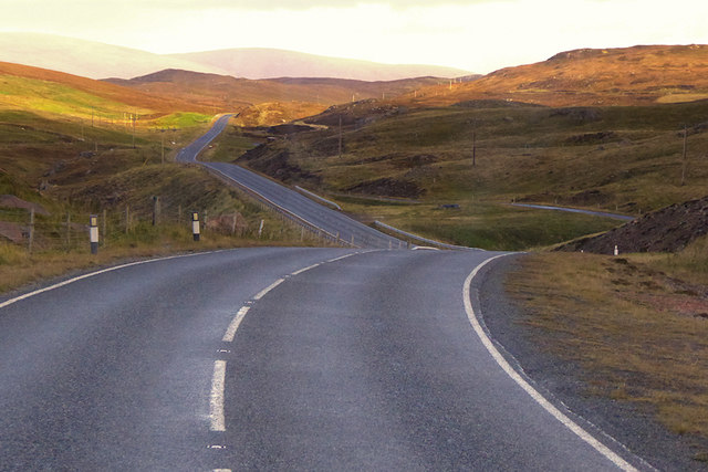
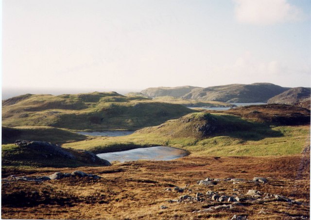
Litla Waters is a picturesque freshwater marsh located in the scenic Shetland Islands, Scotland. It is a small body of water, resembling a pond or pool, nestled amidst the stunning natural beauty of the area. Surrounded by lush greenery and rolling hills, Litla Waters is a tranquil and serene spot that offers a respite from the hustle and bustle of daily life.

The marsh is fed by natural springs and rainwater, ensuring a constant flow of fresh, clean water. The depth of Litla Waters varies throughout the year, with it being at its highest during the rainy season and at its lowest during the dry months. Despite its small size, the marsh is home to a diverse range of flora and fauna, making it a thriving ecosystem.

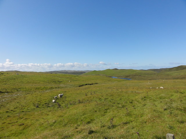
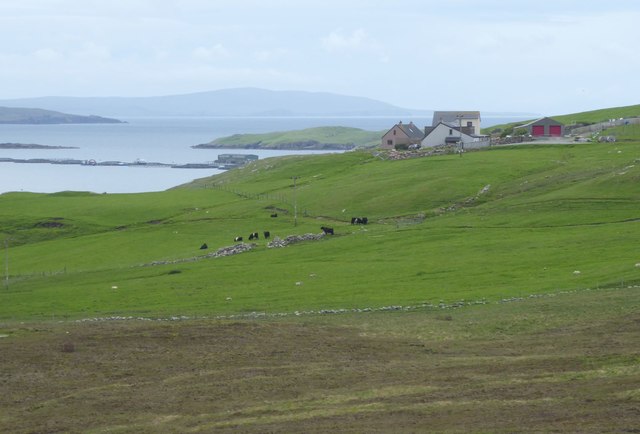
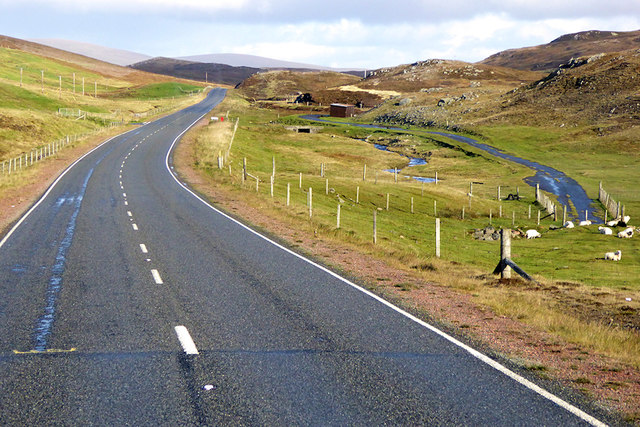
The surrounding vegetation comprises reeds, grasses, and other wetland plants that provide a habitat for numerous animal species. Bird enthusiasts will delight in the sight of various avian species, including ducks, swans, and wading birds, which frequent the marsh. Additionally, Litla Waters is known for its vibrant insect life, with dragonflies and damselflies darting over the water's surface.

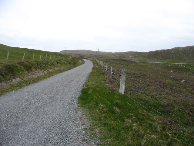
The calm and peaceful atmosphere of Litla Waters makes it an ideal spot for nature lovers and those seeking solitude. Visitors can enjoy leisurely walks around the marsh, take in the stunning views, and observe the wildlife in their natural habitat. Whether it's for a quiet picnic or a moment of reflection, Litla Waters offers a serene escape into the beauty of Shetland's natural surroundings.

If you have any feedback on the listing, please let us know in the comments section below.
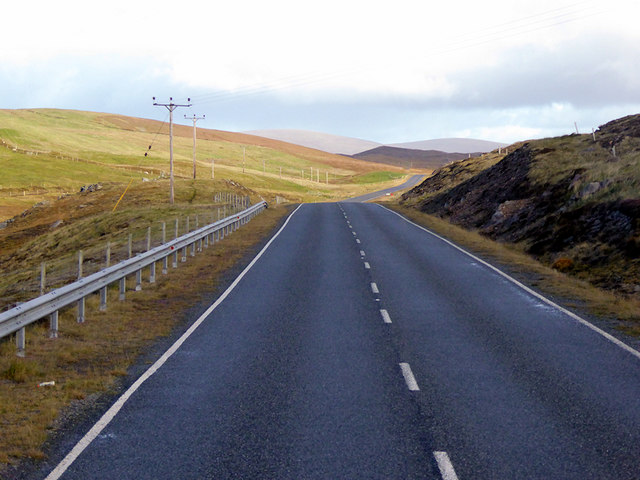
Litla Waters Images

Images are sourced within 2km of 60.42017/-1.3910178 or Grid Reference HU3370. Thanks to Geograph Open Source API. All images are credited.

Johnnie Mann's Loch I wonder who Johnnie Mann was?
Johnnie Mann's Loch
I wonder who Johnnie Mann was?
Mangaster Voe
Mangaster Voe
The lane from Mangaster The A970, heading south for Mavis Grind and Brae, can be seen on the right.
The lane from Mangaster
The A970, heading south for Mavis Grind and Brae, can be seen on the right.
The old road Single track remains of the A970 road
The old road
Single track remains of the A970 road
Sheep on the moor View of Stanes Moor
Sheep on the moor
View of Stanes Moor
Loch of Lunnister View from the road
Loch of Lunnister
View from the road
Mangaster Voe
Mangaster Voe
Pastures and ruins  South east of Mangaster.
Mangaster Voe in the foreground.
Pastures and ruins
South east of Mangaster. Mangaster Voe in the foreground.
Homestead on promontory  Overlooking Mangaster Voe.
Too Brekk is hill beyond on the left.
Homestead on promontory
Overlooking Mangaster Voe. Too Brekk is hill beyond on the left.
Burn of Mangaster Heads towards Mangaster Voe through rough grazing. 
Better pasture on the right..
Burn of Mangaster
Heads towards Mangaster Voe through rough grazing. Better pasture on the right..
Sheep and cattle grazing East of Mangaster.
Mangaster Voe on the left.
Sheep and cattle grazing
East of Mangaster. Mangaster Voe on the left.
Loch of Haggrister
Loch of Haggrister
A970 near Mangaster The A970 runs for 71 miles across most of the length of the "Mainland" in the Shetland Islands. It is a good-quality single-carriageway road for most of its route. Travelling from south to north, the road begins at Grutness near Sumburgh Airport and winds around the many hills and inlets passing close to a number of small villages without going through any large ones before Lerwick. After looping around Lerwick, a short spur runs to Scalloway whilst the main route continues northwards towards Brae where it crosses the narrow isthmus of Mavis Grind. At Sandy Lochs the road splits and a four-mile spur goes through Urafirth to Hillswick. The main route continuing to the right towards its northern terminus at Isbister. This last part of the route tends to be narrower with passing places.

<span class="nowrap"><a title="https://www.sabre-roads.org.uk/wiki/index.php?title=A970" rel="nofollow ugc noopener" href="https://www.sabre-roads.org.uk/wiki/index.php?title=A970">Link</a><img style="margin-left:2px;" alt="External link" title="External link - shift click to open in new window" src="https://s1.geograph.org.uk/img/external.png" width="10" height="10"/></span>  SABRE
A970 near Mangaster
The A970 runs for 71 miles across most of the length of the "Mainland" in the Shetland Islands. It is a good-quality single-carriageway road for most of its route. Travelling from south to north, the road begins at Grutness near Sumburgh Airport and winds around the many hills and inlets passing close to a number of small villages without going through any large ones before Lerwick. After looping around Lerwick, a short spur runs to Scalloway whilst the main route continues northwards towards Brae where it crosses the narrow isthmus of Mavis Grind. At Sandy Lochs the road splits and a four-mile spur goes through Urafirth to Hillswick. The main route continuing to the right towards its northern terminus at Isbister. This last part of the route tends to be narrower with passing places. LinkExternal link SABRE
Northbound A970 near Mangaster The A970 runs for 71 miles across most of the length of the "Mainland" in the Shetland Islands. It is a good-quality single-carriageway road for most of its route. Travelling from south to north, the road begins at Grutness near Sumburgh Airport and winds around the many hills and inlets passing close to a number of small villages without going through any large ones before Lerwick. After looping around Lerwick, a short spur runs to Scalloway whilst the main route continues northwards towards Brae where it crosses the narrow isthmus of Mavis Grind. At Sandy Lochs the road splits and a four-mile spur goes through Urafirth to Hillswick. The main route continuing to the right towards its northern terminus at Isbister. This last part of the route tends to be narrower with passing places.

<span class="nowrap"><a title="https://www.sabre-roads.org.uk/wiki/index.php?title=A970" rel="nofollow ugc noopener" href="https://www.sabre-roads.org.uk/wiki/index.php?title=A970">Link</a><img style="margin-left:2px;" alt="External link" title="External link - shift click to open in new window" src="https://s1.geograph.org.uk/img/external.png" width="10" height="10"/></span>  SABRE
Northbound A970 near Mangaster
The A970 runs for 71 miles across most of the length of the "Mainland" in the Shetland Islands. It is a good-quality single-carriageway road for most of its route. Travelling from south to north, the road begins at Grutness near Sumburgh Airport and winds around the many hills and inlets passing close to a number of small villages without going through any large ones before Lerwick. After looping around Lerwick, a short spur runs to Scalloway whilst the main route continues northwards towards Brae where it crosses the narrow isthmus of Mavis Grind. At Sandy Lochs the road splits and a four-mile spur goes through Urafirth to Hillswick. The main route continuing to the right towards its northern terminus at Isbister. This last part of the route tends to be narrower with passing places. LinkExternal link SABRE
A970 Northbound The A970 runs for 71 miles across most of the length of the "Mainland" in the Shetland Islands. It is a good-quality single-carriageway road for most of its route. Travelling from south to north, the road begins at Grutness near Sumburgh Airport and winds around the many hills and inlets passing close to a number of small villages without going through any large ones before Lerwick. After looping around Lerwick, a short spur runs to Scalloway whilst the main route continues northwards towards Brae where it crosses the narrow isthmus of Mavis Grind. At Sandy Lochs the road splits and a four-mile spur goes through Urafirth to Hillswick. The main route continuing to the right towards its northern terminus at Isbister. This last part of the route tends to be narrower with passing places.

<span class="nowrap"><a title="https://www.sabre-roads.org.uk/wiki/index.php?title=A970" rel="nofollow ugc noopener" href="https://www.sabre-roads.org.uk/wiki/index.php?title=A970">Link</a><img style="margin-left:2px;" alt="External link" title="External link - shift click to open in new window" src="https://s1.geograph.org.uk/img/external.png" width="10" height="10"/></span>  SABRE
A970 Northbound
The A970 runs for 71 miles across most of the length of the "Mainland" in the Shetland Islands. It is a good-quality single-carriageway road for most of its route. Travelling from south to north, the road begins at Grutness near Sumburgh Airport and winds around the many hills and inlets passing close to a number of small villages without going through any large ones before Lerwick. After looping around Lerwick, a short spur runs to Scalloway whilst the main route continues northwards towards Brae where it crosses the narrow isthmus of Mavis Grind. At Sandy Lochs the road splits and a four-mile spur goes through Urafirth to Hillswick. The main route continuing to the right towards its northern terminus at Isbister. This last part of the route tends to be narrower with passing places. LinkExternal link SABRE
A970 near Mangaster The A970 runs for 71 miles across most of the length of the "Mainland" in the Shetland Islands. It is a good-quality single-carriageway road for most of its route. Travelling from south to north, the road begins at Grutness near Sumburgh Airport and winds around the many hills and inlets passing close to a number of small villages without going through any large ones before Lerwick. After looping around Lerwick, a short spur runs to Scalloway whilst the main route continues northwards towards Brae where it crosses the narrow isthmus of Mavis Grind. At Sandy Lochs the road splits and a four-mile spur goes through Urafirth to Hillswick. The main route continuing to the right towards its northern terminus at Isbister. This last part of the route tends to be narrower with passing places.

<span class="nowrap"><a title="https://www.sabre-roads.org.uk/wiki/index.php?title=A970" rel="nofollow ugc noopener" href="https://www.sabre-roads.org.uk/wiki/index.php?title=A970">Link</a><img style="margin-left:2px;" alt="External link" title="External link - shift click to open in new window" src="https://s1.geograph.org.uk/img/external.png" width="10" height="10"/></span>  SABRE
A970 near Mangaster
The A970 runs for 71 miles across most of the length of the "Mainland" in the Shetland Islands. It is a good-quality single-carriageway road for most of its route. Travelling from south to north, the road begins at Grutness near Sumburgh Airport and winds around the many hills and inlets passing close to a number of small villages without going through any large ones before Lerwick. After looping around Lerwick, a short spur runs to Scalloway whilst the main route continues northwards towards Brae where it crosses the narrow isthmus of Mavis Grind. At Sandy Lochs the road splits and a four-mile spur goes through Urafirth to Hillswick. The main route continuing to the right towards its northern terminus at Isbister. This last part of the route tends to be narrower with passing places. LinkExternal link SABRE
Northbound A970 The A970 runs for 71 miles across most of the length of the "Mainland" in the Shetland Islands. It is a good-quality single-carriageway road for most of its route. Travelling from south to north, the road begins at Grutness near Sumburgh Airport and winds around the many hills and inlets passing close to a number of small villages without going through any large ones before Lerwick. After looping around Lerwick, a short spur runs to Scalloway whilst the main route continues northwards towards Brae where it crosses the narrow isthmus of Mavis Grind. At Sandy Lochs the road splits and a four-mile spur goes through Urafirth to Hillswick. The main route continuing to the right towards its northern terminus at Isbister. This last part of the route tends to be narrower with passing places.

<span class="nowrap"><a title="https://www.sabre-roads.org.uk/wiki/index.php?title=A970" rel="nofollow ugc noopener" href="https://www.sabre-roads.org.uk/wiki/index.php?title=A970">Link</a><img style="margin-left:2px;" alt="External link" title="External link - shift click to open in new window" src="https://s1.geograph.org.uk/img/external.png" width="10" height="10"/></span>  SABRE
Northbound A970
The A970 runs for 71 miles across most of the length of the "Mainland" in the Shetland Islands. It is a good-quality single-carriageway road for most of its route. Travelling from south to north, the road begins at Grutness near Sumburgh Airport and winds around the many hills and inlets passing close to a number of small villages without going through any large ones before Lerwick. After looping around Lerwick, a short spur runs to Scalloway whilst the main route continues northwards towards Brae where it crosses the narrow isthmus of Mavis Grind. At Sandy Lochs the road splits and a four-mile spur goes through Urafirth to Hillswick. The main route continuing to the right towards its northern terminus at Isbister. This last part of the route tends to be narrower with passing places. LinkExternal link SABRE
Lochs and a lumpy landscape, near Islesburgh This area is fascinating for the series of small lochs (lochans) some forming a circle.  Many are connected one to the next by small burns. The landscape itself is largely devoid of human settlement, and even of sheep.  Yet in its barren-ness, it is very beautiful.
Lochs and a lumpy landscape, near Islesburgh
This area is fascinating for the series of small lochs (lochans) some forming a circle. Many are connected one to the next by small burns. The landscape itself is largely devoid of human settlement, and even of sheep. Yet in its barren-ness, it is very beautiful.
Show me another place!

Litla Waters is located at Grid Ref: HU3370 (Lat: 60.42017, Lng: -1.3910178)

Unitary Authority: Shetland Islands

Police Authority: Highlands and Islands

What 3 Words

///lamplight.hound.yelled. Near Brae, Shetland Islands

Related Wikis

Mavis Grind

Mavis Grind (Old Norse: Mæfeiðs grind or Mæveiðs grind, meaning "gate of the narrow isthmus") is a narrow isthmus joining the Northmavine peninsula to...

Sullom

Sullom is a village on the Shetland peninsula of Northmavine, between Haggrister and Bardister. It lies on the northwest side of Sullom Voe, to which it...

Brae

"Brae" is also the Lowland Scots language word for the slope or brow of a hill.Brae (Old Norse: Breiðeið, meaning "the wide isthmus") is a village on the...

Gunnister

Gunnister is a small 'abandoned' village at the North-West Mainland in Shetland, Scotland. It is most commonly known for the Gunnister Man - the remains...

Busta Voe

Busta Voe, (HU665350), in the north central Mainland, Shetland, is a sea inlet lying between the village of Brae and the island of Muckle Roe. At the head...

Punds Water

Punds Water is a freshwater loch near Mangaster in Northmavine, Shetland. It also gives its name to a nearby Neolithic heel-shaped cairn. == Heel-shaped... ==
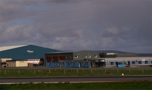
Scatsta Airport

Scatsta Airport (IATA: SCS, ICAO: EGPM), was a commercial airport on the island of Mainland, Shetland in Scotland located 17 nautical miles (31 km; 20...

Sullom Voe

Sullom Voe is an inlet of the North Sea between the parishes of Delting and Northmavine in Shetland, Scotland. It is a location of the Sullom Voe oil terminal...

Nearby Amenities

Located within 500m of 60.42017,-1.3910178
Power: pole
Lat/Long: 60.4158612/-1.3917097
Power: pole
Lat/Long: 60.416571/-1.3910526
Power: pole
Lat/Long: 60.4172106/-1.3909775
Power: pole
Lat/Long: 60.4178329/-1.390897
Power: pole
Lat/Long: 60.4183917/-1.3908327
Power: pole
Lat/Long: 60.4188949/-1.3912404
Power: pole
Lat/Long: 60.4194113/-1.3917017
Power: pole
Lat/Long: 60.4198813/-1.3921067
Power: pole
Lat/Long: 60.4203685/-1.3925305
Power: pole
Lat/Long: 60.4210756/-1.393126
Power: pole
Lat/Long: 60.4216965/-1.393657
Power: pole
Lat/Long: 60.4223903/-1.3942605
Power: pole
Lat/Long: 60.4229927/-1.3947836
Power: pole
Lat/Long: 60.42355/-1.3956445
Power: pole
Lat/Long: 60.4206255/-1.3994775
Power: pole
Lat/Long: 60.4207899/-1.3980779
Power: pole
Lat/Long: 60.4209212/-1.3968125
Power: pole
Lat/Long: 60.4210265/-1.3959209
Power: pole
Lat/Long: 60.4211578/-1.3947921
The data included in this document is from www.openstreetmap.org. The data is made available under ODbL.

Have you been to Litla Waters?

Leave your review of Litla Waters below (or comments, questions and feedback).