Great Milton

Settlement in Oxfordshire South Oxfordshire

England

Great Milton

Le Manoir Le Manoir aux Quat'Saisons hotel and restaurant
Le Manoir Credit: Nick Barber

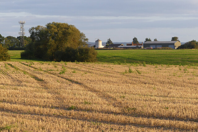
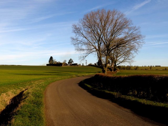
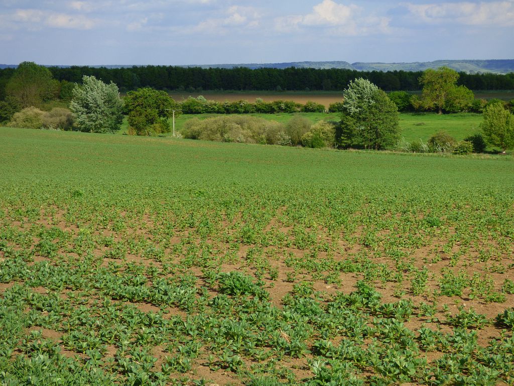
Great Milton is a charming village located in the county of Oxfordshire, England. Situated approximately 10 miles southeast of the historic city of Oxford, Great Milton has a population of around 1,000 residents. The village is nestled in a picturesque rural setting, surrounded by beautiful countryside and rolling hills.

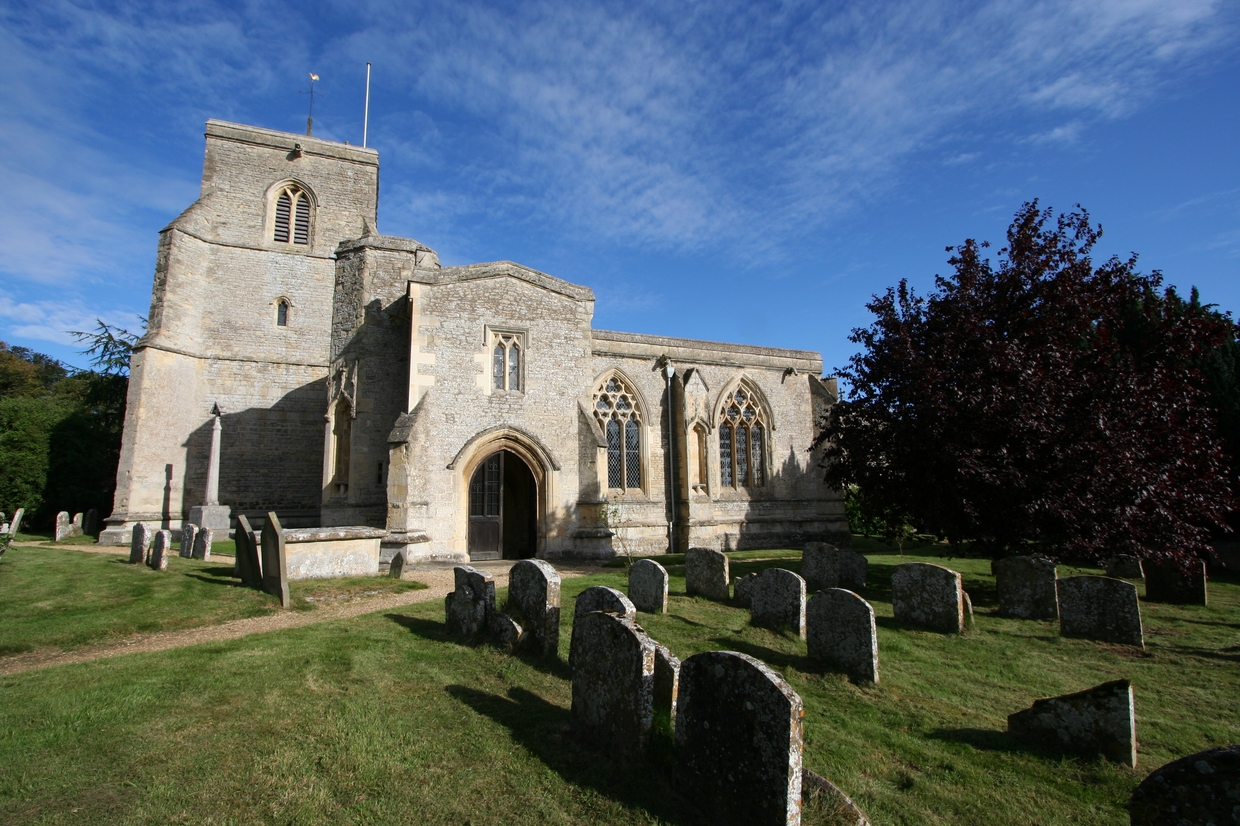
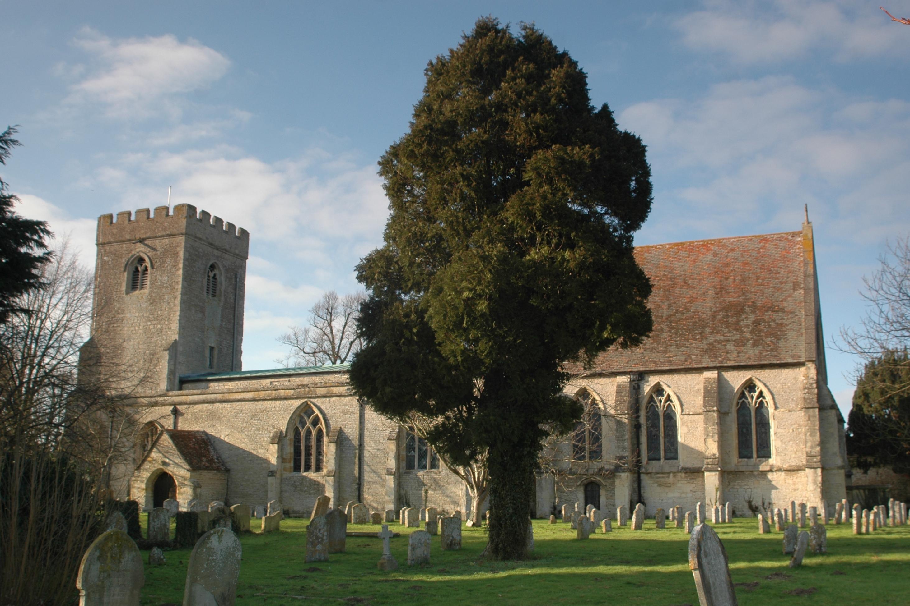
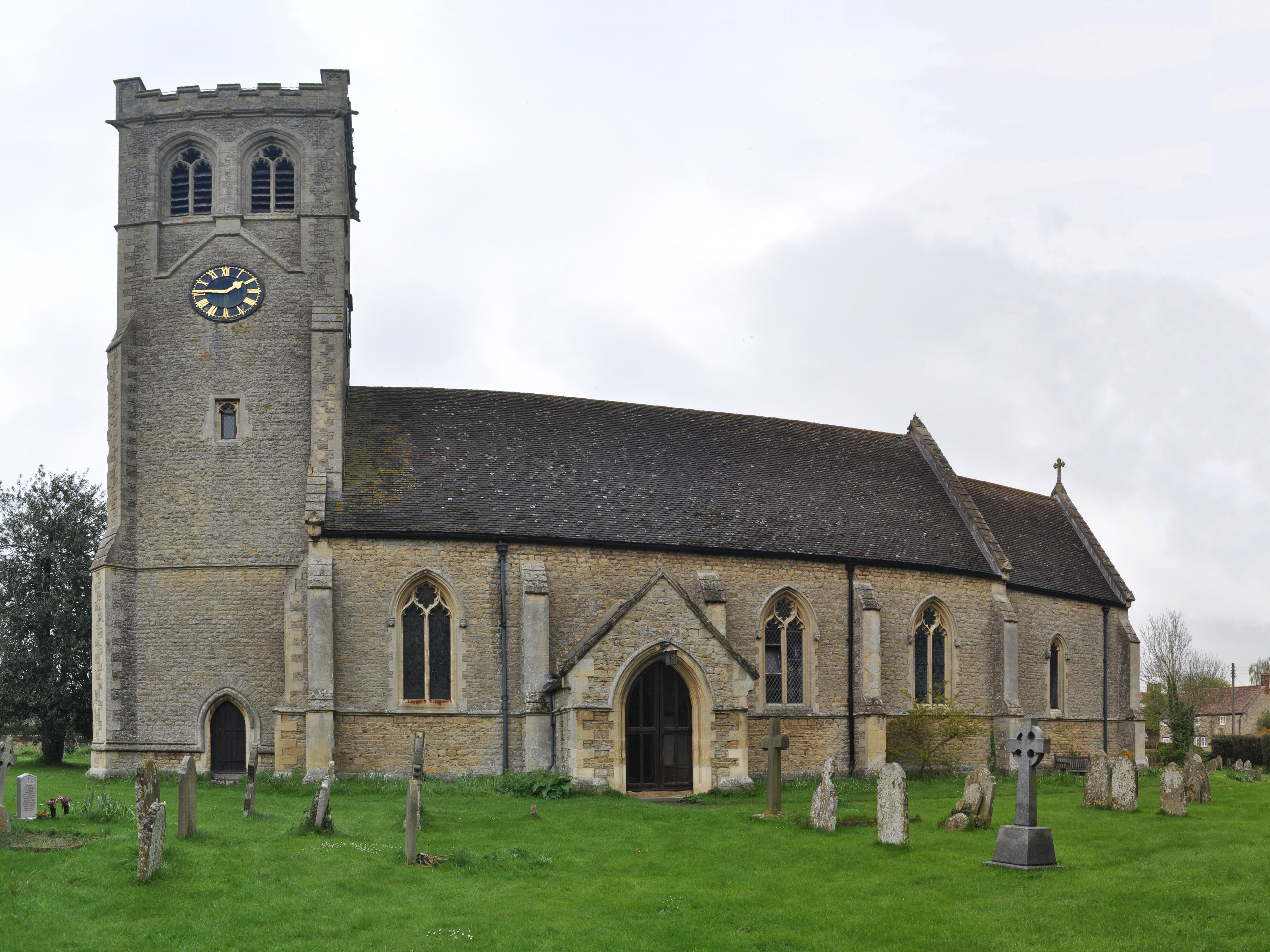
Great Milton is known for its rich history, with evidence of human settlement dating back to the Roman times. The village features a number of historic buildings, including the Grade I listed St. Mary's Church, which dates back to the 12th century. The church's striking architecture and beautiful stained glass windows make it a popular attraction for both locals and visitors.

The village is also home to Le Manoir aux Quat'Saisons, a renowned luxury hotel and restaurant owned by celebrity chef Raymond Blanc. The establishment has been awarded two Michelin stars and is highly regarded for its exquisite cuisine and stunning gardens.

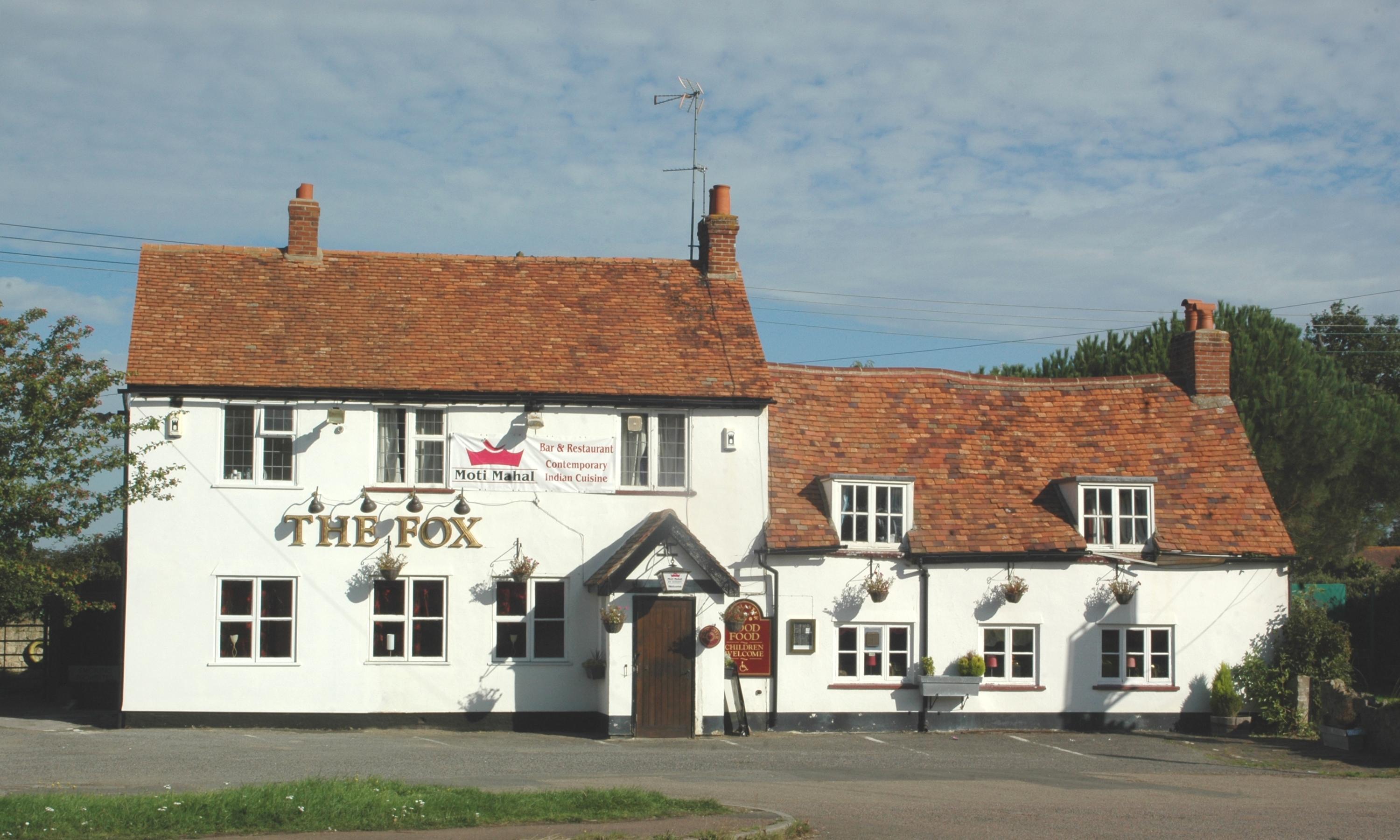
In addition to its historical and culinary attractions, Great Milton offers a range of amenities for residents and visitors. These include a primary school, a village hall, a post office, and a number of small shops and businesses. The village also benefits from excellent transport links, with easy access to major roads and nearby rail connections.

Overall, Great Milton is a charming and idyllic village, offering a peaceful and picturesque setting combined with a rich history and a taste of culinary excellence.

If you have any feedback on the listing, please let us know in the comments section below.

Great Milton Images

Images are sourced within 2km of 51.720361/-1.08873 or Grid Reference SP6302. Thanks to Geograph Open Source API. All images are credited.

Le Manoir Le Manoir aux Quat'Saisons hotel and restaurant
Le Manoir
Le Manoir aux Quat'Saisons hotel and restaurant
Farmland, Great Haseley A footpath follows the edge of this field to the north of village.
Farmland, Great Haseley
A footpath follows the edge of this field to the north of village.
Farmland, Great Haseley A redundant stile on a footpath approaching the church from Latchford Lane.
Farmland, Great Haseley
A redundant stile on a footpath approaching the church from Latchford Lane.
The M40, Great Milton Viewed from the footbridge near Chilworth House is the bridge carrying the slip-road allowing southbound traffic to join from the A40.
The M40, Great Milton
Viewed from the footbridge near Chilworth House is the bridge carrying the slip-road allowing southbound traffic to join from the A40.
Farmland, Great Milton With a footpath approaching Chilworth Road from the west.
Farmland, Great Milton
With a footpath approaching Chilworth Road from the west.
Farmland, Great Milton A field-side footpath approaches the northern end of the village.
Farmland, Great Milton
A field-side footpath approaches the northern end of the village.
Farmland, Great Milton A crop of beans with a building on the Wheatley campus of Oxford Brookes University seen in the background.
Farmland, Great Milton
A crop of beans with a building on the Wheatley campus of Oxford Brookes University seen in the background.
Pasture, Great Milton A footpath crosses damp grassland beside the River Thame with arable land rising beyond.
Pasture, Great Milton
A footpath crosses damp grassland beside the River Thame with arable land rising beyond.
Farmland, Great Haseley Barley beside the bridleway at Sands Farm.
Farmland, Great Haseley
Barley beside the bridleway at Sands Farm.
Farmland, Great Milton Orpwoods Farm is seen from the footpath alongside the M40 near Trindalls Farm.
Farmland, Great Milton
Orpwoods Farm is seen from the footpath alongside the M40 near Trindalls Farm.
Great Haseley Windmill
The road to Milton Common
A stile on the footpath The footpath runs to Tetsworth.
A stile on the footpath
The footpath runs to Tetsworth.
The road to Great Haseley
M40 Slip-road The view near junction 8 on the M40, on the slip road from the A40 at Oxford.
M40 Slip-road
The view near junction 8 on the M40, on the slip road from the A40 at Oxford.
Joining the M40 The M40 motorway near junction 8 near Oxford.
Joining the M40
The M40 motorway near junction 8 near Oxford.
Road to Milton Common The road goes through farmland between Great Haseley and Milton Common.
It is quite near a motorway junction and is busier than you might imagine.
Road to Milton Common
The road goes through farmland between Great Haseley and Milton Common. It is quite near a motorway junction and is busier than you might imagine.
Farm Track, Milton Common These days Milton Common is the name of the straggle of development around the M40/A40 junction a short way to the north, but the map also puts that name to the group of fields just here.
I guess that was the original common, although it's all enclosed now.
The public footpath shown on the map is on the other side of the hedge.
Farm Track, Milton Common
These days Milton Common is the name of the straggle of development around the M40/A40 junction a short way to the north, but the map also puts that name to the group of fields just here. I guess that was the original common, although it's all enclosed now. The public footpath shown on the map is on the other side of the hedge.
Show me another place!

Great Milton is located at Grid Ref: SP6302 (Lat: 51.720361, Lng: -1.08873)

Administrative County: Oxfordshire

District: South Oxfordshire

Police Authority: Thames Valley

What 3 Words

///donation.bloodshot.situation. Near Wheatley, Oxfordshire

Nearby Locations

Milton, Great Great Milton

Related Wikis

Great Milton

Great Milton is a village and civil parish in Oxfordshire, about 7 miles (11 km) east of Oxford. The 2011 Census recorded the parish's population as 1...

Great Haseley

Great Haseley is a village and civil parish in South Oxfordshire, England. The village is about 4.5 miles (7 km) southwest of Thame. The parish includes...

Wells Farm

Wells Farm is a 64-hectare (160-acre) nature reserve on the eastern outskirts of Little Milton in Oxfordshire. It is managed by the Berkshire, Buckinghamshire...

Oxford MSA

Oxford services is a motorway service station next to junction 8A of the M40 motorway at Waterstock near Wheatley in Oxfordshire, several miles to the...

Little Milton, Oxfordshire

Little Milton is a village and civil parish in Oxfordshire, about 6 miles (10 km) southwest of Thame and 7 miles (11 km) southeast of Oxford. The parish...

Cuddesdon and Denton

Cuddesdon and Denton is a civil parish in the county of Oxfordshire, England. Forming part of South Oxfordshire district its main settlements are Cuddesdon...

Tiddington railway station

Tiddington railway station was on the Wycombe Railway and served the village of Tiddington, Oxfordshire. On 24 October 1864 the Wycombe Railway opened...

Tiddington, Oxfordshire

Tiddington is a village in the civil parish of Tiddington-with-Albury, in the South Oxfordshire district, in Oxfordshire, England. It is about 3+1⁄2 miles...

Nearby Amenities

Located within 500m of 51.720361,-1.08873
Great Milton
Place: village
Source Name: dictaphone
Lat/Long: 51.7214445/-1.0899799
Post Box
Ref: OX44 495
Lat/Long: 51.718085/-1.0923638
Bus Stop
Bus: yes
Naptan AtcoCode: 340001467FUL
Naptan NaptanCode: oxfgtadj
Public Transport: platform
Lat/Long: 51.7205256/-1.0874972
Bus Stop
Thame Road
Bus: yes
Naptan AtcoCode: 340001690TRE
Naptan Bearing: E
Naptan CommonName: Thame Road
Naptan Indicator: Outside No 6
Naptan Landmark: No 6
Naptan NaptanCode: oxfgatjp
Naptan Street: Thame Road
Public Transport: platform
Route Ref: 103;104;111
Source: naptan_import;survey
Lat/Long: 51.7206532/-1.0826736
Bus Stop
Lych Gate Lane
Bus: yes
Naptan AtcoCode: 340003281CNR
Naptan Bearing: SW
Naptan CommonName: Lych Gate Lane
Naptan Indicator: Corner
Naptan Landmark: Lych Gate Lane
Naptan NaptanCode: oxfawtdw
Naptan Street: Church Road
Public Transport: platform
Route Ref: 103;104
Source: naptan_import;survey
Lat/Long: 51.7182255/-1.0918003
Bench
Lat/Long: 51.7204405/-1.0890765
Bench
Lat/Long: 51.7203656/-1.0892987
Turning Circle
Turning Circle: knuckle
Lat/Long: 51.7210326/-1.0867037
Barrier: kissing_gate
Lat/Long: 51.7185635/-1.0887761
Bus Stop
Potts Close
Bus: yes
Naptan AtcoCode: 340003282CNR
Naptan Bearing: NW
Naptan CommonName: Potts Close
Naptan Indicator: Corner
Naptan Landmark: Potts Close
Naptan NaptanCode: oxfawtdm
Naptan Street: Lower End
Public Transport: platform
Source: naptan_import;survey
Lat/Long: 51.7236744/-1.0922343
Telephone
Defibrillator
Booth: K6
Covered: booth
Defibrillator Location: inside old red phone box, High Street, Great Milton
Emergency: defibrillator
Man Made: telephone_box
Old Phone: +44 1844 279361
Ref GB The Circuit: C5A4ACD8-F3D3-4E55-A8D1-AD210093B30E
Lat/Long: 51.7218177/-1.0896688
Bus Stop
Post Office
Bus: yes
Naptan AtcoCode: 340001691LES
Naptan Bearing: SE
Naptan CommonName: Post Office
Naptan Indicator: Outside
Naptan Landmark: Post Office
Naptan NaptanCode: oxfgatjd
Naptan Street: Lower End
Public Transport: platform
Route Ref: 103;104
Source: naptan_import;survey
Lat/Long: 51.721807/-1.0897374
Post Box
Post Box Type: lamp
Ref: OX44 494
Lat/Long: 51.7219647/-1.0897435
Bus Stop
Chillingworth Road
Bus: yes
Naptan AtcoCode: 340001689FF
Naptan Bearing: E
Naptan CommonName: Chillingworth Road
Naptan Indicator: Corner
Naptan Landmark: Chillingworth Road
Naptan NaptanCode: oxfgatjw
Naptan Street: Thame Road
Public Transport: platform
Route Ref: 103;104;111
Source: naptan_import;survey
Lat/Long: 51.7206199/-1.0857824
Bus Stop
Chillingworth Road
Bus: yes
Naptan AtcoCode: 340001689OFF
Naptan Bearing: W
Naptan BusStopType: CUS
Naptan CommonName: Chillingworth Road
Naptan Indicator: Opposite
Naptan Landmark: Chillingworth Road
Naptan NaptanCode: oxfgatjt
Naptan Street: Thame Road
Physically Present: no
Public Transport: platform
Source: naptan_import
Lat/Long: 51.7205695/-1.0857392
Bus Stop
Thame Road
Bus: yes
Naptan AtcoCode: 340001690TRW
Naptan Bearing: W
Naptan BusStopType: CUS
Naptan CommonName: Thame Road
Naptan Indicator: Opposite No 6
Naptan Landmark: No 6
Naptan NaptanCode: oxfgatjm
Naptan Street: Thame Road
Physically Present: no
Public Transport: platform
Source: naptan_import
Lat/Long: 51.7206079/-1.0827363
Bus Stop
Post Office
Bus: yes
Naptan AtcoCode: 340001691LEN
Naptan Bearing: NW
Naptan CommonName: Post Office
Naptan Indicator: Opposite
Naptan Landmark: CE School
Naptan NaptanCode: oxfgatjg
Naptan Street: Lower End
Public Transport: platform
Source: naptan_import;survey
Lat/Long: 51.7224276/-1.0901704
Bus Stop
The Bull
Bus: yes
Naptan AtcoCode: 340001697OPP
Naptan Bearing: S
Naptan CommonName: The Bull
Naptan Indicator: opp
Naptan Landmark: The Bull
Naptan NaptanCode: oxfawtdp
Naptan Street: Church Road
Public Transport: platform
Route Ref: 103;104;111
Source: naptan_import;survey
Lat/Long: 51.72037/-1.0893616
Bus Stop
The Bull
Bus: yes
Naptan AtcoCode: 340001697OUT
Naptan Bearing: N
Naptan BusStopType: CUS
Naptan CommonName: The Bull
Naptan Indicator: Outside
Naptan Landmark: The Bull
Naptan NaptanCode: oxfgatdp
Naptan Street: The Green
Physically Present: no
Public Transport: platform
Route Ref: 103;104;111
Source: naptan_import;survey
Lat/Long: 51.7203747/-1.0894857
Bus Stop
Lych Gate Lane
Bus: yes
Naptan AtcoCode: 340003281OPP
Naptan Bearing: NE
Naptan CommonName: Lych Gate Lane
Naptan Indicator: Opposite
Naptan Landmark: Lych Gate Lane
Naptan NaptanCode: oxfawtdt
Naptan Street: Church Road
Naptan Verified: no
Public Transport: platform
Source: naptan_import
Lat/Long: 51.7180244/-1.0926378
Bus Stop
Potts Close
Naptan AtcoCode: 340003282OPP
Naptan Bearing: SE
Naptan BusStopType: CUS
Naptan CommonName: Potts Close
Naptan Indicator: Opposite
Naptan Landmark: Potts Close
Naptan NaptanCode: oxfawtdj
Naptan Street: Lower End
Naptan Verified: no
Public Transport: platform
Source: naptan_import
Lat/Long: 51.7238296/-1.0923867
Power: pole
Source: Bing
Lat/Long: 51.7232123/-1.0853303
Power: pole
Source: Bing
Lat/Long: 51.7236699/-1.0847324
Power: pole
Source: Bing
Lat/Long: 51.7227553/-1.0859294
Power: pole
Source: Bing
Lat/Long: 51.7182797/-1.0946452
Parking
Lat/Long: 51.7199974/-1.0892694
Bus Stop
Fullers Field
Naptan AtcoCode: 340001467OPF
Naptan Bearing: W
Naptan CommonName: Fullers Field
Naptan Indicator: opp
Naptan NaptanCode: oxfgtadm
Naptan Street: Thame Road
Public Transport: platform
Lat/Long: 51.7204835/-1.0874346
Fixme: solar panels?
Lat/Long: 51.7201249/-1.0847399
Direction: 165
Generator Method: photovoltaic
Generator Output Electricity: yes
Generator Solar Modules: 8
Generator Source: solar
Generator Type: solar_photovoltaic_panel
Location: roof
Power: generator
Lat/Long: 51.7232882/-1.0905005
The data included in this document is from www.openstreetmap.org. The data is made available under ODbL.

Have you been to Great Milton?

Leave your review of Great Milton below (or comments, questions and feedback).