Hidden Loch

Lake, Pool, Pond, Freshwater Marsh in Shetland

Scotland

Hidden Loch

Moorland above North Gluss Looking towards Yamna Field.
Moorland above North Gluss Credit: Mike Pennington

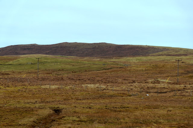
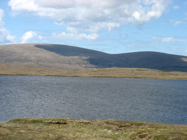
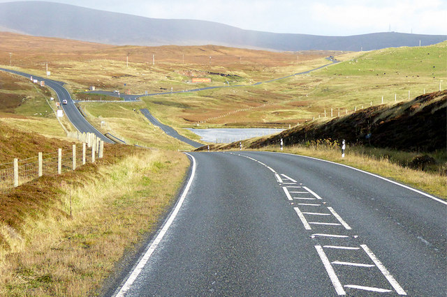
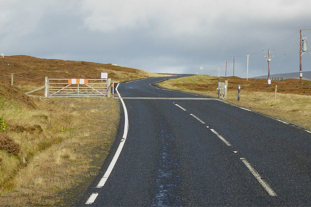
Hidden Loch is a picturesque freshwater body located in the remote and rugged landscape of Shetland, Scotland. Nestled amidst rolling hills and heather-covered moors, this hidden gem is a haven for nature enthusiasts and offers a tranquil escape from the hustle and bustle of everyday life.

As its name suggests, Hidden Loch is a secluded water feature that measures approximately 200 meters in length and 100 meters in width. It is surrounded by lush vegetation, including reeds, grasses, and wildflowers, which provide a rich habitat for a variety of plant and animal species.

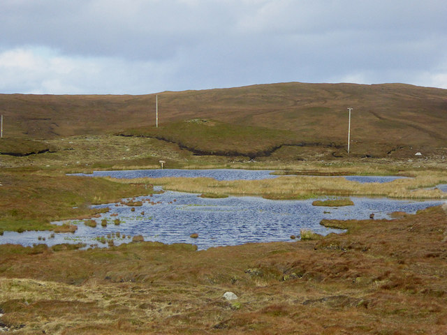
The loch's waters are remarkably clear and pristine, reflecting the ever-changing colors of the sky. It is fed by several small streams that cascade down from the surrounding hills, ensuring a constant flow of fresh, cold water. The depth of the loch varies, with some areas reaching up to 10 meters, making it an ideal habitat for fish, such as brown trout and Arctic char.

The natural beauty of Hidden Loch is further enhanced by the presence of a freshwater marsh on its eastern shore. This marshland is characterized by its waterlogged soil, which supports a diverse range of wetland plants, including sedges, rushes, and flowering water lilies. It serves as a vital breeding ground for numerous bird species, including ducks, geese, and waders, which can often be spotted wading through the shallow waters in search of food.

Hidden Loch is a true hidden gem, offering a tranquil and unspoiled environment for visitors to explore and appreciate the wonders of nature.

If you have any feedback on the listing, please let us know in the comments section below.

Hidden Loch Images

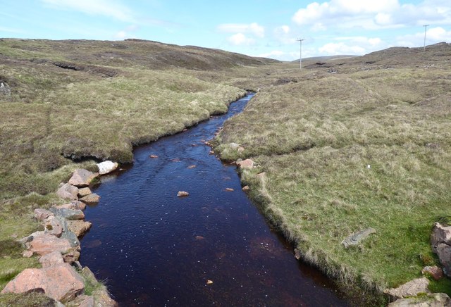
Images are sourced within 2km of 60.483574/-1.4041675 or Grid Reference HU3277. Thanks to Geograph Open Source API. All images are credited.

Moorland above North Gluss Looking towards Yamna Field.
Moorland above North Gluss
Looking towards Yamna Field.
North Gluss
North Gluss
Eela Water Ronas Hill (the highest hill in Shetland) and Mid Field beyond.
Eela Water
Ronas Hill (the highest hill in Shetland) and Mid Field beyond.
The north tip of Punds Water
Single track road View of the A970 single track road heading north
Single track road
View of the A970 single track road heading north
Cattle grid on the A970 to Urrafirth
Burn of Eelawater The outflow from Eela Water.
Heading for Hamar Voe.
Burn of Eelawater
The outflow from Eela Water. Heading for Hamar Voe.
Peat cutting Stacked for drying.
Peat cutting
Stacked for drying.
Road junction on A970 The A970 is a single-carriageway road that runs from south to north of Mainland Shetland, Scotland. The road also spurs to Scalloway and Hillswick.
This is the spur for Hillswick so all three roads are the A970!
Note the new road cutting directly over the hill while the old road meanders beside the loch and around the hill.
Road junction on A970
The A970 is a single-carriageway road that runs from south to north of Mainland Shetland, Scotland. The road also spurs to Scalloway and Hillswick. This is the spur for Hillswick so all three roads are the A970! Note the new road cutting directly over the hill while the old road meanders beside the loch and around the hill.
Cattle Grid on Side Road near Punds Water
Northbound A970 towards Sandy Lochs The A970 runs for 71 miles across most of the length of the "Mainland" in the Shetland Islands. It is a good-quality single-carriageway road for most of its route. Travelling from south to north, the road begins at Grutness near Sumburgh Airport and winds around the many hills and inlets passing close to a number of small villages without going through any large ones before Lerwick. After looping around Lerwick, a short spur runs to Scalloway whilst the main route continues northwards towards Brae where it crosses the narrow isthmus of Mavis Grind. At Sandy Lochs the road splits and a four-mile spur goes through Urafirth to Hillswick. The main route continuing to the right towards its northern terminus at Isbister. This last part of the route tends to be narrower with passing places.

<span class="nowrap"><a title="https://www.sabre-roads.org.uk/wiki/index.php?title=A970" rel="nofollow ugc noopener" href="https://www.sabre-roads.org.uk/wiki/index.php?title=A970">Link</a><img style="margin-left:2px;" alt="External link" title="External link - shift click to open in new window" src="https://s1.geograph.org.uk/img/external.png" width="10" height="10"/></span>  SABRE
Northbound A970 towards Sandy Lochs
The A970 runs for 71 miles across most of the length of the "Mainland" in the Shetland Islands. It is a good-quality single-carriageway road for most of its route. Travelling from south to north, the road begins at Grutness near Sumburgh Airport and winds around the many hills and inlets passing close to a number of small villages without going through any large ones before Lerwick. After looping around Lerwick, a short spur runs to Scalloway whilst the main route continues northwards towards Brae where it crosses the narrow isthmus of Mavis Grind. At Sandy Lochs the road splits and a four-mile spur goes through Urafirth to Hillswick. The main route continuing to the right towards its northern terminus at Isbister. This last part of the route tends to be narrower with passing places. LinkExternal link SABRE
Flossy Loch, Shetland
Cattle Grid on the A970 The A970 runs for 71 miles across most of the length of the "Mainland" in the Shetland Islands. It is a good-quality single-carriageway road for most of its route. Travelling from south to north, the road begins at Grutness near Sumburgh Airport and winds around the many hills and inlets passing close to a number of small villages without going through any large ones before Lerwick. After looping around Lerwick, a short spur runs to Scalloway whilst the main route continues northwards towards Brae where it crosses the narrow isthmus of Mavis Grind. At Sandy Lochs the road splits and a four-mile spur goes through Urafirth to Hillswick. The main route continuing to the right towards its northern terminus at Isbister. This last part of the route tends to be narrower with passing places.

<span class="nowrap"><a title="https://www.sabre-roads.org.uk/wiki/index.php?title=A970" rel="nofollow ugc noopener" href="https://www.sabre-roads.org.uk/wiki/index.php?title=A970">Link</a><img style="margin-left:2px;" alt="External link" title="External link - shift click to open in new window" src="https://s1.geograph.org.uk/img/external.png" width="10" height="10"/></span>  SABRE
Cattle Grid on the A970
The A970 runs for 71 miles across most of the length of the "Mainland" in the Shetland Islands. It is a good-quality single-carriageway road for most of its route. Travelling from south to north, the road begins at Grutness near Sumburgh Airport and winds around the many hills and inlets passing close to a number of small villages without going through any large ones before Lerwick. After looping around Lerwick, a short spur runs to Scalloway whilst the main route continues northwards towards Brae where it crosses the narrow isthmus of Mavis Grind. At Sandy Lochs the road splits and a four-mile spur goes through Urafirth to Hillswick. The main route continuing to the right towards its northern terminus at Isbister. This last part of the route tends to be narrower with passing places. LinkExternal link SABRE
Heights of Olnesfirth
Little People Watching the A970 Garden gnomes on the rocks alongside the A970 near Urafirth
Little People Watching the A970
Garden gnomes on the rocks alongside the A970 near Urafirth
Cattle Grid on the Road to Orbister
Wester Water mill and sluice The old sluice way to channel water to this mill is clearly seen here.
Wester Water mill and sluice
The old sluice way to channel water to this mill is clearly seen here.
Fresh cut peat  Fresh cut peat set out to dry by the side of Eela Water
Fresh cut peat
Fresh cut peat set out to dry by the side of Eela Water
Show me another place!

Hidden Loch is located at Grid Ref: HU3277 (Lat: 60.483574, Lng: -1.4041675)

Unitary Authority: Shetland Islands

Police Authority: Highlands and Islands

What 3 Words

///calendars.escorting.commit. Near Brae, Shetland Islands

Nearby Locations

Flossy Loch Hidden Loch

Related Wikis

Eela Water

Eela Water is a freshwater loch (lake) in Northmavine, part of the mainland of Shetland in Scotland. Besides being a freshwater fishing location, the site...

Northmavine

Northmavine or Northmaven (Old Norse: Norðan Mæfeið, meaning ‘the land north of the Mavis Grind’) is a peninsula in northwest Mainland Shetland in Scotland...

Punds Water

Punds Water is a freshwater loch near Mangaster in Northmavine, Shetland. It also gives its name to a nearby Neolithic heel-shaped cairn. == Heel-shaped... ==

Voe, Northmavine

Voe is a settlement on the Northmavine peninsula of Mainland, Shetland, Scotland. It is at the head of Ronas Voe and just off the A970 road. == Whaling... ==

Nearby Amenities

Located within 500m of 60.483574,-1.4041675
Passing Place
Lat/Long: 60.480087/-1.4058407
Passing Place
Lat/Long: 60.4812569/-1.4051381
Passing Place
Lat/Long: 60.4825551/-1.4047842
Passing Place
Lat/Long: 60.4840521/-1.4030646
Passing Place
Lat/Long: 60.4865608/-1.3990077
Passing Place
Lat/Long: 60.4867256/-1.3977501
Power: pole
Lat/Long: 60.4799626/-1.4076072
Power: pole
Lat/Long: 60.4804872/-1.4072558
Power: pole
Lat/Long: 60.4811863/-1.4067596
Power: pole
Lat/Long: 60.4815894/-1.4057377
Power: pole
Lat/Long: 60.481818/-1.4046031
Power: pole
Lat/Long: 60.4820718/-1.4035249
Power: pole
Lat/Long: 60.4825184/-1.4012235
Power: pole
Lat/Long: 60.4827642/-1.4001989
Power: pole
Lat/Long: 60.4829836/-1.3990456
Power: pole
Lat/Long: 60.4832611/-1.397844
Power: pole
Lat/Long: 60.4835545/-1.3964224
Power: pole
Lat/Long: 60.4838135/-1.3952154
The data included in this document is from www.openstreetmap.org. The data is made available under ODbL.

Have you been to Hidden Loch?

Leave your review of Hidden Loch below (or comments, questions and feedback).