Neogar Shun

Lake, Pool, Pond, Freshwater Marsh in Shetland

Scotland

Neogar Shun

Olnesfirth and Hamar Voe
Olnesfirth and Hamar Voe Credit: David Purchase

Neogar Shun, located in the picturesque Shetland Islands, is a stunning freshwater feature that encompasses a combination of a lake, pool, pond, and freshwater marsh. Nestled amidst the rugged and lush landscape, this natural wonder offers a diverse and unique habitat for various flora and fauna.

Covering an area of approximately 10 acres, Neogar Shun boasts crystal-clear waters that shimmer under the sun's rays. The lake, with its calm and serene atmosphere, serves as a perfect retreat for both locals and visitors alike, who can engage in activities such as fishing, boating, and swimming.

Adjacent to the lake lies a pool, a slightly smaller body of water that is home to a variety of aquatic plants and animals. The pool provides an ideal environment for waterfowl, such as ducks and swans, which can be observed gracefully gliding across its surface.

Further within the vicinity, a pond can be found, characterized by its shallower depth and abundant vegetation. This thriving ecosystem supports a myriad of amphibians, including frogs and newts, which rely on the pond's rich resources for their survival.

Lastly, the freshwater marsh surrounding Neogar Shun is a vital component of this natural habitat. This wetland area hosts an array of plant species, including reeds and sedges, which provide shelter and sustenance for numerous bird species and small mammals.

Overall, Neogar Shun in Shetland is a captivating blend of lake, pool, pond, and freshwater marsh, offering a diverse and vibrant ecosystem teeming with life. Its tranquil beauty and ecological significance make it a must-visit destination for nature enthusiasts and those seeking a peaceful escape.

If you have any feedback on the listing, please let us know in the comments section below.
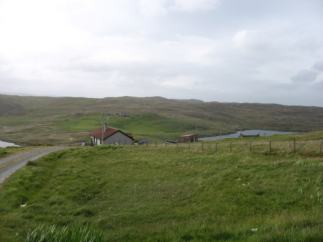
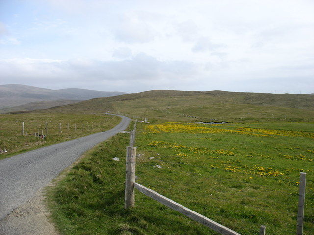
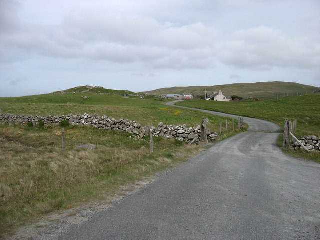
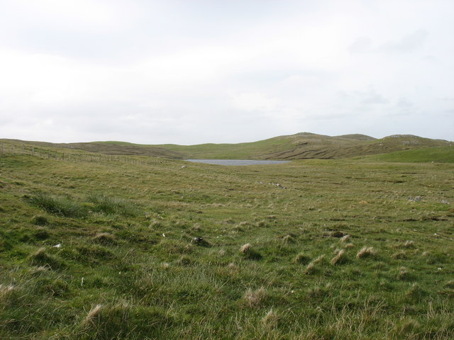
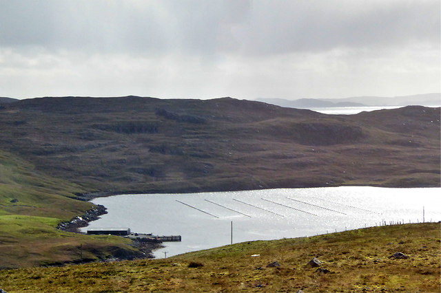
Neogar Shun Images

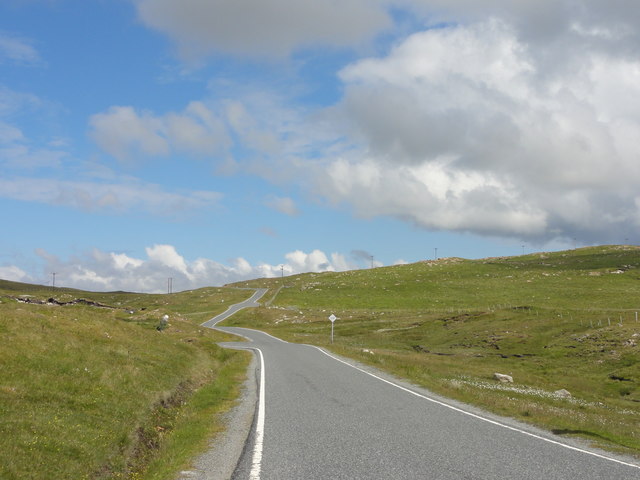
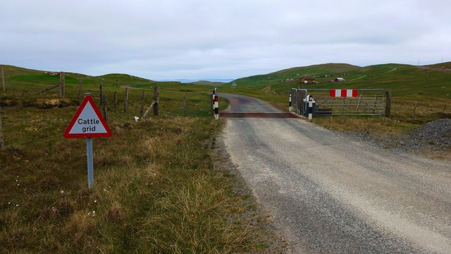
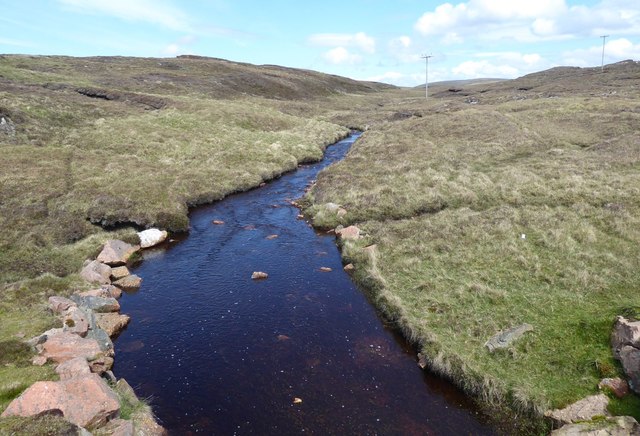
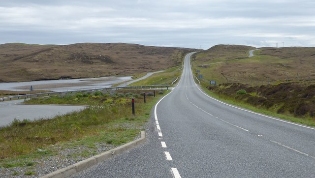
Images are sourced within 2km of 60.469913/-1.4112924 or Grid Reference HU3276. Thanks to Geograph Open Source API. All images are credited.

Olnesfirth and Hamar Voe
The lane from Olnesfirth The A970 is in the slight dip about 250 metres ahead.
The lane from Olnesfirth
The A970 is in the slight dip about 250 metres ahead.
Hamar Farm I was at the end of the public road: the rather battered sign says Private Road, although I doubt that there would have been any objection had I walked closer. But there wasn't anywhere to park!
Hamar Farm
I was at the end of the public road: the rather battered sign says Private Road, although I doubt that there would have been any objection had I walked closer. But there wasn't anywhere to park!
Stubba Water, and its surrounding low hills
The north tip of Punds Water
Punds Water One of the larger lochs in this part of Shetland.
Punds Water
One of the larger lochs in this part of Shetland.
The A970 heading for Brae Passing Smirnadale Water on the right.
The A970 heading for Brae
Passing Smirnadale Water on the right.
Punds Water View from the lay-by at Punds Water
Punds Water
View from the lay-by at Punds Water
Single track road View of the A970 single track road heading north
Single track road
View of the A970 single track road heading north
Cattle grid on the A970 to Urrafirth
Burn of Eelawater The outflow from Eela Water.
Heading for Hamar Voe.
Burn of Eelawater
The outflow from Eela Water. Heading for Hamar Voe.
Peat cutting Stacked for drying.
Peat cutting
Stacked for drying.
Road junction on A970 The A970 is a single-carriageway road that runs from south to north of Mainland Shetland, Scotland. The road also spurs to Scalloway and Hillswick.
This is the spur for Hillswick so all three roads are the A970!
Note the new road cutting directly over the hill while the old road meanders beside the loch and around the hill.
Road junction on A970
The A970 is a single-carriageway road that runs from south to north of Mainland Shetland, Scotland. The road also spurs to Scalloway and Hillswick. This is the spur for Hillswick so all three roads are the A970! Note the new road cutting directly over the hill while the old road meanders beside the loch and around the hill.
Hamar Voe Mussel Fishery Hamar Voe is an inlet on the east coast of the Northmavine on the northwest of mainland Shetland. It is the site for a common mussel (Mytilus edulis) fishery, comprised of a single long-line mussel farm located along the east shore of the main body of the voe.
Hamar Voe Mussel Fishery
Hamar Voe is an inlet on the east coast of the Northmavine on the northwest of mainland Shetland. It is the site for a common mussel (Mytilus edulis) fishery, comprised of a single long-line mussel farm located along the east shore of the main body of the voe.
Layby on the A970 The A970 runs for 71 miles across most of the length of the "Mainland" in the Shetland Islands. It is a good-quality single-carriageway road for most of its route. Travelling from south to north, the road begins at Grutness near Sumburgh Airport and winds around the many hills and inlets passing close to a number of small villages without going through any large ones before Lerwick. After looping around Lerwick, a short spur runs to Scalloway whilst the main route continues northwards towards Brae where it crosses the narrow isthmus of Mavis Grind. At Sandy Lochs the road splits and a four-mile spur goes through Urafirth to Hillswick. The main route continuing to the right towards its northern terminus at Isbister. This last part of the route tends to be narrower with passing places.

<span class="nowrap"><a title="https://www.sabre-roads.org.uk/wiki/index.php?title=A970" rel="nofollow ugc noopener" href="https://www.sabre-roads.org.uk/wiki/index.php?title=A970">Link</a><img style="margin-left:2px;" alt="External link" title="External link - shift click to open in new window" src="https://s1.geograph.org.uk/img/external.png" width="10" height="10"/></span>  SABRE
Layby on the A970
The A970 runs for 71 miles across most of the length of the "Mainland" in the Shetland Islands. It is a good-quality single-carriageway road for most of its route. Travelling from south to north, the road begins at Grutness near Sumburgh Airport and winds around the many hills and inlets passing close to a number of small villages without going through any large ones before Lerwick. After looping around Lerwick, a short spur runs to Scalloway whilst the main route continues northwards towards Brae where it crosses the narrow isthmus of Mavis Grind. At Sandy Lochs the road splits and a four-mile spur goes through Urafirth to Hillswick. The main route continuing to the right towards its northern terminus at Isbister. This last part of the route tends to be narrower with passing places. LinkExternal link SABRE
Layby on the A970 near Smirnadale Water The A970 runs for 71 miles across most of the length of the "Mainland" in the Shetland Islands. It is a good-quality single-carriageway road for most of its route. Travelling from south to north, the road begins at Grutness near Sumburgh Airport and winds around the many hills and inlets passing close to a number of small villages without going through any large ones before Lerwick. After looping around Lerwick, a short spur runs to Scalloway whilst the main route continues northwards towards Brae where it crosses the narrow isthmus of Mavis Grind. At Sandy Lochs the road splits and a four-mile spur goes through Urafirth to Hillswick. The main route continuing to the right towards its northern terminus at Isbister. This last part of the route tends to be narrower with passing places.

<span class="nowrap"><a title="https://www.sabre-roads.org.uk/wiki/index.php?title=A970" rel="nofollow ugc noopener" href="https://www.sabre-roads.org.uk/wiki/index.php?title=A970">Link</a><img style="margin-left:2px;" alt="External link" title="External link - shift click to open in new window" src="https://s1.geograph.org.uk/img/external.png" width="10" height="10"/></span>  SABRE
Layby on the A970 near Smirnadale Water
The A970 runs for 71 miles across most of the length of the "Mainland" in the Shetland Islands. It is a good-quality single-carriageway road for most of its route. Travelling from south to north, the road begins at Grutness near Sumburgh Airport and winds around the many hills and inlets passing close to a number of small villages without going through any large ones before Lerwick. After looping around Lerwick, a short spur runs to Scalloway whilst the main route continues northwards towards Brae where it crosses the narrow isthmus of Mavis Grind. At Sandy Lochs the road splits and a four-mile spur goes through Urafirth to Hillswick. The main route continuing to the right towards its northern terminus at Isbister. This last part of the route tends to be narrower with passing places. LinkExternal link SABRE
Layby on the Southbound A970 near Smirnadale Water The A970 runs for 71 miles across most of the length of the "Mainland" in the Shetland Islands. It is a good-quality single-carriageway road for most of its route. Travelling from south to north, the road begins at Grutness near Sumburgh Airport and winds around the many hills and inlets passing close to a number of small villages without going through any large ones before Lerwick. After looping around Lerwick, a short spur runs to Scalloway whilst the main route continues northwards towards Brae where it crosses the narrow isthmus of Mavis Grind. At Sandy Lochs the road splits and a four-mile spur goes through Urafirth to Hillswick. The main route continuing to the right towards its northern terminus at Isbister. This last part of the route tends to be narrower with passing places.

<span class="nowrap"><a title="https://www.sabre-roads.org.uk/wiki/index.php?title=A970" rel="nofollow ugc noopener" href="https://www.sabre-roads.org.uk/wiki/index.php?title=A970">Link</a><img style="margin-left:2px;" alt="External link" title="External link - shift click to open in new window" src="https://s1.geograph.org.uk/img/external.png" width="10" height="10"/></span>  SABRE
Layby on the Southbound A970 near Smirnadale Water
The A970 runs for 71 miles across most of the length of the "Mainland" in the Shetland Islands. It is a good-quality single-carriageway road for most of its route. Travelling from south to north, the road begins at Grutness near Sumburgh Airport and winds around the many hills and inlets passing close to a number of small villages without going through any large ones before Lerwick. After looping around Lerwick, a short spur runs to Scalloway whilst the main route continues northwards towards Brae where it crosses the narrow isthmus of Mavis Grind. At Sandy Lochs the road splits and a four-mile spur goes through Urafirth to Hillswick. The main route continuing to the right towards its northern terminus at Isbister. This last part of the route tends to be narrower with passing places. LinkExternal link SABRE
Northbound A970, Punds Water The A970 runs for 71 miles across most of the length of the "Mainland" in the Shetland Islands. It is a good-quality single-carriageway road for most of its route. Travelling from south to north, the road begins at Grutness near Sumburgh Airport and winds around the many hills and inlets passing close to a number of small villages without going through any large ones before Lerwick. After looping around Lerwick, a short spur runs to Scalloway whilst the main route continues northwards towards Brae where it crosses the narrow isthmus of Mavis Grind. At Sandy Lochs the road splits and a four-mile spur goes through Urafirth to Hillswick. The main route continuing to the right towards its northern terminus at Isbister. This last part of the route tends to be narrower with passing places.

<span class="nowrap"><a title="https://www.sabre-roads.org.uk/wiki/index.php?title=A970" rel="nofollow ugc noopener" href="https://www.sabre-roads.org.uk/wiki/index.php?title=A970">Link</a><img style="margin-left:2px;" alt="External link" title="External link - shift click to open in new window" src="https://s1.geograph.org.uk/img/external.png" width="10" height="10"/></span>  SABRE
Northbound A970, Punds Water
The A970 runs for 71 miles across most of the length of the "Mainland" in the Shetland Islands. It is a good-quality single-carriageway road for most of its route. Travelling from south to north, the road begins at Grutness near Sumburgh Airport and winds around the many hills and inlets passing close to a number of small villages without going through any large ones before Lerwick. After looping around Lerwick, a short spur runs to Scalloway whilst the main route continues northwards towards Brae where it crosses the narrow isthmus of Mavis Grind. At Sandy Lochs the road splits and a four-mile spur goes through Urafirth to Hillswick. The main route continuing to the right towards its northern terminus at Isbister. This last part of the route tends to be narrower with passing places. LinkExternal link SABRE
Show me another place!

Neogar Shun is located at Grid Ref: HU3276 (Lat: 60.469913, Lng: -1.4112924)

Unitary Authority: Shetland Islands

Police Authority: Highlands and Islands

What 3 Words

///worms.array.detained. Near Brae, Shetland Islands

Nearby Locations

Neogar Shun Sandy Lochs

Related Wikis

Punds Water

Punds Water is a freshwater loch near Mangaster in Northmavine, Shetland. It also gives its name to a nearby Neolithic heel-shaped cairn. == Heel-shaped... ==

Gunnister

Gunnister is a small 'abandoned' village at the North-West Mainland in Shetland, Scotland. It is most commonly known for the Gunnister Man - the remains...

Eela Water

Eela Water is a freshwater loch (lake) in Northmavine, part of the mainland of Shetland in Scotland. Besides being a freshwater fishing location, the site...

Northmavine

Northmavine or Northmaven (Old Norse: Norðan Mæfeið, meaning ‘the land north of the Mavis Grind’) is a peninsula in northwest Mainland Shetland in Scotland...

Nearby Amenities

Located within 500m of 60.469913,-1.4112924
Power: pole
Lat/Long: 60.4666831/-1.405322
Power: pole
Lat/Long: 60.4673759/-1.4058208
Power: pole
Lat/Long: 60.4679073/-1.4062446
Power: pole
Lat/Long: 60.4683449/-1.4064512
Power: pole
Lat/Long: 60.4687812/-1.4066416
Power: pole
Lat/Long: 60.4693616/-1.4074114
Power: pole
Lat/Long: 60.4699195/-1.4081275
Power: pole
Lat/Long: 60.4704417/-1.4093077
Power: pole
Lat/Long: 60.4711529/-1.4093721
Power: pole
Lat/Long: 60.4718165/-1.4094982
Power: pole
Lat/Long: 60.4724722/-1.4095464
Power: pole
Lat/Long: 60.4731199/-1.4096108
The data included in this document is from www.openstreetmap.org. The data is made available under ODbL.

Have you been to Neogar Shun?

Leave your review of Neogar Shun below (or comments, questions and feedback).