Ardsley Reservoir

Lake, Pool, Pond, Freshwater Marsh in Yorkshire

England

Ardsley Reservoir

St Michael's East Ardsley: lych gate The lych gate is close to, but distinct from the main churchyard entrance.
St Michael's East Ardsley: lych gate Credit: Stephen Craven

Ardsley Reservoir is a man-made lake located in Yorkshire, England. It is situated in the village of Ardsley, near Barnsley. The reservoir was constructed in the early 20th century to ensure a consistent water supply for the local area.

Covering an area of approximately 30 hectares, Ardsley Reservoir is surrounded by picturesque countryside, offering a tranquil and scenic setting. It is a popular spot for outdoor activities such as walking, birdwatching, and fishing. The reservoir is also home to a variety of wildlife, including ducks, geese, and swans, making it a haven for nature enthusiasts.

The water in Ardsley Reservoir is freshwater, sourced primarily from nearby rivers and rainfall. It is an important source of drinking water for the local community and is carefully managed to ensure its quality. The reservoir has a capacity of around 450 million gallons, making it a significant reservoir for the area.

The reservoir is enclosed by a dam on one side, which helps maintain the water levels and prevent flooding. The dam features a spillway, which allows excess water to flow out safely during times of heavy rainfall.

Ardsley Reservoir is a valuable asset to the local community, providing a beautiful natural environment and a vital water supply. Its peaceful surroundings and diverse wildlife make it a popular destination for both locals and visitors alike. Whether it's for a leisurely walk or to simply enjoy the serenity of the water, Ardsley Reservoir offers a pleasant escape from the hustle and bustle of everyday life.

If you have any feedback on the listing, please let us know in the comments section below.

Ardsley Reservoir Images

Images are sourced within 2km of 53.719972/-1.5600201 or Grid Reference SE2924. Thanks to Geograph Open Source API. All images are credited.

St Michael's East Ardsley: lych gate The lych gate is close to, but distinct from the main churchyard entrance.
St Michael's East Ardsley: lych gate
The lych gate is close to, but distinct from the main churchyard entrance.
St Michael's East Ardsley: war memorial The memorial is in the churchyard to the south of the church buildings. It is inscribed on all four sides with the names of the fallen of World War I, ordered by the year of death.
St Michael's East Ardsley: war memorial
The memorial is in the churchyard to the south of the church buildings. It is inscribed on all four sides with the names of the fallen of World War I, ordered by the year of death.
St Michael's East Ardsley: south side The tower is a prominent local landmark and contains a peal of eight bells and a clock by Potts of Leeds.
St Michael's East Ardsley: south side
The tower is a prominent local landmark and contains a peal of eight bells and a clock by Potts of Leeds.
St Michael's East Ardsley: south door An unusual feature for a 19th century church is this Norman doorway, retained from the earlier building on the site. It is seen here through the outer security gate of the porch.
St Michael's East Ardsley: south door
An unusual feature for a 19th century church is this Norman doorway, retained from the earlier building on the site. It is seen here through the outer security gate of the porch.
St Michael's East Ardsley: benchmark Cut into the south-west corner of the tower, with a bolt, and still looking clean-cut. See <a href="https://www.geograph.org.uk/photo/3339789">SE3025 : Benchmark on St Michael's Church</a> for a closer view. None of the older maps avaialble online seem to show it, but bench-marks.org.uk gives a value of 141.01m.
St Michael's East Ardsley: benchmark
Cut into the south-west corner of the tower, with a bolt, and still looking clean-cut. See SE3025 : Benchmark on St Michael's Church for a closer view. None of the older maps avaialble online seem to show it, but bench-marks.org.uk gives a value of 141.01m.
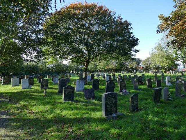
St Michael's East Ardsley: churchyard The churchyard is still open for burials.
St Michael's East Ardsley: churchyard
The churchyard is still open for burials.
St Michael's East Ardsley: churchyard extension The serried ranks of polished granite memorials make this look very much like a Council (secular) cemetery, but as far as I can tell it is an extension to the churchyard, just that a different style of memorial is permitted here.
St Michael's East Ardsley: churchyard extension
The serried ranks of polished granite memorials make this look very much like a Council (secular) cemetery, but as far as I can tell it is an extension to the churchyard, just that a different style of memorial is permitted here.
St Michael's East Ardsley: churchyard entrance The metal gate bears the name of the church.
St Michael's East Ardsley: churchyard entrance
The metal gate bears the name of the church.
Manhole cover, Church Lane, East Ardsley A 'no-rok' circular cover by Lees of Gomersal.
Manhole cover, Church Lane, East Ardsley
A 'no-rok' circular cover by Lees of Gomersal.
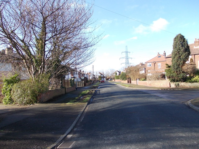
Green space, Church Lane, East Ardsley The housing beyond is relatively modern (at least compared with the 19th century church and hall).
Green space, Church Lane, East Ardsley
The housing beyond is relatively modern (at least compared with the 19th century church and hall).
St Michael's church hall, Church Lane, East Ardsley The right hand side is the original Sunday School of 1837, and on the left the 'Jubilee Wing' of 1897.
St Michael's church hall, Church Lane, East Ardsley
The right hand side is the original Sunday School of 1837, and on the left the 'Jubilee Wing' of 1897.
St Michael's church hall, Church Lane, East Ardsley (detail) Above the door are dates of construction (1837) and extension (1897). See <a href="https://www.geograph.org.uk/photo/7626300">SE3025 : St Michael's church hall, Church Lane, East Ardsley</a> for context.
St Michael's church hall, Church Lane, East Ardsley (detail)
Above the door are dates of construction (1837) and extension (1897). See SE3025 : St Michael's church hall, Church Lane, East Ardsley for context.
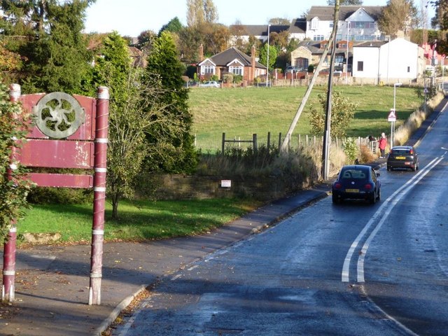
Blossom Cottage, Bradford Road, East Ardsley The building is end-on to the road and comprises at least two dwellings. The road is the main A650 between Bradford and Wakefield, which is still busy despite most through traffic taking the M62.
Blossom Cottage, Bradford Road, East Ardsley
The building is end-on to the road and comprises at least two dwellings. The road is the main A650 between Bradford and Wakefield, which is still busy despite most through traffic taking the M62.
Esso filling station, Bradford Road, East Ardsley With a Tesco Express as part of the offering.
Esso filling station, Bradford Road, East Ardsley
With a Tesco Express as part of the offering.
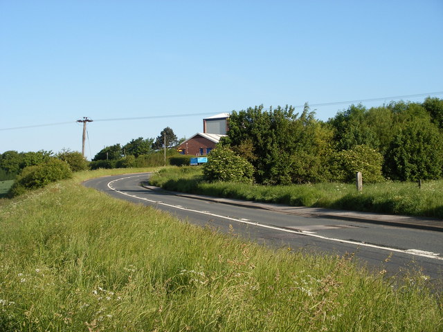
Derelict sheds, East Ardsley (1) These buildings have lost most of their cladding. There was fencing along the site boundary with dangerous structure warnings.
Derelict sheds, East Ardsley (1)
These buildings have lost most of their cladding. There was fencing along the site boundary with dangerous structure warnings.
Derelict sheds, East Ardsley (2) These buildings have lost most of their cladding. There was fencing along the site boundary with dangerous structure warnings.
Derelict sheds, East Ardsley (2)
These buildings have lost most of their cladding. There was fencing along the site boundary with dangerous structure warnings.
Field west of Pilden Lane With a horse box on the far side.
Field west of Pilden Lane
With a horse box on the far side.
Stile in the woods On the Leeds Country Way.
Stile in the woods
On the Leeds Country Way.
Show me another place!

Ardsley Reservoir is located at Grid Ref: SE2924 (Lat: 53.719972, Lng: -1.5600201)

Division: West Riding

Unitary Authority: Leeds

Police Authority: West Yorkshire

What 3 Words

///faced.vague.kick. Near Morley, West Yorkshire

Nearby Locations

Ardsley Reservoir

Related Wikis

Beggarington Hill

Beggarington Hill is a hamlet in the county of West Yorkshire, England, in the City of Leeds and at the border of Kirklees. Historically, it was part of...

Woodkirk

Woodkirk is an ancient village between Leeds and Dewsbury, West Yorkshire, England. The parish church is a grade II listed building. It is traditionally...

East Ardsley

East Ardsley is a village in the City of Leeds metropolitan borough, in West Yorkshire, England. East Ardsley forms part of the Heavy Woollen District...

Jaw Hill

Jaw Hill is a hill in the City of Leeds district of West Yorkshire, England. It is near Kirkhamgate in the City of Wakefield district. == History == A...

Tingley

Tingley is a suburban village in the City of Leeds in West Yorkshire, Northern England, forming part of the parish of West Ardsley. Tingley forms part...

Woodkirk Priory

Woodkirk Priory was a cell of Augustinian Canons in West Yorkshire, England. William, second earl of Warenne (d. 1138), had granted the land for its foundation...

Tingley railway station

Tingley railway station served the settlement of Tingley, West Yorkshire, England, from 1857 to 1966 on the Leeds, Bradford and Halifax Junction Railway...

Carr Gate

Carr Gate is a village in the Wakefield district, in the county of West Yorkshire, England. The village stands to the north-west of Wakefield, and south...

Nearby Amenities

Located within 500m of 53.719972,-1.5600201
Material: wood
Power: pole
Lat/Long: 53.7213139/-1.5531835
Material: wood
Power: pole
Lat/Long: 53.7221652/-1.5538601
Material: wood
Power: pole
Lat/Long: 53.7227688/-1.5543762
The data included in this document is from www.openstreetmap.org. The data is made available under ODbL.

Have you been to Ardsley Reservoir?

Leave your review of Ardsley Reservoir below (or comments, questions and feedback).