Adel Dam

Lake, Pool, Pond, Freshwater Marsh in Yorkshire

England

Adel Dam

Dalesway A stile on the Dalesway close to Eccup Reservoir Leeds
Dalesway Credit: Mick Melvin

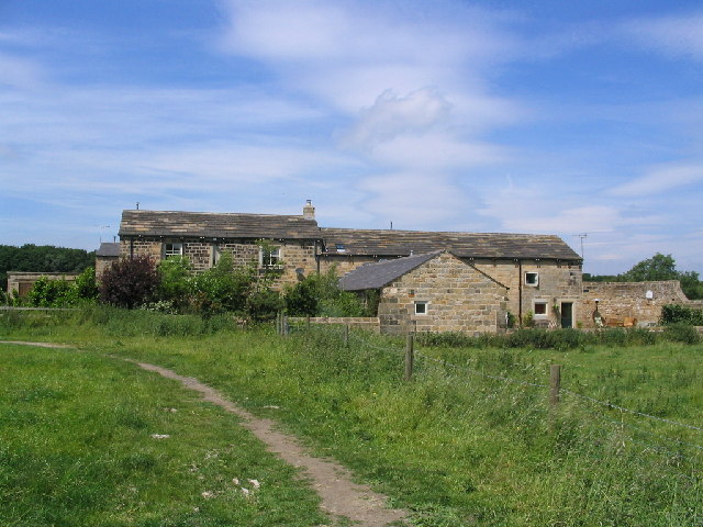
Adel Dam is a picturesque freshwater marsh located in Adel, Yorkshire, in the United Kingdom. Spanning over an area of approximately 25 acres, it is a haven for nature enthusiasts and wildlife lovers alike. The dam was originally constructed in the early 19th century to provide water for Adel Mill, a nearby corn mill.

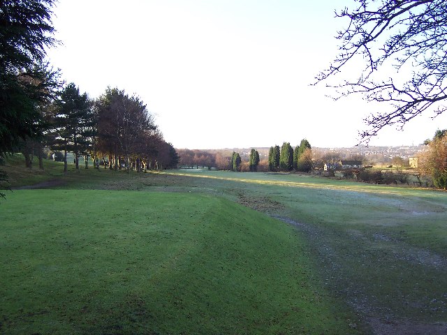
Surrounded by lush greenery and nestled amidst the rolling hills, Adel Dam offers a serene and tranquil atmosphere. It is primarily composed of a large lake, accompanied by smaller bodies of water such as pools and ponds. These interconnected water bodies create a diverse and dynamic ecosystem, supporting a wide variety of flora and fauna.

The area is a paradise for birdwatchers, as it attracts a plethora of bird species throughout the year. Visitors can spot a range of native and migratory birds, including herons, ducks, swans, and various species of songbirds. The dense vegetation surrounding the water bodies provides an ideal habitat for small mammals, amphibians, and reptiles.

Adel Dam is also home to a diverse range of plant life. The marshland is adorned with vibrant wildflowers, reeds, and grasses. Willow and alder trees line the banks of the water bodies, creating a picturesque landscape that changes with the seasons.

The dam is a popular destination for leisurely walks, picnics, and photography. It offers well-maintained footpaths that wind through the marshland, allowing visitors to explore the area at their own pace. Additionally, there is a visitor center that provides information about the local wildlife and conservation efforts.

Overall, Adel Dam is a natural gem that offers a peaceful retreat from the hustle and bustle of everyday life. It provides a valuable habitat for wildlife and serves as an educational and recreational destination for both locals and tourists.

If you have any feedback on the listing, please let us know in the comments section below.
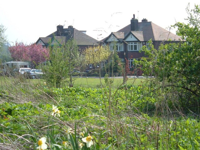
Adel Dam Images

Images are sourced within 2km of 53.866945/-1.5856092 or Grid Reference SE2741. Thanks to Geograph Open Source API. All images are credited.

Dalesway A stile on the Dalesway close to Eccup Reservoir Leeds
Dalesway
A stile on the Dalesway close to Eccup Reservoir Leeds
Golden Acre Park The lake at Golden Acre Park near Leeds.
Golden Acre Park
The lake at Golden Acre Park near Leeds.
The Bridge Golden Acre Park The bridge over Marsh Beck in Golden Acre Park Leeds
The Bridge Golden Acre Park
The bridge over Marsh Beck in Golden Acre Park Leeds
Old Rushes Farm Old Rushes Farm seen from the Leeds Country Way
Old Rushes Farm
Old Rushes Farm seen from the Leeds Country Way
Frosty morning on Headingley Golf Course Not actually in Headingley - but situated between Adel, Alwoodley and Eccup Lane
Frosty morning on Headingley Golf Course
Not actually in Headingley - but situated between Adel, Alwoodley and Eccup Lane
Farmland near Eccup. Just E of Eccup Whin.
Farmland near Eccup.
Just E of Eccup Whin.
St John The Baptist Church, Church Lane, Adel, Leeds This is one of the oldest churches in the Leeds area, dating back to Norman times (11th-12th century). Unusually for such an old church, it was not developed, enlarged or extended in Victorian times.
St John The Baptist Church, Church Lane, Adel, Leeds
This is one of the oldest churches in the Leeds area, dating back to Norman times (11th-12th century). Unusually for such an old church, it was not developed, enlarged or extended in Victorian times.
Adel Methodist Church, Holt Lane, Adel, Leeds
St John the Baptist Church, Church Lane, Adel, Leeds This church has a lovely Norman doorway.
St John the Baptist Church, Church Lane, Adel, Leeds
This church has a lovely Norman doorway.
Road repairs, Long Causeway, Adel, Leeds At the north end of Long Causeway, by its junction with Stairfoot Lane and Back Church Lane
Road repairs, Long Causeway, Adel, Leeds
At the north end of Long Causeway, by its junction with Stairfoot Lane and Back Church Lane
Stairfoot Lane, Alwoodley, Leeds Looking west towards Adel, near the junction of King Lane.
Stairfoot Lane, Alwoodley, Leeds
Looking west towards Adel, near the junction of King Lane.
Sycamore Close, Bramhope, LS16 Cul-de-sac at the southernmost edge of the village of Bramhope. Shown as undeveloped on the 1940s map.
Sycamore Close, Bramhope, LS16
Cul-de-sac at the southernmost edge of the village of Bramhope. Shown as undeveloped on the 1940s map.
Kings Drive, Bramhope, LS16 Situated just off the A660, Otley road. View from "Private Land", not someone's front garden.
Kings Drive, Bramhope, LS16
Situated just off the A660, Otley road. View from "Private Land", not someone's front garden.
A small deciduous wood, Bramhope Situated at the junction of Arthington Road and Black Hill Lane. Looking north east.
A small deciduous wood, Bramhope
Situated at the junction of Arthington Road and Black Hill Lane. Looking north east.
Five Lane Ends The junction of five roads! Two lead north-east to Eccup, one south-east to Alwoodley, one south-west to Adel and one north-west to Bramhope.
Five Lane Ends
The junction of five roads! Two lead north-east to Eccup, one south-east to Alwoodley, one south-west to Adel and one north-west to Bramhope.
The stream at Golden Acre Park The reed bed on the right is a recent development - I remememebr about 15 years ago there was open water, then a small sandbank which has grown (or been deliberately built up) over the years.
Seen just after coming through the tunnel from the car park.
The stream at Golden Acre Park
The reed bed on the right is a recent development - I remememebr about 15 years ago there was open water, then a small sandbank which has grown (or been deliberately built up) over the years. Seen just after coming through the tunnel from the car park.
Flower beds and monkey puzzle, Golden Acre Park Some of the flower beds near the cafe, with a monkey puzzle (Araucaria araucana)
Flower beds and monkey puzzle, Golden Acre Park
Some of the flower beds near the cafe, with a monkey puzzle (Araucaria araucana)
Field at Black Hill looking towards Bramhope This is taken from the plantation within Golden Acre Park, looking over the boundary fence.
Field at Black Hill looking towards Bramhope
This is taken from the plantation within Golden Acre Park, looking over the boundary fence.
Show me another place!

Adel Dam is located at Grid Ref: SE2741 (Lat: 53.866945, Lng: -1.5856092)

Division: West Riding

Unitary Authority: Leeds

Police Authority: West Yorkshire

What 3 Words

///echo.them.town. Near Bramhope, West Yorkshire

Related Wikis

Golden Acre Park

Golden Acre Park is a public park in Bramhope, Leeds, West Yorkshire, England (grid reference SE267417), administered by Leeds City Council. It is on...

Leeds Country Way

The Leeds Country Way is a circular long-distance footpath of 62 miles (99 km) around Leeds, West Yorkshire, England. It is never more than 7 miles (11...

Breary Marsh

Breary Marsh is a Local Nature Reserve and Site of Special Scientific Interest situated adjacent to Golden Acre Park in Leeds, West Yorkshire, England...

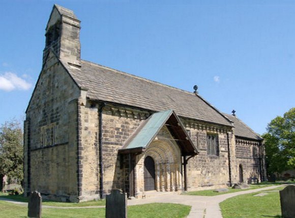
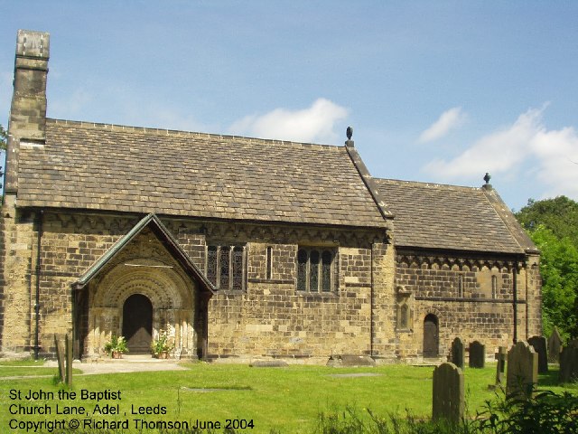
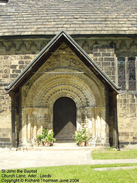
St John the Baptist Church, Adel

The Grade I listed, mainly Norman Church of Saint John the Baptist in Adel, Leeds, West Yorkshire, England has been described by Nicholas Pevsner as 'one...

Holt Park

Holt Park is a medium-sized low-rise 1970s housing estate in the northwest suburbs of Leeds, West Yorkshire, England. It is approximately 6 miles (10...

Eccup

Eccup is a village in the parish of Alwoodley and north of the City of Leeds, West Yorkshire, England. It is just north of Alwoodley and east of Bramhope...

A660 road

The A660 is a major road in the Leeds and Bradford districts of West Yorkshire, England that runs from Leeds city centre to Burley-in-Wharfedale where...

Ralph Thoresby School

Ralph Thoresby School is a foundation secondary school and sixth form located in Holt Park, Leeds, West Yorkshire, England. Named after the antiquarian...

Nearby Amenities

Located within 500m of 53.866945,-1.5856092
Duck Hut
Building: yes
Leisure: bird_hide
Lat/Long: 53.8695958/-1.5913194
Bus Stop
Leeds Road
Bench: no
Bin: yes
Bus: yes
Local Ref: 45014859
Naptan AtcoCode: 450014859
Naptan Bearing: SE
Naptan CommonName: Leeds Road
Naptan Crossing: Cocker Hill Farm
Naptan Indicator: Stop 45014859
Naptan Landmark: Parkway Hotel
Naptan PlusbusZoneRef: LEEDS
Naptan ShortCommonName: Otley Rd at Hotel
Naptan Street: Leeds Road
Naptan Verified: no
Public Transport: platform
Shelter: no
Source: naptan_import
Timetable: yes
Lat/Long: 53.8677124/-1.5930934
Burgodonum
Archaeological Site: fortification
Description: Roman fort on Ilkley - Tadcaster road
Fortification Type: castrum
Historic: archaeological_site
Historic Period: roman
Source Geometry: OS Sheet CCIII.NW, publ. 1894
Lat/Long: 53.8643906/-1.5821762
Bar
meanwood valley end
Fixme: Does this really exist? If so location needs checking. In the hotel?
Lat/Long: 53.8676198/-1.5929982
Man Made: mast
Source: survey
Tower Type: communication
Lat/Long: 53.8649462/-1.5911856
Waste Basket
Collection Times: Tu; Th
Condition: FAIR
Ref UK Leedscc Bin: 1754
Waste Basket Model: METAL TWIN
Lat/Long: 53.867456/-1.592728
Leeds Road
Bus: yes
Public Transport: stop_position
Lat/Long: 53.8675838/-1.5931052
Adel Mill
Historic: industrial
Output: unknown
Source: OS Sheet CCIII.NW, publ. 1894
Lat/Long: 53.8630179/-1.583533
The data included in this document is from www.openstreetmap.org. The data is made available under ODbL.

Have you been to Adel Dam?

Leave your review of Adel Dam below (or comments, questions and feedback).