Farnley Lake

Lake, Pool, Pond, Freshwater Marsh in Yorkshire Harrogate

England

Farnley Lake

Farnley church Southeastern aspect of Farnley parish church.
Farnley church Credit: David Spencer

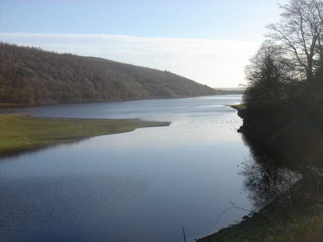
Farnley Lake is a picturesque body of water located in the county of Yorkshire, England. Nestled amidst the rolling hills and verdant countryside, this tranquil lake is a popular destination for nature enthusiasts and those seeking a peaceful retreat.

Spanning an area of approximately 10 acres, Farnley Lake is categorized as a freshwater pond or small lake. It is fed by natural springs and rainfall, ensuring a constant supply of clear, clean water. The lake is surrounded by lush vegetation and a diverse range of flora, creating a vibrant and scenic landscape.

The lake is home to a variety of freshwater fish species, including carp, pike, and perch. Anglers flock to Farnley Lake to test their skills and enjoy a day of fishing in the serene surroundings. The lake's calm waters also attract a multitude of waterfowl, making it a haven for birdwatchers. Visitors can often spot species such as swans, ducks, and herons, adding to the natural beauty of the area.

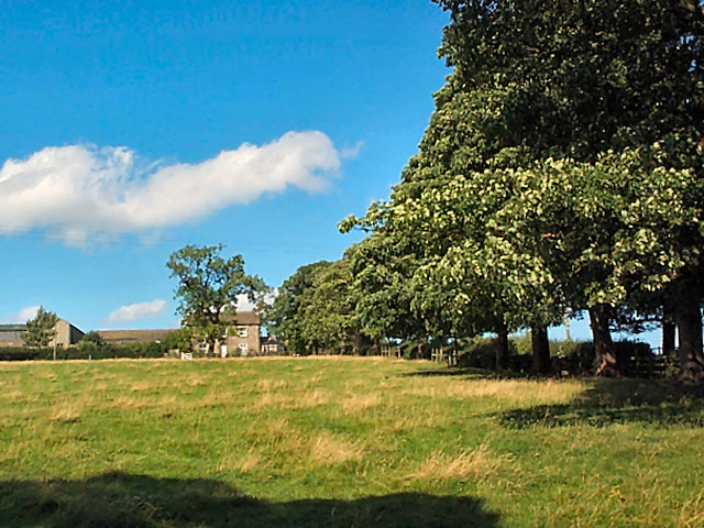
The surrounding area of Farnley Lake includes a freshwater marsh, which provides a habitat for numerous plant and animal species. This marshland is a thriving ecosystem, fostering biodiversity and attracting a range of wildlife. From the vibrant colors of blooming wildflowers to the gentle melodies of birdsong, the marsh offers a sensory experience that further enhances the allure of Farnley Lake.

In conclusion, Farnley Lake in Yorkshire is a captivating destination for those seeking tranquility and natural beauty. With its serene waters, diverse wildlife, and lush surroundings, this idyllic freshwater pond and its adjacent marshland offer a truly immersive experience for visitors.

If you have any feedback on the listing, please let us know in the comments section below.
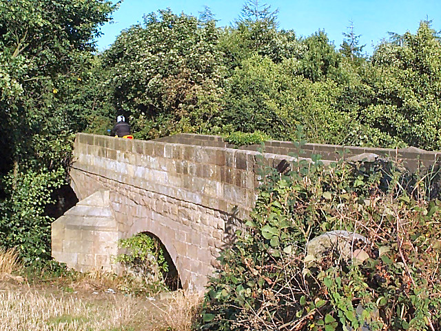
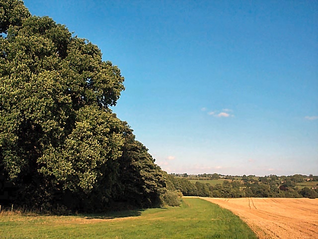
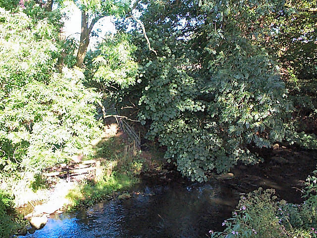
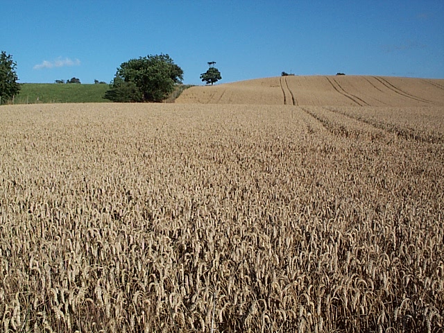
Farnley Lake Images

Images are sourced within 2km of 53.923971/-1.6560663 or Grid Reference SE2247. Thanks to Geograph Open Source API. All images are credited.

Farnley church Southeastern aspect of Farnley parish church.
Farnley church
Southeastern aspect of Farnley parish church.
Mount Pleasant farm Pleasant tree-lined drive, no nonsense farmhouse and humdrum functional farm buildings. View northwards from Farnley Lane.
Mount Pleasant farm
Pleasant tree-lined drive, no nonsense farmhouse and humdrum functional farm buildings. View northwards from Farnley Lane.
Corn field east of Otley Most of the field boundaries on the current 1:25k appear to have been removed, leaving just one huge East Anglian style cornfield covering most of the gridsquare, shelving gently downwards towards the River Wharfe.
Corn field east of Otley
Most of the field boundaries on the current 1:25k appear to have been removed, leaving just one huge East Anglian style cornfield covering most of the gridsquare, shelving gently downwards towards the River Wharfe.
Stubble and straw bales east of Otley The different stages of harvesting are shown here. Bales of straw await collection on the western horizon at the gridsquare boundary, there is bare stubble in the foreground, and between them an area of recently ploughed land looks almost like a wall.
Stubble and straw bales east of Otley
The different stages of harvesting are shown here. Bales of straw await collection on the western horizon at the gridsquare boundary, there is bare stubble in the foreground, and between them an area of recently ploughed land looks almost like a wall.
Leathley Bridge The bridge crosses the River Washburn shortly before its confluence with the Wharfe.  Although vegetation obscures the river and the bridge's main span, the motorcyclist on the bridge's brow establishes the scale of the bridge.  It is therefore surprising that the modest River Washburn supports such an enormous series of reservoirs on its way to this point.
Leathley Bridge
The bridge crosses the River Washburn shortly before its confluence with the Wharfe. Although vegetation obscures the river and the bridge's main span, the motorcyclist on the bridge's brow establishes the scale of the bridge. It is therefore surprising that the modest River Washburn supports such an enormous series of reservoirs on its way to this point.
Farnley Estate land To the left, a private wood and hidden lake belonging to the Farnley Estate.  To the right, a cornfield with an eco-friendly margin of grassland that includes the footpath which crosses the gridsquare east/west.
Farnley Estate land
To the left, a private wood and hidden lake belonging to the Farnley Estate. To the right, a cornfield with an eco-friendly margin of grassland that includes the footpath which crosses the gridsquare east/west.
River Washburn at Leathley Seen from the footbridge near Fishpool looking southwards, the river has surprisingly steep wooded banks.
River Washburn at Leathley
Seen from the footbridge near Fishpool looking southwards, the river has surprisingly steep wooded banks.
Hilly cornfield, Leathley Moor The term 'moor' implies an upland location but, as seen here, it doesn't necessarily imply that the land is barren.
Hilly cornfield, Leathley Moor
The term 'moor' implies an upland location but, as seen here, it doesn't necessarily imply that the land is barren.
Lindley Bridge The bridge carries a quiet minor road across the wooded course of the River Washburn below Lindley Wood Reservoir.
Lindley Bridge
The bridge carries a quiet minor road across the wooded course of the River Washburn below Lindley Wood Reservoir.
Dam of Lindley Wood reservoir
Small valley near Haddockstones Farm This almost, but not quite, dry valley runs eastwards on the north side of the footpath, and demonstrates how the vegetation varies with the ground conditions even in such a tiny area.
Small valley near Haddockstones Farm
This almost, but not quite, dry valley runs eastwards on the north side of the footpath, and demonstrates how the vegetation varies with the ground conditions even in such a tiny area.
Gates of Farnley Hall Farnely Hall is an Elizabethan hall with late C18th additions and was visited by Ruskin and J M W Turner.  The C21st public has to make do with this view.
Gates of Farnley Hall
Farnely Hall is an Elizabethan hall with late C18th additions and was visited by Ruskin and J M W Turner. The C21st public has to make do with this view.
Farnley Hall. Looking N from the A659, near Otley.
Farnley Hall.
Looking N from the A659, near Otley.
Lindley Hall Farm Here the farm buildings have been modernised and, I suspect, converted into several homes.
Lindley Hall Farm
Here the farm buildings have been modernised and, I suspect, converted into several homes.
Houses opposite Lindley Hall Farm, Lindley, North Yorkshire These are built in vernacular style, but are modern (not shown on the 1974 1:25000 map).
Houses opposite Lindley Hall Farm, Lindley, North Yorkshire
These are built in vernacular style, but are modern (not shown on the 1974 1:25000 map).
Overflow and Dam, Lindley Wood Reservoir Lindley Wood is one of 4 reservoirs in the Washburn Valley. It was built in the 1870s to supply water to Leeds.
Overflow and Dam, Lindley Wood Reservoir
Lindley Wood is one of 4 reservoirs in the Washburn Valley. It was built in the 1870s to supply water to Leeds.
Dam, Lindley Wood Reservoir Environment Agency River Level Recorder in foreground.
Dam, Lindley Wood Reservoir
Environment Agency River Level Recorder in foreground.
Environment Agency River Level Recorder By the overflow of Lindley Wood Reservoir
Environment Agency River Level Recorder
By the overflow of Lindley Wood Reservoir
Show me another place!

Farnley Lake is located at Grid Ref: SE2247 (Lat: 53.923971, Lng: -1.6560663)

Division: West Riding

Administrative County: North Yorkshire

District: Harrogate

Police Authority: North Yorkshire

What 3 Words

///nudge.wells.dolly. Near Stainburn, North Yorkshire

Related Wikis

Leathley

Leathley is a village and civil parish in the Harrogate district of North Yorkshire, England, the parish includes the townships of both Castley and Leathley...

Farnley Hall, North Yorkshire

Farnley Hall is a stately home in Farnley, North Yorkshire, England. It is located near Otley. The original early seventeenth-century house was added to...

Lindley, North Yorkshire

Lindley is a village and civil parish in the Harrogate district of North Yorkshire, England. It is near Lindley Wood Reservoir and 1 mile north of Otley...

Farnley, North Yorkshire

Farnley is a village and civil parish in the Harrogate district of North Yorkshire, England, near Otley, West Yorkshire. The name "Farnley" indicates that...

River Washburn

The River Washburn is a river in Yorkshire, England. It originates high in the Yorkshire Dales and ends where it meets the River Wharfe. It lies within...

Lindley Wood Reservoir

Lindley Wood Reservoir is located in the Washburn valley north of Otley in Yorkshire, England. == History == The reservoir was built by navvies between...

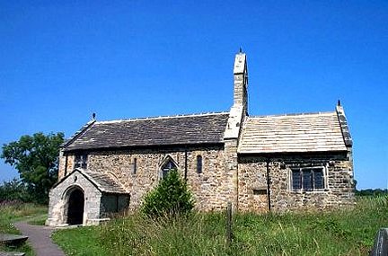
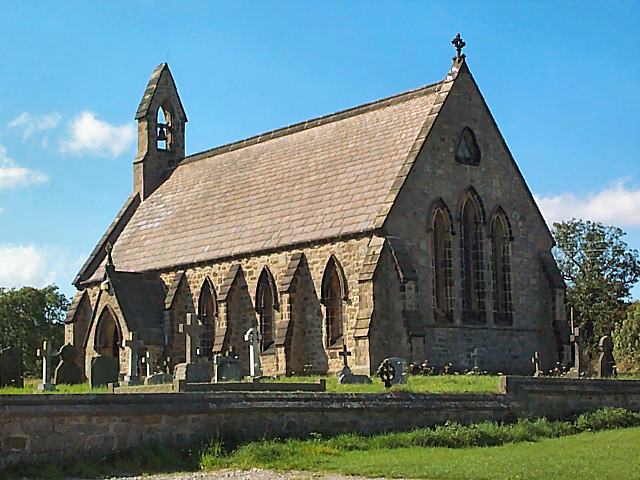
St Mary's Church, Stainburn

St Mary's Church is a redundant Anglican church in the village of Stainburn, North Yorkshire, England. It is recorded in the National Heritage List for...

Braythorn

Braythorn is a village in the Harrogate district of North Yorkshire, England.

Nearby Amenities

Located within 500m of 53.923971,-1.6560663
Moss House
Building: yes
Fixme: Does this still exist as a ruin?
Source: OS Yorkshire 187, 1851
Lat/Long: 53.9243087/-1.6549226
Pub
Sun Inn
Source: local_knowledge
Lat/Long: 53.9233071/-1.6487693
Leathley Mill
Archaeological Site: industrial
Historic: industrial
Output: corn
Source: OS Yorkshire 187, 1851
Lat/Long: 53.9254803/-1.6498645
Information: guidepost
Tourism: information
Lat/Long: 53.925473/-1.6491652
Barrier: stile
Lat/Long: 53.9254666/-1.6491955
The data included in this document is from www.openstreetmap.org. The data is made available under ODbL.

Have you been to Farnley Lake?

Leave your review of Farnley Lake below (or comments, questions and feedback).