Bowmoor Lake
Lake, Pool, Pond, Freshwater Marsh in Gloucestershire Cotswold
England
Bowmoor Lake
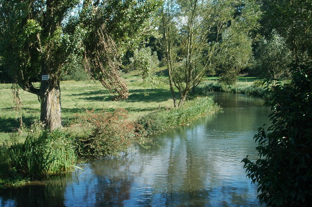
Bowmoor Lake, located in Gloucestershire, is a picturesque body of water known for its stunning natural beauty and diverse ecosystem. This freshwater lake spans an area of approximately 100 acres and is surrounded by lush greenery and rolling hills, providing a serene and tranquil setting for visitors.
As a popular destination for nature enthusiasts and anglers, Bowmoor Lake offers a variety of recreational activities. The lake itself is well-stocked with a range of fish species, including carp, pike, and perch, making it an ideal spot for fishing. Anglers can be seen casting their lines from the shores or from boats, enjoying the peaceful ambiance and the thrill of a potential catch.
The lake is also a haven for birdwatchers, as it attracts a wide array of bird species throughout the year. Visitors can spot common waterfowl such as mallards and swans, as well as more elusive birds like kingfishers and herons. With its surrounding marshes and reed beds, Bowmoor Lake provides a vital habitat for these birds and other wildlife, creating a rich and diverse ecosystem.
For those looking to explore the lake's surroundings, there are several walking trails and picnic areas available. The scenic views and abundant wildlife make it a popular spot for photographers and nature lovers alike. Additionally, the lake hosts various events and competitions throughout the year, attracting both locals and tourists to its shores.
Overall, Bowmoor Lake in Gloucestershire offers a unique and enchanting experience for visitors, combining natural beauty, recreational activities, and abundant wildlife in a peaceful and idyllic setting.
If you have any feedback on the listing, please let us know in the comments section below.
Bowmoor Lake Images
Images are sourced within 2km of 51.689751/-1.7300108 or Grid Reference SU1899. Thanks to Geograph Open Source API. All images are credited.
![A figure of eight walk from Lechlade-on-Thames [7] The path now runs along the field edge.
After leaving Lechlade, the route joins the long distance Thames and Severn Way and passes the southern edge of Bowmoor Lake. Turning north, and looping around the northern edge of the lake, the Thames and Severn Way is re-joined and followed to the banks of the River Thames and back to Lechlade. Slightly over 5 miles.](https://s1.geograph.org.uk/geophotos/07/26/41/7264121_27a44cb8.jpg)
![A figure of eight walk from Lechlade-on-Thames [8] The path approaches the point where it joins the Thames and Severn Way.
After leaving Lechlade, the route joins the long distance Thames and Severn Way and passes the southern edge of Bowmoor Lake. Turning north, and looping around the northern edge of the lake, the Thames and Severn Way is re-joined and followed to the banks of the River Thames and back to Lechlade. Slightly over 5 miles.](https://s2.geograph.org.uk/geophotos/07/26/41/7264122_b7e2555a.jpg)
![A figure of eight walk from Lechlade-on-Thames [9] The path to Main Street leaves the track that is the Thames and Severn Way.
After leaving Lechlade, the route joins the long distance Thames and Severn Way and passes the southern edge of Bowmoor Lake. Turning north, and looping around the northern edge of the lake, the Thames and Severn Way is re-joined and followed to the banks of the River Thames and back to Lechlade. Slightly over 5 miles.](https://s3.geograph.org.uk/geophotos/07/26/41/7264123_4324e15f.jpg)
![A figure of eight walk from Lechlade-on-Thames [43] Now beyond the southern edge of the lake, the track continues with access to a property on the right.
After leaving Lechlade, the route joins the long distance Thames and Severn Way and passes the southern edge of Bowmoor Lake. Turning north, and looping around the northern edge of the lake, the Thames and Severn Way is re-joined and followed to the banks of the River Thames and back to Lechlade. Slightly over 5 miles.](https://s1.geograph.org.uk/geophotos/07/26/52/7265265_1600e270.jpg)
![A figure of eight walk from Lechlade-on-Thames [44] A property on the south side of the track.
After leaving Lechlade, the route joins the long distance Thames and Severn Way and passes the southern edge of Bowmoor Lake. Turning north, and looping around the northern edge of the lake, the Thames and Severn Way is re-joined and followed to the banks of the River Thames and back to Lechlade. Slightly over 5 miles.](https://s3.geograph.org.uk/geophotos/07/26/52/7265267_35ae6a48.jpg)
![A figure of eight walk from Lechlade-on-Thames [45] Looking back along the road.
After leaving Lechlade, the route joins the long distance Thames and Severn Way and passes the southern edge of Bowmoor Lake. Turning north, and looping around the northern edge of the lake, the Thames and Severn Way is re-joined and followed to the banks of the River Thames and back to Lechlade. Slightly over 5 miles.](https://s2.geograph.org.uk/geophotos/07/26/60/7266014_7ccd338b.jpg)
![A figure of eight walk from Lechlade-on-Thames [46] At this junction of paths, the route now heads south towards the confluence of the River Coln with the River Thames.
After leaving Lechlade, the route joins the long distance Thames and Severn Way and passes the southern edge of Bowmoor Lake. Turning north, and looping around the northern edge of the lake, the Thames and Severn Way is re-joined and followed to the banks of the River Thames and back to Lechlade. Slightly over 5 miles.](https://s3.geograph.org.uk/geophotos/07/26/60/7266015_db91a609.jpg)
![A figure of eight walk from Lechlade-on-Thames [47] The track gives access to leads to The Round House.
After leaving Lechlade, the route joins the long distance Thames and Severn Way and passes the southern edge of Bowmoor Lake. Turning north, and looping around the northern edge of the lake, the Thames and Severn Way is re-joined and followed to the banks of the River Thames and back to Lechlade. Slightly over 5 miles.](https://s0.geograph.org.uk/geophotos/07/26/60/7266016_33728d6f.jpg)
![A figure of eight walk from Lechlade-on-Thames [48] The public footpath veers to the left, the track continues to The Round House.
After leaving Lechlade, the route joins the long distance Thames and Severn Way and passes the southern edge of Bowmoor Lake. Turning north, and looping around the northern edge of the lake, the Thames and Severn Way is re-joined and followed to the banks of the River Thames and back to Lechlade. Slightly over 5 miles.](https://s1.geograph.org.uk/geophotos/07/26/60/7266017_e2af831d.jpg)
![A figure of eight walk from Lechlade-on-Thames [49] This bridge carries the track to The Round House over the River Coln.
Here the River Coln and the River Thames have their confluence and, between the rivers, the now disused Thames and Severn Canal comes to an end as it meets the river.
After leaving Lechlade, the route joins the long distance Thames and Severn Way and passes the southern edge of Bowmoor Lake. Turning north, and looping around the northern edge of the lake, the Thames and Severn Way is re-joined and followed to the banks of the River Thames and back to Lechlade. Slightly over 5 miles.](https://s2.geograph.org.uk/geophotos/07/26/60/7266018_b8ba8707.jpg)
![A figure of eight walk from Lechlade-on-Thames [50] This footbridge carries the long distance Thames and Severn Way over the River Thames. Here the River Coln and the River Thames have their confluence and, between the rivers, the now disused Thames and Severn Canal comes to an end as it joins the river.
After leaving Lechlade, the route joins the long distance Thames and Severn Way and passes the southern edge of Bowmoor Lake. Turning north, and looping around the northern edge of the lake, the Thames and Severn Way is re-joined and followed to the banks of the River Thames and back to Lechlade. Slightly over 5 miles.](https://s3.geograph.org.uk/geophotos/07/26/60/7266019_f4c5d9d6.jpg)
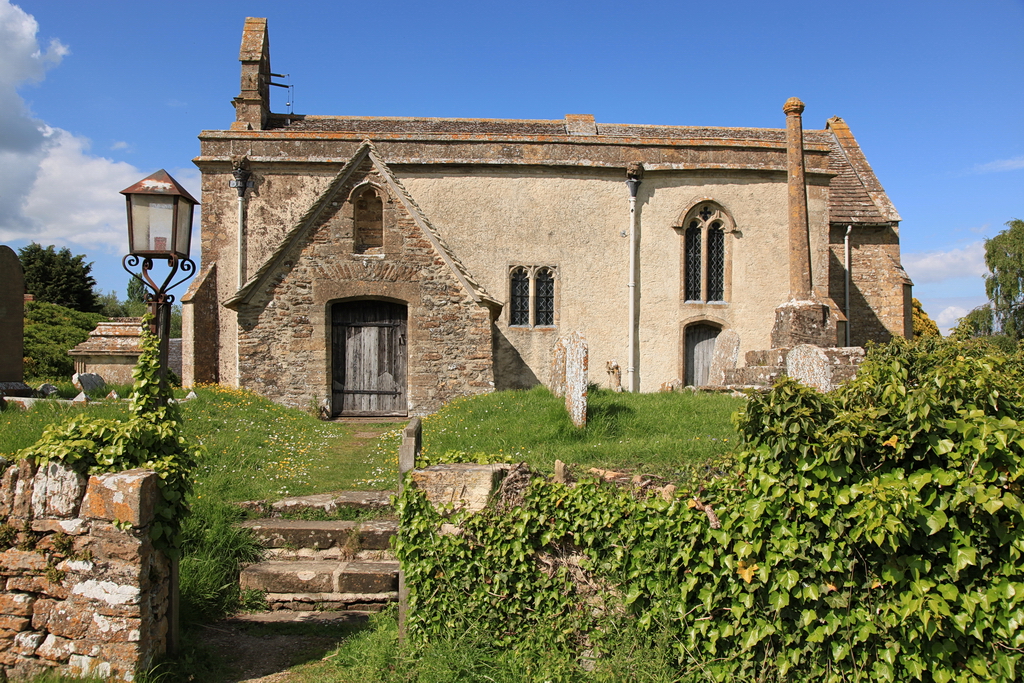
![A figure of eight walk from Lechlade-on-Thames [51] The Round House is set alongside the now disused Thames and Severn Canal where it comes to an end as it joins the River Thames. Seen from the path that is now both the Thames and Severn Way and The Thames Path. The Round House and the Round House Cottage are both listed, grade II, with details for The Round House at: <span class="nowrap"><a title="https://historicengland.org.uk/listing/the-list/list-entry/1089423" rel="nofollow ugc noopener" href="https://historicengland.org.uk/listing/the-list/list-entry/1089423">Link</a><img style="margin-left:2px;" alt="External link" title="External link - shift click to open in new window" src="https://s1.geograph.org.uk/img/external.png" width="10" height="10"/></span> and for Round House Cottage at: <span class="nowrap"><a title="https://historicengland.org.uk/listing/the-list/list-entry/1089424" rel="nofollow ugc noopener" href="https://historicengland.org.uk/listing/the-list/list-entry/1089424">Link</a><img style="margin-left:2px;" alt="External link" title="External link - shift click to open in new window" src="https://s1.geograph.org.uk/img/external.png" width="10" height="10"/></span>
After leaving Lechlade, the route joins the long distance Thames and Severn Way and passes the southern edge of Bowmoor Lake. Turning north, and looping around the northern edge of the lake, the Thames and Severn Way is re-joined and followed to the banks of the River Thames and back to Lechlade. Slightly over 5 miles.](https://s0.geograph.org.uk/geophotos/07/26/60/7266020_4f023a98.jpg)
![A figure of eight walk from Lechlade-on-Thames [52] The path, both the Thames and Severn Way and The Thames Path, runs alongside the River Thames towards Lechlade.
After leaving Lechlade, the route joins the long distance Thames and Severn Way and passes the southern edge of Bowmoor Lake. Turning north, and looping around the northern edge of the lake, the Thames and Severn Way is re-joined and followed to the banks of the River Thames and back to Lechlade. Slightly over 5 miles.](https://s1.geograph.org.uk/geophotos/07/26/60/7266021_c8c87121.jpg)
![A figure of eight walk from Lechlade-on-Thames [54] A view across the fields to The Round House. There is a closer view of the Round House at <a href="https://www.geograph.org.uk/photo/7266020">SU2098 : A figure of eight walk from Lechlade-on-Thames [51]</a>.
After leaving Lechlade, the route joins the long distance Thames and Severn Way and passes the southern edge of Bowmoor Lake. Turning north, and looping around the northern edge of the lake, the Thames and Severn Way is re-joined and followed to the banks of the River Thames and back to Lechlade. Slightly over 5 miles.](https://s0.geograph.org.uk/geophotos/07/26/60/7266024_c50a8b90.jpg)


Bowmoor Lake is located at Grid Ref: SU1899 (Lat: 51.689751, Lng: -1.7300108)
Administrative County: Gloucestershire
District: Cotswold
Police Authority: Gloucestershire
What 3 Words
///slime.backlog.thousands. Near Lechlade, Gloucestershire
Nearby Locations
Related Wikis
River Coln
The River Coln is a river in Gloucestershire, England. It rises to the north of Brockhampton, a village to the east of Cheltenham, and flows in a south/south...
Whelford
Whelford is a village in the civil parish of Kempsford, in the Cotswold district, in the county of Gloucestershire, England. Whelford lies in the Cotswold...
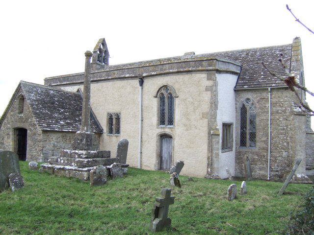
St John the Baptist Church, Inglesham
St John the Baptist Church in Inglesham, near Swindon, Wiltshire, England, has Anglo-Saxon origins but most of the current structure was built around 1205...
Inglesham
Inglesham is a small village and civil parish in the Borough of Swindon, Wiltshire, England, notable for the Grade-I listed St John the Baptist Church...
Nearby Amenities
Located within 500m of 51.689751,-1.7300108Have you been to Bowmoor Lake?
Leave your review of Bowmoor Lake below (or comments, questions and feedback).