Albert Reservoir

Lake, Pool, Pond, Freshwater Marsh in Yorkshire

England

Albert Reservoir

Bankfield Museum In Akroyd Park at Boothtown, a council run museum.
Bankfield Museum Credit: Kevin Waterhouse

Albert Reservoir is a freshwater body located in the county of Yorkshire, England. It is situated in the borough of Barnsley, near the village of Royston. The reservoir covers an area of approximately 45 hectares and was originally constructed in the 19th century for the purpose of supplying water to the local industries.

The reservoir is surrounded by picturesque countryside and is a popular spot for outdoor activities such as fishing, birdwatching, and walking. It is home to a variety of water birds, including herons, ducks, geese, and swans, making it a haven for bird enthusiasts. The tranquil atmosphere and scenic views also make it a favored spot for picnicking and relaxation.

The water in Albert Reservoir is sourced from a nearby stream and is primarily used for recreational purposes. It is regularly stocked with fish, including carp, roach, and bream, attracting anglers from the surrounding areas. Fishing permits are available for purchase, allowing visitors to enjoy a day of peaceful fishing in the serene surroundings.

The reservoir is surrounded by a mixture of woodland and grassland, providing a diverse habitat for a range of plant and animal species. The area is also known for its wetland vegetation, including reeds and rushes, creating a freshwater marsh environment that supports a unique ecosystem.

In summary, Albert Reservoir in Yorkshire is a picturesque freshwater body that offers a range of recreational activities, including fishing, birdwatching, and walking. Its serene surroundings and diverse wildlife make it a popular destination for nature lovers and those seeking a peaceful escape in the beautiful Yorkshire countryside.

If you have any feedback on the listing, please let us know in the comments section below.

Albert Reservoir Images

Images are sourced within 2km of 53.727812/-1.8908359 or Grid Reference SE0725. Thanks to Geograph Open Source API. All images are credited.

Bankfield Museum In Akroyd Park at Boothtown, a council run museum.
Bankfield Museum
In Akroyd Park at Boothtown, a council run museum.
The Victoria Memorial In The Square within the model Victorian village of Akroydon, Halifax.
The Victoria Memorial
In The Square within the model Victorian village of Akroydon, Halifax.
The former Christ Church School, Pellon, Halifax This is a revisit to the first geograph for the square <a href="https://www.geograph.org.uk/photo/39495">SE0726 : Pellon Community Centre</a>, taken in August 2005. The school building appears to be disused at present.
The former Christ Church School, Pellon, Halifax
This is a revisit to the first geograph for the square SE0726 : Pellon Community Centre, taken in August 2005. The school building appears to be disused at present.
Crossley Heath School Mixed Grammar School and Sixth Form with Academy status, formed by the amalgamation of Heath Grammar founded in 1585 and Crossley Porter School founded in 1887.
Located in Savile Park, Halifax.
Crossley Heath School
Mixed Grammar School and Sixth Form with Academy status, formed by the amalgamation of Heath Grammar founded in 1585 and Crossley Porter School founded in 1887. Located in Savile Park, Halifax.
Wainhouse Tower At 247 feet, the tower is reputed to be the tallest folly in the world.
Designed as an elaborate chimney for Dye Works owned by John Wainhouse, and constructed between 1871 to 1875 to comply with the Smoke Abatement Act. However, Wainhouse sold out before completion and the new owners refused to pay the cost of the chimney.
Wainhouse kept the tower for himself as an observatory.
Grade II Listed Building. Open on Bank Holidays.
<a href="https://www.geograph.org.uk/photo/6936161">SE0724 : Base of the Wainhouse Tower</a>

<span class="nowrap"><a title="www.visitcalderdale.com>attra-wainhouse-tower" rel="nofollow ugc noopener" href="http://www.visitcalderdale.com>attra-wainhouse-tower">Link</a><img style="margin-left:2px;" alt="External link" title="External link - shift click to open in new window" src="https://s1.geograph.org.uk/img/external.png" width="10" height="10"/></span>
Wainhouse Tower
At 247 feet, the tower is reputed to be the tallest folly in the world. Designed as an elaborate chimney for Dye Works owned by John Wainhouse, and constructed between 1871 to 1875 to comply with the Smoke Abatement Act. However, Wainhouse sold out before completion and the new owners refused to pay the cost of the chimney. Wainhouse kept the tower for himself as an observatory. Grade II Listed Building. Open on Bank Holidays. SE0724 : Base of the Wainhouse Tower LinkExternal link
View from Rochdale Road, King Cross
Base of the Wainhouse Tower Doorway to the tallest folly in the world - a structure at 247 feet, can be seen pretty much from anywhere in Mid Calderdale
<a href="https://www.geograph.org.uk/photo/6936124">SE0724 : Wainhouse Tower</a>
Base of the Wainhouse Tower
Doorway to the tallest folly in the world - a structure at 247 feet, can be seen pretty much from anywhere in Mid Calderdale SE0724 : Wainhouse Tower
The Wainhouse Tavern On Upper Washer Lane, it was formerly known as the Royal. The change of name has probably something to do with former occupant John Wainhouse - the same Victorian gentleman responsible for the nearby tower, which also bears his name.
<a href="https://www.geograph.org.uk/photo/2054746">SE0724 : The Royal pub, Upper Washer Lane</a>
The Wainhouse Tavern
On Upper Washer Lane, it was formerly known as the Royal. The change of name has probably something to do with former occupant John Wainhouse - the same Victorian gentleman responsible for the nearby tower, which also bears his name. SE0724 : The Royal pub, Upper Washer Lane
Descending to Darcey Hey Lane Fine old cobbled route below the A58, Rochdale Road
Descending to Darcey Hey Lane
Fine old cobbled route below the A58, Rochdale Road
Houses under construction, Wakefield Road, Sowerby Bridge The access will be from Washer Lane, above the site.
Houses under construction, Wakefield Road, Sowerby Bridge
The access will be from Washer Lane, above the site.
Boy Lane
Boy Lane
Hawthorn Street viewed from Aachen Way
Aachen Hall The folly of Wainhouse Tower can be seen behind
Aachen Hall
The folly of Wainhouse Tower can be seen behind
Broad Street, Halifax
Water cascading down Windle Royd Lane I was trying to walk up the hill to get to a wedding in the church, but ended up with wet feet where the pavement gives out a short way further up.  This was on a day of prolonged heavy rain following 'Storm Eunice' on the 18th.
Water cascading down Windle Royd Lane
I was trying to walk up the hill to get to a wedding in the church, but ended up with wet feet where the pavement gives out a short way further up. This was on a day of prolonged heavy rain following 'Storm Eunice' on the 18th.
Church of St John the Evangelist, Warley - outside Photographed briefly on a very wet day, see <a href="https://www.geograph.org.uk/photo/7102165">SE0624 : Water cascading down Windle Royd Lane</a>. The church was built in 1877-78 by the prolific local architect W Swinden Barber and is grade II listed (list entry 1259129).
Church of St John the Evangelist, Warley - outside
Photographed briefly on a very wet day, see SE0624 : Water cascading down Windle Royd Lane. The church was built in 1877-78 by the prolific local architect W Swinden Barber and is grade II listed (list entry 1259129).
Church of St John the Evangelist, Warley - inside The church was built in 1877-78 by the prolific local architect W Swinden Barber and is grade II listed (list entry 1259129).
Church of St John the Evangelist, Warley - inside
The church was built in 1877-78 by the prolific local architect W Swinden Barber and is grade II listed (list entry 1259129).
Church of St John the Evangelist, Warley - stained glass One of three windows in the south aisle, this one shows Christ in the Temple as a twelve year old boy. The others depict the Nativity and Presentation.
Church of St John the Evangelist, Warley - stained glass
One of three windows in the south aisle, this one shows Christ in the Temple as a twelve year old boy. The others depict the Nativity and Presentation.
Show me another place!

Albert Reservoir is located at Grid Ref: SE0725 (Lat: 53.727812, Lng: -1.8908359)

Division: West Riding

Unitary Authority: Calderdale

Police Authority: West Yorkshire

What 3 Words

///brick.army.never. Near Sowerby Bridge, West Yorkshire

Nearby Locations

Albert Reservoir Pellon

Related Wikis

Thrum Hall

Thrum Hall was a rugby league stadium on Hanson Lane in Halifax, West Yorkshire, England. It was the home of Halifax for 112 years. The site on which the...

The Halifax Academy

The Halifax Academy (formerly Halifax High) is a mixed all-through school located in Halifax, West Yorkshire, England. The school is predominantly made...

Pellon railway station

Pellon railway station is a closed station that served the area of Pellon in Halifax, West Yorkshire, England. == History == It was one of two stations...
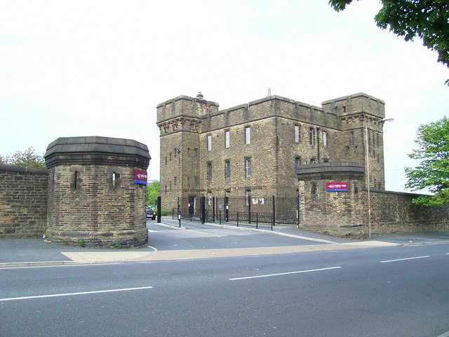
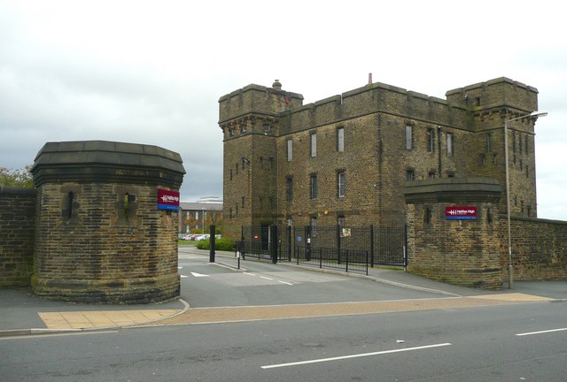
Wellesley Barracks

Wellesley Barracks is a military installation in Halifax, West Yorkshire, England. == History == The barracks was built in the Fortress Gothic Revival...

Nearby Amenities

Located within 500m of 53.727812,-1.8908359
Mini Roundabout
Direction: clockwise
Lat/Long: 53.727719/-1.8972214
Bus Stop
Moor End Road Sandbeds Road
Bus: yes
Local Ref: 45017302
Naptan AtcoCode: 450017302
Naptan Bearing: SE
Naptan CommonName: Moor End Road Sandbeds Road
Naptan Crossing: Sandbeds Road
Naptan Indicator: Stop 45017302
Naptan Notes: Shelter installed 15 August 2008, still awaiting photo and snagging sheets as at 22 August 2008
Naptan PlusbusZoneRef: LEEDS
Naptan ShortCommonName: Sandbeds Road
Naptan Street: Moor End Road
Naptan Verified: no
Public Transport: platform
Source: naptan_import
Lat/Long: 53.7310149/-1.8933781
Bus Stop
Moor End Road Sandbeds Road
Bus: yes
Local Ref: 45017303
Naptan AtcoCode: 450017303
Naptan Bearing: NW
Naptan CommonName: Moor End Road Sandbeds Road
Naptan Crossing: Sandbeds Terrace
Naptan Indicator: Stop 45017303
Naptan Notes: OSR taken place 220905
Naptan PlusbusZoneRef: LEEDS
Naptan ShortCommonName: Sandbeds Terrace
Naptan Street: Moor End Road
Naptan Verified: no
Public Transport: platform
Source: naptan_import
Lat/Long: 53.7308442/-1.8934544
Bus Stop
Moor End Road Cross Street
Bench: no
Bus: yes
Local Ref: 45017304
Naptan AtcoCode: 450017304
Naptan Bearing: SE
Naptan CommonName: Moor End Road Cross Street
Naptan Crossing: Cross Street
Naptan Indicator: Stop 45017304
Naptan Landmark: Social Club (Pellon)
Naptan Notes: OSR taken place 011105 size 2 case fitted
Naptan PlusbusZoneRef: LEEDS
Naptan ShortCommonName: Cross Street
Naptan Street: Moorend Road
Naptan Verified: no
Public Transport: platform
Shelter: yes
Source: naptan_import
Lat/Long: 53.7304381/-1.8916213
Bus Stop
Moor End Road Cross Street West
Bench: no
Bus: yes
Local Ref: 45017305
Naptan AtcoCode: 450017305
Naptan Bearing: NW
Naptan CommonName: Moor End Road Cross Street West
Naptan Crossing: Cross Street West
Naptan Indicator: Stop 45017305
Naptan Landmark: Wellington Court
Naptan Notes: OSR taken place 230905
Naptan PlusbusZoneRef: LEEDS
Naptan ShortCommonName: Cross Street West
Naptan Street: Moor End Road
Naptan Verified: no
Public Transport: platform
Shelter: no
Source: naptan_import
Lat/Long: 53.7303033/-1.8916974
Bus Stop
Rye Lane Bottom Stretchgate Lane
Bus: yes
Local Ref: 45017306
Naptan AtcoCode: 450017306
Naptan Bearing: N
Naptan CommonName: Rye Lane Bottom Stretchgate Lane
Naptan Crossing: Stretchgate Lane
Naptan Indicator: Stop 45017306
Naptan Landmark: School
Naptan Notes: OSR taken place 180106
Naptan PlusbusZoneRef: LEEDS
Naptan ShortCommonName: Holmes Terrace
Naptan Street: Sandbeds Road
Naptan Verified: no
Public Transport: platform
Source: naptan_import
Lat/Long: 53.7293628/-1.8953225
Bus Stop
Sandbeds Road Holmes Terrace
Bus: yes
Local Ref: 45017307
Naptan AtcoCode: 450017307
Naptan Bearing: S
Naptan CommonName: Sandbeds Road Holmes Terrace
Naptan Crossing: Holmes Terrace
Naptan Indicator: Stop 45017307
Naptan Landmark: School
Naptan Notes: OSR taken place 180106
Naptan PlusbusZoneRef: LEEDS
Naptan ShortCommonName: Holmes Terrace
Naptan Street: Sandbeds Road
Naptan Verified: no
Public Transport: platform
Source: naptan_import
Lat/Long: 53.7293177/-1.8951255
Bus Stop
Rye Lane Bottom Ling Bob
Bus: yes
Local Ref: 45017369
Naptan AtcoCode: 450017369
Naptan Bearing: NW
Naptan CommonName: Rye Lane Bottom Ling Bob
Naptan Crossing: Ling Bob
Naptan Indicator: Stop 45017369
Naptan Landmark: Unknown
Naptan PlusbusZoneRef: LEEDS
Naptan ShortCommonName: Ling Bob
Naptan Street: Rye Lane
Naptan Verified: no
Public Transport: platform
Source: naptan_import
Lat/Long: 53.7283395/-1.8969771
Bus Stop
Rye Lane
Bus: yes
Local Ref: 45017370
Naptan AtcoCode: 450017370
Naptan Bearing: SE
Naptan CommonName: Rye Lane
Naptan Crossing: Ling Bob
Naptan Indicator: Stop 45017370
Naptan Landmark: School
Naptan Notes: OSR taken place 311005
Naptan PlusbusZoneRef: LEEDS
Naptan ShortCommonName: Ling Bob
Naptan Street: Rye Lane
Naptan Verified: no
Public Transport: platform
Source: naptan_import
Lat/Long: 53.7283663/-1.89678
Bus Stop
Albert Road Highroad Well Lane
Bus: yes
Local Ref: 45017371
Naptan AtcoCode: 450017371
Naptan Bearing: SE
Naptan CommonName: Albert Road Highroad Well Lane
Naptan Crossing: Highroad Well Lane
Naptan Indicator: Stop 45017371
Naptan Notes: OSR taken place 311005
Naptan PlusbusZoneRef: LEEDS
Naptan ShortCommonName: Highroad Well Lane
Naptan Street: Albert Road
Naptan Verified: no
Public Transport: platform
Source: naptan_import
Lat/Long: 53.7276654/-1.8969182
Bus Stop
Albert Road Highroad Well Lane
Bus: yes
Local Ref: 45017372
Naptan AtcoCode: 450017372
Naptan Bearing: NW
Naptan CommonName: Albert Road Highroad Well Lane
Naptan Crossing: High Royd Well Lane
Naptan Indicator: Stop 45017372
Naptan Notes: OSR taken place 311005
Naptan PlusbusZoneRef: LEEDS
Naptan ShortCommonName: Highroad Well Lane
Naptan Street: Albert Road
Naptan Verified: no
Public Transport: platform
Source: naptan_import
Lat/Long: 53.7275125/-1.8968124
Bus Stop
Albert Road
Local Ref: 45017373
Naptan AtcoCode: 450017373
Naptan Bearing: NW
Naptan CommonName: Albert Road
Naptan Crossing: Sandhall Green
Naptan Indicator: Stop 45017373
Naptan Notes: OSR taken place 180106
Naptan PlusbusZoneRef: LEEDS
Naptan ShortCommonName: Sandhall Green
Naptan Street: Albert Road
Naptan Verified: no
Source: naptan_import
Lat/Long: 53.7271071/-1.8957373
Bus Stop
Albert Road Albert Drive
Local Ref: 45017374
Naptan AtcoCode: 450017374
Naptan Bearing: SE
Naptan CommonName: Albert Road Albert Drive
Naptan Crossing: Albert Drive
Naptan Indicator: Stop 45017374
Naptan Notes: OSR taken place 201205
Naptan PlusbusZoneRef: LEEDS
Naptan ShortCommonName: Albert Drive
Naptan Street: Albert Road
Naptan Verified: no
Source: naptan_import
Lat/Long: 53.7270347/-1.895207
Bus Stop
Albert Road Albert View
Bus: yes
Local Ref: 45017375
Naptan AtcoCode: 450017375
Naptan Bearing: W
Naptan CommonName: Albert Road Albert View
Naptan Crossing: Albert View
Naptan Indicator: Stop 45017375
Naptan Landmark: Victoria Terminal
Naptan PlusbusZoneRef: LEEDS
Naptan ShortCommonName: Albert View
Naptan Street: Albert Road
Naptan Verified: no
Public Transport: platform
Source: naptan_import
Lat/Long: 53.7261606/-1.8926478
Bus Stop
Albert Road
Bus: yes
Local Ref: 45017376
Naptan AtcoCode: 450017376
Naptan Bearing: E
Naptan CommonName: Albert Road
Naptan Crossing: Albert View
Naptan Indicator: Stop 45017376
Naptan Landmark: Victoria Terminal
Naptan PlusbusZoneRef: LEEDS
Naptan ShortCommonName: Albert View
Naptan Street: Albert Road
Naptan Verified: no
Public Transport: platform
Source: naptan_import
Lat/Long: 53.726232/-1.8921019
Bus Stop
Albert Road Spring Hall Lane
Bus: yes
Local Ref: 45017377
Naptan AtcoCode: 450017377
Naptan Bearing: W
Naptan CommonName: Albert Road Spring Hall Lane
Naptan Crossing: Spring Hall Lane
Naptan Indicator: Stop 45017377
Naptan Notes: OSR taken place 201205
Naptan PlusbusZoneRef: LEEDS
Naptan ShortCommonName: Spring Hall Lane
Naptan Street: Albert Road
Naptan Verified: no
Public Transport: platform
Source: naptan_import
Lat/Long: 53.7259905/-1.8904734
Bus Stop
Albert Road Spring Hall Lane
Bus: yes
Local Ref: 45017378
Naptan AtcoCode: 450017378
Naptan Bearing: E
Naptan CommonName: Albert Road Spring Hall Lane
Naptan Crossing: Spring Hall Lane
Naptan Indicator: Stop 45017378
Naptan Notes: OSR taken place 071105
Naptan PlusbusZoneRef: LEEDS
Naptan ShortCommonName: Spring Hall Lane
Naptan Street: Albert Road
Naptan Verified: no
Public Transport: platform
Source: naptan_import
Lat/Long: 53.7260438/-1.8901583
Bus Stop
Hanson Lane Thrum Hall Lane
Bus: yes
Local Ref: 45017379
Naptan AtcoCode: 450017379
Naptan Bearing: W
Naptan CommonName: Hanson Lane Thrum Hall Lane
Naptan Crossing: Thrum Hall Lane
Naptan Indicator: Stop 45017379
Naptan Landmark: ASDA
Naptan Notes: OSR taken place 071105
Naptan PlusbusZoneRef: LEEDS
Naptan ShortCommonName: Clay Pits Lane
Naptan Street: Hanson Lane
Naptan Verified: no
Public Transport: platform
Source: naptan_import
Lat/Long: 53.7256258/-1.8878398
Bus Stop
Hanson Lane Clay Pits Lane
Bus: yes
Local Ref: 45017380
Naptan AtcoCode: 450017380
Naptan Bearing: E
Naptan CommonName: Hanson Lane Clay Pits Lane
Naptan Crossing: Clay Pit Lane
Naptan Indicator: Stop 45017380
Naptan Landmark: ASDA
Naptan Notes: OSR taken place 071105
Naptan PlusbusZoneRef: LEEDS
Naptan ShortCommonName: Clay Pit Lane
Naptan Street: Hanson Lane
Naptan Verified: no
Public Transport: platform
Source: naptan_import
Lat/Long: 53.7256614/-1.8873747
Bus Stop
Spring Hall Lane Long Lower Lane
Bench: no
Bin: no
Bus: yes
Lit: yes
Local Ref: 45017384
Naptan AtcoCode: 450017384
Naptan Bearing: SW
Naptan CommonName: Spring Hall Lane Long Lower Lane
Naptan Crossing: Lower Clay Pits
Naptan Indicator: Stop 45017384
Naptan Landmark: Church
Naptan PlusbusZoneRef: LEEDS
Naptan ShortCommonName: Lower Clay Pits
Naptan Street: Spring Hall Lane
Naptan Verified: no
Public Transport: platform
Shelter: yes
Source: naptan_import
Tactile Paving: no
Lat/Long: 53.7283171/-1.8874217
Bus Stop
Spring Hall Lane Pellon
Bench: no
Bin: no
Bus: yes
Lit: yes
Local Ref: 45017385
Naptan AtcoCode: 450017385
Naptan Bearing: NE
Naptan CommonName: Spring Hall Lane Pellon
Naptan Indicator: Stop 45017385
Naptan Landmark: Church
Naptan PlusbusZoneRef: LEEDS
Naptan ShortCommonName: Long Lover Lane
Naptan Street: Spring Hall Lane
Naptan Verified: no
Public Transport: platform
Shelter: yes
Source: naptan_import
Tactile Paving: no
Lat/Long: 53.7281157/-1.8878986
Bus Stop
Albert Road Spring Hall Lane
Bench: no
Bin: yes
Bus: yes
Local Ref: 45017386
Naptan AtcoCode: 450017386
Naptan Bearing: N
Naptan CommonName: Albert Road Spring Hall Lane
Naptan Crossing: Albert Road
Naptan Indicator: Stop 45017386
Naptan Notes: OSR taken place 071105
Naptan PlusbusZoneRef: LEEDS
Naptan ShortCommonName: Albert Road
Naptan Street: Spring Hall Lane
Naptan Verified: no
Public Transport: platform
Shelter: yes
Source: naptan_import
Tactile Paving: no
Lat/Long: 53.7264183/-1.8894188
Bus Stop
Spring Hall Lane Hanson Lane
Bench: no
Bin: no
Bus: yes
Lit: no
Local Ref: 45017387
Naptan AtcoCode: 450017387
Naptan Bearing: E
Naptan CommonName: Spring Hall Lane Hanson Lane
Naptan Crossing: Hanson Lane
Naptan Indicator: Stop 45017387
Naptan Notes: OSR taken place 191205
Naptan PlusbusZoneRef: LEEDS
Naptan ShortCommonName: Hanson Lane
Naptan Street: Spring Hall Lane
Naptan Verified: no
Public Transport: platform
Shelter: no
Source: naptan_import
Tactile Paving: no
Lat/Long: 53.7261575/-1.8892982
Bus Stop
Spring Hall Lane Spring Grove
Local Ref: 45017388
Naptan AtcoCode: 450017388
Naptan Bearing: SW
Naptan CommonName: Spring Hall Lane Spring Grove
Naptan Crossing: Spring Grove
Naptan Indicator: Stop 45017388
Naptan Notes: OSR taken place 041105
Naptan PlusbusZoneRef: LEEDS
Naptan ShortCommonName: Newstead Avenue
Naptan Street: Spring Hall Lane
Naptan Verified: no
Source: naptan_import
Lat/Long: 53.7239298/-1.8908651
Bus Stop
Spring Hall Lane Spring Grove
Bus: yes
Local Ref: 45017389
Naptan AtcoCode: 450017389
Naptan Bearing: NE
Naptan CommonName: Spring Hall Lane Spring Grove
Naptan Crossing: Spring Grove
Naptan Indicator: Stop 45017389
Naptan Notes: OSR taken place 041105
Naptan PlusbusZoneRef: LEEDS
Naptan ShortCommonName: Newstead Avenue
Naptan Street: Spring Hall Lane
Naptan Verified: no
Public Transport: platform
Source: naptan_import
Lat/Long: 53.72393/-1.8910166
Bus Stop
Pellon New Road Stretchgate Lane
Bus: yes
Local Ref: 45017468
Naptan AtcoCode: 450017468
Naptan Bearing: NW
Naptan CommonName: Pellon New Road Stretchgate Lane
Naptan Crossing: Stretchgate Lane
Naptan Indicator: Stop 45017468
Naptan Notes: OSR taken place 071105
Naptan PlusbusZoneRef: LEEDS
Naptan ShortCommonName: Stretchgate Lane
Naptan Street: Pellon New Road
Naptan Verified: no
Public Transport: platform
Source: naptan_import
Lat/Long: 53.7297714/-1.889895
Bus Stop
Pellon New Road Stretchgate Lane
Bus: yes
Local Ref: 45017469
Naptan AtcoCode: 450017469
Naptan Bearing: SE
Naptan CommonName: Pellon New Road Stretchgate Lane
Naptan Crossing: Stretchgate Lane
Naptan Indicator: Stop 45017469
Naptan Landmark: Fountain Head PH
Naptan PlusbusZoneRef: LEEDS
Naptan ShortCommonName: Stretchgate Lane
Naptan Street: Pellon New Road
Naptan Verified: no
Public Transport: platform
Source: naptan_import
Lat/Long: 53.7296357/-1.8890011
Bus Stop
Pellon Golden Pheasant
Bus: yes
Local Ref: 45017470
Naptan AtcoCode: 450017470
Naptan Bearing: E
Naptan CommonName: Pellon Golden Pheasant
Naptan Crossing: Spring Hall Lane
Naptan Indicator: Stop 45017470
Naptan Landmark: Golden Pheasant PH
Naptan PlusbusZoneRef: LEEDS
Naptan ShortCommonName: Spring Hall Lane
Naptan Street: Pellon New Road
Naptan Verified: yes
Public Transport: platform
Source: naptan_import
Lat/Long: 53.729461/-1.885496
Bus Stop
Pellon New Road Spring Hall Lane
Bench: yes
Bin: yes
Local Ref: 45017471
Naptan AtcoCode: 450017471
Naptan Bearing: W
Naptan CommonName: Pellon New Road Spring Hall Lane
Naptan Crossing: Spring Hall Lane
Naptan Indicator: Stop 45017471
Naptan Landmark: Golden Pheasant PH
Naptan PlusbusZoneRef: LEEDS
Naptan ShortCommonName: Spring Hall Lane
Naptan Street: Pellon New Road
Naptan Verified: no
Shelter: yes
Source: naptan_import
Tactile Paving: no
Lat/Long: 53.7292946/-1.8863076
Bus Stop
Spring Hall Lane Spring Hall Grove
Bus: yes
Local Ref: 45025400
Naptan AtcoCode: 450025400
Naptan Bearing: S
Naptan CommonName: Spring Hall Lane Spring Hall Grove
Naptan Crossing: Spring Hall Grove
Naptan Indicator: Stop 45025400
Naptan Landmark: ASDA
Naptan Notes: OSR taken place 041105
Naptan PlusbusZoneRef: LEEDS
Naptan ShortCommonName: Hanson Lane
Naptan Street: Spring Hall Lane
Naptan Verified: no
Public Transport: platform
Source: naptan_import
Lat/Long: 53.7257263/-1.8895418
Fast Food
McDonald's
Addr City: Halifax
Addr Postcode: HX1 4PG
Brand: McDonald's
Brand Wikidata: Q38076
Brand Wikipedia: en:McDonald's
Contact Website: https://www.mcdonalds.com/gb/en-gb/location/halifax/asda-halifax/thrum-hall-lane/8261320.html
Cuisine: burger
Description: Inside Asda
Fhrs Id: 347086
Takeaway: yes
Lat/Long: 53.7249418/-1.8891119
Recycling
Lat/Long: 53.7243019/-1.8873451
Mini Roundabout
Direction: clockwise
Lat/Long: 53.7290893/-1.8953307
Pub
The New Street
Lat/Long: 53.7294284/-1.8928397
Noexit: yes
Lat/Long: 53.724159/-1.8886027
Noexit: yes
Lat/Long: 53.7242727/-1.8893119
Atm
Fee: no
Operator: Barclays Bank PLC
Lat/Long: 53.7250925/-1.8882749
Noexit: yes
Lat/Long: 53.7242689/-1.8949755
Turning Circle
Lat/Long: 53.7263301/-1.8877068
Noexit: yes
Lat/Long: 53.7268215/-1.8885099
Noexit: yes
Lat/Long: 53.7264557/-1.8870628
Noexit: yes
Lat/Long: 53.7269857/-1.8870146
Noexit: yes
Lat/Long: 53.7268754/-1.8878125
Turning Circle
Sandbeds Terrace
Lat/Long: 53.7303274/-1.8936715
New Pellon
Is In: Halifax
Place: suburb
Source: npe
Lat/Long: 53.7307331/-1.8963709
Noexit: yes
Lat/Long: 53.7266548/-1.8869766
Mount Pellon
Place: neighbourhood
Lat/Long: 53.7294996/-1.8871382
Noexit: yes
Lat/Long: 53.7242015/-1.888961
Pellon
Abandoned Railway: station
Railway: site
Wikidata: Q7161592
Wikipedia: en:Pellon railway station
Lat/Long: 53.7290788/-1.8836018
Barrier: yes
Foot: yes
Lat/Long: 53.728378/-1.894026
Barrier: yes
Foot: yes
Lat/Long: 53.7233257/-1.8903981
Crossing
Lat/Long: 53.7260577/-1.8894581
Crossing
Lat/Long: 53.7259501/-1.8897813
Crossing
Lat/Long: 53.7257873/-1.8895994
Crossing
Button Operated: yes
Crossing: traffic_signals
Crossing Island: no
Tactile Paving: yes
Traffic Signals Sound: yes
Lat/Long: 53.7258891/-1.8893104
Morrisons Daily
Addr City: Halifax
Addr Postcode: HX2 0QF
Addr Street: Highroad Well Lane
Brand: Morrisons Daily
Brand Wikidata: Q99752411
Fhrs Id: 347544
Operator: McColl's
Operator Wikidata: Q16997477
Shop: convenience
Website: https://my.morrisons.com/storefinder/64320/morrisons-daily-halifax-highroad-well-lane
Lat/Long: 53.7285753/-1.896448
The data included in this document is from www.openstreetmap.org. The data is made available under ODbL.

Have you been to Albert Reservoir?

Leave your review of Albert Reservoir below (or comments, questions and feedback).