Eastern Lake

Lake, Pool, Pond, Freshwater Marsh in Dorset

England

Eastern Lake

Ferry Road, Studland Ferry Road heading north across Studland Heath, towards the chain ferry which provides a connection to Sandbanks and onwards towards Poole, Bournemouth and beyond.
Ferry Road, Studland Credit: Malc McDonald

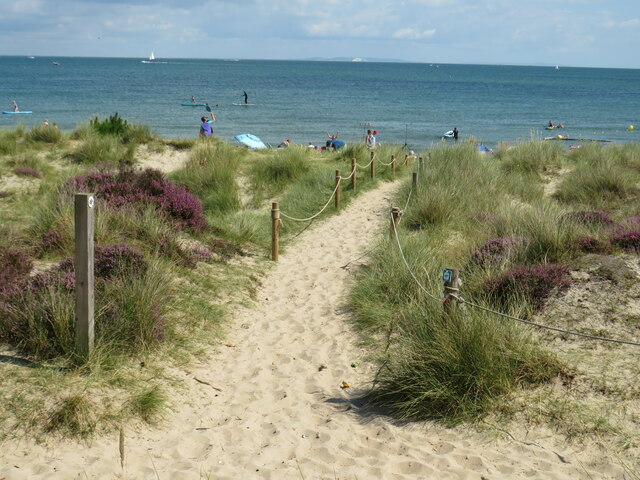
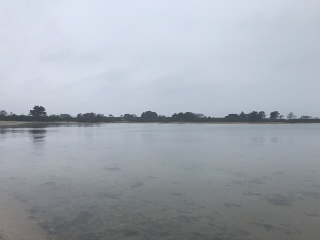
Eastern Lake, located in Dorset, is a picturesque freshwater marsh that offers a serene and tranquil environment for visitors. Spanning over a vast area, the lake is a popular destination for nature enthusiasts and outdoor adventurers alike.

With crystal-clear waters and a diverse ecosystem, Eastern Lake is home to a wide array of flora and fauna. Lush vegetation surrounds the lake, including cattails, water lilies, and various aquatic plants that thrive in the marshy environment. The lake also serves as a habitat for numerous bird species, such as herons, ducks, and geese, making it a haven for birdwatching enthusiasts.

The calm and still nature of Eastern Lake makes it an ideal spot for various water activities. Visitors can enjoy boating, kayaking, and canoeing on the peaceful waters, taking in the breathtaking views of the surrounding landscape. Fishing is also a popular pastime, with the lake being abundant in various freshwater fish species, including bass, pike, and perch.

For those seeking a more relaxed experience, Eastern Lake provides several picnic areas and walking trails. Visitors can take a leisurely stroll along the lake's edge, immersing themselves in the tranquility of the marshland. The area is also a great spot for nature photography, with its beautiful scenery and wildlife.

Overall, Eastern Lake in Dorset offers a unique natural experience, combining the beauty of a lake, pool, pond, and freshwater marsh. Its diverse ecosystem, water activities, and serene surroundings make it a must-visit destination for nature lovers and anyone seeking a peaceful retreat.

If you have any feedback on the listing, please let us know in the comments section below.

Eastern Lake Images

Images are sourced within 2km of 50.664859/-1.9522935 or Grid Reference SZ0385. Thanks to Geograph Open Source API. All images are credited.

Ferry Road, Studland Ferry Road heading north across Studland Heath, towards the chain ferry which provides a connection to Sandbanks and onwards towards Poole, Bournemouth and beyond.
Ferry Road, Studland
Ferry Road heading north across Studland Heath, towards the chain ferry which provides a connection to Sandbanks and onwards towards Poole, Bournemouth and beyond.
Path onto Studland Beach A sandy path on the dunes leading onto Studland Beach.  The beach is owned and managed by the National Trust, who look after much of the Studland peninsula.

In the distance, the chalk cliffs of The Needles, at the westernmost tip of the Isle of Wight, can be seen.
Path onto Studland Beach
A sandy path on the dunes leading onto Studland Beach. The beach is owned and managed by the National Trust, who look after much of the Studland peninsula. In the distance, the chalk cliffs of The Needles, at the westernmost tip of the Isle of Wight, can be seen.
Path near Studland Beach A path on the dunes behind Studland Beach.  This view looks towards Old Harry Rocks, in the distance to the left of the image.  The beach, and much of the Studland peninsula, are owned and managed by the National Trust.
Path near Studland Beach
A path on the dunes behind Studland Beach. This view looks towards Old Harry Rocks, in the distance to the left of the image. The beach, and much of the Studland peninsula, are owned and managed by the National Trust.
Ferry Road, Studland Ferry Road, approaching the village of Studland.  This road forms part of the route of the B3351.
Ferry Road, Studland
Ferry Road, approaching the village of Studland. This road forms part of the route of the B3351.
Ferry Road, Studland Ferry Road is on the route of the B3351, up to the turning for Knoll Beach where the B3351 ends.  The road beyond, leading to the Sandbanks ferry, is unclassified.
Ferry Road, Studland
Ferry Road is on the route of the B3351, up to the turning for Knoll Beach where the B3351 ends. The road beyond, leading to the Sandbanks ferry, is unclassified.
Knoll Beach, Studland Knoll Beach at Studland, photographed on a particularly dull and gloomy day in August 2021.  The wooden building in the background houses a café and a National Trust shop.  The National Trust are custodians of the beach and much of the Studland peninsula.
Knoll Beach, Studland
Knoll Beach at Studland, photographed on a particularly dull and gloomy day in August 2021. The wooden building in the background houses a café and a National Trust shop. The National Trust are custodians of the beach and much of the Studland peninsula.
Path by Studland beach A path along the back of Studland beach, photographed on a particularly dull and gloomy day in August 2021.  The beach and the surrounding land are owned and managed by the National Trust.
Path by Studland beach
A path along the back of Studland beach, photographed on a particularly dull and gloomy day in August 2021. The beach and the surrounding land are owned and managed by the National Trust.
Ready to Launch Ready to Launch watersports at Knoll Beach
Ready to Launch
Ready to Launch watersports at Knoll Beach
Knoll Beach heading down to Middle Beach Not a sign you see every day! Knoll Beach heading down to Middle Beach
Knoll Beach heading down to Middle Beach
Not a sign you see every day! Knoll Beach heading down to Middle Beach
Looking towards Bramble Bush Bay
On the chain ferry from Sandbanks
Marina entrance
Marina entrance
Bramble Bush Bay
Bramble Bush Bay
Studland Heath bridleway
Track on Studland Heath
Studland Bay beach walk
Show me another place!

Eastern Lake is located at Grid Ref: SZ0385 (Lat: 50.664859, Lng: -1.9522935)

Unitary Authority: Dorset

Police Authority: Dorset

What 3 Words

///stable.crows.hindering. Near Poole, Dorset

Nearby Locations

Eastern Lake One Acre Pond

Related Wikis

Studland and Godlingston Heath National Nature Reserve

The Studland and Godlingston Heaths NNR is located on the Isle of Purbeck in the English county of Dorset. It borders Studland Bay on the south side of...

Shell Bay

Shell Bay is a small bay in Dorset, England on the Studland peninsula. It is on the south side of the mouth of Poole Harbour and connected with Sandbanks...
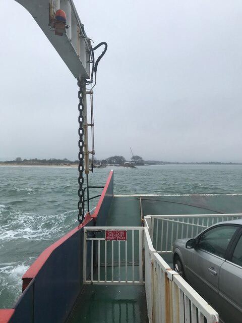
Sandbanks Ferry

Sandbanks Ferry is a vehicular chain ferry which crosses the entrance of Poole Harbour in the English county of Dorset. The route runs from Sandbanks to...

Haven Hotel

The Haven Hotel is a historic AA four star hotel in Sandbanks, near Poole, Dorset on the south coast of England. The hotel dates from the Victorian era...

Nearby Amenities

Located within 500m of 50.664859,-1.9522935
Source: PGS
Lat/Long: 50.660736/-1.9500374
Source: PGS
Lat/Long: 50.6617197/-1.9494728
Source: PGS
Lat/Long: 50.6623214/-1.9489257
Source: PGS
Lat/Long: 50.6630277/-1.9484152
Source: PGS
Lat/Long: 50.6633717/-1.9481942
Source: PGS
Lat/Long: 50.6640695/-1.9476425
Source: PGS
Lat/Long: 50.6645197/-1.9472523
Source: PGS
Lat/Long: 50.6652207/-1.9467408
Source: PGS
Lat/Long: 50.6656097/-1.9464575
Source: PGS
Lat/Long: 50.6659794/-1.9461504
Description: Southern boundary marker of nudist beach
Information: board
Tourism: information
Lat/Long: 50.6612504/-1.9498822
The data included in this document is from www.openstreetmap.org. The data is made available under ODbL.

Have you been to Eastern Lake?

Leave your review of Eastern Lake below (or comments, questions and feedback).