Balder Foot

Lake, Pool, Pond, Freshwater Marsh in Durham

England

Balder Foot

B6278 towards Eggleston
B6278 towards Eggleston Credit: JThomas

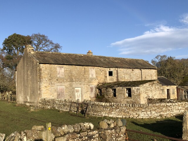
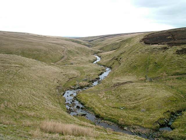
Balder Foot is a picturesque freshwater ecosystem located in Durham, England. It comprises a lake, pool, pond, and freshwater marsh, creating a diverse and thriving habitat for various flora and fauna.

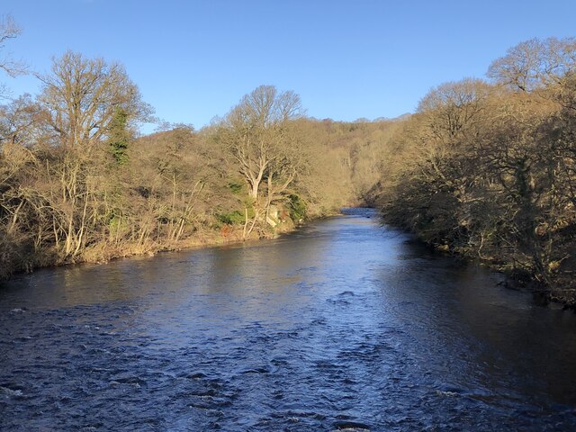
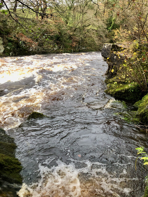
The centerpiece of Balder Foot is the lake, which spans a considerable area. Its crystal-clear waters are fed by the Balder River, providing a constant source of freshwater. The lake is surrounded by lush greenery, with reeds and water lilies adorning its edges. It serves as a haven for many aquatic species, including fish, turtles, and waterfowl.

Adjacent to the lake is a tranquil pool, which is smaller in size but equally enchanting. It is fed by natural springs, ensuring a continuous flow of clean water. This pool serves as a breeding ground for amphibians such as frogs and newts, as well as a watering hole for birds and small mammals.

A charming pond can also be found within the Balder Foot area. It offers a more secluded and intimate environment, with its shallow waters embodying a peaceful atmosphere. The pond is home to a variety of aquatic plants and insects, attracting dragonflies and butterflies.

Lastly, the freshwater marsh completes the ecosystem at Balder Foot. It is a wetland characterized by tall grasses, sedges, and cattails. This marshland provides a habitat for numerous bird species, including herons and marsh harriers. It also acts as a natural filtration system, purifying the water that flows into the lake and pool.

Overall, Balder Foot in Durham is a treasure trove of biodiversity, offering a range of aquatic habitats that support a rich and thriving ecosystem.

If you have any feedback on the listing, please let us know in the comments section below.
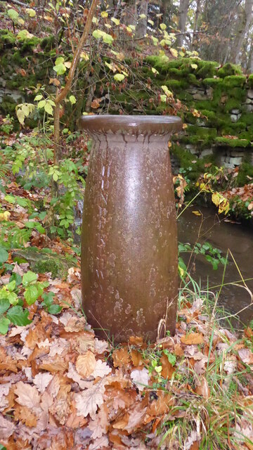
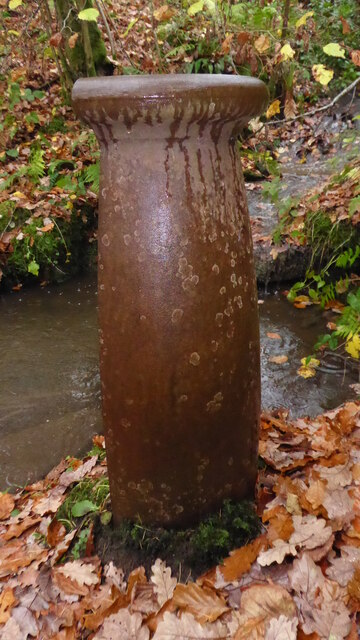
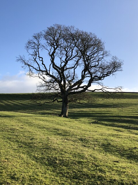
Balder Foot Images

Images are sourced within 2km of 54.57612/-1.9804757 or Grid Reference NZ0120. Thanks to Geograph Open Source API. All images are credited.

B6278 towards Eggleston
Grazing, High Shipley
B6278, High Shipley Towards Eggleston.
B6278, High Shipley
Towards Eggleston.
Footpath across a field close to Widen Beck
Remains of Doe Park Mill
Not so old Boundary Marker on the west bank of the River Tees Parish Boundary Marker on the south side of a stream running into the River Tees. On the boundary of Hunderthwaite and Romaldkirk parishes. Inscribed HUNDERTHWAITE. The Romaldkirk marker is at NZ 00480 21316 on the north bank of the stream. A list of the boundary markers can be found here <span class="nowrap"><a title="https://1drv.ms/w/s!Apt1XW0zY8DDgcFsnkpupbpYSiiVEQ?e=TaoW1W" rel="nofollow ugc noopener" href="https://1drv.ms/w/s!Apt1XW0zY8DDgcFsnkpupbpYSiiVEQ?e=TaoW1W">Link</a><img style="margin-left:2px;" alt="External link" title="External link - shift click to open in new window" src="https://s1.geograph.org.uk/img/external.png" width="10" height="10"/></span>. Read "Marking Parish Boundaries Along the Teesdale Way" ISBN 0 9520624 2 9.

Milestone Society National ID: YN_TEES10pb
Not so old Boundary Marker on the west bank of the River Tees
Parish Boundary Marker on the south side of a stream running into the River Tees. On the boundary of Hunderthwaite and Romaldkirk parishes. Inscribed HUNDERTHWAITE. The Romaldkirk marker is at NZ 00480 21316 on the north bank of the stream. A list of the boundary markers can be found here LinkExternal link. Read "Marking Parish Boundaries Along the Teesdale Way" ISBN 0 9520624 2 9. Milestone Society National ID: YN_TEES10pb
Not so old Boundary Marker on the west bank of the River Tees Parish Boundary Marker on the north side of a stream running into the River Tees. On the boundary of Hunderthwaite and Romaldkirk parishes. Inscribed ROMALDKIRK. The Hunderthwaite marker is at NZ 00479 21315 on the south bank of the stream. A list of the boundary markers can be found here <span class="nowrap"><a title="https://1drv.ms/w/s!Apt1XW0zY8DDgcFsnkpupbpYSiiVEQ?e=TaoW1W" rel="nofollow ugc noopener" href="https://1drv.ms/w/s!Apt1XW0zY8DDgcFsnkpupbpYSiiVEQ?e=TaoW1W">Link</a><img style="margin-left:2px;" alt="External link" title="External link - shift click to open in new window" src="https://s1.geograph.org.uk/img/external.png" width="10" height="10"/></span>. Read "Marking Parish Boundaries Along the Teesdale Way" ISBN 0 9520624 2 9.

Milestone Society National ID: YN_TEES10pb
Not so old Boundary Marker on the west bank of the River Tees
Parish Boundary Marker on the north side of a stream running into the River Tees. On the boundary of Hunderthwaite and Romaldkirk parishes. Inscribed ROMALDKIRK. The Hunderthwaite marker is at NZ 00479 21315 on the south bank of the stream. A list of the boundary markers can be found here LinkExternal link. Read "Marking Parish Boundaries Along the Teesdale Way" ISBN 0 9520624 2 9. Milestone Society National ID: YN_TEES10pb
Bare tree in rigg-and-furrow field
Bare tree beside the Teesdale Way
River Tees in gorge from viewpoint above Shipley Wood
River Tees from footbridge north of Cotherstone
Dairy Cottage at Woden Croft
Derelict farmhouse and buildings at Low Garth
River Tees downstream beyond shingle shore The river is heading east towards a sharp bend to the south-east. The steep bank rising above that bend has a number of rock faces which collectively seem to be known as Cotherstone Crag.
River Tees downstream beyond shingle shore
The river is heading east towards a sharp bend to the south-east. The steep bank rising above that bend has a number of rock faces which collectively seem to be known as Cotherstone Crag.
Ruins of former mill Balder mill or Doe Park mill was used until the construction of reservoirs upstream interrupted the water supply.
Ruins of former mill
Balder mill or Doe Park mill was used until the construction of reservoirs upstream interrupted the water supply.
Summerhouse ‘Heritage Gateway - Summerhouse and attached garden wall’.<<span class="nowrap"><a title="https://www.heritagegateway.org.uk/Gateway/Results_Single.aspx?resourceID=5&uid=1121047" rel="nofollow ugc noopener" href="https://www.heritagegateway.org.uk/Gateway/Results_Single.aspx?resourceID=5&uid=1121047">Link</a><img style="margin-left:2px;" alt="External link" title="External link - shift click to open in new window" src="https://s1.geograph.org.uk/img/external.png" width="10" height="10"/></span> > [accessed 19 November 2023]
Summerhouse
‘Heritage Gateway - Summerhouse and attached garden wall’.<LinkExternal link > [accessed 19 November 2023]
Rear Aspect of Summerhouse Listed as 19th century — for more info. see &lt;span class=&quot;nowrap&quot;&gt;&lt;a title=&quot;https://www.heritagegateway.org.uk/Gateway/Results_Single.aspx?resourceID=5&amp;amp;uid=1160214&quot; rel=&quot;nofollow ugc noopener&quot; href=&quot;https://www.heritagegateway.org.uk/Gateway/Results_Single.aspx?resourceID=5&amp;amp;uid=1160214&quot;&gt;Link&lt;/a&gt;&lt;img style=&quot;margin-left:2px;&quot; alt=&quot;External link&quot; title=&quot;External link - shift click to open in new window&quot; src=&quot;https://s1.geograph.org.uk/img/external.png&quot; width=&quot;10&quot; height=&quot;10&quot;/&gt;&lt;/span&gt;
Rear Aspect of Summerhouse
Listed as 19th century — for more info. see LinkExternal link
River Tees in Full Spate by the Unreachable Fairy Cupboards
Show me another place!

Balder Foot is located at Grid Ref: NZ0120 (Lat: 54.57612, Lng: -1.9804757)

Unitary Authority: County Durham

Police Authority: Durham

What 3 Words

///lakeside.qualified.requires. Near Lartington, Co. Durham

Related Wikis

Cotherstone Castle

Cotherstone Castle was in the village of Cotherstone by the River Tees some 3 miles (5 km) north-east of Barnard Castle in County Durham, England. This...

Cotherstone

Cotherstone is a village and civil parish in the district and county of Durham, England. Its historic county is Yorkshire, being just south of the River...

River Balder

The Balder is an English river that rises on the eastern slope of Stainmore Common in the Pennine Chain and flows eastwards for about 23.4 kilometres...

Cotherstone railway station

Cotherstone railway station was situated on the Tees Valley Railway between Barnard Castle and Middleton-in-Teesdale. It served the village of Cotherstone...

Shipley and Great Woods

Shipley and Great Woods is a Site of Special Scientific Interest in the Teesdale district of south-west County Durham, England. It occupies a steep ravine...

Baldersdale Woodlands

Baldersdale Woodlands is a Site of Special Scientific Interest in the Teesdale district of south-west County Durham, England. It consists primarily of...

Lartington railway station

Lartington railway station was situated on the South Durham & Lancashire Union Railway between Barnard Castle and Kirkby Stephen East. It served the village...

Lartington

Lartington is a village and civil parish about 2 miles (3 km) west of the town of Barnard Castle, in Teesdale, in the Pennines of England. The 2011 Census...

Related Videos

Walking the Dog.1

Experimental video, learning to use editing software. In this one I have sped up a video of me walking my dog from my point of ...

Leaving!

It's is a mix of different types of transport; walking, car and train. It's about leaving but not really going anywhere!

Lartington Hall Wedding Day

Unedtied footage at Lartington Hall We are inspired storytellers and we want to tell your love story. Just like falling in love, we want ...

Nearby Amenities

Located within 500m of 54.57612,-1.9804757
Pub
Fox & Hounds
Addr City: Barnard Castle
Addr Housename: Fox and Hounds
Addr Postcode: DL12 9PF
Addr Street: Cotherstone
Addr Village: Cotherstone
Fhrs Id: 302611
Phone: +44 1833 650241
Source Addr: FHRS Open Data
Website: https://www.cotherstonefox.co.uk/
Lat/Long: 54.5734013/-1.9851034
Barrier: stile
Foot: yes
Lat/Long: 54.5770959/-1.9807243
Barrier: stile
Foot: yes
Lat/Long: 54.5800103/-1.9783223
Barrier: stile
Foot: yes
Lat/Long: 54.5794953/-1.97863
Barrier: kissing_gate
Foot: yes
Lat/Long: 54.5779529/-1.9815206
Bus Stop
Red Lion
Naptan AtcoCode: 13007815D
Naptan Bearing: SE
Naptan CommonName: Red Lion
Naptan Indicator: south east bound
Naptan Landmark: Landmark not known
Naptan NaptanCode: durgagpw
Naptan Notes: Opposite 1-2 Nicholson Terrace on B6277 Spout Bank- Cotherstone
Naptan Street: Street not known
Naptan Verified: no
Source: naptan_import
Lat/Long: 54.5720293/-1.982335
Bus Stop
Red Lion
Naptan AtcoCode: 13007815H
Naptan Bearing: NW
Naptan CommonName: Red Lion
Naptan Indicator: north west bound
Naptan Landmark: Landmark not known
Naptan NaptanCode: durgagta
Naptan Notes: Red Lion Inn- B6277 Spout Bank- Cotherstone
Naptan Street: Street not known
Naptan Verified: no
Source: naptan_import
Lat/Long: 54.5721911/-1.9829382
Bus Stop
Fox and Hounds
Naptan AtcoCode: 13007816D
Naptan Bearing: SE
Naptan CommonName: Fox and Hounds
Naptan Indicator: south east bound
Naptan Landmark: Landmark not known
Naptan NaptanCode: durgagtd
Naptan Notes: 2 Balderview Cottages- B6277 Spout Bank- Cotherstone
Naptan Street: Street not known
Naptan Verified: no
Source: naptan_import
Lat/Long: 54.5739169/-1.9852115
Bus Stop
Fox and Hounds
Naptan AtcoCode: 13007816H
Naptan Bearing: NW
Naptan CommonName: Fox and Hounds
Naptan Indicator: north west bound
Naptan Landmark: Landmark not known
Naptan NaptanCode: durgagtg
Naptan Notes: Opposite Rose Cottage- B6277 Spout Bank- Cotherstone
Naptan Street: Street not known
Naptan Verified: no
Source: naptan_import
Lat/Long: 54.5736743/-1.9850878
Low Shipley
Place: farm
Lat/Long: 54.5780277/-1.9750661
Cotherstone Castle
HE Ref: 1005583
Archaeological Site: fortification
Designation: scheduled_monument
Historic: archaeological_site
Image: https://www.geograph.org.uk/photo/6001793
Wikidata: Q5175357
Lat/Long: 54.5751059/-1.9809562
Barrier: stile
Material: stone
Source: survey;gps
Stile: stepover
Lat/Long: 54.572429/-1.9825374
Clock
Display: sundial
Support: wall_mounted
Lat/Long: 54.5745395/-1.981272
Parking
Access: customers
Lat/Long: 54.5731702/-1.9852477
Cotherstone South substation
Power: pole
Transformer: distribution
Lat/Long: 54.5729502/-1.9855374
Post Box
Lat/Long: 54.5728782/-1.9833938
Board Type: notice
Information: board
Tourism: information
Lat/Long: 54.573234/-1.9839837
Bench
Backrest: yes
Image: https://www.geograph.org.uk/photo/6194553
Lat/Long: 54.5760169/-1.9812633
Bench
Backrest: yes
Image: https://www.geograph.org.uk/photo/2707733
Material: stone
Lat/Long: 54.5759361/-1.9808824
Barrier: stile
Lat/Long: 54.5736717/-1.9810764
The data included in this document is from www.openstreetmap.org. The data is made available under ODbL.

Have you been to Balder Foot?

Leave your review of Balder Foot below (or comments, questions and feedback).