Green, Great

Settlement in Suffolk Babergh

England

Green, Great

Little green at Cockfield
Little green at Cockfield Credit: Jonathan Thacker

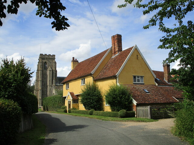
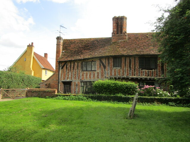
Green, Great, Suffolk is a picturesque village located in the eastern part of England. Situated in the county of Suffolk, it is nestled amidst the stunning countryside and offers residents and visitors a tranquil and idyllic setting.

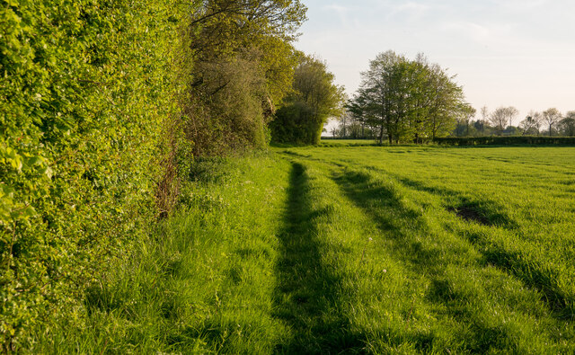
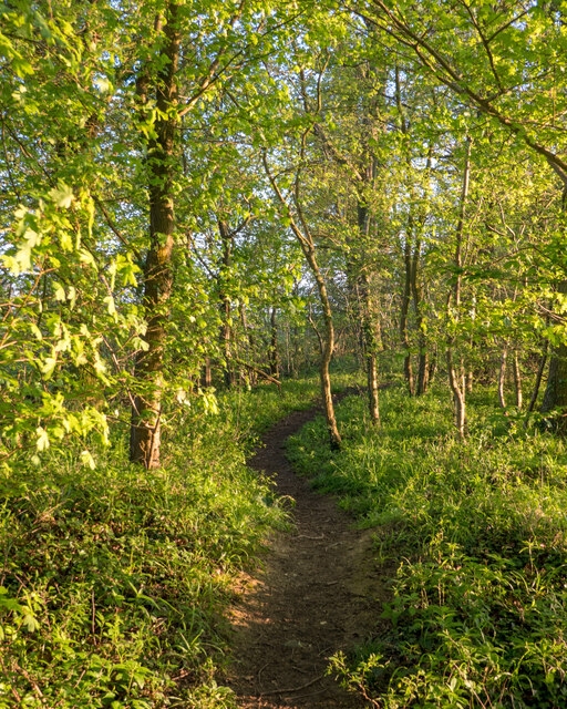
The village is characterized by its lush green landscapes and rolling hills, making it a haven for nature enthusiasts and outdoor enthusiasts alike. The area boasts numerous walking and cycling trails, providing ample opportunities to explore the surrounding countryside and take in the breathtaking views.

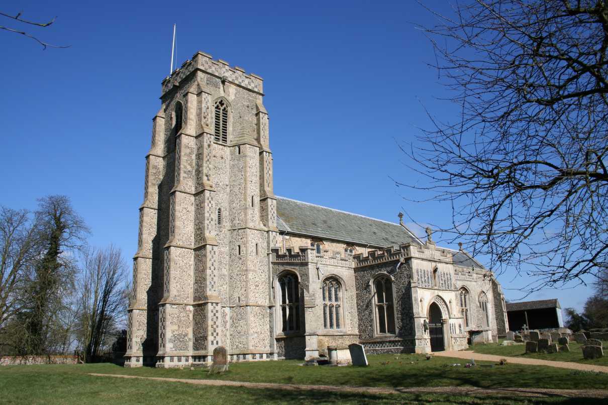
Green, Great, Suffolk is also renowned for its rich history and heritage. The village features a number of historic buildings, including a 12th-century church with intricate architecture and a charming thatched-roof pub that dates back to the 17th century. These landmarks offer visitors a glimpse into the village's past and provide a sense of nostalgia.

Despite its small size, the village is home to a vibrant community. Local amenities include a village hall, a primary school, and a community center, which host various events and activities throughout the year. The community spirit is evident in the village's annual summer fete, where residents come together to celebrate and showcase the best of Green, Great, Suffolk.

For those seeking a peaceful retreat, Green, Great, Suffolk offers a perfect escape from the hustle and bustle of city life. With its picturesque landscapes, rich history, and welcoming community, it is truly a hidden gem in the heart of Suffolk.

If you have any feedback on the listing, please let us know in the comments section below.

Green, Great Images

Images are sourced within 2km of 52.168374/0.801899 or Grid Reference TL9155. Thanks to Geograph Open Source API. All images are credited.

Little green at Cockfield
Footpath at Cockfield
Church Farmhouse and St. Peter's church, Cockfield Church Farmhouse dates from the sixteenth century <span class="nowrap"><a title="https://historicengland.org.uk/listing/the-list/list-entry/1037334" rel="nofollow ugc noopener" href="https://historicengland.org.uk/listing/the-list/list-entry/1037334">Link</a><img style="margin-left:2px;" alt="External link" title="External link - shift click to open in new window" src="https://s1.geograph.org.uk/img/external.png" width="10" height="10"/></span> St. Peter's church is largely of the fourteenth and fifteenth centuries <span class="nowrap"><a title="https://historicengland.org.uk/listing/the-list/list-entry/1037333" rel="nofollow ugc noopener" href="https://historicengland.org.uk/listing/the-list/list-entry/1037333">Link</a><img style="margin-left:2px;" alt="External link" title="External link - shift click to open in new window" src="https://s1.geograph.org.uk/img/external.png" width="10" height="10"/></span>
Church Farmhouse and St. Peter's church, Cockfield
Church Farmhouse dates from the sixteenth century LinkExternal link St. Peter's church is largely of the fourteenth and fifteenth centuries LinkExternal link
Church Cottage, Cockfield Partly of medieval origin <span class="nowrap"><a title="https://historicengland.org.uk/listing/the-list/list-entry/1194237?section=official-listing" rel="nofollow ugc noopener" href="https://historicengland.org.uk/listing/the-list/list-entry/1194237?section=official-listing">Link</a><img style="margin-left:2px;" alt="External link" title="External link - shift click to open in new window" src="https://s1.geograph.org.uk/img/external.png" width="10" height="10"/></span>
Church Cottage, Cockfield
Partly of medieval origin LinkExternal link
Church Cottage, Cockfield Of medieval origin <span class="nowrap"><a title="https://historicengland.org.uk/listing/the-list/list-entry/1194237?section=official-listing" rel="nofollow ugc noopener" href="https://historicengland.org.uk/listing/the-list/list-entry/1194237?section=official-listing">Link</a><img style="margin-left:2px;" alt="External link" title="External link - shift click to open in new window" src="https://s1.geograph.org.uk/img/external.png" width="10" height="10"/></span>
Church Farm (on the left) dates from the sixteenth century <span class="nowrap"><a title="https://historicengland.org.uk/listing/the-list/list-entry/1037334?section=official-listing" rel="nofollow ugc noopener" href="https://historicengland.org.uk/listing/the-list/list-entry/1037334?section=official-listing">Link</a><img style="margin-left:2px;" alt="External link" title="External link - shift click to open in new window" src="https://s1.geograph.org.uk/img/external.png" width="10" height="10"/></span>
Church Cottage, Cockfield
Of medieval origin LinkExternal link Church Farm (on the left) dates from the sixteenth century LinkExternal link
St. Peter's church, Cockfield Dates from the fourteenth and fifteenth centuries <span class="nowrap"><a title="https://historicengland.org.uk/listing/the-list/list-entry/1037333?section=official-listing" rel="nofollow ugc noopener" href="https://historicengland.org.uk/listing/the-list/list-entry/1037333?section=official-listing">Link</a><img style="margin-left:2px;" alt="External link" title="External link - shift click to open in new window" src="https://s1.geograph.org.uk/img/external.png" width="10" height="10"/></span>
St. Peter's church, Cockfield
Dates from the fourteenth and fifteenth centuries LinkExternal link
Monument to James Harvey, St. Peter's church, Cockfield James Harvey died in 1723 aged 20 years while sill a student at the University in Cambridge.
Monument to James Harvey, St. Peter's church, Cockfield
James Harvey died in 1723 aged 20 years while sill a student at the University in Cambridge.
Pond near the church at Cockfield
The churchyard at Cockfield Part of the churchyard is left uncut to encourage wildlife.
The churchyard at Cockfield
Part of the churchyard is left uncut to encourage wildlife.
Cockfield Village Hall Dates from 1975-6.
Cockfield Village Hall
Dates from 1975-6.
Barley field at Cockfield Nearly ready for harvesting.
Barley field at Cockfield
Nearly ready for harvesting.
Footpath on Field Boundary, Thorpe Green The path leads to Bull's Wood Nature Reserve - <a href="https://www.geograph.org.uk/photo/7477940">TL9254 : Path in Bull's Wood, Cockfield</a>
Footpath on Field Boundary, Thorpe Green
The path leads to Bull's Wood Nature Reserve - TL9254 : Path in Bull's Wood, Cockfield
Path in Bull's Wood, Cockfield Bull's Wood Nature Reserve is is part of the Thorpe Morieux Woods Site of Special Scientific Interest and is managed by the Suffolk Wildlife Trust: <span class="nowrap"><a title="https://www.suffolkwildlifetrust.org/bullswood" rel="nofollow ugc noopener" href="https://www.suffolkwildlifetrust.org/bullswood">Link</a><img style="margin-left:2px;" alt="External link" title="External link - shift click to open in new window" src="https://s1.geograph.org.uk/img/external.png" width="10" height="10"/></span> . They say:

"The wood is famed countrywide for its rare spring-time oxlips, which are limited to just 100 sites in East Anglia, carpeting swathes of the woodland floor in buttery yellow. Anyone visiting between March and June will also be treated to abundant displays of early-purple orchid, spurge-laurel, wood anemone and herb-paris. Yet, the spectacular show of flowers is certainly not the only reason to visit Bull’s Wood.

The circular walk that winds past traditionally managed coppices of hazel and ash, takes you through lush rides opened up for butterflies such as the gatekeeper, speckled wood and orange tip. Birds such as marsh tits, long-tailed tits and tree-creeper can also be regularly seen. The walk itself is relatively short and can be completed in about 15 minutes. But with the only other foot prints you are likely to see belonging to the wood’s roe deer, there is plenty of opportunity just to stand and stare."
Path in Bull's Wood, Cockfield
Bull's Wood Nature Reserve is is part of the Thorpe Morieux Woods Site of Special Scientific Interest and is managed by the Suffolk Wildlife Trust: LinkExternal link . They say: "The wood is famed countrywide for its rare spring-time oxlips, which are limited to just 100 sites in East Anglia, carpeting swathes of the woodland floor in buttery yellow. Anyone visiting between March and June will also be treated to abundant displays of early-purple orchid, spurge-laurel, wood anemone and herb-paris. Yet, the spectacular show of flowers is certainly not the only reason to visit Bull’s Wood. The circular walk that winds past traditionally managed coppices of hazel and ash, takes you through lush rides opened up for butterflies such as the gatekeeper, speckled wood and orange tip. Birds such as marsh tits, long-tailed tits and tree-creeper can also be regularly seen. The walk itself is relatively short and can be completed in about 15 minutes. But with the only other foot prints you are likely to see belonging to the wood’s roe deer, there is plenty of opportunity just to stand and stare."
Bradfield St Clare village sign <a title="https://www.geograph.org.uk/photo/7684844" href="https://www.geograph.org.uk/photo/7684844">Link</a>
Bradfield St Clare village sign
Bradfield St Clare village sign <a title="https://www.geograph.org.uk/photo/7684843" href="https://www.geograph.org.uk/photo/7684843">Link</a>
Bradfield St Clare village sign
War Memorial at Bradfield St Clare The memorial is incorporated into the base of the village sign. <a title="https://www.geograph.org.uk/photo/7684844" href="https://www.geograph.org.uk/photo/7684844">Link</a>
War Memorial at Bradfield St Clare
The memorial is incorporated into the base of the village sign. Link
Hexagonal pillbox in Old Hall Lane, Cockfield The pillbox is similar to a type FW3/22 but has the additional entrance porch instead of the normal doorway. One of many in the area on the Eastern Command Stop-line which stretched from Sutton on The Wash to Colchester and the coast.
Hexagonal pillbox in Old Hall Lane, Cockfield
The pillbox is similar to a type FW3/22 but has the additional entrance porch instead of the normal doorway. One of many in the area on the Eastern Command Stop-line which stretched from Sutton on The Wash to Colchester and the coast.
Great Green: Dukes Meadow housing estate (cul-de-sac)
Show me another place!

Green, Great is located at Grid Ref: TL9155 (Lat: 52.168374, Lng: 0.801899)

Administrative County: Suffolk

District: Babergh

Police Authority: Suffolk

What 3 Words

///reminds.backed.aimed. Near Lavenham, Suffolk

Nearby Locations

Great Green Green, Great

Related Wikis

Bull's Wood

Bull's Wood is a 12 hectare nature reserve east of Cockfield in Suffolk, England. It is managed by the Suffolk Wildlife Trust, and is part of the Thorpe...

Cockfield, Suffolk

Cockfield is a village and civil parish located approximately 3+1⁄2 miles (5.6 km) from Lavenham in Suffolk, England. The village consists of a central...

Bradfield Woods

Bradfield Woods is an 81.4-hectare (201-acre) biological Site of Special Scientific Interest between Bury St Edmunds and Stowmarket in Suffolk. The site...
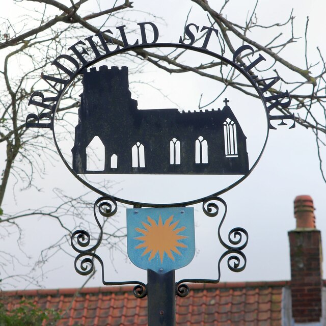
Bradfield St Clare

Bradfield St. Clare is a village and civil parish in the West Suffolk district of Suffolk, England, about six miles south of Bury St Edmunds. According...

Nearby Amenities

Located within 500m of 52.168374,0.801899
Bus Stop
Chapel Road
Naptan AtcoCode: 390010449
Naptan Bearing: N
Naptan CommonName: Chapel Road
Naptan Indicator: N-bound
Naptan Landmark: Great Green
Naptan NaptanCode: sufagjda
Naptan Street: Unclassified
Naptan Verified: no
Source: naptan_import
Lat/Long: 52.1674973/0.8002677
Bus Stop
Chapel Road
Naptan AtcoCode: 390010450
Naptan Bearing: S
Naptan BusStopType: CUS
Naptan CommonName: Chapel Road
Naptan Indicator: S-bound
Naptan Landmark: Great Green
Naptan NaptanCode: sufagjdg
Naptan Street: Unclassified
Naptan Verified: no
Source: naptan_import
Lat/Long: 52.1674869/0.8003255
Bus Stop
Plough and Fleece
Naptan AtcoCode: 390010451
Naptan Bearing: W
Naptan CommonName: Plough and Fleece
Naptan Indicator: adj
Naptan Landmark: Plough and Fleece
Naptan NaptanCode: sufagjdj
Naptan Street: Felsham Road
Naptan Verified: no
Source: naptan_import
Lat/Long: 52.1693083/0.801259
Bus Stop
Plough and Fleece
Naptan AtcoCode: 390010452
Naptan Bearing: E
Naptan BusStopType: CUS
Naptan CommonName: Plough and Fleece
Naptan Indicator: opp
Naptan Landmark: Plough and Fleece
Naptan NaptanCode: sufagjdm
Naptan Street: Felsham Road
Naptan Verified: no
Source: naptan_import
Lat/Long: 52.1694355/0.8012995
Post Box
Post Box Type: lamp
Ref: IP30 2069
Lat/Long: 52.1673913/0.8003648
Cockfield Great Green
Place: hamlet
Lat/Long: 52.1686879/0.8021421
Fuel
Lat/Long: 52.1688538/0.8048148
Historic: pump
Lat/Long: 52.1674007/0.8004405
Advertising: board
Lat/Long: 52.1672844/0.8002957
The data included in this document is from www.openstreetmap.org. The data is made available under ODbL.

Have you been to Green, Great?

Leave your review of Green, Great below (or comments, questions and feedback).