Roger's Hole

Lake, Pool, Pond, Freshwater Marsh in Northumberland

England

Roger's Hole

Old and new walls near Sweethope Crags
Old and new walls near Sweethope Crags Credit: Andrew Curtis

Roger's Hole is a picturesque freshwater marsh located in Northumberland, England. Situated amidst the rolling hills and lush greenery of the region, it is a haven for nature enthusiasts and a popular spot for outdoor activities. The site is primarily known for its exceptional natural beauty and diverse aquatic ecosystem.

Covering an area of approximately 10 acres, Roger's Hole is formed by a natural depression in the landscape that has filled with water over time. The water source predominantly comes from rainfall, creating a serene and tranquil environment. The marsh is surrounded by dense vegetation, including reeds, grasses, and shrubs, providing a perfect habitat for a wide variety of flora and fauna.

The water in Roger's Hole is crystal clear and teeming with life. It supports a diverse range of aquatic plants such as water lilies, reed mace, and marsh marigolds, which add vibrant colors to the landscape. The marsh is home to numerous species of birds, including herons, ducks, and swans, which can often be spotted gliding gracefully across the water or nesting in the surrounding trees.

Visitors to Roger's Hole can enjoy a range of activities such as birdwatching, fishing, and picnicking. The site offers several well-maintained walking trails, allowing visitors to explore the marsh and its surroundings at their own pace. The peaceful ambiance and stunning natural scenery make it an ideal place for relaxation and escape from the hustle and bustle of everyday life.

Overall, Roger's Hole is a hidden gem in Northumberland, offering a delightful blend of natural beauty and tranquility. Its rich biodiversity and serene atmosphere make it a must-visit destination for nature lovers and those seeking a peaceful retreat in the heart of the English countryside.

If you have any feedback on the listing, please let us know in the comments section below.

Roger's Hole Images

Images are sourced within 2km of 55.133492/-2.0462393 or Grid Reference NY9782. Thanks to Geograph Open Source API. All images are credited.
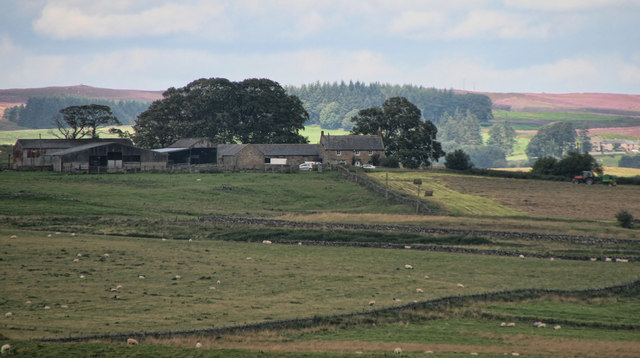
Old and new walls near Sweethope Crags
Old boundary wall near Sweethope Crags
Ridge south of Sweethope Crags
Old boundary below Sweethope Crags
Disused limestone quarry, north of Quarry House "Firstly, at the east of this part of the area, is a limekiln [site 12] which is also marked on the Thockrington Tithe Map of 1844. No kiln is marked on the site in the Second Edition Ordnance Survey Map (1898) - indicating that it was disused by that date - but the map indicates a quarry adjacent and to the east of the site of the limekiln. This quarry would have been the source of limestone when the kiln was operating. Today, the limekiln appears only as a grassy mound, although the ramp which was used for loading the kiln is evident on the south side. No arch (from which the lime was drawn) is now visible, but it is likely that at least one drawing arch was originally located at the foot of the north side of the kiln, facing the modern tarmac road."
A Field Survey at Quarry House and North Heugh Farms, Northumberland.
P.C. Sellers and D.H. Prothero (1991). Northern Archaeology Vol.11 p.57-72.
Disused limestone quarry, north of Quarry House
"Firstly, at the east of this part of the area, is a limekiln [site 12] which is also marked on the Thockrington Tithe Map of 1844. No kiln is marked on the site in the Second Edition Ordnance Survey Map (1898) - indicating that it was disused by that date - but the map indicates a quarry adjacent and to the east of the site of the limekiln. This quarry would have been the source of limestone when the kiln was operating. Today, the limekiln appears only as a grassy mound, although the ramp which was used for loading the kiln is evident on the south side. No arch (from which the lime was drawn) is now visible, but it is likely that at least one drawing arch was originally located at the foot of the north side of the kiln, facing the modern tarmac road." A Field Survey at Quarry House and North Heugh Farms, Northumberland. P.C. Sellers and D.H. Prothero (1991). Northern Archaeology Vol.11 p.57-72.
Site of lead mine, north of Quarry House See description here <a href="https://www.geograph.org.uk/photo/7402988">NY9680 : Site of lead mine, north of Quarry House</a>
Site of lead mine, north of Quarry House
Site of lead mine, north of Quarry House The mine shaft, blocked by dumped rubbish, lies within the fenced enclosure (now wooded). The area of stones in the foreground may have been part of the mine spoil heap although the 2nd Edition map does show a small building nearby. These features were all within a larger enclosure. Just south of what is now an unfenced road, west of the shaft, the map indicates a small pond probably part of the infrastructure for the lead mine.

"The second feature marked on the First Edition Ordnance Survey Map is an old lead mine. A brief history of this site is given in the Northumberland county history (Hodgson, 1897). A lease was issued in 1736 by the local landowner, George Delaval, for 'John Lee of Calf Gapp' and some other persons to work for lead on this site. The outcome of this enterprise is unrecorded, but in 1828 the site was worked again by Messrs Milner and Featherstone, who found it unproductive. Greenwood's county map of 1828 identifies a 'lead mine' on this site.
From the county history entry, it appears that the site was disused after about 1828 ..."
A Field Survey at Quarry House and North Heugh Farms, Northumberland.
P. C. Sellers and D. H. Prothero (1991). Northern Archaeology Vol.11 p.57-72.

The mine was reopened in 1874 with the formation of the Quarry House Lead Mining Company with three shafts sunk into limestone and shales 20-30 fathoms below the Whin Sill. The vein was described as varying in width from a narrow string to 60cm. Shares were sold with the benefit of an optimistic prospectus and descriptions of distinguished mining engineers, but no returns appear to have been made.
R A Fairbairn (2000) British Mining No 65. Allendale, Tynedale and Derwent Lead Mines. Northern Mine Research Society.
Site of lead mine, north of Quarry House
The mine shaft, blocked by dumped rubbish, lies within the fenced enclosure (now wooded). The area of stones in the foreground may have been part of the mine spoil heap although the 2nd Edition map does show a small building nearby. These features were all within a larger enclosure. Just south of what is now an unfenced road, west of the shaft, the map indicates a small pond probably part of the infrastructure for the lead mine. "The second feature marked on the First Edition Ordnance Survey Map is an old lead mine. A brief history of this site is given in the Northumberland county history (Hodgson, 1897). A lease was issued in 1736 by the local landowner, George Delaval, for 'John Lee of Calf Gapp' and some other persons to work for lead on this site. The outcome of this enterprise is unrecorded, but in 1828 the site was worked again by Messrs Milner and Featherstone, who found it unproductive. Greenwood's county map of 1828 identifies a 'lead mine' on this site. From the county history entry, it appears that the site was disused after about 1828 ..." A Field Survey at Quarry House and North Heugh Farms, Northumberland. P. C. Sellers and D. H. Prothero (1991). Northern Archaeology Vol.11 p.57-72. The mine was reopened in 1874 with the formation of the Quarry House Lead Mining Company with three shafts sunk into limestone and shales 20-30 fathoms below the Whin Sill. The vein was described as varying in width from a narrow string to 60cm. Shares were sold with the benefit of an optimistic prospectus and descriptions of distinguished mining engineers, but no returns appear to have been made. R A Fairbairn (2000) British Mining No 65. Allendale, Tynedale and Derwent Lead Mines. Northern Mine Research Society.
Bield, north of Quarry House A roughly semi-circular high dry-stone wall, open on the west side. It is marked on the 2nd Edition 25" OS map as a 'Bield'.

"This is a Cumbrian dialect word for a shelter or animal den, from the Old English belde. Goose bields, found in Cumbria, are designed so geese penned in cannot escape and foxes cannot get in. These are circular shelter with high walls overhanging on the inside (to stop the geese) and outside (so as to stop the foxes). The word is also used for a general livestock shelter."
Keys to the Past, glossary: <span class="nowrap"><a title="https://keystothepast.info/glossary/?AZ=B" rel="nofollow ugc noopener" href="https://keystothepast.info/glossary/?AZ=B">Link</a><img style="margin-left:2px;" alt="External link" title="External link - shift click to open in new window" src="https://s1.geograph.org.uk/img/external.png" width="10" height="10"/></span>
Bield, north of Quarry House
A roughly semi-circular high dry-stone wall, open on the west side. It is marked on the 2nd Edition 25" OS map as a 'Bield'. "This is a Cumbrian dialect word for a shelter or animal den, from the Old English belde. Goose bields, found in Cumbria, are designed so geese penned in cannot escape and foxes cannot get in. These are circular shelter with high walls overhanging on the inside (to stop the geese) and outside (so as to stop the foxes). The word is also used for a general livestock shelter." Keys to the Past, glossary: LinkExternal link
Stand of Trees near Ferneyrigg
Looking up Towards Ray Fell Ray Fell is in <a href="https://www.geograph.org.uk/gridref/NY9585">NY9585</a>.
Looking up Towards Ray Fell
Ray Fell is in NY9585.
Trig point of Bavington Crags The trig point at Bavington Crags stands above a broken line of rocks, close to an un-fenced minor road. The land about is marginal farmland.
Trig point of Bavington Crags
The trig point at Bavington Crags stands above a broken line of rocks, close to an un-fenced minor road. The land about is marginal farmland.
Crookdene Crookdene Farm.
Crookdene
Crookdene Farm.
Hawthorn Wind blown Hawthorn tree near The Shield.
Hawthorn
Wind blown Hawthorn tree near The Shield.
St Mary's Pike Cattle grid at St Mary's Pike.
St Mary's Pike
Cattle grid at St Mary's Pike.
Crookdene Road near Crookdene Farm.
Crookdene
Road near Crookdene Farm.
Plashetts Farm The farmhouse at Plashetts.
Plashetts Farm
The farmhouse at Plashetts.
Green Crag Green Crag at Great Bavington.
Green Crag
Green Crag at Great Bavington.
Northside Northside Farm.
Northside
Northside Farm.
Show me another place!

Roger's Hole is located at Grid Ref: NY9782 (Lat: 55.133492, Lng: -2.0462393)

Unitary Authority: Northumberland

Police Authority: Northumbria

What 3 Words

///unimpeded.armrests.tapers. Near Corsenside, Northumberland

Related Wikis

Bavington Crags

Bavington Crags is a Site of Special Scientific Interest (SSSI) in north Northumberland, England. The site is an outcropping of the Whin Sill which gives...

Sweethope Loughs

Sweethope Loughs are two freshwater lakes almost 1 mile (1.6 km) in length, the smaller one just east of the larger, in the southern part of Northumberland...

Thockrington

Thockrington is a village and former civil parish, now in the parish of Bavington, in Northumberland, England. The village lies about 10 miles (16 km)...

Little Harle Tower

Little Harle Tower is a Grade II* listed privately owned country house with 15th-century origins, located at Little Harle, Kirkwhelpington, Northumberland...

Kirkwhelpington

Kirkwhelpington is a village and civil parish in the English county of Northumberland about 13 miles (21 km) northeast of Hexham. It is on the River Wansbeck...

Bavington Hall

Bavington Hall is a 17th-century privately owned country house at Little Bavington in Northumberland. It is a Grade II* listed building.A tower house...

Knowesgate railway station

Knowesgate was a stone-built railway station with goods sidings in Northumberland, England on the Wansbeck Railway between Morpeth and Reedsmouth, which...

Kirkharle Hall

Kirkharle Hall was a country house at Kirkharle, Northumberland, England, the former seat of the Loraine family, now much reduced and in use as a farmhouse...

Nearby Amenities

Located within 500m of 55.133492,-2.0462393
Crookdean Hill
Place: locality
Lat/Long: 55.1359767/-2.0425767
Barrier: cattle_grid
Lat/Long: 55.1296214/-2.0425407
The data included in this document is from www.openstreetmap.org. The data is made available under ODbL.

Have you been to Roger's Hole?

Leave your review of Roger's Hole below (or comments, questions and feedback).