Burnhope Dam

Lake, Pool, Pond, Freshwater Marsh in Durham

England

Burnhope Dam

Gate in fence on Bolt's Law A public footpath passes through the gate. The trig point might be thought to be at the highest point of the hill but at 540 m it is in fact one metre lower than another location on Bolt's Law, roughly half a kilometre to the south-west, behind the camera position.
Gate in fence on Bolt's Law Credit: Trevor Littlewood

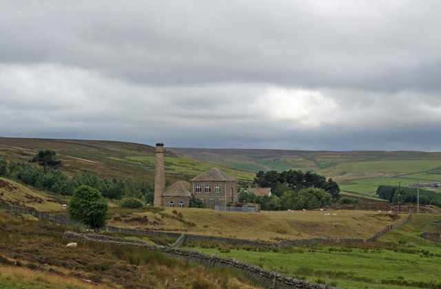
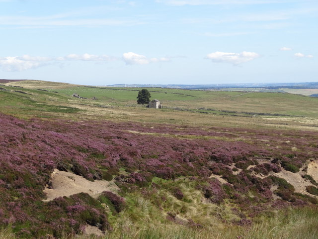
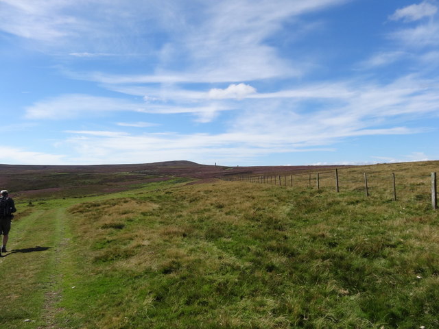
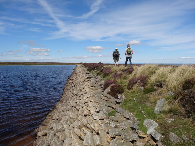
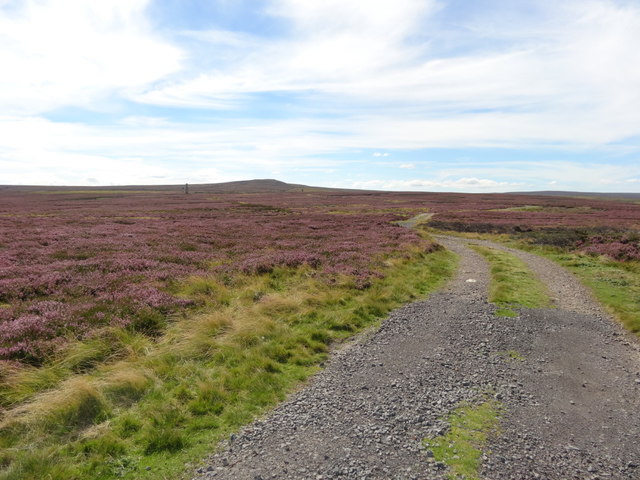
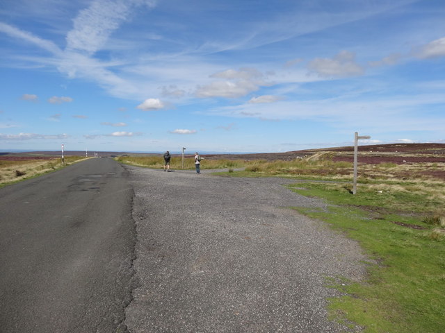
Burnhope Dam is a man-made reservoir located in County Durham, England. It was constructed in the early 1930s to supply water to the surrounding area. The dam is situated in the scenic setting of the North Pennines Area of Outstanding Natural Beauty, offering stunning views of the surrounding countryside.

The reservoir covers an area of approximately 10 hectares and has a maximum depth of 15 meters. The water in the dam is sourced from the nearby Burnhope Burn, a small river that flows through the area. The dam is a popular spot for fishing, with a variety of freshwater fish species such as brown trout and perch being found in its waters.

Surrounding the dam is a freshwater marsh, which provides a habitat for a range of plant and animal species. Visitors to Burnhope Dam can enjoy walking trails around the reservoir, as well as birdwatching opportunities. The dam is also a popular spot for picnicking and enjoying the peaceful surroundings.

If you have any feedback on the listing, please let us know in the comments section below.

Burnhope Dam Images

Images are sourced within 2km of 54.809623/-2.0604451 or Grid Reference NY9646. Thanks to Geograph Open Source API. All images are credited.

Gate in fence on Bolt's Law A public footpath passes through the gate. The trig point might be thought to be at the highest point of the hill but at 540 m it is in fact one metre lower than another location on Bolt's Law, roughly half a kilometre to the south-west, behind the camera position.
Gate in fence on Bolt's Law
A public footpath passes through the gate. The trig point might be thought to be at the highest point of the hill but at 540 m it is in fact one metre lower than another location on Bolt's Law, roughly half a kilometre to the south-west, behind the camera position.
Heather moorland south of Bolt's Law trig point The foreground moorland runs away towards the valley and slopes of the Stanhope Burn. The distant hill is Collier Law.
Heather moorland south of Bolt's Law trig point
The foreground moorland runs away towards the valley and slopes of the Stanhope Burn. The distant hill is Collier Law.
Moorland descending towards Stanhope Burn The area of heather moorland immediately below the camera position is apparently known as Hope Head; a stream groove there and others join to form the Stanhope Burn beyond which lies the sunlit Collier Law.
Moorland descending towards Stanhope Burn
The area of heather moorland immediately below the camera position is apparently known as Hope Head; a stream groove there and others join to form the Stanhope Burn beyond which lies the sunlit Collier Law.
Presser Pumping Station near the top of Bale Hill Consett Water Company established in 1859 merged and became the Weardale and Consett Water Company in 1902. Some time late in the 19th or early 20th century one of the two former companies had taken over the engine house of closed Derwent Lead Mines and developed this Grade II Listed pumping house to supply water to Consett. It is reported that they started paying rent to the estate in 1902 and the rent in 1911 was £360.
Presser Pumping Station near the top of Bale Hill
Consett Water Company established in 1859 merged and became the Weardale and Consett Water Company in 1902. Some time late in the 19th or early 20th century one of the two former companies had taken over the engine house of closed Derwent Lead Mines and developed this Grade II Listed pumping house to supply water to Consett. It is reported that they started paying rent to the estate in 1902 and the rent in 1911 was £360.
View towards Sandyford Farmhouse (ruined)
Footpath towards Sikehead Dams
Grouse Butt and Moorland
Sikehead Dam
Sikehead Dam
Sikehead reservoir and Bolt's Law
Track towards Sikehead Dams
Meadows Edge Road towards Baybridge Choice of Bridleway or footpath
Meadows Edge Road towards Baybridge
Choice of Bridleway or footpath
Road at Dead Friar's bank
Edmondbyers Common from Dead Friar's
Road and bridge at Far Sandyford Looking south-eastward.
Road and bridge at Far Sandyford
Looking south-eastward.
Ordnance Survey Flush Bracket G3169 This bracket can be found on the buttress wall of Far Sandyford Bridge. The benchmark height is recorded as being 416.815 metres above sea level.
For more detail see : <span class="nowrap"><a title="http://www.bench-marks.org.uk/bm12503" rel="nofollow ugc noopener" href="http://www.bench-marks.org.uk/bm12503">Link</a><img style="margin-left:2px;" alt="External link" title="External link - shift click to open in new window" src="https://s1.geograph.org.uk/img/external.png" width="10" height="10"/></span>
Ordnance Survey Flush Bracket G3169
This bracket can be found on the buttress wall of Far Sandyford Bridge. The benchmark height is recorded as being 416.815 metres above sea level. For more detail see : LinkExternal link
Flue and chimney at Sikehead Lead Mine The flue running up to the chimney would have been covered over with an arched stone roof. At intervals, someone (probably a child) would have been sent in to scrape residue (which was rich in lead) off the sides and roof. Health and safety was not high on the priority list in the 'good old days'.
Flue and chimney at Sikehead Lead Mine
The flue running up to the chimney would have been covered over with an arched stone roof. At intervals, someone (probably a child) would have been sent in to scrape residue (which was rich in lead) off the sides and roof. Health and safety was not high on the priority list in the 'good old days'.
Track to Sandyford Shooters' track and footpath.
Track to Sandyford
Shooters' track and footpath.
Band of rushes on heather moor The rushes are on or just north of Bell's Hill which is on a slope above the Stanhope Burn. Collier Law is the distant hill.
Band of rushes on heather moor
The rushes are on or just north of Bell's Hill which is on a slope above the Stanhope Burn. Collier Law is the distant hill.
Show me another place!

Burnhope Dam is located at Grid Ref: NY9646 (Lat: 54.809623, Lng: -2.0604451)

Unitary Authority: County Durham

Police Authority: Durham

What 3 Words

///vaccines.newest.fidgeting. Near Stanhope, Co. Durham

Nearby Locations

Burnhope Dam

Related Wikis

Ramshaw, Consett

Ramshaw is a small village in County Durham, in England. It is situated to the south of Hunstanworth, a few miles west of Consett. Lead mining was an important...

Townfield

Townfield is a village in County Durham, in England. It is situated just to the south of Hunstanworth and part of that parish, about 10 miles (16 km) west...

Hunstanworth

Hunstanworth is a village in County Durham, England. It is situated approximately 10 miles to the west of Consett, south-west of the village of Blanchland...

Beldon Burn

Beldon Burn is a headwater stream of the River Derwent in Northumberland and County Durham, England.It rises at Quickcleugh Moss as the Quickcleugh Burn...

Nearby Amenities

Located within 500m of 54.809623,-2.0604451
Hunting Stand
Hunting Stand: grouse_butt
Lat/Long: 54.8132433/-2.0589548
Hunting Stand
Hunting Stand: grouse_butt
Lat/Long: 54.8129102/-2.0597166
Hunting Stand
Hunting Stand: grouse_butt
Lat/Long: 54.8126529/-2.0603201
Hunting Stand
Hunting Stand: grouse_butt
Lat/Long: 54.8124017/-2.0609128
Hunting Stand
Hunting Stand: grouse_butt
Lat/Long: 54.8121668/-2.0614868
Hunting Stand
Hunting Stand: grouse_butt
Lat/Long: 54.8118546/-2.0622244
Hunting Stand
Hunting Stand: grouse_butt
Lat/Long: 54.8115331/-2.0629755
Hunting Stand
Hunting Stand: grouse_butt
Lat/Long: 54.8112093/-2.0637131
Hunting Stand
Hunting Stand: grouse_butt
Lat/Long: 54.8108275/-2.0645848
Hunting Stand
Hunting Stand: grouse_butt
Lat/Long: 54.8104673/-2.0654324
Hunting Stand
Hunting Stand: grouse_butt
Lat/Long: 54.8072104/-2.0662987
Hunting Stand
Hunting Stand: grouse_butt
Lat/Long: 54.8097594/-2.0606782
Hunting Stand
Hunting Stand: grouse_butt
Lat/Long: 54.8099565/-2.0603241
The data included in this document is from www.openstreetmap.org. The data is made available under ODbL.

Have you been to Burnhope Dam?

Leave your review of Burnhope Dam below (or comments, questions and feedback).