Hatherton Junction
Lake, Pool, Pond, Freshwater Marsh in Staffordshire South Staffordshire
England
Hatherton Junction

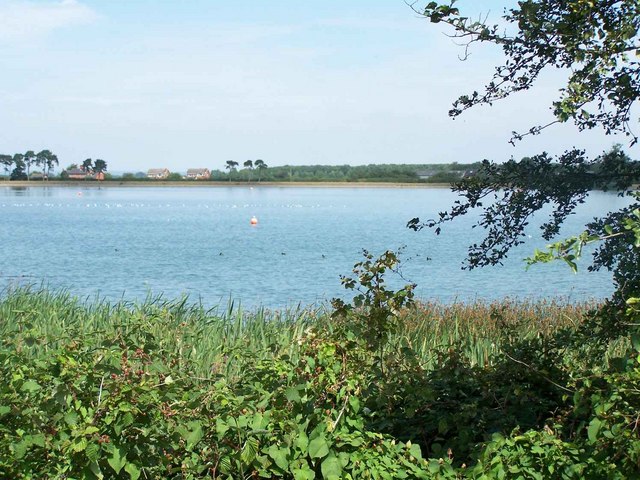
Hatherton Junction is a picturesque area located in Staffordshire, England. This unique destination boasts a variety of natural features, including a lake, pool, pond, and freshwater marsh, making it a haven for wildlife and nature enthusiasts.
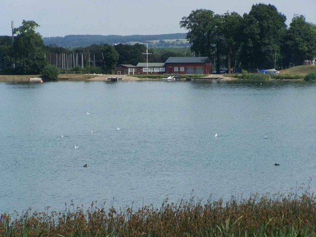
The heart of Hatherton Junction is its expansive lake, which offers stunning panoramic views and serves as a focal point for outdoor activities. The lake is surrounded by lush greenery and is home to a diverse range of aquatic life, such as fish and waterfowl. Visitors can enjoy boating, fishing, or simply relax on the lake's shores, taking in the tranquil surroundings.
Adjacent to the lake is a smaller pool, which provides a more secluded environment for those seeking a quieter experience. The pool is surrounded by reeds and other vegetation, creating a serene atmosphere that is perfect for birdwatching or simply enjoying the peacefulness of nature.
A short distance away from the pool is a charming pond, which is teeming with an array of plant life and smaller wildlife. This small body of water is a popular spot for nature enthusiasts, who can observe various species of frogs, insects, and water plants in their natural habitat.
Lastly, Hatherton Junction is also home to a freshwater marsh, characterized by its wetland area and its abundant vegetation. This marshland is an important habitat for numerous species of birds, reptiles, and amphibians, making it a prime location for birdwatchers and wildlife photographers.
Overall, Hatherton Junction in Staffordshire is a remarkable destination, offering a diverse range of natural features that cater to both outdoor enthusiasts and nature lovers alike.
If you have any feedback on the listing, please let us know in the comments section below.
Hatherton Junction Images
Images are sourced within 2km of 52.674299/-2.098114 or Grid Reference SJ9308. Thanks to Geograph Open Source API. All images are credited.


Hatherton Junction is located at Grid Ref: SJ9308 (Lat: 52.674299, Lng: -2.098114)
Administrative County: Staffordshire
District: South Staffordshire
Police Authority: Staffordshire
What 3 Words
///refrain.triads.unframed. Near Coven, Staffordshire
Nearby Locations
Related Wikis
Hatherton Canal
The Hatherton Canal is a derelict branch of the Staffordshire and Worcestershire Canal in south Staffordshire, England. It was constructed in two phases...
Gailey Reservoirs
Gailey Reservoir is a pair of canal feeder reservoirs in South Staffordshire, separated by a dam, and owned by the Canal & River Trust. Gailey Upper Reservoir...
Four Ashes railway station
Four Ashes railway station was a railway station built by the Grand Junction Railway in 1837.: 28 It served the small village of Four Ashes, Staffordshire...

Four Ashes, Staffordshire
Four Ashes is a village in the district of South Staffordshire in Staffordshire, England, located about 4 miles (6.4 km) west of Cannock, 7 miles (11 km...
Nearby Amenities
Located within 500m of 52.674299,-2.098114Have you been to Hatherton Junction?
Leave your review of Hatherton Junction below (or comments, questions and feedback).