Etalmill Stream

Lake, Pool, Pond, Freshwater Marsh in Northumberland

England

Etalmill Stream

Round bales, Berryhill
Round bales, Berryhill Credit: Richard Webb

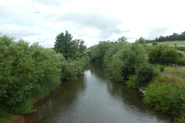
Etalmill Stream is a picturesque freshwater body located in Northumberland, England. It is a small yet captivating water feature that encompasses a lake, pool, pond, and freshwater marsh, making it a diverse and unique ecosystem.

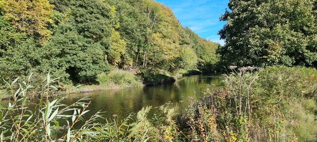
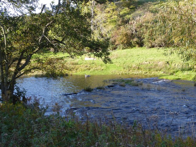
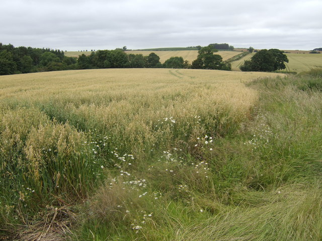
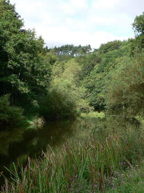
The stream is nestled in a tranquil setting surrounded by lush greenery, creating an idyllic landscape that is a haven for nature enthusiasts and wildlife alike. The lake is the central feature of Etalmill Stream, characterized by its calm and sparkling waters, reflecting the beauty of the surrounding vegetation and sky. It serves as a vital water source for the various species that inhabit the area.

Adjacent to the lake, a pool can be found, which is slightly shallower and provides a habitat for a variety of aquatic plants and small fish. This pool acts as a nursery for many species, supporting their growth and survival. The pond, on the other hand, is a secluded and serene area within the stream, often covered with lily pads and reeds. It is home to a diverse range of amphibians, including frogs and newts.

The freshwater marsh, with its lush vegetation and thriving plant life, is an essential part of Etalmill Stream's ecosystem. This marshland acts as a natural filtration system, purifying the water and providing a habitat for a broad range of bird species and other wetland creatures.

Etalmill Stream presents an opportunity for visitors to immerse themselves in the natural beauty of Northumberland. Its diverse range of water features and abundant wildlife make it a captivating destination for nature lovers, photographers, and those seeking tranquility amidst the natural world.

If you have any feedback on the listing, please let us know in the comments section below.

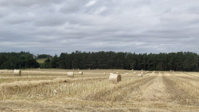
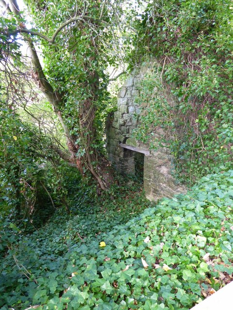
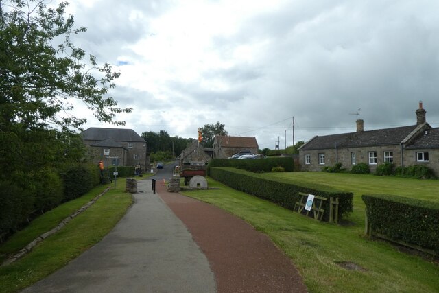
Etalmill Stream Images

Images are sourced within 2km of 55.64989/-2.117592 or Grid Reference NT9239. Thanks to Geograph Open Source API. All images are credited.

Round bales, Berryhill
B6354, Berryhill
B6354, Berryhill
Barleymill Covert, Northumberland Looking northeast along the southern bank of the River Till in the vicinity of Barleymill Covert.
Barleymill Covert, Northumberland
Looking northeast along the southern bank of the River Till in the vicinity of Barleymill Covert.
View of the River Till View much improved by Storm Arwen blowing down the now logged tree beside the path.
View of the River Till
View much improved by Storm Arwen blowing down the now logged tree beside the path.
Young swan on the River Till By Barleymill Bank.
Young swan on the River Till
By Barleymill Bank.
Remains of Etal Barley Mill There are records of a mill here since at least the late 18th century.
Remains of Etal Barley Mill
There are records of a mill here since at least the late 18th century.
Climbing at Berry Hill Superb Northumberland sandstone provides great climbing in the area. The rock is weathered into strange flutings and arches - a friend said it's like climbing on a cathedral. The tracks below are from the sheep & cattle in the field
Climbing at Berry Hill
Superb Northumberland sandstone provides great climbing in the area. The rock is weathered into strange flutings and arches - a friend said it's like climbing on a cathedral. The tracks below are from the sheep & cattle in the field
View towards Duddo Hill Oats, barley and wheat all in view.
View towards Duddo Hill
Oats, barley and wheat all in view.
Berryhill Crag A south facing sandstone crag with some good climbing potential
Berryhill Crag
A south facing sandstone crag with some good climbing potential
River Till near Tiptoe Farm The lovely wooded River Till is the only tributary of the River Tweed to be wholly in England.
River Till near Tiptoe Farm
The lovely wooded River Till is the only tributary of the River Tweed to be wholly in England.
Tindal House Farm Despite appearing to be derelict these cart sheds are still in use.
Tindal House Farm
Despite appearing to be derelict these cart sheds are still in use.
Lane to Berryhill farm and crags
The Castle Gatehouse
Station buildings at Hetherslaw The smoke is from the locomotive being fired for the day's trains.
Station buildings at Hetherslaw
The smoke is from the locomotive being fired for the day's trains.
Coal and water Looking towards the coal, wood and water supplies at Heatherslaw.
Coal and water
Looking towards the coal, wood and water supplies at Heatherslaw.
Bridge over the River Till The bridge also crosses the Heatherslaw Light Railway.
Bridge over the River Till
The bridge also crosses the Heatherslaw Light Railway.
River Till from the bridge On the right the track of the Heatherslaw Light Railway can be seen.
River Till from the bridge
On the right the track of the Heatherslaw Light Railway can be seen.
Path to Heatherslaw Mill Compare with <a href="https://www.geograph.org.uk/photo/4158449">NT9338 : Heatherslaw village</a> eight years later.
Path to Heatherslaw Mill
Compare with NT9338 : Heatherslaw village eight years later.
Show me another place!

Etalmill Stream is located at Grid Ref: NT9239 (Lat: 55.64989, Lng: -2.117592)

Unitary Authority: Northumberland

Police Authority: Northumbria

What 3 Words

///sprinting.darts.closes. Near Ford, Northumberland

Related Wikis

Etal, Northumberland

Etal ( EE-təl) is a small village in the far north of the county of Northumberland, England, in the civil parish of Ford. It lies on a bridging point of...
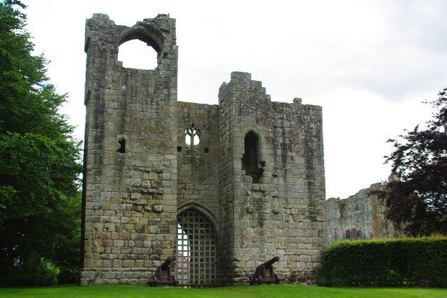
Etal Castle

Etal Castle is a ruined medieval fortification in the village of Etal, Northumberland, England. It was built around 1341 by Robert Manners, and comprised...

Ford Forge

Ford Forge (Ford Mill), Northumberland, England is located on the River Till between the villages of Ford and Etal. Buildings housing a water-powered forge...

Heatherslaw Mill

Heatherslaw Mill is a water mill situated on the Ford and Etal Estate, 7 miles north of the town of Wooler in the English county of Northumberland. It...

Crookham, Northumberland

Crookham is a village on the River Till in Northumberland, in England. It is situated approximately 8 km (5.0 mi) to the east of Coldstream and 14 km...

Ford Castle

Ford Castle is a Grade I listed building situated at a shallow crossing point on the River Till, Ford, Northumberland, England. The castle dates from about...

Lady Waterford Hall

Lady Waterford Hall is the former village school of the estate village of Ford, Northumberland. It is now used as the village hall and is a Grade II* listed...

Ford, Northumberland

Ford is a small village and civil parish in Northumberland, England, about 13 miles (21 km) from Berwick-upon-Tweed. The parish also includes Etal. �...

Nearby Amenities

Located within 500m of 55.64989,-2.117592
Post Box
Operator: Royal Mail
Post Box Type: lamp
Ref: TD12 72
Royal Cypher: scottish_crown
Lat/Long: 55.6479266/-2.1171544
Cafe
Lavender Tea Rooms
Addr City: Cornhill-on-Tweed
Addr Country: GB
Addr County: Northumberland
Addr Hamlet: Etal
Addr Housenumber: 2
Addr Postcode: TD12 4TN
Fhrs Id: 286395
Website: http://www.thelavendertearooms.org.uk/
Lat/Long: 55.6479021/-2.1170037
Etal
Place: village
Wikidata: Q5402396
Wikipedia: en:Etal
Lat/Long: 55.6479372/-2.117584
Railway: turntable
Lat/Long: 55.6465539/-2.122313
Toilets
Lat/Long: 55.6469202/-2.1202414
Etal Railway Station
Railway: station
Usage: tourism
Lat/Long: 55.646411/-2.1226374
Historic: castle
Lat/Long: 55.6473784/-2.1204107
Post Office
Etal Post Office
Addr City: Cornhill-on-Tweed
Addr Country: GB
Addr County: Northumberland
Addr Hamlet: Etal
Addr Housenumber: 2
Addr Postcode: TD12 4TN
Opening Hours Post Office: Mo-Th 09:00-13:00
Ref Pol Id: 16512
Shop: convenience
Lat/Long: 55.6478252/-2.1169599
Booth: KX100
Covered: booth
Disused Amenity: telephone
Man Made: telephone_box
Lat/Long: 55.6476687/-2.1157895
Turning Circle
Lat/Long: 55.6482873/-2.1180171
Direction: SSE
Generator Method: photovoltaic
Generator Output Electricity: yes
Generator Solar Modules: 12
Generator Source: solar
Generator Type: solar_photovoltaic_panel
Location: roof
Power: generator
Lat/Long: 55.6478038/-2.1170059
The data included in this document is from www.openstreetmap.org. The data is made available under ODbL.

Have you been to Etalmill Stream?

Leave your review of Etalmill Stream below (or comments, questions and feedback).