Wolverhampton Locks

Lake, Pool, Pond, Freshwater Marsh in Staffordshire

England

Wolverhampton Locks

Aldersley Stadium This comprises an athletics track and a sports village.
Aldersley Stadium Credit: Bill Boaden

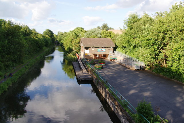
Wolverhampton Locks, located in Staffordshire, England, is a series of canal locks that provide a vital link between the Staffordshire and Worcestershire Canal and the Shropshire Union Canal. This historic site is a significant engineering feat, comprising a total of 21 locks that traverse a height difference of around 132 feet.

The locks were constructed in the late 18th century and were instrumental in facilitating transportation of goods across the canal network during the Industrial Revolution. Today, they serve as a popular tourist attraction, drawing visitors from near and far who are intrigued by the engineering prowess and historical significance of the site.

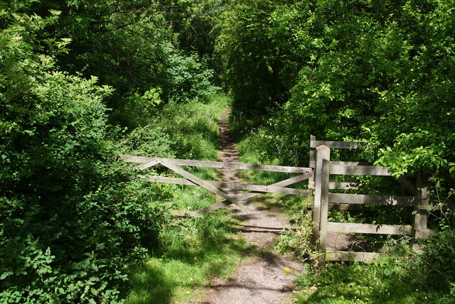
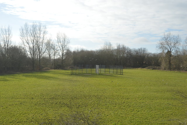
Adjacent to Wolverhampton Locks is a picturesque freshwater marsh, which offers a tranquil and scenic environment. This marshland supports a diverse range of plant and animal species, making it a valuable ecosystem within the Staffordshire countryside. Visitors can enjoy leisurely walks along the marsh, observing the abundant wildlife that inhabits the area.

Additionally, the locks are surrounded by a network of lakes, pools, and ponds, all of which contribute to the overall charm and beauty of the site. These bodies of water provide a peaceful setting for various recreational activities such as fishing, boating, and picnicking.

Wolverhampton Locks, Staffordshire, stands as a testament to the rich industrial heritage of the region. Its combination of canal locks, freshwater marsh, and surrounding water bodies make it an idyllic destination for history enthusiasts, nature lovers, and those seeking a tranquil escape in the heart of England.

If you have any feedback on the listing, please let us know in the comments section below.

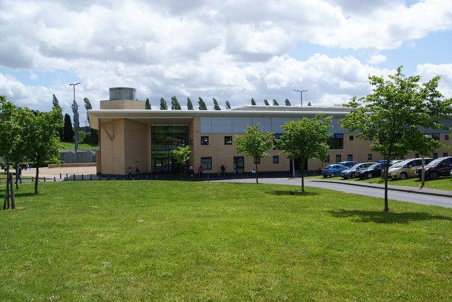
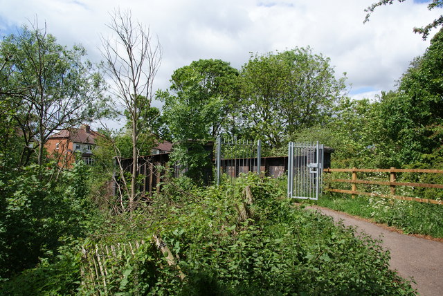
Wolverhampton Locks Images

Images are sourced within 2km of 52.603183/-2.1335687 or Grid Reference SJ9100. Thanks to Geograph Open Source API. All images are credited.

Aldersley Stadium This comprises an athletics track and a sports village.
Aldersley Stadium
This comprises an athletics track and a sports village.
Path along a former railway track
Bridge over the former railway The thick spring foliage makes it difficult to get a good view.
Bridge over the former railway
The thick spring foliage makes it difficult to get a good view.
The Golden Eagle A pub on the corner of Court Road and Hordern Road.
The Golden Eagle
A pub on the corner of Court Road and Hordern Road.
The Staffordshire and Worcestershire Canal Taken from a cycle path bridge alongside Hordern Road.
The Staffordshire and Worcestershire Canal
Taken from a cycle path bridge alongside Hordern Road.
Southbound freight train on the Kingswinford Branch  at Aldersley Junction View northward, towards Codsall, Wellington and Shrewsbury (to the left), Oxley Sidings, Wolverhampton etc. (to the right). The train is headed towards Kingswinford Junction and Stourbridge Junction, on a line only opened in 1925, closed to passengers in 1932, to goods in 1965. The locomotive (4-6-0 No. 5900 'Hinderton Hall' is now preserved at Didcot Railway Centre, having been built in 3/31 and withdrawn in 12/63. (On this occasion there was no one on the footplate, the crew evidently having a break - hopefully having left the brakes on). (Compare this view with <a href="https://www.geograph.org.uk/photo/2439076">SJ8901 : Bridge over the former railway</a>)!
Southbound freight train on the Kingswinford Branch at Aldersley Junction
View northward, towards Codsall, Wellington and Shrewsbury (to the left), Oxley Sidings, Wolverhampton etc. (to the right). The train is headed towards Kingswinford Junction and Stourbridge Junction, on a line only opened in 1925, closed to passengers in 1932, to goods in 1965. The locomotive (4-6-0 No. 5900 'Hinderton Hall' is now preserved at Didcot Railway Centre, having been built in 3/31 and withdrawn in 12/63. (On this occasion there was no one on the footplate, the crew evidently having a break - hopefully having left the brakes on). (Compare this view with SJ8901 : Bridge over the former railway)!
The Pilot - Green Lane Interwar public house designed by local architect Richard Twentyman.
The Pilot - Green Lane
Interwar public house designed by local architect Richard Twentyman.
Modern pub sign at the Pilot PH The pub draws its name from the nearby Wolverhampton Airport.
Modern pub sign at the Pilot PH
The pub draws its name from the nearby Wolverhampton Airport.
Council Housing - Aldersley Road Stylistically similar to the early 1950s Underhill Estate. A clear indication that this was built as a council estate are the 'NO PARKING' and 'NO BALL GAMES' signs on any patch of open ground.
Council Housing - Aldersley Road
Stylistically similar to the early 1950s Underhill Estate. A clear indication that this was built as a council estate are the 'NO PARKING' and 'NO BALL GAMES' signs on any patch of open ground.
Between the bridges on Aldersley Road The former railway bridge is owned by Wolverhampton council and lies at the end of the Valley Park.
Between the bridges on Aldersley Road
The former railway bridge is owned by Wolverhampton council and lies at the end of the Valley Park.
Tettenhall, primary school St Michael's C.E.(A) Primary School, on Lower Street. There is a stone plaque beneath the gable, with "National School"; modern buildings are behind, out of sight. <span class="nowrap"><a title="http://www.stmichaelsce.org.uk/about.html" rel="nofollow ugc noopener" href="http://www.stmichaelsce.org.uk/about.html">Link</a><img style="margin-left:2px;" alt="External link" title="External link - shift click to open in new window" src="https://s1.geograph.org.uk/img/external.png" width="10" height="10"/></span>
Tettenhall, primary school
St Michael's C.E.(A) Primary School, on Lower Street. There is a stone plaque beneath the gable, with "National School"; modern buildings are behind, out of sight. LinkExternal link
Tettenhall, health centre Lower Green Health Centre, on Aldersley Road: <span class="nowrap"><a title="http://www.tettenhallmedicalpractice.nhs.uk/contact-us-3/" rel="nofollow ugc noopener" href="http://www.tettenhallmedicalpractice.nhs.uk/contact-us-3/">Link</a><img style="margin-left:2px;" alt="External link" title="External link - shift click to open in new window" src="https://s1.geograph.org.uk/img/external.png" width="10" height="10"/></span>
Tettenhall, health centre
Lower Green Health Centre, on Aldersley Road: LinkExternal link
Mitre Inn The view to the Pub on Lower Green Tettenhall.
Mitre Inn
The view to the Pub on Lower Green Tettenhall.
Moored narrowboats at Newbridge, Wolverhampton Ahead are Tettenhall New Bridge then Tettenhall Old Bridge (Nos 62 and 61).
Moored narrowboats at Newbridge, Wolverhampton
Ahead are Tettenhall New Bridge then Tettenhall Old Bridge (Nos 62 and 61).
Tunstall Water Bridge, Staffs & Worcs Canal Referred to as the Dunstall Water Bridge by the Ordnance Survey (but clearly plated as Tunstall Water Bridge), bridge 63 carries the Smestow Brook over the canal.
Tunstall Water Bridge, Staffs & Worcs Canal
Referred to as the Dunstall Water Bridge by the Ordnance Survey (but clearly plated as Tunstall Water Bridge), bridge 63 carries the Smestow Brook over the canal.
Tettenhall, tennis courts Albert Lawn Tennis Club, on Aldersley Road: <span class="nowrap"><a title="http://www.albertltc.co.uk/cms/" rel="nofollow ugc noopener" href="http://www.albertltc.co.uk/cms/">Link</a><img style="margin-left:2px;" alt="External link" title="External link - shift click to open in new window" src="https://s1.geograph.org.uk/img/external.png" width="10" height="10"/></span>
Tettenhall, tennis courts
Albert Lawn Tennis Club, on Aldersley Road: LinkExternal link
Discus and Hammer Net
Canal arm entrance  north of Newbridge, Wolverhampton A short arm off the main line leads to Victoria Wharf where a former boat yard premises is now mainly used for caravan storage and moorings for two or three boats.
Canal arm entrance north of Newbridge, Wolverhampton
A short arm off the main line leads to Victoria Wharf where a former boat yard premises is now mainly used for caravan storage and moorings for two or three boats.
Show me another place!

Wolverhampton Locks is located at Grid Ref: SJ9100 (Lat: 52.603183, Lng: -2.1335687)

Unitary Authority: Wolverhampton

Police Authority: West Midlands

What 3 Words

///nuns.pace.swan. Near Wolverhampton, West Midlands

Nearby Locations

Wolverhampton Locks

Related Wikis

Stafford Road (closed 1852) railway station

Stafford Road railway station served the city of Wolverhampton, England from 1850 to 1852 on the Wolverhampton-Shrewsbury line. The station opened in October...

Gorsebrook

Gorsebrook is an historic area of Wolverhampton, West Midlands, located alongside the Stafford Road between the areas of Dunstall, Oxley and Bushbury....

Dunstall Park railway station

Dunstall Park railway station was a station north of Wolverhampton Low Level railway station on the Great Western Railway's London Paddington to Birkenhead...

Oxley TRSMD

Oxley Traction and Rolling Stock Maintenance Depot is a railway depot located in Wolverhampton, West Midlands, operated by Alstom to maintain Avanti West...

Dunstall Hill

Dunstall Hill is an inner-city area of Wolverhampton, West Midlands, England. It is located on the north of the city centre within the St Peter's ward...

Wolverhampton Racecourse

Wolverhampton Racecourse is a thoroughbred horse racing venue located in Wolverhampton, West Midlands, England. The track was the first to be floodlit...

Christ Church, Wolverhampton

Christ Church, Wolverhampton is a former parish church in the Church of England in Wolverhampton == History == The church was built in 1867 to designs...

Bushbury railway station

Bushbury railway station was a railway station opened by the London and North Western Railway on 2 August 1852. It served the Bushbury area of Wolverhampton...

Nearby Amenities

Located within 500m of 52.603183,-2.1335687
Crossing
Crossing: traffic_signals
Crossing Ref: toucan
Source: OpenStreetCam survey
Lat/Long: 52.6037346/-2.1303675
Seamark Type: gate
Waterway: lock_gate
Lat/Long: 52.6048447/-2.13921
Seamark Type: gate
Waterway: lock_gate
Lat/Long: 52.6046934/-2.1389534
Seamark Type: gate
Waterway: lock_gate
Lat/Long: 52.6038248/-2.1361494
Seamark Type: gate
Waterway: lock_gate
Lat/Long: 52.6037441/-2.1358324
Lock: yes
Seamark Type: gate
Waterway: lock_gate
Lat/Long: 52.6027751/-2.1319785
Seamark Type: gate
Waterway: lock_gate
Lat/Long: 52.6026874/-2.1316569
Seamark Type: gate
Waterway: lock_gate
Lat/Long: 52.6022998/-2.1300871
Seamark Type: gate
Waterway: lock_gate
Lat/Long: 52.6018116/-2.12846
Seamark Type: gate
Waterway: lock_gate
Lat/Long: 52.6016587/-2.1282252
Seamark Type: gate
Waterway: lock_gate
Lat/Long: 52.6009614/-2.1274816
Seamark Type: gate
Waterway: lock_gate
Lat/Long: 52.6007787/-2.1273151
Crossing
Crossing: traffic_signals
Source: OpenStreetCam survey
Lat/Long: 52.6071184/-2.130478
Bus Stop
Gorsebrook Rd / Carter Rd
Bus: yes
Naptan AtcoCode: 43000749401
Naptan Bearing: NE
Naptan BusStopType: CUS
Naptan CommonName: Carter Rd
Naptan Indicator: adj
Naptan NaptanCode: nwmjmjpj
Naptan PlusbusZoneRef: BHAMNWS
Naptan Status: ACT
Naptan StopType: BCT
Naptan Street: GORSEBROOK RD
Naptan Towards: Oxley
Naptan Verified: no
Public Transport: platform
Route Ref: 62;62A
Source: WMCA
Lat/Long: 52.6012077/-2.1358982
Bus Stop
Gorsebrook Rd / Carter Rd
NaPTANAreaCode: 43000749402
Bus: yes
Naptan AtcoCode: 43000749402
Naptan Bearing: SW
Naptan BusStopType: MKD
Naptan CommonName: Carter Rd
Naptan Indicator: opp
Naptan NaptanCode: nwmjmjpm
Naptan PlusbusZoneRef: BHAMNWS
Naptan Status: ACT
Naptan StopType: BCT
Naptan Street: GORSEBROOK RD
Naptan Towards: Wolverhampton
Naptan Verified: no
Public Transport: platform
Route Ref: 62;62A
Shelter: yes
Shelter Ref: 101919
Source: WMCA
Lat/Long: 52.6005691/-2.1361768
Bus Stop
Gorsebrook Rd / Stafford Rd
NaPTANAreaCode: 43000749501
Bus: yes
Naptan AtcoCode: 43000749501
Naptan Bearing: SE
Naptan BusStopType: MKD
Naptan CommonName: Stafford Rd
Naptan Indicator: before
Naptan NaptanCode: nwmjmjpt
Naptan PlusbusZoneRef: BHAMNWS
Naptan Status: ACT
Naptan StopType: BCT
Naptan Street: GORSEBROOK RD
Naptan Towards: Oxley
Public Transport: platform
Route Ref: 62;62A
Shelter: yes
Shelter Ref: 101911
Source: WMCA
Lat/Long: 52.6019325/-2.1309245
Bus Stop
Gorsebrook Rd / Stafford Rd
NaPTANAreaCode: 43000749502
Bus: yes
Naptan AtcoCode: 43000749502
Naptan Bearing: NW
Naptan BusStopType: MKD
Naptan CommonName: Stafford Rd
Naptan Indicator: after
Naptan NaptanCode: nwmjmjpw
Naptan PlusbusZoneRef: BHAMNWS
Naptan Status: ACT
Naptan StopType: BCT
Naptan Street: GORSEBROOK RD
Naptan Towards: Wolverhampton
Naptan Verified: no
Public Transport: platform
Route Ref: 62;62A
Shelter: yes
Shelter Ref: 101910
Source: WMCA
Lat/Long: 52.6019859/-2.1313824
Bus Stop
Stafford Rd / Gorsebrook Rd
NaPTANAreaCode: 43000750501
Bus: yes
Naptan AtcoCode: 43000750501
Naptan Bearing: N
Naptan BusStopType: MKD
Naptan CommonName: Gorsebrook Rd
Naptan Indicator: adj
Naptan NaptanCode: nwmjmjwj
Naptan PlusbusZoneRef: BHAMNWS
Naptan Status: ACT
Naptan StopType: BCT
Naptan Street: STAFFORD RD
Naptan Towards: Oxley
Naptan Verified: no
Public Transport: platform
Route Ref: 3;4;32;33;54;62;62A;67;76A;154;876;877;878
Shelter: yes
Shelter Ref: 101906
Source: WMCA
Lat/Long: 52.6011025/-2.1301369
Bus Stop
Stafford Rd / Gorsebrook Rd
NaPTANAreaCode: 43000750502
Bench: yes
Bin: yes
Bus: yes
Bus Bay: yes
Image: https://storage11.openstreetcam.org/files/photo/2019/4/12/lth/1371842_65696_618.jpg
Naptan AtcoCode: 43000750502
Naptan Bearing: S
Naptan BusStopType: MKD
Naptan CommonName: Gorsebrook Rd
Naptan Indicator: opp
Naptan NaptanCode: nwmjmjwm
Naptan PlusbusZoneRef: BHAMNWS
Naptan Status: ACT
Naptan StopType: BCT
Naptan Street: STAFFORD RD
Naptan Towards: Wolverhampton
Naptan Verified: no
Public Transport: platform
Route Ref: 3;4;32;33;54;62;62A;67;76A;154;876;877;878
Shelter: yes
Shelter Ref: 101909
Source: WMCA
Survey Date: 2019-04-12
Lat/Long: 52.6011607/-2.1297115
Bus Stop
Bushbury Lane / Stafford Rd
NaPTANAreaCode: 43000751103
Bench: yes
Bin: yes
Bus: yes
Lit: yes
Naptan AtcoCode: 43000751103
Naptan Bearing: NE
Naptan BusStopType: MKD
Naptan CommonName: Stafford Rd
Naptan Indicator: opp
Naptan NaptanCode: nwmjmjwp
Naptan PlusbusZoneRef: BHAMNWS
Naptan Status: ACT
Naptan StopType: BCT
Naptan Street: BUSHBURY LANE
Naptan Towards: Bushbury
Naptan Verified: no
Public Transport: platform
Route Ref: 32;33;67
Shelter: yes
Shelter Ref: 101915
Source: WMCA
Tactile Paving: no
Lat/Long: 52.6057468/-2.1285732
Bus Stop
Bushbury Lane / Stafford Rd
Bench: no
Bin: no
Bus: yes
Lit: yes
Naptan AtcoCode: 43000751104
Naptan Bearing: S
Naptan BusStopType: MKD
Naptan CommonName: Stafford Rd
Naptan Indicator: before
Naptan NaptanCode: nwmtmdta
Naptan PlusbusZoneRef: BHAMNWS
Naptan Status: ACT
Naptan StopType: BCT
Naptan Street: BUSHBURY LANE
Naptan Towards: Wolverhampton
Naptan Verified: no
Public Transport: platform
Route Ref: 32;33;67
Shelter: no
Source: WMCA
Tactile Paving: no
Lat/Long: 52.605783/-2.1283814
Bus Stop
Stafford Rd / Bushbury Lane
NaPTANAreaCode: 43007200101
Bus: yes
Bus Bay: yes
Naptan AtcoCode: 43007200101
Naptan Bearing: N
Naptan BusStopType: MKD
Naptan CommonName: Bushbury Lane
Naptan Indicator: opp
Naptan NaptanCode: nwmpmgdj
Naptan PlusbusZoneRef: BHAMNWS
Naptan Status: ACT
Naptan StopType: BCT
Naptan Street: STAFFORD RD
Naptan Towards: Oxley
Naptan Verified: no
Public Transport: platform
Route Ref: 3;4;54;76A;154;876;877;878
Shelter: yes
Shelter Ref: 101914
Source: WMCA
Lat/Long: 52.6040278/-2.1303697
Bus Stop
Stafford Rd / Bushbury Lane
NaPTANAreaCode: 43007200102
Bus: yes
Bus Bay: yes
Naptan AtcoCode: 43007200102
Naptan Bearing: S
Naptan BusStopType: MKD
Naptan CommonName: Bushbury Lane
Naptan Indicator: adj
Naptan NaptanCode: nwmpmgdm
Naptan PlusbusZoneRef: BHAMNWS
Naptan Status: ACT
Naptan StopType: BCT
Naptan Street: STAFFORD RD
Naptan Towards: Wolverhampton
Naptan Verified: no
Public Transport: platform
Route Ref: 3;4;32;33;54;67;76A;154;876;877;878
Shelter: yes
Shelter Ref: 101913
Source: WMCA
Lat/Long: 52.6038573/-2.1300443
Bus Stop
Glaisher Drive / Wolverhampton Science Park
Bus: yes
Naptan AtcoCode: 43007200301
Naptan Bearing: NW
Naptan BusStopType: MKD
Naptan CommonName: Wolverhampton Science Park
Naptan Indicator: adj
Naptan NaptanCode: nwmtatpm
Naptan PlusbusZoneRef: BHAMNWS
Naptan Status: ACT
Naptan StopType: BCT
Naptan Street: GLAISHER DRIVE
Naptan Towards: Wolverhampton
Naptan Verified: no
Public Transport: platform
Source: WMCA
Lat/Long: 52.6028723/-2.127477
Bus Stop
Showell Rd / Park & Ride Site
Bus: yes
Naptan AtcoCode: 43007204501
Naptan Bearing: W
Naptan BusStopType: MKD
Naptan CommonName: Park & Ride Site
Naptan Indicator: opp
Naptan NaptanCode: nwmtgadm
Naptan PlusbusZoneRef: BHAMNWS
Naptan Status: ACT
Naptan StopType: BCT
Naptan Street: SHOWELL RD
Naptan Towards: Wolverhampton
Naptan Verified: no
Public Transport: platform
Source: WMCA
Lat/Long: 52.6043034/-2.1276948
Bus Stop
Coxwell Avenue / Science Park
Bus: yes
Naptan AtcoCode: 43007205001
Naptan Bearing: W
Naptan BusStopType: MKD
Naptan CommonName: Science Park
Naptan Indicator: opp
Naptan NaptanCode: nwmtgadp
Naptan PlusbusZoneRef: BHAMNWS
Naptan Status: ACT
Naptan StopType: BCT
Naptan Street: COXWELL AVENUE
Naptan Towards: Wolverhampton
Naptan Verified: no
Public Transport: platform
Source: WMCA
Lat/Long: 52.6023153/-2.1290043
Mini Roundabout
Direction: clockwise
Lat/Long: 52.6003575/-2.1364083
Turning Circle
Lat/Long: 52.6068304/-2.1313042
Telephone
Booth: KXPlus
Covered: booth
Mapillary: 1492135124486091
Survey Date: 2021-06-24
Lat/Long: 52.6035602/-2.1306002
Post Box
Brand: Royal Mail
Brand Wikidata: Q638098
Operator: Royal Mail
Operator Wikidata: Q638098
Post Box Mounting: pier
Post Box Type: lamp
Lat/Long: 52.6035624/-2.1305352
Addr Housenumber: Castlereagh Court
Lat/Long: 52.6053321/-2.1304568
Addr Housenumber: Huskisson Court
Lat/Long: 52.6050638/-2.1307227
Dunstall Hill
Place: locality
Source: OS 1:25k/knowledge
Lat/Long: 52.5988367/-2.1340085
Railway: switch
Lat/Long: 52.6041592/-2.135141
Railway: switch
Lat/Long: 52.6037669/-2.1342939
Railway: switch
Lat/Long: 52.6042681/-2.1355172
Railway: switch
Lat/Long: 52.6046074/-2.1365239
Railway: switch
Lat/Long: 52.6050118/-2.1371083
Railway: switch
Lat/Long: 52.6051314/-2.1356043
Railway: buffer_stop
Lat/Long: 52.6063068/-2.1386696
Railway: buffer_stop
Lat/Long: 52.6063416/-2.1386427
Parking
Capacity: 15
Lat/Long: 52.6072309/-2.1307805
Crossing
Crossing: unmarked
Crossing Island: yes
Source: OpenStreetCam survey
Tactile Paving: yes
Lat/Long: 52.6044271/-2.1296752
Crossing
Crossing: traffic_signals
Crossing Ref: toucan
Source: OpenStreetCam survey
Lat/Long: 52.6050801/-2.1299242
Dunstall Park
Abandoned Railway: station
Railway: site
Lat/Long: 52.600118/-2.1281949
Waterway: weir
Lat/Long: 52.6010481/-2.1276114
Waterway: weir
Lat/Long: 52.601869/-2.1285915
Seamark Type: gate
Waterway: lock_gate
Lat/Long: 52.6022266/-2.1297559
Waterway: weir
Lat/Long: 52.6022775/-2.1302028
Waterway: weir
Lat/Long: 52.6027942/-2.1322816
Waterway: weir
Lat/Long: 52.6038142/-2.1363456
Waterway: weir
Lat/Long: 52.6048771/-2.1393567
Railway: switch
Lat/Long: 52.6050891/-2.1352995
Railway: switch
Lat/Long: 52.6040893/-2.134557
Stop
Lat/Long: 52.6044591/-2.136403
Railway: buffer_stop
Lat/Long: 52.6048236/-2.1367372
Railway: switch
Lat/Long: 52.6054442/-2.1374923
Railway: buffer_stop
Lat/Long: 52.6063676/-2.1385993
Give Way
Lat/Long: 52.6042983/-2.1301944
Wulfrun's Well
Heritage: 2
Heritage Operator: Historic England
Historic: memorial
Listed Status: Grade II
Source: survey
Lat/Long: 52.6020111/-2.1339306
Locomotive wheels
Source: survey
Tourism: artwork
Lat/Long: 52.6021213/-2.1310322
Crossing
Crossing: uncontrolled
Source: visual survey;bing
Lat/Long: 52.6006432/-2.1362045
Crossing
Crossing: unmarked
Crossing Island: yes
Tactile Paving: yes
Lat/Long: 52.6017673/-2.1297417
GWR Stafford Road Works
Historic: memorial
Source: survey
Lat/Long: 52.5993656/-2.1306215
Railway: switch
Lat/Long: 52.6038905/-2.1345781
Railway: switch
Lat/Long: 52.6042986/-2.1354556
Railway: switch
Lat/Long: 52.6044351/-2.1357057
Railway: switch
Lat/Long: 52.6042751/-2.1351121
Railway: crossing
Lat/Long: 52.6046091/-2.1356567
Railway: buffer_stop
Lat/Long: 52.6046042/-2.1362876
Railway: switch
Lat/Long: 52.6057805/-2.1361273
Railway: switch
Lat/Long: 52.6060155/-2.1363264
Railway: switch
Lat/Long: 52.6043082/-2.1350921
Railway: crossing
Lat/Long: 52.604719/-2.1353759
Railway: railway_crossing
Lat/Long: 52.60151/-2.1320263
Stafford Road Junction
Railway: switch
Lat/Long: 52.6017197/-2.1322882
Stafford Road Junction
Railway: switch
Lat/Long: 52.6017628/-2.1322662
Give Way
Lat/Long: 52.601535/-2.1301985
Give Way
Lat/Long: 52.6018095/-2.1304458
Give Way
Lat/Long: 52.6016879/-2.1298196
Give Way
Lat/Long: 52.6019553/-2.1301485
Give Way
Lat/Long: 52.604411/-2.1297564
Give Way
Lat/Long: 52.6046968/-2.1299509
Vending Machine
Stafford Rd
Category: Stop
Mode: Bus
Naptan: 43007200101
Operator: TfWM
Payment: no
Postal Code: WV10 6
Public Transport Ticket: Swift Card
Shelter: 101914
Source: TfWM
Top Up: yes
Vending: public_transport_tickets
Lat/Long: 52.6040081/-2.13037
Vending Machine
Stafford Rd
Category: Stop
Mode: Bus
Naptan: 43007200102
Operator: TfWM
Payment: no
Postal Code: WV10 6
Public Transport Ticket: Swift Card
Shelter: 101913
Source: TfWM
Top Up: yes
Vending: public_transport_tickets
Lat/Long: 52.6038365/-2.1300447
Crossing
Crossing: marked
Lat/Long: 52.604739/-2.129117
Crossing
Crossing: traffic_signals
Crossing Ref: toucan
Source: OpenStreetCam survey
Lat/Long: 52.6050007/-2.1301251
Man Made: surveillance
Source: OpenStreetCam survey
Lat/Long: 52.6052238/-2.129788
Crossing
Crossing: traffic_signals
Source: OpenStreetCam survey
Lat/Long: 52.6071817/-2.1303754
Crossing
Crossing: unmarked
Crossing Island: yes
Tactile Paving: yes
Lat/Long: 52.6016928/-2.1297656
Crossing
Crossing: traffic_signals
Crossing Ref: toucan
Source: OpenStreetCam survey
Lat/Long: 52.603612/-2.1302345
Crossing
Crossing: unmarked
Crossing Island: yes
Source: OpenStreetCam survey
Tactile Paving: yes
Lat/Long: 52.6045103/-2.1296793
Crossing
Lat/Long: 52.603219/-2.1283174
Crossing
Lat/Long: 52.6031929/-2.1280712
Crossing
Lat/Long: 52.6030678/-2.1283385
Crossing
Lat/Long: 52.6029715/-2.1285442
Barrier: lift_gate
Lat/Long: 52.6040198/-2.1286877
Barrier: lift_gate
Lat/Long: 52.6039779/-2.1286755
Barrier: lift_gate
Lat/Long: 52.6032814/-2.1279502
Bicycle Parking
Lat/Long: 52.6030042/-2.129618
Leisure: picnic_table
Lat/Long: 52.6041229/-2.1295706
Crossing
Lat/Long: 52.6037707/-2.1290141
Barrier: lift_gate
Lat/Long: 52.6026459/-2.1274157
Crossing
Crossing: marked
Lat/Long: 52.6019477/-2.1295051
Crossing
Crossing: marked
Lat/Long: 52.6018404/-2.1291114
Crossing
Crossing: marked
Lat/Long: 52.6049464/-2.1288589
Crossing
Crossing: marked
Lat/Long: 52.6048234/-2.1290199
Crossing
Crossing: marked
Lat/Long: 52.6046/-2.1290926
Crossing
Crossing: unmarked
Crossing Island: yes
Tactile Paving: yes
Lat/Long: 52.60173/-2.1306199
Crossing
Crossing: unmarked
Crossing Island: yes
Tactile Paving: yes
Lat/Long: 52.60179/-2.1306217
Railway: switch
Lat/Long: 52.6064466/-2.138041
Railway: buffer_stop
Lat/Long: 52.6047198/-2.1365679
Stafford Road Junction
Railway: junction
Lat/Long: 52.6013712/-2.1318615
Railway: switch
Lat/Long: 52.6039433/-2.1345431
Railway: switch
Lat/Long: 52.6036604/-2.134254
Railway: switch
Lat/Long: 52.6041067/-2.134864
Railway: crossing
Lat/Long: 52.6046821/-2.1354789
Railway: crossing
Lat/Long: 52.6046342/-2.1356024
Railway: switch
Lat/Long: 52.6053875/-2.1358182
Railway: crossing
Lat/Long: 52.6047769/-2.1352308
Railway: crossing
Lat/Long: 52.6047362/-2.1353366
Railway: crossing
Lat/Long: 52.6044979/-2.1359029
Railway: crossing
Lat/Long: 52.6045208/-2.1358549
Railway: crossing
Lat/Long: 52.60453/-2.13584
Railway: crossing
Lat/Long: 52.6043715/-2.1358867
Railway: crossing
Lat/Long: 52.6043464/-2.1359047
Railway: switch
Lat/Long: 52.6048007/-2.1368597
Railway: switch
Lat/Long: 52.6055269/-2.1381951
Railway: switch
Lat/Long: 52.6055878/-2.138498
Railway: crossing
Lat/Long: 52.6060551/-2.1389336
Railway: crossing
Lat/Long: 52.6057944/-2.1388593
Railway: crossing
Lat/Long: 52.6046559/-2.1355447
Railway: crossing
Lat/Long: 52.6047617/-2.1352748
Railway: switch
Lat/Long: 52.6042954/-2.1347194
Railway: crossing
Lat/Long: 52.6065392/-2.1364741
Railway: crossing
Lat/Long: 52.6065681/-2.1363992
Crossing
Crossing: uncontrolled
Crossing Island: yes
Crossing Markings: surface
Tactile Paving: yes
Traffic Calming: table
Lat/Long: 52.6058848/-2.1302376
The data included in this document is from www.openstreetmap.org. The data is made available under ODbL.

Have you been to Wolverhampton Locks?

Leave your review of Wolverhampton Locks below (or comments, questions and feedback).