Longdale Dub

Lake, Pool, Pond, Freshwater Marsh in Yorkshire Richmondshire

England

Longdale Dub

Path down to Semer Water There are only two lakes in the Yorkshire Dales, Malham Tarn and Semer Water. Semer Water was formed during the last Ice Age by a moraine which effectively dammed the valley. The lake today is a shadow of its former self but is still three miles in circumference and 45 feet deep. This is the footpath back down to Semer Water in evening sunlight.
Path down to Semer Water Credit: Marathon

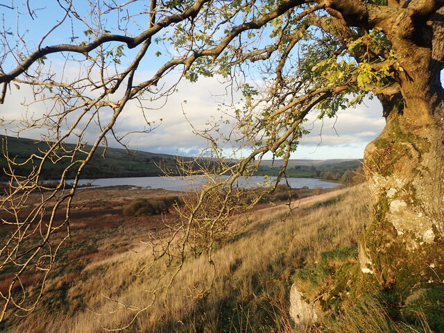
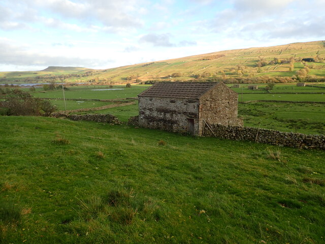
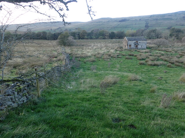
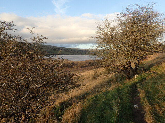
Longdale Dub is a picturesque freshwater marsh located in the region of Yorkshire, England. Nestled amidst the rolling hills and countryside, it offers a serene and idyllic escape for nature enthusiasts and wildlife lovers alike.

Covering an area of approximately 10 acres, Longdale Dub is home to a diverse range of flora and fauna. The marsh is characterized by its tranquil surroundings, with lush vegetation and reeds forming a dense cover across the expanse of water. The area is also dotted with small islands, adding to its natural charm.

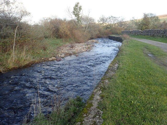
The freshwater in Longdale Dub is sourced from underground springs, ensuring a constant flow of clean and clear water. This creates a favorable habitat for a variety of aquatic life, including fish, frogs, and water insects. The marsh also attracts a wide array of bird species, making it a popular spot for birdwatching enthusiasts. Visitors may catch sight of herons, kingfishers, and even the occasional swan gracefully gliding across the water.

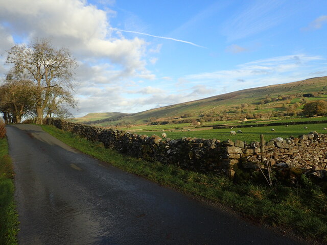
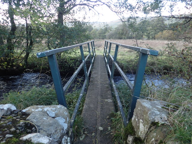
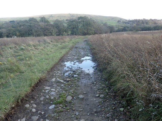
Surrounding the marsh, there are footpaths and benches, allowing visitors to explore and appreciate the beauty of Longdale Dub at their own pace. The quiet and peaceful ambiance makes it an ideal place for relaxation and reflection.

Longdale Dub is not only a natural haven but also serves as an important ecosystem, providing a habitat for various plants and animals. Its scenic beauty and abundant wildlife make it a must-visit destination for those seeking a tranquil retreat in the heart of Yorkshire.

If you have any feedback on the listing, please let us know in the comments section below.

Longdale Dub Images

Images are sourced within 2km of 54.264509/-2.1512509 or Grid Reference SD9085. Thanks to Geograph Open Source API. All images are credited.

Path down to Semer Water There are only two lakes in the Yorkshire Dales, Malham Tarn and Semer Water. Semer Water was formed during the last Ice Age by a moraine which effectively dammed the valley. The lake today is a shadow of its former self but is still three miles in circumference and 45 feet deep. This is the footpath back down to Semer Water in evening sunlight.
Path down to Semer Water
There are only two lakes in the Yorkshire Dales, Malham Tarn and Semer Water. Semer Water was formed during the last Ice Age by a moraine which effectively dammed the valley. The lake today is a shadow of its former self but is still three miles in circumference and 45 feet deep. This is the footpath back down to Semer Water in evening sunlight.
Marsett Lane This is just outside the hamlet of Marsett on the way to Countersett. The hill in the distance is Addlebrough.
Marsett Lane
This is just outside the hamlet of Marsett on the way to Countersett. The hill in the distance is Addlebrough.
Footbridge over Cragdale Water The footpath between Stalling Busk and Marsett is wet at the best of times. Cragdale water and then Raydale Beck are crossed by footbridges. This is the first one.
Footbridge over Cragdale Water
The footpath between Stalling Busk and Marsett is wet at the best of times. Cragdale water and then Raydale Beck are crossed by footbridges. This is the first one.
A barn in Raydale This view is from a meeting of footpaths downhill from Stelling Busk on the way to Cragdale Water.
A barn in Raydale
This view is from a meeting of footpaths downhill from Stelling Busk on the way to Cragdale Water.
Old barn seen from Marsett Lane The barns in the Yorkshire Dales are in varying stages of dilapidation. This one seems quite good and it appears to have a new roof. The hill in the distance on the left is Addlebrough.
Old barn seen from Marsett Lane
The barns in the Yorkshire Dales are in varying stages of dilapidation. This one seems quite good and it appears to have a new roof. The hill in the distance on the left is Addlebrough.
Marsett Beck This looks downstream from Marsett Bridge. Marsett Beck flows into Crooks Beck a short distance ahead which in turn flows into Semer Water.
Marsett Beck
This looks downstream from Marsett Bridge. Marsett Beck flows into Crooks Beck a short distance ahead which in turn flows into Semer Water.
Track between two streams The track has just crossed Raydale Beck and is heading to the footbridge over Cragdale Water.
Track between two streams
The track has just crossed Raydale Beck and is heading to the footbridge over Cragdale Water.
Isolated barn in a field The barns in the Yorkshire Dales are in varying stages of dilapidation. This one seems in quite good condition and it appears to have a decent roof. This view is from the footpath which leads from Busk Lane towards Semer Water.
Isolated barn in a field
The barns in the Yorkshire Dales are in varying stages of dilapidation. This one seems in quite good condition and it appears to have a decent roof. This view is from the footpath which leads from Busk Lane towards Semer Water.
Fading light near Stalling Busk This view is of the footpath which leads from Semer Water towards Busk Lane.
Fading light near Stalling Busk
This view is of the footpath which leads from Semer Water towards Busk Lane.
Footpath near Stalling Busk This view is of the footpath which leads from Semer Water towards Busk Lane.
Footpath near Stalling Busk
This view is of the footpath which leads from Semer Water towards Busk Lane.
Old stone barn near Semer Water The barns in the Yorkshire Dales are in varying stages of dilapidation. This one seems in reasonably good condition and it appears to have a decent roof. This view is from the footpath which leads from Busk Lane towards Semer Water.
Old stone barn near Semer Water
The barns in the Yorkshire Dales are in varying stages of dilapidation. This one seems in reasonably good condition and it appears to have a decent roof. This view is from the footpath which leads from Busk Lane towards Semer Water.
Stalling Busk Old Church Stalling Busk Old Church (on the right here) above Semer Water in a side valley of Wensleydale was rebuilt in 1822 on the site of an older church which had been founded in 1609 to serve the scattered communities of the dale. It was abandoned when the new church was built in 1909.
Stalling Busk Old Church
Stalling Busk Old Church (on the right here) above Semer Water in a side valley of Wensleydale was rebuilt in 1822 on the site of an older church which had been founded in 1609 to serve the scattered communities of the dale. It was abandoned when the new church was built in 1909.
Fading light near Stalling Busk This view is from the footpath which leads from Semer Water towards Busk Lane, just before Stalling Busk Old Church is reached.
Fading light near Stalling Busk
This view is from the footpath which leads from Semer Water towards Busk Lane, just before Stalling Busk Old Church is reached.
Footpath to Semer Water There are only two lakes in the Yorkshire Dales, Malham Tarn and Semer Water. Semer Water was formed during the last Ice Age by a moraine which effectively dammed the valley. The lake today is a shadow of its former self but is still three miles in circumference and 45 feet deep. Legend has it that there is a drowned village under the water.
Footpath to Semer Water
There are only two lakes in the Yorkshire Dales, Malham Tarn and Semer Water. Semer Water was formed during the last Ice Age by a moraine which effectively dammed the valley. The lake today is a shadow of its former self but is still three miles in circumference and 45 feet deep. Legend has it that there is a drowned village under the water.
Ruined chapel in Raydale The remains of the chapel near Stalling Busk.
Ruined chapel in Raydale
The remains of the chapel near Stalling Busk.
Show me another place!

Longdale Dub is located at Grid Ref: SD9085 (Lat: 54.264509, Lng: -2.1512509)

Division: North Riding

Administrative County: North Yorkshire

District: Richmondshire

Police Authority: North Yorkshire

What 3 Words

///geology.dares.radiating. Near Leyburn, North Yorkshire

Related Wikis

Marsett

Marsett is one of three settlements in around Semer Water in Raydale, a small side dale off Wensleydale in North Yorkshire, England. Marsett is only a...

St Matthew's Church, Stalling Busk

St Matthew's Church, Stalling Busk is a Grade II listed parish church in the Church of England in Stalling Busk, North Yorkshire. == History == The church...

Stalling Busk

Stalling Busk is one of three settlements around Semer Water in the Richmondshire district of North Yorkshire in the small dale of Raydale just off...

Semerwater

Semerwater () is the second largest natural lake in North Yorkshire, England, after Malham Tarn. It is half a mile (800 m) long, covers 100 acres (0.40...

Countersett

Countersett is the largest of the three settlements in Raydale, around Semerwater in the Richmondshire district of North Yorkshire, England. It is in the...

Wether Fell

Wether Fell (archaically Wetherfell), also known as Drumaldrace (the name of its summit), is a mountain in the Yorkshire Dales National Park, in North...

Fleet Moss

Fleet Moss is a upland area separating Wharfedale from Wensleydale in North Yorkshire, England. The area is 1,850 ft (560 m) above sea level (although...

Burtersett

Burtersett is a small village in the Yorkshire Dales, North Yorkshire, England. It lies approximately 1 mile (1.6 km) east from Hawes and Gayle. The village...

Nearby Amenities

Located within 500m of 54.264509,-2.1512509
The data included in this document is from www.openstreetmap.org. The data is made available under ODbL.

Have you been to Longdale Dub?

Leave your review of Longdale Dub below (or comments, questions and feedback).