Hurstwood Reservoir

Lake, Pool, Pond, Freshwater Marsh in Lancashire Burnley

England

Hurstwood Reservoir

The Pennine Bridleway above Swinden Water The bridleway does a lot of zigzags both on this side and the other side of the valley.
The Pennine Bridleway above Swinden Water Credit: Bill Boaden

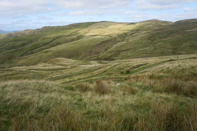
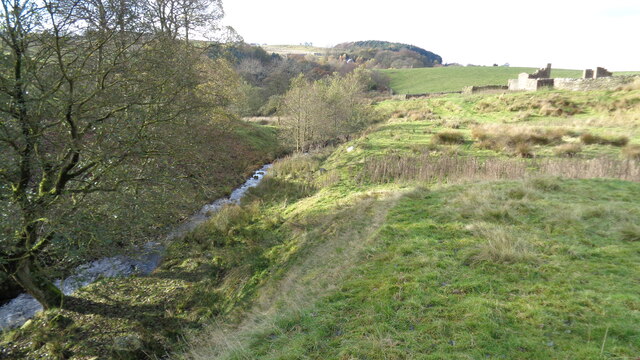
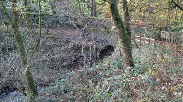
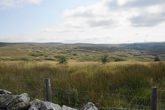
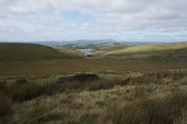
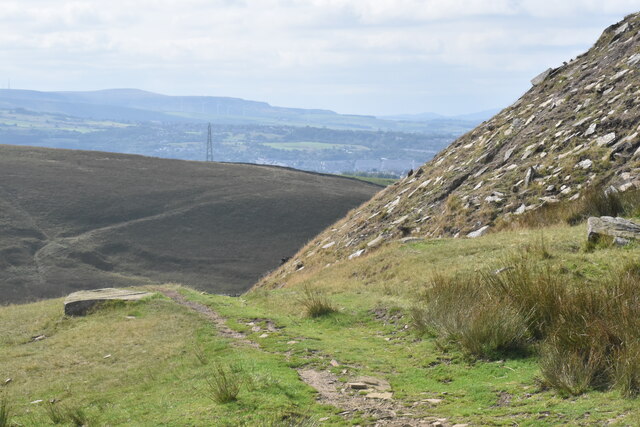
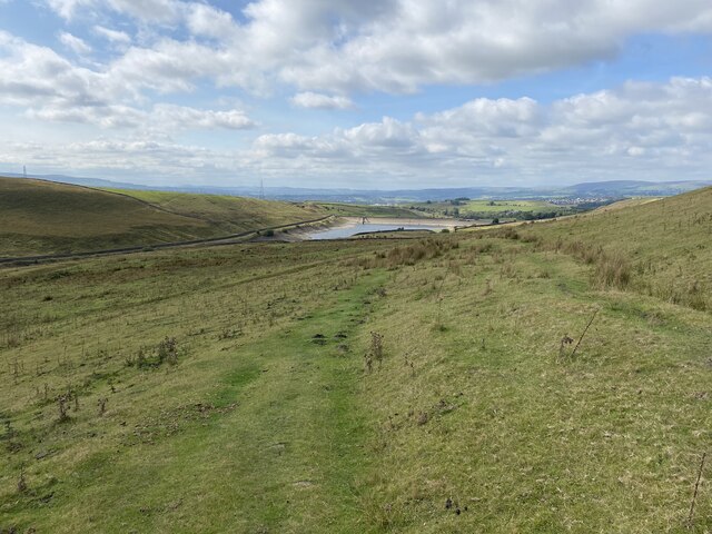
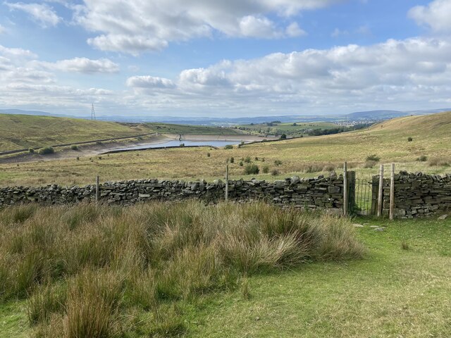
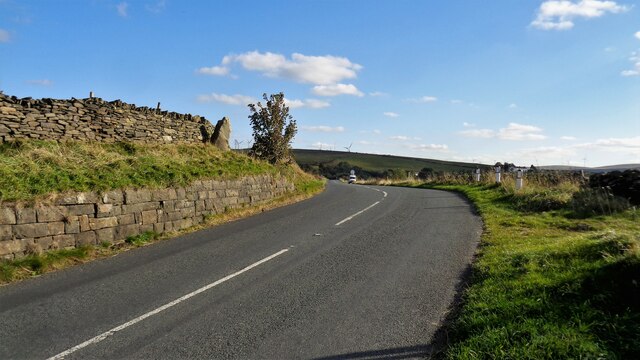
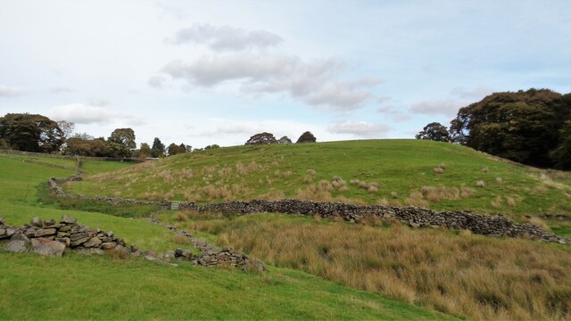
Hurstwood Reservoir, located in Lancashire, England, is a freshwater reservoir encompassing an area of approximately 26 acres. It was originally constructed in the late 19th century to provide a reliable water supply to the surrounding areas. The reservoir is nestled amidst picturesque countryside, surrounded by rolling hills and lush greenery, making it a popular destination for nature enthusiasts.

The reservoir serves as an important habitat for a variety of bird species, attracting birdwatchers from far and wide. Species commonly spotted include great crested grebes, tufted ducks, and Canada geese. The tranquil waters of the reservoir also support a diverse range of aquatic plant life, adding to its ecological significance.

Visitors to Hurstwood Reservoir can enjoy a range of recreational activities. Fishing is a popular pastime, with the reservoir being well-stocked with brown and rainbow trout, providing ample opportunities for anglers. Additionally, the reservoir offers opportunities for sailing and canoeing, with boat launches available for those wishing to explore its calm waters.

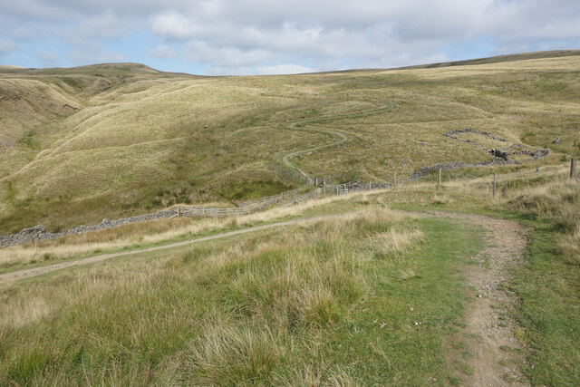
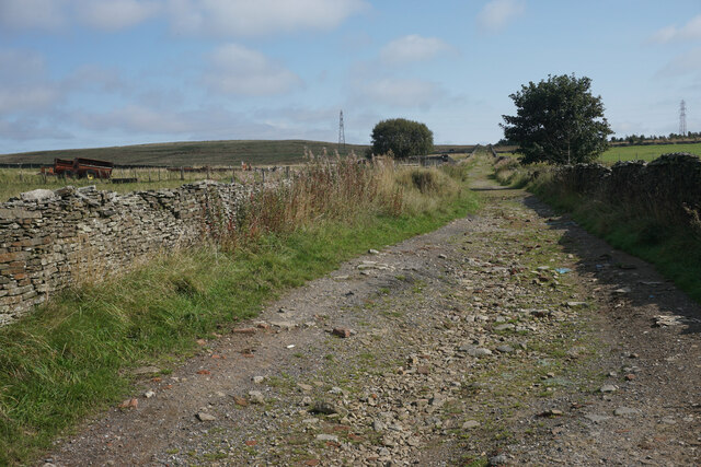
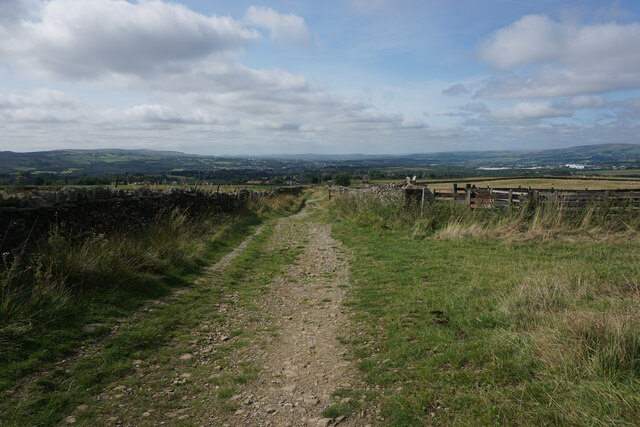
Surrounding the reservoir is a network of walking trails, providing scenic routes for hikers and nature lovers. The paths wind through the surrounding woodland and offer stunning views of the reservoir and its surroundings. Picnic areas are also available, allowing visitors to relax and enjoy the peaceful ambiance of the area.

Hurstwood Reservoir, with its abundant wildlife, serene atmosphere, and recreational offerings, provides a welcome escape from the hustle and bustle of everyday life, making it a cherished destination for both locals and tourists alike.

If you have any feedback on the listing, please let us know in the comments section below.

Hurstwood Reservoir Images

Images are sourced within 2km of 53.780939/-2.1706888 or Grid Reference SD8831. Thanks to Geograph Open Source API. All images are credited.

The Pennine Bridleway above Swinden Water The bridleway does a lot of zigzags both on this side and the other side of the valley.
The Pennine Bridleway above Swinden Water
The bridleway does a lot of zigzags both on this side and the other side of the valley.
The Pennine Bridleway crossing Swinden Water A winding route which reflects previous quarrying activity in the valley.
The Pennine Bridleway crossing Swinden Water
A winding route which reflects previous quarrying activity in the valley.
Limestone Hushings Landscape On the east bank of Hurstwood Reservoir
Limestone Hushings Landscape
On the east bank of Hurstwood Reservoir
Cant Clough With the remains of Hey Laithe on the right in this view
Cant Clough
With the remains of Hey Laithe on the right in this view
Foxstones Bridge Over the infant River Brun
Foxstones Bridge
Over the infant River Brun
Millers Green A new housing development on the edge of Worsthorne. The green gap between Worsthorne and the Burnley conurbation is getting smaller.
Millers Green
A new housing development on the edge of Worsthorne. The green gap between Worsthorne and the Burnley conurbation is getting smaller.
Gorple Road The road has become a track continuing across the Pennines.
Gorple Road
The road has become a track continuing across the Pennines.
Gorple Road Heading straight down towards Worsthorne. The view extends from Crown Point and Great Hameldon on the left round to Pendle and Pen-y-Ghent which are out of this image on the right.
Gorple Road
Heading straight down towards Worsthorne. The view extends from Crown Point and Great Hameldon on the left round to Pendle and Pen-y-Ghent which are out of this image on the right.
The results of quarrying above Hurstwood Reservoir Scarring on the hillside viewed from Gorple Road.
The results of quarrying above Hurstwood Reservoir
Scarring on the hillside viewed from Gorple Road.
Moorland below Ben Edge Swinden Reservoir is at the bottom and Pendle in the background.
Moorland below Ben Edge
Swinden Reservoir is at the bottom and Pendle in the background.
Path on Delf Hill The path down to Swinden Bridge passes the remains of quarrying on Delf Hill.
Path on Delf Hill
The path down to Swinden Bridge passes the remains of quarrying on Delf Hill.
Dilapidated wall on Delf Hill The remains of former quarrying on the top of the hill are quite evident.
Dilapidated wall on Delf Hill
The remains of former quarrying on the top of the hill are quite evident.
Path down to Swinden Bridge The lower part of the path is a gentle grassy descent. Swinden Reservoir is seen below, with the water level clearly below capacity.
Path down to Swinden Bridge
The lower part of the path is a gentle grassy descent. Swinden Reservoir is seen below, with the water level clearly below capacity.
Iron gate in a wall The gate is an unusual feature on the moors, but it is in perfect working order.
Iron gate in a wall
The gate is an unusual feature on the moors, but it is in perfect working order.
Rebuilt bridge across Shedden Clough Used by the Pennine Bridleway and the Burnley Way
Rebuilt bridge across Shedden Clough
Used by the Pennine Bridleway and the Burnley Way
Work at Middle Pasture Farm Is it renovation work?
Work at Middle Pasture Farm
Is it renovation work?
The Long Causeway at Stump Cross The way marking stone known as Stump Cross is at the top of the roadside embankment on the bend. This stone has not been dressed unlike the Mount Cross which is further along this ancient route
The Long Causeway at Stump Cross
The way marking stone known as Stump Cross is at the top of the roadside embankment on the bend. This stone has not been dressed unlike the Mount Cross which is further along this ancient route
Round Hill There are earthworks marked on the OS map for the hill. There are surface stones visible in that area. More remarkable are the large monoliths built into the field walls around this area and perhaps they had been in the earthworks in times past.
Round Hill
There are earthworks marked on the OS map for the hill. There are surface stones visible in that area. More remarkable are the large monoliths built into the field walls around this area and perhaps they had been in the earthworks in times past.
Show me another place!

Hurstwood Reservoir is located at Grid Ref: SD8831 (Lat: 53.780939, Lng: -2.1706888)

Administrative County: Lancashire

District: Burnley

Police Authority: Lancashire

What 3 Words

///second.pulse.poetic. Near Burnley, Lancashire

Related Wikis

Worsthorne-with-Hurstwood

Worsthorne-with-Hurstwood is a civil parish in the Borough of Burnley, in Lancashire, England. Situated on the eastern outskirts of Burnley, in 2011 it...

Hurstwood

Hurstwood is a rural hamlet on the eastern outskirts of Burnley in Lancashire, England. It is in the civil parish of Worsthorne-with-Hurstwood and the...

Fother Royd Wood

Fother Royd Wood is a woodland in Lancashire, England, near Worsthorne. It covers a total area of 1.03 hectares (2.55 acres). It is owned and managed by...

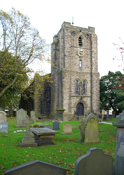
St John the Evangelist's Church, Worsthorne

St John the Evangelist's Church is in Church Square in the village of Worsthorne, Lancashire, England. It is an active Anglican parish church in the deanery...

Worsthorne

Worsthorne is a rural village on the eastern outskirts of Burnley in Lancashire, England. It is in the civil parish of Worsthorne-with-Hurstwood and the...

Cliviger

Cliviger is a civil parish in the Borough of Burnley, in Lancashire, England. It is situated to the southeast of Burnley, and northwest of Todmorden....

Unity College, Burnley

Unity College is a mixed 11-16 comprehensive school in Burnley, Lancashire, England. == History == === Former school === Towneley High School originally...

Church of St John the Divine, Holme Chapel

The Church of St John the Divine is in Burnley Road, Holme Chapel, a village in the civil parish of Cliviger, near Burnley, Lancashire, England. It is...

Nearby Amenities

Located within 500m of 53.780939,-2.1706888
Power: tower
Lat/Long: 53.7841398/-2.1691115
Power: tower
Lat/Long: 53.7805472/-2.1679058
Power: tower
Lat/Long: 53.7783526/-2.1691266
The data included in this document is from www.openstreetmap.org. The data is made available under ODbL.

Have you been to Hurstwood Reservoir?

Leave your review of Hurstwood Reservoir below (or comments, questions and feedback).