Island Pool

Lake, Pool, Pond, Freshwater Marsh in Worcestershire Malvern Hills

England

Island Pool

Footpath to the River Severn between the houses at Ryall
Footpath to the River Severn between the houses at Ryall Credit: Sarah Charlesworth

The requested URL returned error: 429 Too Many Requests

If you have any feedback on the listing, please let us know in the comments section below.

Island Pool Images

Images are sourced within 2km of 52.077675/-2.1946761 or Grid Reference SO8642. Thanks to Geograph Open Source API. All images are credited.

Footpath to the River Severn between the houses at Ryall
A4104 at Ryall
A4104 at Ryall
Looking down the Severn at Upton
Boats in the Marina
Boats in the Marina
Footpath to Ryall
Footpath to Ryall
Threatening clouds north of Upton
Oilseed rape and cow parsley The footpath passing along the edge of this field is currently a little overgrown with oilseed rape and wild cow parsley.
Oilseed rape and cow parsley
The footpath passing along the edge of this field is currently a little overgrown with oilseed rape and wild cow parsley.
Houses on Quay Lane Houses on Quay Lane, Earl's Croome.
Houses on Quay Lane
Houses on Quay Lane, Earl's Croome.
Earls Grange, Earl's Croome These four houses in Earls Grange were built in 1997 on land which used to be the play area of the former village school in Earl's Croome.
Earls Grange, Earl's Croome
These four houses in Earls Grange were built in 1997 on land which used to be the play area of the former village school in Earl's Croome.
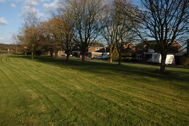
Play area, Earl's Croome Formerly part of school play area this land was set-aside as a play area after to the school was closed and redeveloped.
Play area, Earl's Croome
Formerly part of school play area this land was set-aside as a play area after to the school was closed and redeveloped.
Hawthorn blossom Hawthorn blossom in Earl's Croome.
Hawthorn blossom
Hawthorn blossom in Earl's Croome.
Hawthorn blossom This Hawthorn tree Earl's Croome is heavy in blossom.
Hawthorn blossom
This Hawthorn tree Earl's Croome is heavy in blossom.
Apple tree in blossom Apple tree in blossom in Earl's Croome.
Apple tree in blossom
Apple tree in blossom in Earl's Croome.
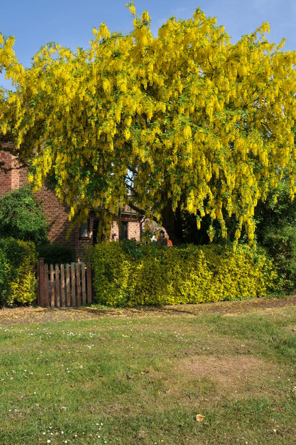
Laburnum in flower Laburnum in flower in Orchard Close, Earl's Croome.
Laburnum in flower
Laburnum in flower in Orchard Close, Earl's Croome.
Orchard Close, Earl's Croome
Silver birch trees Silver birch trees in Earl's Croome.
Silver birch trees
Silver birch trees in Earl's Croome.
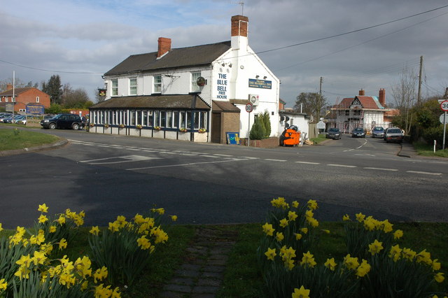
Road junction in Earl's Croome Road junction of Quay Lane and the road to Dunstall in Earl's Croome.
Road junction in Earl's Croome
Road junction of Quay Lane and the road to Dunstall in Earl's Croome.
Blank road sign, Earl's Croome Each Spring during the breeding season a sign warning of frogs and toads in the road appears here for a couple of months.  See: <a href="https://www.geograph.org.uk/photo/2310285">SO8742 : Toad in the road</a>
Blank road sign, Earl's Croome
Each Spring during the breeding season a sign warning of frogs and toads in the road appears here for a couple of months. See: SO8742 : Toad in the road
Show me another place!

Island Pool is located at Grid Ref: SO8642 (Lat: 52.077675, Lng: -2.1946761)

Administrative County: Worcestershire

District: Malvern Hills

Police Authority: West Mercia

What 3 Words

///cloak.soon.messaging. Near Upton upon Severn, Worcestershire

Related Wikis

Earls Croome

Earl's Croome is a village and civil parish in the Malvern Hills District in the county of Worcestershire, England. It had a population of 243 in 2021...

Baughton

Baughton is a hamlet in Worcestershire, England. The Population of Baughton is 193. The population as a whole is older than the national average and the...

Ryall, Worcestershire

Ryall is a village in the south of Worcestershire, England, on the east bank of the River Severn, near Upton-upon-Severn on the opposite bank. The village...

Dunstall Common

Dunstall Common is a village in Worcestershire, England.

Nearby Amenities

Located within 500m of 52.077675,-2.1946761
Earl's Croome
Place: village
Wikidata: Q5326536
Lat/Long: 52.0780738/-2.1924365
Bus Stop
Earls Croome
Bus: yes
Naptan AtcoCode: 2000G060000
Naptan Bearing: N
Naptan BusStopType: CUS
Naptan CommonName: Earls Croome
Naptan Crossing: Quay Lane
Naptan Indicator: adj
Naptan NaptanCode: wocdgmdt
Naptan Street: Church Lane
Naptan Verified: no
Public Transport: platform
Shelter: no
Source: naptan_import
Lat/Long: 52.0783466/-2.1909655
Bus Stop
Yorkshire Grey
Bus: yes
Naptan AtcoCode: 2000G060001
Naptan Bearing: N
Naptan CommonName: Yorkshire Grey
Naptan Indicator: Adj
Naptan Landmark: Yorkshire Grey Inn
Naptan NaptanCode: wocdgmdw
Naptan Street: Worcester Road
Naptan Verified: no
Public Transport: platform
Source: naptan_import
Lat/Long: 52.0776878/-2.2008448
Bus Stop
Yorkshire Grey
Bus: yes
Naptan AtcoCode: 2000G500688
Naptan Bearing: S
Naptan CommonName: Yorkshire Grey
Naptan Indicator: opp
Naptan Landmark: Yokshire Grey Inn
Naptan NaptanCode: wocdpgwm
Naptan Street: A38
Naptan Verified: no
Public Transport: platform
Source: naptan_import
Lat/Long: 52.076365/-2.1999145
Bus Stop
Earls Croome
Bus: yes
Naptan AtcoCode: 2000G760000
Naptan Bearing: S
Naptan BusStopType: CUS
Naptan CommonName: Earls Croome
Naptan Crossing: Quay Lane
Naptan Indicator: opp
Naptan NaptanCode: wocgpatg
Naptan Street: Church Lane
Naptan Verified: no
Public Transport: platform
Source: naptan_import
Lat/Long: 52.0782212/-2.1906732
Post Box
Post Box Type: lamp
Ref: WR8 166
Lat/Long: 52.0781947/-2.2013127
Turning Circle
Lat/Long: 52.0780719/-2.1929955
Post Box
Post Box Type: wall
Ref: WR8 207
Lat/Long: 52.0771512/-2.1911932
Telephone
Defibrillator
Booth: K6
Colour: red
Defibrillator Location: inside red telephone box, Church Lane, Earls Croome
Emergency: defibrillator
Man Made: telephone_box
Lat/Long: 52.0771656/-2.1911919
Barrier: stile
Foot: yes
Lat/Long: 52.0762348/-2.2013675
Barrier: stile
Foot: yes
Lat/Long: 52.076732/-2.1998606
Barrier: stile
Foot: yes
Lat/Long: 52.078754/-2.201757
Barrier: stile
Foot: yes
Lat/Long: 52.0783319/-2.1959116
Barrier: stile
Foot: yes
Lat/Long: 52.0772221/-2.1912007
Power: pole
Lat/Long: 52.078901/-2.1917054
Earl's Croome
Power: pole
Transformer: distribution
Voltage Primary: 11000
Lat/Long: 52.0785763/-2.1916813
Power: pole
Lat/Long: 52.0797417/-2.1918342
Power: pole
Lat/Long: 52.080617/-2.1919468
Power: pole
Lat/Long: 52.0808791/-2.1919844
Power: pole
Lat/Long: 52.0814346/-2.1920621
Power: pole
Lat/Long: 52.0810654/-2.1933335
Power: pole
Lat/Long: 52.0807884/-2.1946853
Power: pole
Lat/Long: 52.0805099/-2.1960613
Power: pole
Lat/Long: 52.0802544/-2.1973193
Power: pole
Lat/Long: 52.0794969/-2.2009993
Power: pole
Lat/Long: 52.0797879/-2.1995696
Power: pole
Lat/Long: 52.0800022/-2.1985692
Power: pole
Lat/Long: 52.0806467/-2.1996796
Power: pole
Lat/Long: 52.0756807/-2.200617
Power: pole
Lat/Long: 52.0760484/-2.2005956
Power: pole
Lat/Long: 52.0764028/-2.2005969
Coach House
Power: pole
Transformer: distribution
Voltage Primary: 11000
Lat/Long: 52.0767218/-2.2010757
Power: pole
Lat/Long: 52.0771932/-2.2018871
Power: pole
Lat/Long: 52.0803343/-2.1902007
Power: pole
Lat/Long: 52.0800046/-2.1885645
Power: pole
Lat/Long: 52.0795876/-2.1881448
The data included in this document is from www.openstreetmap.org. The data is made available under ODbL.

Have you been to Island Pool?

Leave your review of Island Pool below (or comments, questions and feedback).