Bath Pool

Lake, Pool, Pond, Freshwater Marsh in Staffordshire Newcastle-under-Lyme

England

Bath Pool

Trent and Mersey Canal (Hall Green Branch) near Hardings Wood Looking south-east towards Hardings Wood Junction.
This canal is often considered now to be part of the Macclesfield Canal. The moorings on the right are private long-term positions.
Trent and Mersey Canal (Hall Green Branch) near Hardings Wood Credit: Roger Kidd

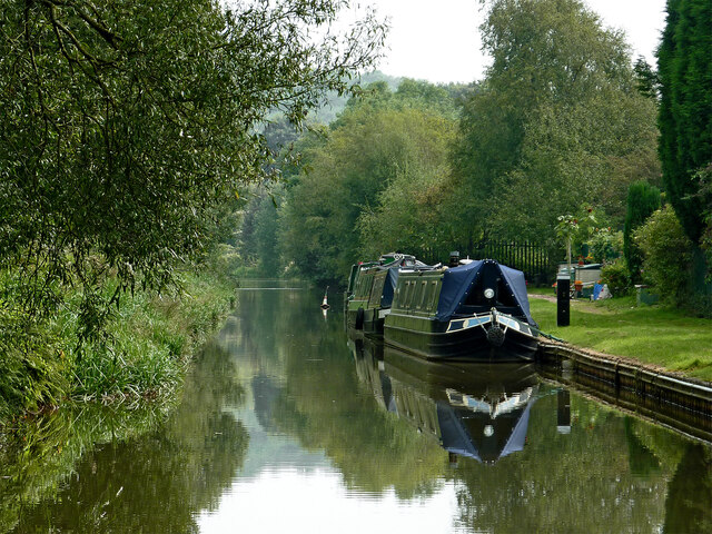
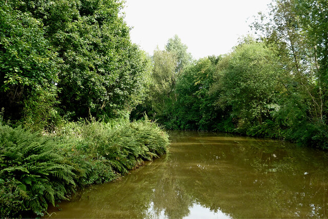
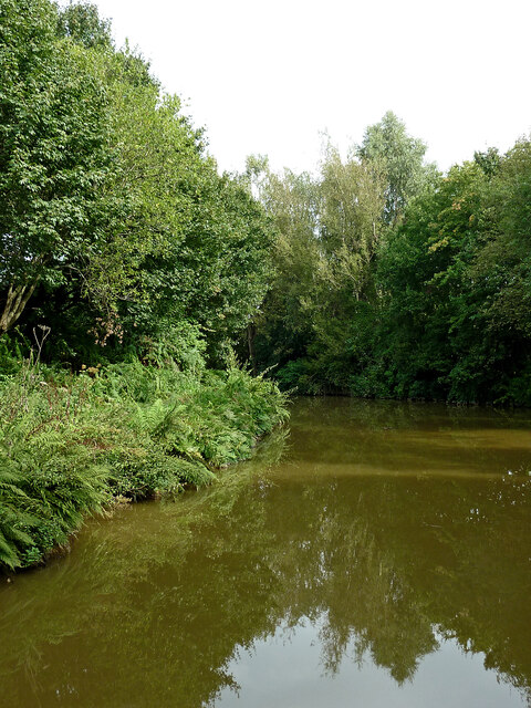
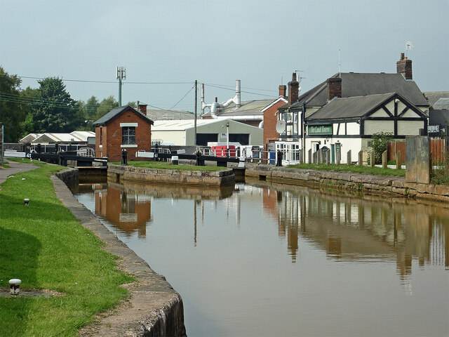
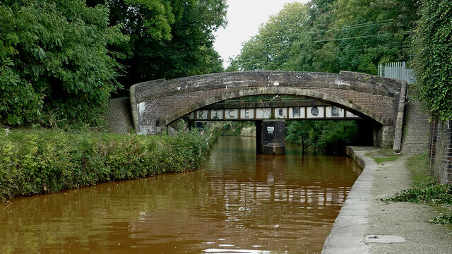
Bath Pool, located in Staffordshire, England, is a picturesque freshwater body known for its natural beauty and diverse ecosystem. Spanning an area of approximately 20 acres, the pool is nestled within a tranquil landscape, surrounded by lush greenery and rolling hills.

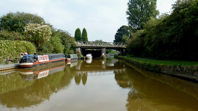
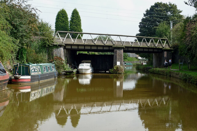
The pool itself is characterized by its calm, clear waters, which are fed by natural springs. It serves as a haven for various aquatic species, including fish, water birds, and amphibians. The diverse range of plant life, such as water lilies and reeds, adds to the pool's aesthetic appeal and provides important habitat and food sources for the resident wildlife.

A popular destination for nature enthusiasts and birdwatchers, Bath Pool offers a unique opportunity to observe a wide variety of bird species in their natural habitat. Visitors can often spot ducks, swans, herons, and kingfishers, among others, either gliding gracefully across the water or nesting in the surrounding trees.

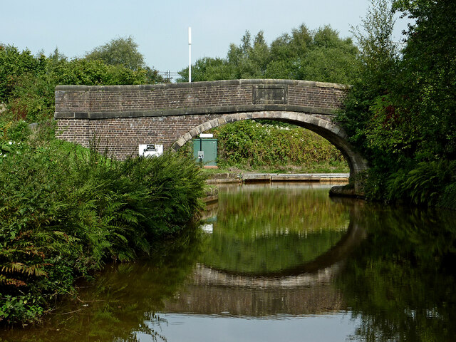
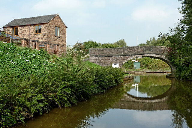
The pool's surrounding area features well-maintained footpaths, allowing visitors to explore the natural beauty of the site at their own pace. Additionally, there are designated picnic areas, providing the perfect spot for a relaxing outdoor meal while enjoying the peaceful ambiance of Bath Pool.

Bath Pool, with its idyllic setting and rich biodiversity, offers a serene environment for individuals seeking a tranquil escape from the hustle and bustle of daily life. Whether it is for leisurely walks, birdwatching, or simply soaking in the natural beauty, this freshwater pool is a hidden gem within Staffordshire's landscape.

If you have any feedback on the listing, please let us know in the comments section below.
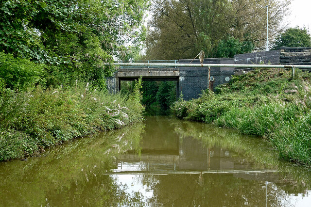
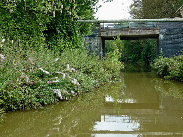
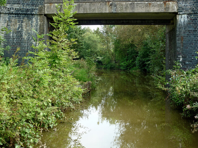
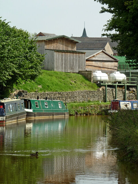
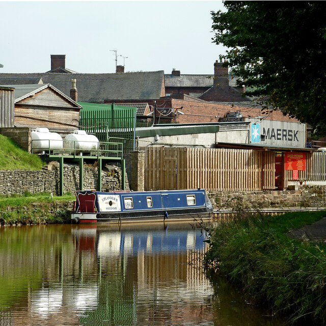
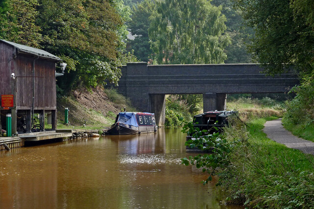
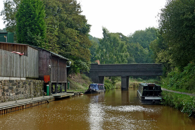
Bath Pool Images

Images are sourced within 2km of 53.074152/-2.2438349 or Grid Reference SJ8353. Thanks to Geograph Open Source API. All images are credited.

Trent and Mersey Canal (Hall Green Branch) near Hardings Wood Looking south-east towards Hardings Wood Junction.
This canal is often considered now to be part of the Macclesfield Canal. The moorings on the right are private long-term positions.
Trent and Mersey Canal (Hall Green Branch) near Hardings Wood
Looking south-east towards Hardings Wood Junction. This canal is often considered now to be part of the Macclesfield Canal. The moorings on the right are private long-term positions.
Canal near Hardings Wood in Staffordshire Looking east-south-east towards Hardings Wood Junction, this is the Trent and Mersey Canal (Hall Green Branch). It is often now considered to be part of the Macclesfield Canal. Ahead is Kidsgrove Bridge, No 97 (Macclesfield Canal numbering), carrying Hardingswood Road.
Canal near Hardings Wood in Staffordshire
Looking east-south-east towards Hardings Wood Junction, this is the Trent and Mersey Canal (Hall Green Branch). It is often now considered to be part of the Macclesfield Canal. Ahead is Kidsgrove Bridge, No 97 (Macclesfield Canal numbering), carrying Hardingswood Road.
Trent and Mersey Canal (Hall Green Branch) near Hardings Wood Looking east-south-east towards Hardings Wood Junction, this is the Trent and Mersey Canal (Hall Green Branch). It is often now considered to be part of the Macclesfield Canal. Ahead is Kidsgrove Bridge, No 97 (Macclesfield Canal numbering), carrying Hardingswood Road.
Trent and Mersey Canal (Hall Green Branch) near Hardings Wood
Looking east-south-east towards Hardings Wood Junction, this is the Trent and Mersey Canal (Hall Green Branch). It is often now considered to be part of the Macclesfield Canal. Ahead is Kidsgrove Bridge, No 97 (Macclesfield Canal numbering), carrying Hardingswood Road.
Canal at Kidsgrove Bridge near Hardings Wood, Staffordshire Looking east-south-east towards Hardings Wood Junction, this is the Trent and Mersey Canal (Hall Green Branch). It is often now considered to be part of the Macclesfield Canal. Kidsgrove Bridge is No 97 (Macclesfield Canal numbering), carrying Hardingswood Road.
Canal at Kidsgrove Bridge near Hardings Wood, Staffordshire
Looking east-south-east towards Hardings Wood Junction, this is the Trent and Mersey Canal (Hall Green Branch). It is often now considered to be part of the Macclesfield Canal. Kidsgrove Bridge is No 97 (Macclesfield Canal numbering), carrying Hardingswood Road.
Trent and Mersey Canal (Hall Green Branch) near Hardings Wood Looking east towards Hardings Wood Junction from near Kidsgrove Bridge  (No 97), this is the Trent and Mersey Canal (Hall Green Branch). It is often now considered to be part of the Macclesfield Canal. The junction with the main line is just out of sight round the bend.
Trent and Mersey Canal (Hall Green Branch) near Hardings Wood
Looking east towards Hardings Wood Junction from near Kidsgrove Bridge (No 97), this is the Trent and Mersey Canal (Hall Green Branch). It is often now considered to be part of the Macclesfield Canal. The junction with the main line is just out of sight round the bend.
Trent and Mersey Canal (Hall Green Branch) near Hardings Wood Looking north-east towards Hardings Wood Junction from near Kidsgrove Bridge  (No 97), this is the Trent and Mersey Canal (Hall Green Branch). It is often now considered to be part of the Macclesfield Canal. The junction with the main line is just out of sight round the bend.
Trent and Mersey Canal (Hall Green Branch) near Hardings Wood
Looking north-east towards Hardings Wood Junction from near Kidsgrove Bridge (No 97), this is the Trent and Mersey Canal (Hall Green Branch). It is often now considered to be part of the Macclesfield Canal. The junction with the main line is just out of sight round the bend.
Hardings Wood Junction near Kidsgrove in Staffordshire This is where the Trent and Mersey Canal (Hall Green Branch) joins the Trent and Mersey Canal main line below Lock No 42. The Hall Green Branch is usually considered to be a part of the Macclesfield Canal now. Consequently the towpath bridge is No 98, using the Macclesfield Canal numbering sequence.
Hardings Wood Junction near Kidsgrove in Staffordshire
This is where the Trent and Mersey Canal (Hall Green Branch) joins the Trent and Mersey Canal main line below Lock No 42. The Hall Green Branch is usually considered to be a part of the Macclesfield Canal now. Consequently the towpath bridge is No 98, using the Macclesfield Canal numbering sequence.
Trent and Mersey Canal near Hardings Wood, Staffordshire This is the view by Hardings Wood Junction, looking towards paired locks No 41, top of the Red Bull flight of six.
Trent and Mersey Canal near Hardings Wood, Staffordshire
This is the view by Hardings Wood Junction, looking towards paired locks No 41, top of the Red Bull flight of six.
Trent and Mersey Canal west of Kidsgrove, Staffordshire Looking east-south-east from Hardings Wood Junction, towards Kidsgrove and Stoke-on-Trent. The bridge carries the railway between Stoke-on-Trent and Manchester.
Trent and Mersey Canal west of Kidsgrove, Staffordshire
Looking east-south-east from Hardings Wood Junction, towards Kidsgrove and Stoke-on-Trent. The bridge carries the railway between Stoke-on-Trent and Manchester.
Canal at Hardings Wood Junction in Staffordshire Looking west-north-west at the Trent and Mersey Canal junction with its Hall Green Branch (leading to the Macclesfield Canal). Ahead are the paired locks No 41, top of the Red Bull flight of six.
Canal at Hardings Wood Junction in Staffordshire
Looking west-north-west at the Trent and Mersey Canal junction with its Hall Green Branch (leading to the Macclesfield Canal). Ahead are the paired locks No 41, top of the Red Bull flight of six.
Canal near Hardings Wood Junction in Staffordshire Looking east-south-east from Hardings Wood Junction, towards Kidsgrove and Stoke-on-Trent. The bridge carries the railway between Stoke-on-Trent and Manchester.
Canal near Hardings Wood Junction in Staffordshire
Looking east-south-east from Hardings Wood Junction, towards Kidsgrove and Stoke-on-Trent. The bridge carries the railway between Stoke-on-Trent and Manchester.
Moored narrowboat near Hardings Wood Junction This is by the Trent and Mersey Canal near Hardings Wood Junction.
The 43ft (13·1 metres) cruiser dates from 1994, partly fitted out by David Piper near Red Bull. I haven't found out where Rigby's Basin is yet, but Brian Curry was also local.

<a href="https://www.geograph.org.uk/photo/6926154">SJ8354 : Trent and Mersey Canal west of Kidsgrove, Staffordshire</a>
Moored narrowboat near Hardings Wood Junction
This is by the Trent and Mersey Canal near Hardings Wood Junction. The 43ft (13·1 metres) cruiser dates from 1994, partly fitted out by David Piper near Red Bull. I haven't found out where Rigby's Basin is yet, but Brian Curry was also local. SJ8354 : Trent and Mersey Canal west of Kidsgrove, Staffordshire
Canal near Kidsgrove in Staffordshire The Trent and Mersey Canal is seen here north of Kidsgrove railway station.
Canal near Kidsgrove in Staffordshire
The Trent and Mersey Canal is seen here north of Kidsgrove railway station.
Canal near Kidsgrove in Staffordshire The Trent and Mersey Canal is seen here north of Kidsgrove railway station. The small industry and housing are by Liverpool Road.
Canal near Kidsgrove in Staffordshire
The Trent and Mersey Canal is seen here north of Kidsgrove railway station. The small industry and housing are by Liverpool Road.
Trent and Mersey Canal near Kidsgrove, Staffordshire Looking south-south-east towards Harecastle Tunnel and Stoke-on-Trent. Ahead is Bridge No 132 which allows access to Kidsgrove Station (formerly Harecastle Station).
The rusty colour of the water is mainly caused by iron ore leaching into the water in the nearby original 1777 Harecastle Tunnel, and drifting northwards.
Trent and Mersey Canal near Kidsgrove, Staffordshire
Looking south-south-east towards Harecastle Tunnel and Stoke-on-Trent. Ahead is Bridge No 132 which allows access to Kidsgrove Station (formerly Harecastle Station). The rusty colour of the water is mainly caused by iron ore leaching into the water in the nearby original 1777 Harecastle Tunnel, and drifting northwards.
Trent and Mersey Canal near Kidsgrove, Staffordshire Looking south-south-east towards Harecastle Tunnel and Stoke-on-Trent. Ahead is Meadows Road Bridge (No 132) which allows access to Kidsgrove Station (formerly Harecastle Station) off to the right.

The rusty colour of the water is mainly caused by iron ore leaching into the water in the nearby original 1777 Harecastle Tunnel, and drifting northwards.
Trent and Mersey Canal near Kidsgrove, Staffordshire
Looking south-south-east towards Harecastle Tunnel and Stoke-on-Trent. Ahead is Meadows Road Bridge (No 132) which allows access to Kidsgrove Station (formerly Harecastle Station) off to the right. The rusty colour of the water is mainly caused by iron ore leaching into the water in the nearby original 1777 Harecastle Tunnel, and drifting northwards.
Canal north of Harecastle Tunnel near Kidsgrove Harecastle Bridge is No 131 across the Trent and Mersey Canal, and is a turnover bridge allowing horses to cross sides without being unhitched from their boats. Close by is the railway bridge carrying lines between Stoke-on-Trent and Manchester (or Crewe). The tunnel north portal is about fifty metres away behind the camera.

The rusty colour of the water is mainly caused by iron ore leaching into the water in the nearby original 1777 Harecastle Tunnel, and drifting northwards.
Canal north of Harecastle Tunnel near Kidsgrove
Harecastle Bridge is No 131 across the Trent and Mersey Canal, and is a turnover bridge allowing horses to cross sides without being unhitched from their boats. Close by is the railway bridge carrying lines between Stoke-on-Trent and Manchester (or Crewe). The tunnel north portal is about fifty metres away behind the camera. The rusty colour of the water is mainly caused by iron ore leaching into the water in the nearby original 1777 Harecastle Tunnel, and drifting northwards.
Show me another place!

Bath Pool is located at Grid Ref: SJ8353 (Lat: 53.074152, Lng: -2.2438349)

Administrative County: Staffordshire

District: Newcastle-under-Lyme

Police Authority: Staffordshire

What 3 Words

///rush.candle.cute. Near Kidsgrove, Staffordshire

Related Wikis

Bathpool Park

Bathpool Park is a public park in a rural area between Newcastle-under-Lyme and Kidsgrove, Staffordshire (near the border with Cheshire). The park became...

Harecastle Tunnel

Harecastle Tunnel is a canal tunnel on the Trent and Mersey Canal in Staffordshire between Kidsgrove and Tunstall. The tunnel, which is 1.6 mi (2.6 km...

Ravenscliffe (ward)

Ravenscliffe is an area of Kidsgrove, Staffordshire, England, lying south of the town centre and west of Sandyford.The name Ravenscliffe was used for a...

Kidsgrove Athletic F.C.

Kidsgrove Athletic F.C. is an English football club based in Kidsgrove, Staffordshire, England currently playing in the Northern Premier League Division...

Harecastle railway tunnel

The Harecastle railway tunnels are three consecutive tunnels on the North Staffordshire Railway at Kidsgrove, Staffordshire, England. Opened to traffic...

The King's Church of England Academy

The King's Church of England Academy (formerly Clough Hall Technology School and then The King's Church of England School) is a mixed secondary school...

Talke Pits

Talke Pits is a former mining village in the Borough of Newcastle-under-Lyme, Staffordshire, England, close to the Cheshire border and the village of Talke...

Talke

Talke is a village in the civil parish of Kidsgrove, in the Newcastle-under-Lyme district, in Staffordshire, England. It is 4 miles (6.4 km) northwest...

Nearby Amenities

Located within 500m of 53.074152,-2.2438349
Parking
Lat/Long: 53.0769927/-2.2457651
Bench
Lat/Long: 53.0715902/-2.2435824
Bench
Lat/Long: 53.0700196/-2.2433121
Leisure: picnic_table
Lat/Long: 53.0721298/-2.2437853
Bench
Lat/Long: 53.0723001/-2.2449838
Power: pole
Lat/Long: 53.071652/-2.2464272
Power: pole
Lat/Long: 53.0716304/-2.2475415
Power: pole
Lat/Long: 53.07237/-2.2399632
Power: pole
Lat/Long: 53.07367/-2.2371043
Power: pole
Lat/Long: 53.0727832/-2.2380251
Power: pole
Lat/Long: 53.0719639/-2.2423852
Power: pole
Lat/Long: 53.071303/-2.2484654
Power: pole
Lat/Long: 53.0717371/-2.2438647
Power: pole
Lat/Long: 53.0719865/-2.2417987
Power: pole
Lat/Long: 53.0721534/-2.241
Power: pole
Lat/Long: 53.0727789/-2.2414387
Power: pole
Lat/Long: 53.0718426/-2.241267
Power: pole
Lat/Long: 53.0717737/-2.2427312
Power: pole
Lat/Long: 53.0721262/-2.2478411
Power: pole
Lat/Long: 53.0718103/-2.2469211
Power: pole
Lat/Long: 53.0729013/-2.2500271
Power: pole
Lat/Long: 53.0723777/-2.2485626
Power: pole
Lat/Long: 53.0728079/-2.2501102
Power: pole
Lat/Long: 53.0716697/-2.2377259
Power: pole
Lat/Long: 53.0717831/-2.2384924
Power: pole
Lat/Long: 53.0719004/-2.2397527
The data included in this document is from www.openstreetmap.org. The data is made available under ODbL.

Have you been to Bath Pool?

Leave your review of Bath Pool below (or comments, questions and feedback).