Ashworth Moor Reservoir
Lake, Pool, Pond, Freshwater Marsh in Lancashire
England
Ashworth Moor Reservoir

Ashworth Moor Reservoir is a picturesque freshwater lake located in the county of Lancashire, England. Nestled amidst the scenic beauty of the Ashworth Valley, this reservoir is a popular spot for locals and visitors alike.
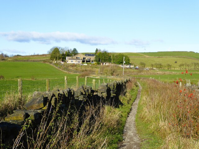
Covering an area of approximately 60 acres, Ashworth Moor Reservoir is a man-made water body that was constructed in the late 19th century to provide a reliable water source for the nearby town of Rochdale. It is surrounded by rolling hills and lush greenery, creating a serene and tranquil atmosphere.
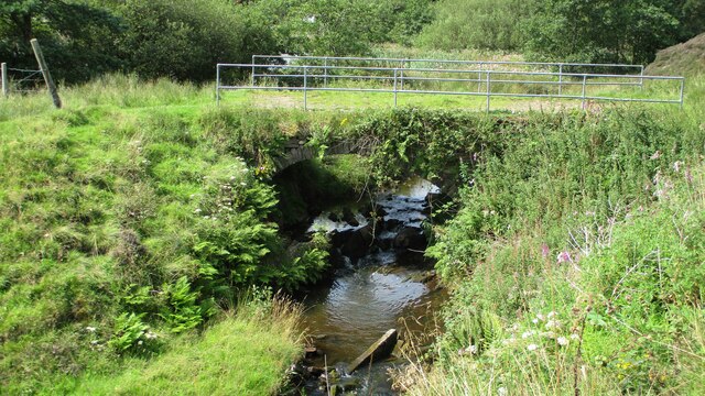
The reservoir is fed by several small streams that flow from the surrounding moorland, ensuring a constant supply of freshwater. The water is clear and pristine, making it ideal for various recreational activities such as fishing, boating, and wildlife observation.
The reservoir is home to a diverse array of wildlife, both above and below the water's surface. Anglers can try their luck at catching brown trout, perch, pike, and roach, which are abundant in these waters. Birdwatchers can spot a variety of avian species, including herons, swans, and ducks, while walking along the reservoir's edge.
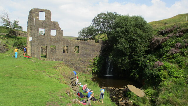
Ashworth Moor Reservoir is also a haven for nature enthusiasts, with its surrounding marshland providing a habitat for numerous plant species and insects. The area is well-maintained, with designated walking trails and picnic spots that allow visitors to immerse themselves in the natural beauty of the surroundings.
Overall, Ashworth Moor Reservoir is a delightful destination for those seeking a peaceful and scenic retreat. Whether it's fishing, boating, birdwatching, or simply enjoying a leisurely stroll, this reservoir offers something for everyone to enjoy in the heart of Lancashire's countryside.
If you have any feedback on the listing, please let us know in the comments section below.
Ashworth Moor Reservoir Images
Images are sourced within 2km of 53.637463/-2.260021 or Grid Reference SD8215. Thanks to Geograph Open Source API. All images are credited.


Ashworth Moor Reservoir is located at Grid Ref: SD8215 (Lat: 53.637463, Lng: -2.260021)
Unitary Authority: Rochdale
Police Authority: Greater Manchester
What 3 Words
///mystified.softly.blazers. Near Ramsbottom, Manchester
Nearby Locations
Related Wikis

Ashworth Moor Reservoir
Ashworth Moor Reservoir is an upland water supply reservoir amongst the Pennines in Greater Manchester, England close to the A680 road between Rochdale...

Cheesden Valley
The Cheesden Valley is a valley in the Heywood area of Greater Manchester, England. It runs on a north–south alignment between Bury and Rochdale in the...

Birtle, Greater Manchester
Birtle is a hamlet within the Metropolitan Borough of Rochdale, in Greater Manchester, England. It lies in the Cheesden Valley, set amongst the Pennines...

Scout Moor Wind Farm
Scout Moor Wind Farm is the second largest onshore wind farm in England. The wind farm, which was built for Peel Wind Power Ltd, produces electricity from...

Greenbooth Reservoir
Greenbooth Reservoir is a reservoir to the north of Heywood and close to Norden in the Metropolitan Borough of Rochdale, within Greater Manchester, England...

Shuttleworth, Greater Manchester
Shuttleworth is a hamlet at the northeastern extremity of the Metropolitan Borough of Bury, in Greater Manchester, England. It lies amongst the South Pennines...

Turn Village
Turn Village is a hamlet in the Rossendale borough of Lancashire, England. It is located in the South Pennines, on the A680 road between Edenfield and...

Norden, Greater Manchester
Norden is a village in the Metropolitan Borough of Rochdale, in Greater Manchester, England. Historically part of Lancashire. The village is situated on...
Nearby Amenities
Located within 500m of 53.637463,-2.260021Have you been to Ashworth Moor Reservoir?
Leave your review of Ashworth Moor Reservoir below (or comments, questions and feedback).