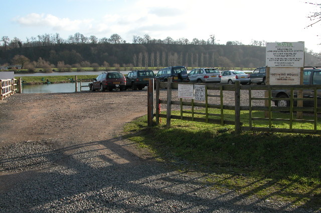
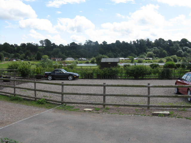
Hillditch Pool

Lake, Pool, Pond, Freshwater Marsh in Worcestershire Wychavon

England

Hillditch Pool

Stourport Road, Titton Junction with Lincombe Lane and Chadwick Lane.
Stourport Road, Titton Credit: David Dixon

Hillditch Pool is a picturesque freshwater marsh located in the county of Worcestershire, England. Nestled amidst a tranquil natural setting, it is a popular destination for nature enthusiasts and those seeking a peaceful retreat.

Covering an area of approximately 5 acres, Hillditch Pool is characterized by its crystal-clear waters and abundant aquatic vegetation. The pool is fed by a small freshwater spring, ensuring a constant flow of clean, unpolluted water. This pristine environment supports a diverse ecosystem, with a wide variety of flora and fauna thriving within its boundaries.

The pool is surrounded by lush greenery and dense woodland, creating a sense of seclusion and tranquility. The diverse vegetation includes water lilies, reeds, and rushes, providing a haven for numerous bird species and other wildlife. Birdwatchers can spot a range of avian residents, including herons, kingfishers, and various waterfowl.

Hillditch Pool also offers recreational opportunities for visitors. Fishing enthusiasts can cast their lines into the pool in search of carp, tench, and perch, among other freshwater species. The calm waters and serene atmosphere make it an ideal spot for angling.

Visitors to Hillditch Pool can enjoy the surrounding natural beauty by taking leisurely walks along the designated paths that wind through the marshland. These paths offer breathtaking views of the pool, as well as opportunities to observe the diverse plant and animal life up close.

Overall, Hillditch Pool in Worcestershire is a hidden gem, providing a peaceful and enchanting oasis for nature lovers and outdoor enthusiasts alike.

If you have any feedback on the listing, please let us know in the comments section below.

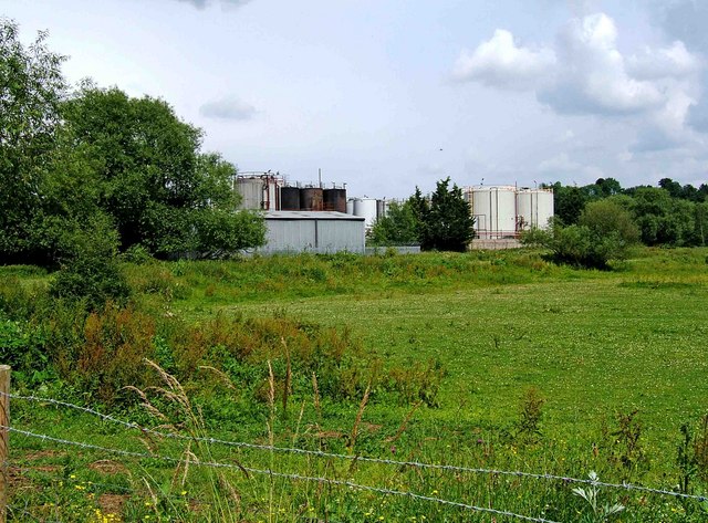
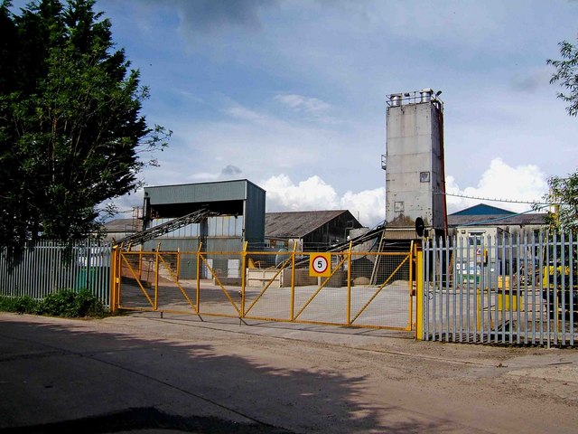
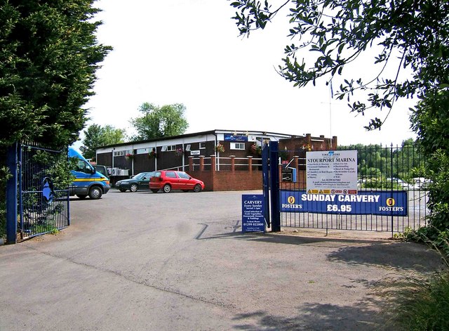
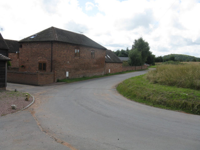
Hillditch Pool Images

Images are sourced within 2km of 52.333378/-2.252504 or Grid Reference SO8270. Thanks to Geograph Open Source API. All images are credited.

Stourport Road, Titton Junction with Lincombe Lane and Chadwick Lane.
Stourport Road, Titton
Junction with Lincombe Lane and Chadwick Lane.
Stourport Road, Chadwick Bank Passing Bell's Farm Shop.
Stourport Road, Chadwick Bank
Passing Bell's Farm Shop.
Fishing lake at Larford Farm Popular fishing lake to the south of Stourport-on-Severn.
Fishing lake at Larford Farm
Popular fishing lake to the south of Stourport-on-Severn.
Orchard on Lincomb Lane, Lincomb
Parsons Lane and Crown Lane crossroads, near Crossway Green
Waresley Farm Shop, Waresley This farm shop is situated by a round-about on the A449 between Worcester and Kidderminster.
Waresley Farm Shop, Waresley
This farm shop is situated by a round-about on the A449 between Worcester and Kidderminster.
Steam ladder dredger John Bradley, Lincomb Lock, Stourport Now sadly retired and without her plant. She was in full cry when this photo was taken and we were just waiting for a boat ride across to her.
Steam ladder dredger John Bradley, Lincomb Lock, Stourport
Now sadly retired and without her plant. She was in full cry when this photo was taken and we were just waiting for a boat ride across to her.
Entrance to Stourport Marina, Nelson Road, Stourport-on-Severn This is one of the entrances to the large Stourport Marina. The Marina is adjacent to and connected to the River Severn.
Entrance to Stourport Marina, Nelson Road, Stourport-on-Severn
This is one of the entrances to the large Stourport Marina. The Marina is adjacent to and connected to the River Severn.
Nelson Road, Stourport-on-Severn This is part of Nelson Road. On the left, behind the metal railings, is Stourport Marina. <a href="https://www.geograph.org.uk/photo/1373705">SO8169 : Entrance to Stourport Marina, Nelson Road, Stourport-on-Severn</a>. Apart from giving access to the marina, Nelson Road serves as one of the main roads through a dreary industrial estate, near the River Severn, and tucked well away from the main part of the town. There is little point in coming down here unless you have specific business with one of the firms based on the estate.
Nelson Road, Stourport-on-Severn
This is part of Nelson Road. On the left, behind the metal railings, is Stourport Marina. SO8169 : Entrance to Stourport Marina, Nelson Road, Stourport-on-Severn. Apart from giving access to the marina, Nelson Road serves as one of the main roads through a dreary industrial estate, near the River Severn, and tucked well away from the main part of the town. There is little point in coming down here unless you have specific business with one of the firms based on the estate.
Start of private road to Lincomb Lock on the River Severn At the end of Nelson Road, on the Sandy Lane Industrial Estate, this private road commences and gives authorised vehicles access to Lincomb Lock. The lock is the highest on the River Severn; the official head of navigation being just upstream of Stourport Bridge.
Start of private road to Lincomb Lock on the River Severn
At the end of Nelson Road, on the Sandy Lane Industrial Estate, this private road commences and gives authorised vehicles access to Lincomb Lock. The lock is the highest on the River Severn; the official head of navigation being just upstream of Stourport Bridge.
Urban fringe seen from Nelson Road, Stourport-on-Severn The industrial structures are on the very edge of Sandy Lane Industrial Estate. Viewed from across the field adjacent to part of Nelson Road.
Urban fringe seen from Nelson Road, Stourport-on-Severn
The industrial structures are on the very edge of Sandy Lane Industrial Estate. Viewed from across the field adjacent to part of Nelson Road.
Industrial buildings in Nelson Road, Stourport-on-Severn These buildings are in Nelson Road, which is part of the Sandy Lane Industrial Estate. This is one of the parts of Stourport that tourists don't normally visit.
Industrial buildings in Nelson Road, Stourport-on-Severn
These buildings are in Nelson Road, which is part of the Sandy Lane Industrial Estate. This is one of the parts of Stourport that tourists don't normally visit.
Stourport Marina Clubhouse, Nelson Road, Stourport-on-Severn The Marina's Clubhouse and restaurant is open to visitors as well as members, and is licensed. The signs proclaim the lunchtime Sunday Carvery, but you would have to know this place exists, as "passing trade" would be virtually non-existent. These premises are right at the far end of the Sandy Lane Industrial Estate. Another entrance to the marina itself is at: <a href="https://www.geograph.org.uk/photo/1373705">SO8169 : Entrance to Stourport Marina, Nelson Road, Stourport-on-Severn</a>.
Stourport Marina Clubhouse, Nelson Road, Stourport-on-Severn
The Marina's Clubhouse and restaurant is open to visitors as well as members, and is licensed. The signs proclaim the lunchtime Sunday Carvery, but you would have to know this place exists, as "passing trade" would be virtually non-existent. These premises are right at the far end of the Sandy Lane Industrial Estate. Another entrance to the marina itself is at: SO8169 : Entrance to Stourport Marina, Nelson Road, Stourport-on-Severn.
Larford Farm
Larford Farm
Larford Farm - Holiday Park & Chalets
Footpath Near Larford Farm
On the Run Roadside cafe by the junction of the A449 and a minor road, south of Waresley
On the Run
Roadside cafe by the junction of the A449 and a minor road, south of Waresley
A4025 crossroads from Lincomb Lane Chadwick Lane is the continuation of route on the opposite side of the main road.
A4025 crossroads from Lincomb Lane
Chadwick Lane is the continuation of route on the opposite side of the main road.
Show me another place!

Hillditch Pool is located at Grid Ref: SO8270 (Lat: 52.333378, Lng: -2.252504)

Administrative County: Worcestershire

District: Wychavon

Police Authority: West Mercia

What 3 Words

///votes.grape.town. Near Hartlebury, Worcestershire

Related Wikis

Hartlebury Common

Hartlebury Common is an area of lowland heath in north Worcestershire, England, situated just outside the town of Stourport-on-Severn. Hartlebury Common...

Hartlebury Castle

Hartlebury Castle, a Grade I listed building, near Hartlebury in Worcestershire, central England, was built in the mid-13th century as a fortified manor...

Worcestershire County Museum

Worcestershire County Museum is a local museum located within Hartlebury Castle in Hartlebury, Worcestershire, England, near the City of Worcester. The...

Stourport power stations

Stourport power stations were two electricity generating stations that supplied electricity to Stourport-on-Severn, Worcestershire and to the wider West...

Hartlebury

Hartlebury is a village and civil parish in the Wychavon district of Worcestershire, England. It is 4 miles (6.4 km) south of Kidderminster. The village...

River Stour, Worcestershire

The Stour (, rhymes with "flour") is a river flowing through the counties of Worcestershire, the West Midlands and Staffordshire in the West Midlands region...

Church of All Saints, Wilden

All Saints Church in Wilden, Worcestershire about one mile to the north east of Stourport. It was designed by William Hopkins with funds provided by Alfred...

Stourport-on-Severn

Stourport-on-Severn, often shortened to Stourport, is a town and civil parish in the Wyre Forest District of North Worcestershire, England, a few miles...

Nearby Amenities

Located within 500m of 52.333378,-2.252504
Power: tower
Source: Bing
Lat/Long: 52.3324748/-2.2491401
Power: tower
Source: Bing
Lat/Long: 52.3311901/-2.2518034
Power: tower
Source: Bing
Lat/Long: 52.3293167/-2.2555628
Power: tower
Source: Bing
Lat/Long: 52.3305578/-2.2484738
Power: tower
Source: Bing
Lat/Long: 52.3349634/-2.2503659
Power: tower
Source: Bing
Lat/Long: 52.3306268/-2.2488798
Power: tower
Source: Bing
Lat/Long: 52.3313161/-2.2473615
Power: tower
Source: Bing
Lat/Long: 52.3305282/-2.2481672
Power: tower
Source: Bing
Lat/Long: 52.3356587/-2.2495353
Power: tower
Source: Bing
Lat/Long: 52.335795/-2.253345
Power: tower
Source: Bing
Lat/Long: 52.3347792/-2.2505461
Power: tower
Source: Bing
Lat/Long: 52.3324989/-2.2494323
Power: tower
Source: Bing
Lat/Long: 52.3313939/-2.2569801
Power: tower
Source: Bing
Lat/Long: 52.3367501/-2.2572215
Parking: surface
Lat/Long: 52.333698/-2.2552238
Waterway: weir
Lat/Long: 52.3327228/-2.2537243
Bench
Lat/Long: 52.3341286/-2.2556965
Turning Circle
Lat/Long: 52.334953/-2.2486281
Power: pole
Transformer: distribution
Voltage Primary: 11000
Lat/Long: 52.3331363/-2.2508079
Location Transition: yes
Power: pole
Lat/Long: 52.3326544/-2.2500595
Chilbrook
Power: pole
Transformer: distribution
Voltage Primary: 11000
Lat/Long: 52.3309621/-2.249794
Location Transition: yes
Power: pole
Lat/Long: 52.3315513/-2.2493729
Hillditch Coppice North
Power: pole
Transformer: distribution
Voltage Primary: 11000
Lat/Long: 52.3347843/-2.2478373
Power: pole
Lat/Long: 52.3338189/-2.2477622
Cheese Press Charlton
Power: pole
Transformer: distribution
Voltage Primary: 11000
Lat/Long: 52.3329519/-2.2476871
Location Transition: yes
Power: pole
Lat/Long: 52.3323397/-2.2484931
Location Transition: yes
Power: pole
Lat/Long: 52.3322586/-2.2484475
Power: pole
Lat/Long: 52.3314243/-2.2480345
Power: pole
Lat/Long: 52.3308244/-2.2470179
The data included in this document is from www.openstreetmap.org. The data is made available under ODbL.

Have you been to Hillditch Pool?

Leave your review of Hillditch Pool below (or comments, questions and feedback).