Brae Pot
Lake, Pool, Pond, Freshwater Marsh in Aberdeenshire
Scotland
Brae Pot

Brae Pot is a small freshwater lake located in Aberdeenshire, Scotland. Situated amidst picturesque surroundings, it is a popular destination for nature enthusiasts and anglers alike. The lake covers an area of approximately 4 acres and has a maximum depth of around 15 feet.
Surrounded by lush greenery and rolling hills, Brae Pot offers a tranquil and serene atmosphere. The lake is fed by several small streams and springs, ensuring a constant flow of freshwater. The water is crystal clear and supports a diverse ecosystem of aquatic plants and wildlife.
Anglers are drawn to Brae Pot for its abundant fish population, which includes species such as brown trout, rainbow trout, and perch. Fishing is permitted on a catch-and-release basis, allowing visitors to enjoy the sport while ensuring the sustainability of the fish population.
The lake is also a haven for birdwatchers, with a variety of waterfowl and wading birds frequenting its shores. Common sightings include mallards, tufted ducks, grey herons, and common sandpipers. The surrounding marshes provide an ideal habitat for these species, attracting them throughout the year.
For those looking to explore the area, there are several walking trails that offer breathtaking views of the lake and its surroundings. The nearby Brae Pot Nature Reserve provides further opportunities to observe wildlife and learn about the local ecosystem.
Overall, Brae Pot is a charming freshwater lake nestled in the heart of Aberdeenshire, offering a peaceful retreat for nature enthusiasts and a haven for a diverse range of flora and fauna.
If you have any feedback on the listing, please let us know in the comments section below.
Brae Pot Images
Images are sourced within 2km of 57.230502/-2.3276605 or Grid Reference NJ8015. Thanks to Geograph Open Source API. All images are credited.


Brae Pot is located at Grid Ref: NJ8015 (Lat: 57.230502, Lng: -2.3276605)
Unitary Authority: Aberdeenshire
Police Authority: North East
What 3 Words
///tilts.districts.potential. Near Kintore, Aberdeenshire
Nearby Locations
Related Wikis

Kintore, Aberdeenshire
Kintore (; Scottish Gaelic: Ceann Tòrr) is a town and former royal burgh near Inverurie in Aberdeenshire, Scotland, now bypassed by the A96 road between...
NECR
NECR (North East Community Radio) was a broadcast radio station based in Kintore, Aberdeenshire, Scotland. NECR was awarded an Independent Local Radio...
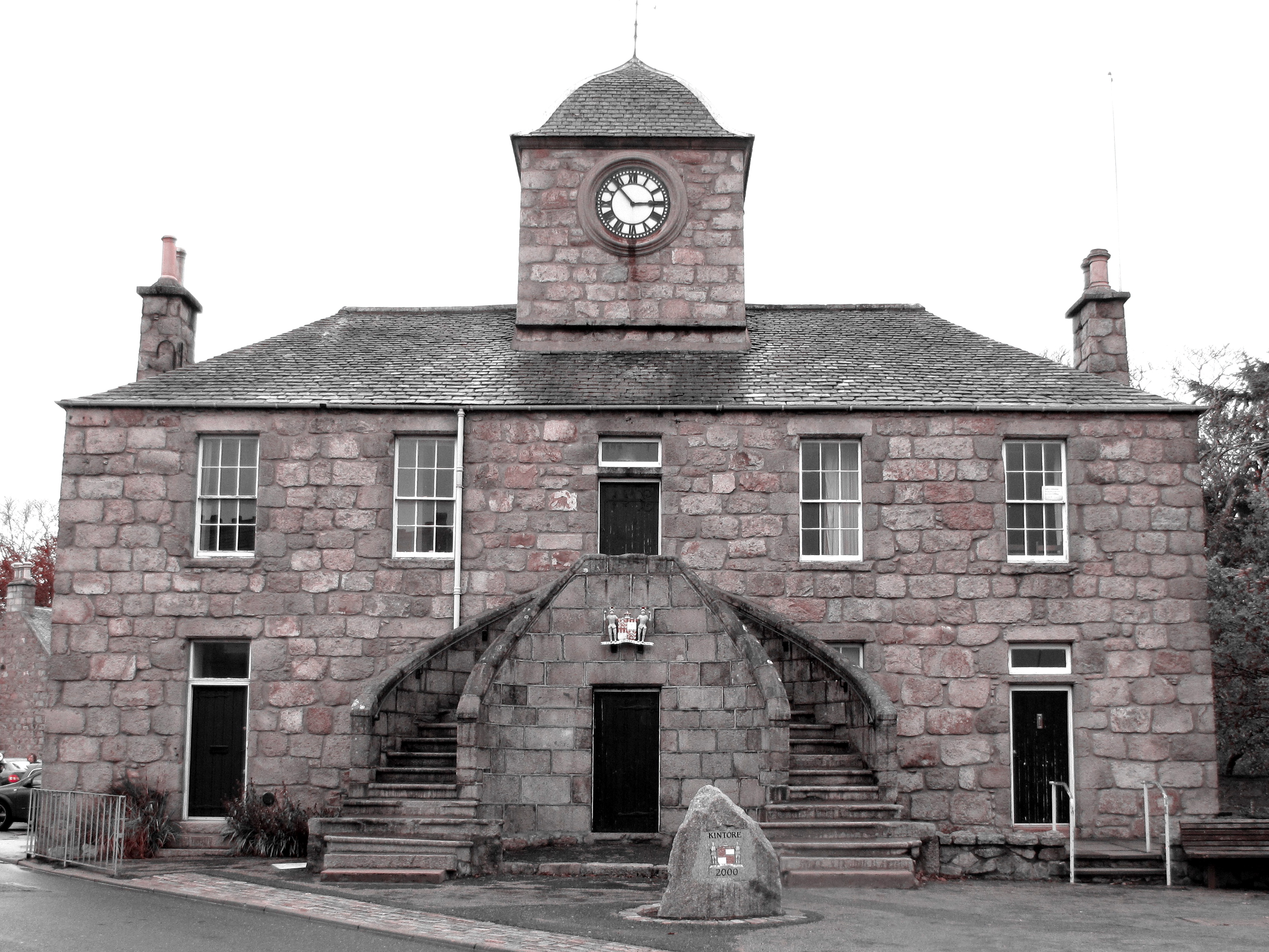
Kintore Town House
Kintore Town House is a municipal structure in The Square, Kintore, Aberdeenshire, Scotland. The structure, which is used as commercial offices, is a Category...

Deers Den
Deers Den is an archaeological site at Kintore, Scotland in Aberdeenshire. The site has mesolithic remains, Iron Age artefacts and is a known Roman Camp...
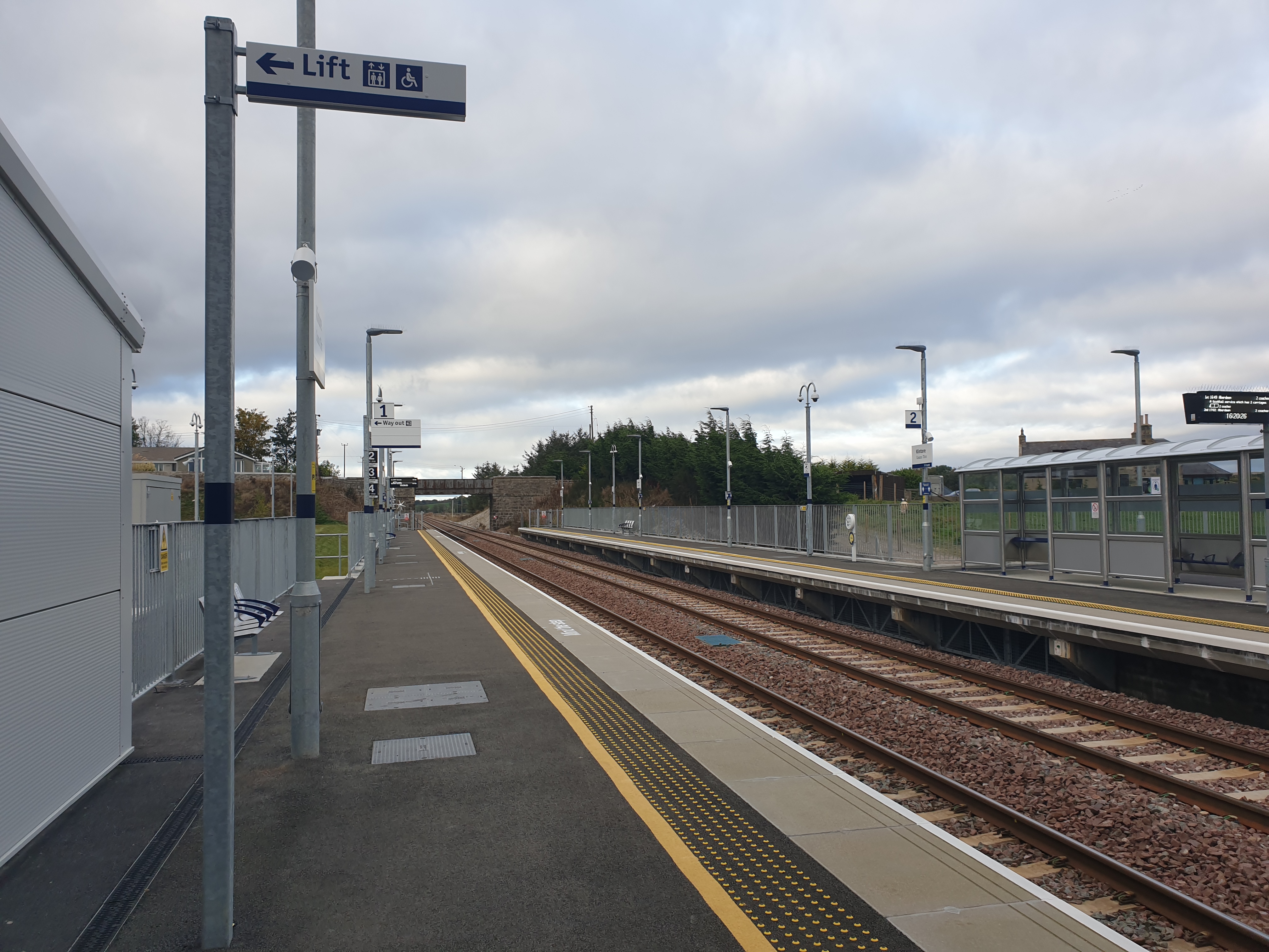
Kintore railway station
Kintore railway station is in Kintore, Scotland on the Aberdeen–Inverness line. Originally opened in 1854, it closed in 1964 but was reopened on a different...
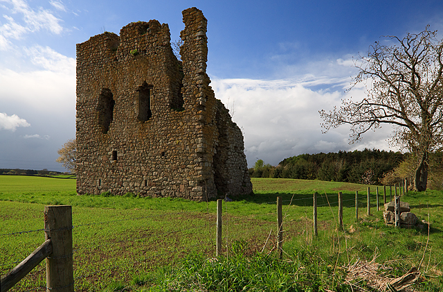
Hallforest Castle
Hallforest Castle is a keep, one of the oldest in Scotland, as it dates from the 14th century. It is about a mile and a half from Kintore, in Aberdeenshire...

Kinaldie railway station
Kinaldie railway station was a railway station in Kinaldie, Aberdeenshire. == History == The station was opened in November 1854 on the Great North of...
Kinellar
Kinellar is a small but ancient human settlement in Aberdeenshire between Kintore and Dyce just off the A96. It is said that the etymology appears to link...
Nearby Amenities
Located within 500m of 57.230502,-2.3276605Have you been to Brae Pot?
Leave your review of Brae Pot below (or comments, questions and feedback).