Trafford Park Lake

Lake, Pool, Pond, Freshwater Marsh in Lancashire

England

Trafford Park Lake

Entering Mode Wheel Locks – 1978 Taken during one of the Mersey Ferries regular cruises along the Manchester Ship Canal. The locks effectively marked the change from canal to docks. No sign yet of the redevelopment of the area as Salford Quays!
Entering Mode Wheel Locks – 1978 Credit: Alan Murray-Rust

Trafford Park Lake, located in Lancashire, is a picturesque body of water that offers a tranquil escape from the bustling city life. This man-made lake, also referred to as Trafford Park Pool or Pond, is nestled within the renowned Trafford Park Industrial Estate.

Spanning over an area of approximately 20 acres, this freshwater lake provides a haven for various flora and fauna. Surrounded by lush greenery, it offers a peaceful oasis for both locals and visitors to enjoy. The lake is a popular spot for recreational activities such as fishing, birdwatching, and leisurely strolls along its scenic shores.

With its diverse aquatic ecosystem, Trafford Park Lake is home to a wide range of fish species, including carp, roach, and tench, making it a haven for anglers. The lake also attracts an array of birdlife, including swans, ducks, and herons, making it a treat for birdwatchers.

Adjacent to the lake is a freshwater marsh that further enhances the natural beauty of the area. This marshland is a habitat for various wetland plants, creating a vibrant and ecologically rich environment.

Trafford Park Lake is easily accessible, with ample parking facilities available nearby. Its central location within Trafford Park makes it a convenient destination for both locals and tourists alike. Whether you are seeking a peaceful retreat or a spot for recreational activities, Trafford Park Lake offers a serene and scenic escape from the urban hustle and bustle.

If you have any feedback on the listing, please let us know in the comments section below.

Trafford Park Lake Images

Images are sourced within 2km of 53.472981/-2.3140331 or Grid Reference SJ7997. Thanks to Geograph Open Source API. All images are credited.

Entering Mode Wheel Locks – 1978 Taken during one of the Mersey Ferries regular cruises along the Manchester Ship Canal. The locks effectively marked the change from canal to docks. No sign yet of the redevelopment of the area as Salford Quays!
Entering Mode Wheel Locks – 1978
Taken during one of the Mersey Ferries regular cruises along the Manchester Ship Canal. The locks effectively marked the change from canal to docks. No sign yet of the redevelopment of the area as Salford Quays!
Manchester Ship Canal - Centenary Bridge, Eccles
Bridgewater Canal at Europa Gate Road Bridge
Bridgewater Canal towards Stretford
Bridgewater Canal towards the Manchester Ship Canal
Bridgewater Canal towards Stretford
The Eccles Cross Built in buff terracotta and brick, this fine building opened in September 1920 as the Regent Cinema. It closed as a cinema in 1962, becoming unsurprisingly a Bingo Hall. It lasted in this guise for only four years before lying empty until 1983 when it became a wine bar, and later a night club called The Silver Screen. In 1999 it re-opened as a Wetherspoons pub under the name The Eccles Cross, the original of which had once stood close by.
The Eccles Cross
Built in buff terracotta and brick, this fine building opened in September 1920 as the Regent Cinema. It closed as a cinema in 1962, becoming unsurprisingly a Bingo Hall. It lasted in this guise for only four years before lying empty until 1983 when it became a wine bar, and later a night club called The Silver Screen. In 1999 it re-opened as a Wetherspoons pub under the name The Eccles Cross, the original of which had once stood close by.
Kerrera Drive
Kerrera Drive
Coach & Horses
Coach & Horses
Mole Wheel Rd
Mole Wheel Rd
Foster St
Foster St
Brough Rd
Brough Rd
Weaste Metrolink station Weaste is a tram stop on the Eccles Line of Greater Manchester's light rail Metrolink system. It opened in 1999 as part of Phase 2 of the network's expansion, and is located the Weaste area of the City of Salford.
Weaste Metrolink station
Weaste is a tram stop on the Eccles Line of Greater Manchester's light rail Metrolink system. It opened in 1999 as part of Phase 2 of the network's expansion, and is located the Weaste area of the City of Salford.
Humber St
Humber St
Weaste Metrolink Station Weaste is a tram stop on the Eccles Line of Greater Manchester's light rail Metrolink system. It opened in 1999 as part of Phase 2 of the network's expansion, and is located the Weaste area of the City of Salford.
Weaste Metrolink Station
Weaste is a tram stop on the Eccles Line of Greater Manchester's light rail Metrolink system. It opened in 1999 as part of Phase 2 of the network's expansion, and is located the Weaste area of the City of Salford.
Eccles New Rd The A57 is a major road. It runs east from Liverpool to Lincoln, via Warrington, Salford and Manchester, then through the Pennines over the Snake Pass, around the Ladybower Reservoir, through Sheffield and past Worksop. Within Manchester a short stretch becomes the A57(M) motorway (the Mancunian Way).
Wikipedia: <span class="nowrap"><a title="http://en.wikipedia.org/wiki/A57_road" rel="nofollow ugc noopener" href="http://en.wikipedia.org/wiki/A57_road">Link</a><img style="margin-left:2px;" alt="External link" title="External link - shift click to open in new window" src="https://s1.geograph.org.uk/img/external.png" width="10" height="10"/></span>
Eccles New Rd
The A57 is a major road. It runs east from Liverpool to Lincoln, via Warrington, Salford and Manchester, then through the Pennines over the Snake Pass, around the Ladybower Reservoir, through Sheffield and past Worksop. Within Manchester a short stretch becomes the A57(M) motorway (the Mancunian Way). Wikipedia: LinkExternal link
Show me another place!

Trafford Park Lake is located at Grid Ref: SJ7997 (Lat: 53.472981, Lng: -2.3140331)

Unitary Authority: Trafford

Police Authority: Greater Manchester

What 3 Words

///aside.jump.cute. Near Trafford Park, Manchester

Nearby Locations

Trafford Park Lake

Related Wikis

Trafford Park Aerodrome

Trafford Park Aerodrome (Manchester) was the first purpose-built airfield in the Manchester area. Its large all-grass landing field was just south of...
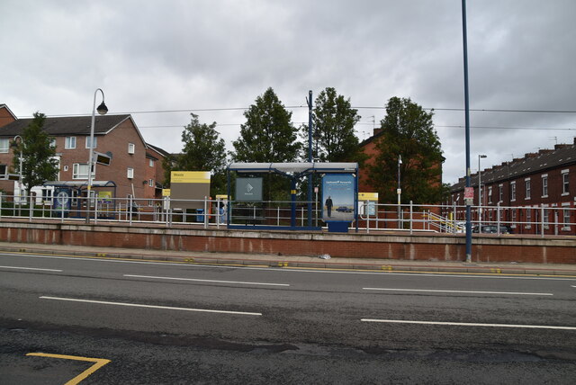
Village tram stop

Village is a Metrolink tram stop built as part of the line to the Trafford Centre, within the Trafford Park Village area of Trafford. Specifically, the...
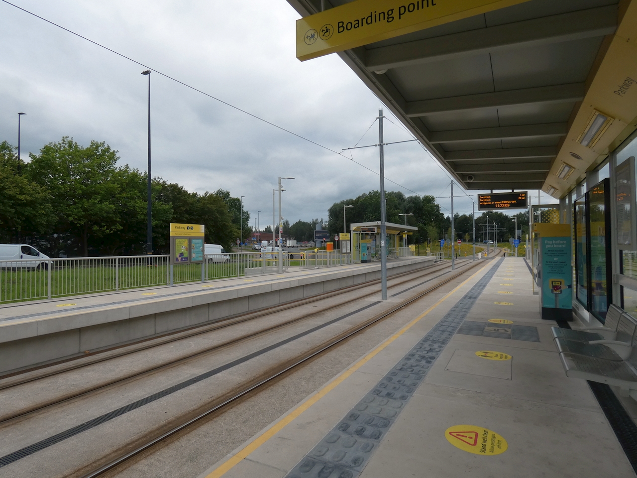
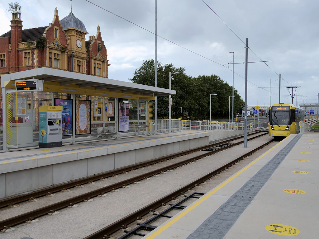
Parkway tram stop

Parkway (originally proposed as Parkway Circle) is a Manchester Metrolink tram stop built on the line to the Trafford Centre. It is located just east of...

Weaste Cemetery

Weaste Cemetery is a public cemetery in Weaste, Salford, Greater Manchester, in England. Opened in 1857, it is the oldest of Salford's four cemeteries...

Nearby Amenities

Located within 500m of 53.472981,-2.3140331
Crossing
Crossing: unmarked
Lat/Long: 53.4712868/-2.3080285
Bus Stop
Trafford Park Road/Mellors Road
Bus: yes
Naptan AtcoCode: 1800SJ01691
Naptan Bearing: SE
Naptan CommonName: Trafford Park Road/Mellors Road
Naptan Indicator: Nr Erf Manchest
Naptan Landmark: ERF MANCHESTER
Naptan NaptanCode: manjmwaw
Naptan PlusbusZoneRef: MNCRPIC
Naptan ShortCommonName: Mellors Road
Naptan Street: Trafford Pk Road
Naptan Verified: no
Network: TfGM
Public Transport: platform
Source: naptan_import
Lat/Long: 53.4738945/-2.3185259
Bus Stop
Trafford Park Road/Lake Road
Bus: yes
Naptan AtcoCode: 1800SJ01701
Naptan Bearing: SE
Naptan CommonName: Trafford Park Road/Lake Road
Naptan Indicator: Nr Level Cross
Naptan Landmark: RYE MOTORS
Naptan NaptanCode: manjmwdg
Naptan PlusbusZoneRef: MNCRPIC
Naptan ShortCommonName: Lake Road
Naptan Street: Trafford Pk Road
Naptan Verified: no
Network: TfGM
Public Transport: platform
Source: naptan_import
Lat/Long: 53.4725094/-2.3163521
Bus Stop
Trafford Park Road/Carborundum
Bus: yes
Naptan AtcoCode: 1800SJ01711
Naptan Bearing: SE
Naptan CommonName: Trafford Park Road/Carborundum
Naptan Indicator: Nr Hilti Ltd
Naptan Landmark: CHURCHILL POINT
Naptan NaptanCode: manjmwdj
Naptan PlusbusZoneRef: MNCRPIC
Naptan ShortCommonName: Carborundum
Naptan Street: Trafford Pk Road
Naptan Verified: no
Network: TfGM
Public Transport: platform
Source: naptan_import
Lat/Long: 53.4709772/-2.3139184
Bus Stop
Trafford Park Road/Mellors Road
Bus: yes
Naptan AtcoCode: 1800SJ01941
Naptan Bearing: NW
Naptan CommonName: Trafford Park Road/Mellors Road
Naptan Indicator: Car Park
Naptan Landmark: CAR PARK
Naptan NaptanCode: manjmwma
Naptan PlusbusZoneRef: MNCRPIC
Naptan ShortCommonName: Mellors Road
Naptan Street: Trafford Pk Road
Naptan Verified: no
Network: TfGM
Public Transport: platform
Source: naptan_import
Lat/Long: 53.4742205/-2.319348
Bus Stop
Trafford Park Road/Carborundum
Bus: yes
Naptan AtcoCode: 1800SJ01961
Naptan Bearing: NW
Naptan CommonName: Trafford Park Road/Carborundum
Naptan Indicator: Nt Warehouses
Naptan Landmark: WAREHOUSES
Naptan NaptanCode: manjmwmd
Naptan PlusbusZoneRef: MNCRPIC
Naptan ShortCommonName: Carborundum
Naptan Street: Trafford Pk Road
Naptan Verified: no
Network: TfGM
Public Transport: platform
Source: naptan_import
Lat/Long: 53.4711504/-2.3144589
Bus Stop
Trafford Park Road/Westbrook Road
Bus: yes
Naptan AtcoCode: 1800SJ01971
Naptan Bearing: NW
Naptan CommonName: Trafford Park Road/Westbrook Road
Naptan Indicator: Autocare Centre
Naptan Landmark: AUTOCARE CENTRE
Naptan NaptanCode: manjmwmg
Naptan PlusbusZoneRef: MNCRPIC
Naptan ShortCommonName: Westbrook Road
Naptan Street: Trafford Pk Road
Naptan Verified: no
Network: TfGM
Public Transport: platform
Source: naptan_import
Lat/Long: 53.4690463/-2.3112797
Bus Stop
Trafford Park Road/Lake Road
Bus: yes
Naptan AtcoCode: 1800SJ15941
Naptan Bearing: NW
Naptan CommonName: Trafford Park Road/Lake Road
Naptan Indicator: Nr Level Cross
Naptan Landmark: LEVEL CROSS
Naptan NaptanCode: mantgjga
Naptan PlusbusZoneRef: MNCRPIC
Naptan ShortCommonName: Lake Road
Naptan Street: Trafford Pk Road
Naptan Verified: no
Network: TfGM
Public Transport: platform
Source: naptan_import
Lat/Long: 53.4725826/-2.3166992
Railway: level_crossing
Lat/Long: 53.473132/-2.3175929
Railway: level_crossing
Lat/Long: 53.4739131/-2.3188647
Give Way
Lat/Long: 53.4726725/-2.3168295
Railway: level_crossing
Lat/Long: 53.4725519/-2.3168587
Railway: level_crossing
Lat/Long: 53.4747831/-2.3202214
Historic Railway: level_crossing
Lat/Long: 53.4690395/-2.3170803
Give Way
Lat/Long: 53.4739504/-2.3188355
Noexit: yes
Lat/Long: 53.4697899/-2.3191338
Crossing
Crossing: uncontrolled
Kerb: lowered
Tactile Paving: no
Lat/Long: 53.4733819/-2.3109359
Crossing
Crossing: uncontrolled
Kerb: lowered
Tactile Paving: yes
Lat/Long: 53.4733994/-2.3108511
Trafford Park
Name Ur: ٹریفورڈ پارک
Place: suburb
Wikidata: Q940877
Wikipedia: en:Trafford Park
Lat/Long: 53.4717516/-2.3209276
Historic Railway: level_crossing
Lat/Long: 53.4689287/-2.3130082
Railway: level_crossing
Lat/Long: 53.4699908/-2.3126848
Noexit: yes
Lat/Long: 53.4720272/-2.3131704
Toilets
Access: customers
Lat/Long: 53.471355/-2.315891
Crossing
Crossing: uncontrolled
Kerb: lowered
Tactile Paving: yes
Lat/Long: 53.4760108/-2.3085907
Noexit: yes
Lat/Long: 53.4741418/-2.3180331
Noexit: yes
Lat/Long: 53.4725848/-2.3176706
Noexit: yes
Lat/Long: 53.4708834/-2.3177752
Noexit: yes
Lat/Long: 53.4704888/-2.3185142
Noexit: yes
Lat/Long: 53.4697029/-2.3191807
Noexit: yes
Lat/Long: 53.4692509/-2.3177726
Railway: level_crossing
Lat/Long: 53.4744605/-2.3197523
Railway: level_crossing
Lat/Long: 53.4744787/-2.3197231
Barrier: lift_gate
Lat/Long: 53.4714253/-2.3090879
Barrier: sliding_gate
Lat/Long: 53.471535/-2.30905
Noexit: yes
Lat/Long: 53.4704494/-2.3137853
Noexit: yes
Lat/Long: 53.4707261/-2.3177654
Noexit: yes
Lat/Long: 53.4699046/-2.3174274
Noexit: yes
Lat/Long: 53.4716933/-2.315571
K & S Auto Centre
Payment Cash: yes
Phone: +44 1618778035
Shop: car_repair
Lat/Long: 53.4691542/-2.3117701
Entrance: yes
Lat/Long: 53.4692002/-2.3116661
Noexit: yes
Lat/Long: 53.4750865/-2.3164104
Noexit: yes
Lat/Long: 53.4727067/-2.3176737
Entrance: main
Lat/Long: 53.4769359/-2.311185
Entrance: main
Lat/Long: 53.4768698/-2.3107755
Railway: level_crossing
Lat/Long: 53.4691592/-2.3113133
Noexit: yes
Lat/Long: 53.4708613/-2.3093272
Noexit: yes
Lat/Long: 53.4703802/-2.3102527
Railway: level_crossing
Lat/Long: 53.4743912/-2.319644
Railway: level_crossing
Lat/Long: 53.474411/-2.3196073
Railway: switch
Lat/Long: 53.4741497/-2.3192149
Noexit: yes
Lat/Long: 53.4732263/-2.3112079
Noexit: yes
Lat/Long: 53.4713125/-2.3139954
Noexit: yes
Lat/Long: 53.4734901/-2.3183835
Noexit: yes
Lat/Long: 53.4728813/-2.3184747
Noexit: yes
Lat/Long: 53.4722537/-2.3181179
Railway: level_crossing
Lat/Long: 53.4722541/-2.3162598
Noexit: yes
Lat/Long: 53.4715831/-2.3158649
Noexit: yes
Lat/Long: 53.4713189/-2.3159949
Give Way
Lat/Long: 53.4728757/-2.316965
Noexit: yes
Lat/Long: 53.4703323/-2.3183325
Noexit: yes
Lat/Long: 53.4695078/-2.3159321
Noexit: yes
Lat/Long: 53.4724429/-2.3119515
Noexit: yes
Lat/Long: 53.473782/-2.3172443
Noexit: yes
Lat/Long: 53.4743777/-2.3165247
Give Way
Lat/Long: 53.4747713/-2.3200448
Give Way
Lat/Long: 53.4749327/-2.3207621
Railway: level_crossing
Lat/Long: 53.4722722/-2.3162202
Railway: switch
Lat/Long: 53.470821/-2.3168508
Railway: switch
Lat/Long: 53.4706147/-2.3168072
Parking
Access: customers
Parking: surface
Lat/Long: 53.473779/-2.3152484
The data included in this document is from www.openstreetmap.org. The data is made available under ODbL.

Have you been to Trafford Park Lake?

Leave your review of Trafford Park Lake below (or comments, questions and feedback).