Nutnell Pool

Lake, Pool, Pond, Freshwater Marsh in Worcestershire Malvern Hills

England

Nutnell Pool

Yarhampton House Early 17th century timber-framed former farmhouse viewed from the passing road.
Yarhampton House Credit: Philip Halling

Nutnell Pool, located in Worcestershire, is a picturesque freshwater marsh that offers a serene and natural escape for visitors. Spanning an area of approximately 10 acres, Nutnell Pool is a tranquil oasis nestled amidst lush greenery and rolling hills.

The pool itself is a shallow body of water, classified as a lake, with a maximum depth of around 3 meters. It is fed by natural springs and small streams that meander through the surrounding marshland, ensuring a constant supply of fresh water. The crystal-clear waters of Nutnell Pool are home to a diverse range of aquatic plants and animals, creating a thriving ecosystem.

Surrounding the pool, visitors can explore a variety of habitats, including reed beds, open water, and marshy areas. These ecosystems support a rich biodiversity, attracting numerous species of birds, insects, and amphibians. Birdwatchers will be delighted to spot species such as herons, grebes, and ducks, among others. It is not uncommon to observe dragonflies darting above the water's surface or to hear the distinctive croaks of frogs in the marshy areas.

Nutnell Pool offers several amenities for visitors to enjoy their experience. There are designated walking trails that wind through the marshland, providing opportunities for leisurely strolls and wildlife observation. Additionally, there are picnic areas and benches strategically placed, allowing visitors to relax and immerse themselves in the tranquility of the surroundings.

Overall, Nutnell Pool in Worcestershire is a stunning freshwater marsh that showcases the beauty of nature. Its diverse ecosystems, abundant wildlife, and peaceful atmosphere make it a haven for nature enthusiasts and those seeking a peaceful retreat away from the bustling city life.

If you have any feedback on the listing, please let us know in the comments section below.

Nutnell Pool Images

Images are sourced within 2km of 52.294648/-2.312884 or Grid Reference SO7866. Thanks to Geograph Open Source API. All images are credited.

Yarhampton House Early 17th century timber-framed former farmhouse viewed from the passing road.
Yarhampton House
Early 17th century timber-framed former farmhouse viewed from the passing road.
A443 near Warford Pool Sign for the church turn off can be seen in the distance. Looking west
A443 near Warford Pool
Sign for the church turn off can be seen in the distance. Looking west
Looking southwest from the B4196 in 1987
Country lane, off A443 road, near Structon's Heath Photographed near its junction with the A443 road.
Country lane, off A443 road, near Structon's Heath
Photographed near its junction with the A443 road.
Victorian wall-mounted postbox, Hillhampton, near Structon's Heath A very old postbox dating back to the reign of Queen Victoria, who died in early 1901. It serves the hamlet of Hillhampton and is near the A443 road.

Postbox number:- WR6 211. Post code:- WR6 6JU. Last collection:- 4.45 pm Monday to Friday; 10.15 am Saturday.

The location of the box can be seen here:- <a href="https://www.geograph.org.uk/photo/3058333">SO7765 : Country lane and postbox, Hillhampton near Structon's Heath</a>.
Victorian wall-mounted postbox, Hillhampton, near Structon's Heath
A very old postbox dating back to the reign of Queen Victoria, who died in early 1901. It serves the hamlet of Hillhampton and is near the A443 road. Postbox number:- WR6 211. Post code:- WR6 6JU. Last collection:- 4.45 pm Monday to Friday; 10.15 am Saturday. The location of the box can be seen here:- SO7765 : Country lane and postbox, Hillhampton near Structon's Heath.
Country lane and postbox, Hillhampton near Structon's Heath One of the few facilities left in many rural area is the postbox. This one is just off the A443 road.

<a href="https://www.geograph.org.uk/photo/3058307">SO7765 : Victorian wall-mounted postbox, Hillhampton, near Structon's Heath</a>.
Country lane and postbox, Hillhampton near Structon's Heath
One of the few facilities left in many rural area is the postbox. This one is just off the A443 road. SO7765 : Victorian wall-mounted postbox, Hillhampton, near Structon's Heath.
Entrance to nurseries at Hillhampton, near Structon's Heath This is not a garden centre open to the public, but a commercial plant and/or vegetable growing centre. There are many rows of large greenhouses here.
Entrance to nurseries at Hillhampton, near Structon's Heath
This is not a garden centre open to the public, but a commercial plant and/or vegetable growing centre. There are many rows of large greenhouses here.
Entrance to Pool House and Pool Cottage, Hillhampton, near Structon's Heath The entrance is off the A443 road but there is no public access here. In the far distance can be glimpsed Witley Church and part of Witley Court, a large ruined house.
Entrance to Pool House and Pool Cottage, Hillhampton, near Structon's Heath
The entrance is off the A443 road but there is no public access here. In the far distance can be glimpsed Witley Church and part of Witley Court, a large ruined house.
The former Rose & Crown (1), at Shrawley, Worcs This former public house closed over a year ago and permission has now been given to convert it into private residential accommodation. It used to be a Marston's house and the building itself is Grade II listed. It dates from the early 19th century with parts dating from the 20th century. It started life as a house, then became licensed premises and will shortly revert to residential use, so it has in effect come full circle. A sad loss to local amenities, but fortunately the village still has the New Inn and nearby is the Lenchford Inn.

<a href="https://www.geograph.org.uk/photo/3431892">SO7965 : The former Rose & Crown (2), at Shrawley, Worcs</a>.
The former Rose & Crown (1), at Shrawley, Worcs
This former public house closed over a year ago and permission has now been given to convert it into private residential accommodation. It used to be a Marston's house and the building itself is Grade II listed. It dates from the early 19th century with parts dating from the 20th century. It started life as a house, then became licensed premises and will shortly revert to residential use, so it has in effect come full circle. A sad loss to local amenities, but fortunately the village still has the New Inn and nearby is the Lenchford Inn. SO7965 : The former Rose & Crown (2), at Shrawley, Worcs.
The former Rose & Crown (2), at Shrawley, Worcs This former pub is on the B4196 road, which runs through the straggly village of Shrawley. It used to have a traditional hanging sign outside but that has already gone and it now awaits conversion into residential accommodation. See also:- <a href="https://www.geograph.org.uk/photo/3431880">SO7965 : The former Rose & Crown (1), at Shrawley, Worcs</a>.
The former Rose & Crown (2), at Shrawley, Worcs
This former pub is on the B4196 road, which runs through the straggly village of Shrawley. It used to have a traditional hanging sign outside but that has already gone and it now awaits conversion into residential accommodation. See also:- SO7965 : The former Rose & Crown (1), at Shrawley, Worcs.
The B4196 road near the former Rose & Crown pub, Shrawley, Worcs The road is heading in the direction of Stourport-on-Severn. The former pub is behind the temporary fencing on the left.

<a href="https://www.geograph.org.uk/photo/3431880">SO7965 : The former Rose & Crown (1), at Shrawley, Worcs</a>.
The B4196 road near the former Rose & Crown pub, Shrawley, Worcs
The road is heading in the direction of Stourport-on-Severn. The former pub is behind the temporary fencing on the left. SO7965 : The former Rose & Crown (1), at Shrawley, Worcs.
The woods of Watkin's Dingle Watkin's Dingle fills the valley on the right of the A4133.  The hedge and woods on the left are part of the  Witley Court estate
The woods of Watkin's Dingle
Watkin's Dingle fills the valley on the right of the A4133. The hedge and woods on the left are part of the Witley Court estate
Worcester Lodge of Witley Court
Field of rape east of Great Witley The trees on the right screen commercial nurseries <a href="https://www.geograph.org.uk/photo/3059306">SO7765 : Entrance to nurseries at Hillhampton, near Structon's Heath</a>
Field of rape east of Great Witley
The trees on the right screen commercial nurseries SO7765 : Entrance to nurseries at Hillhampton, near Structon's Heath
Access road to the church etc., Astley, Worcs The road on the left gives access to St. Peter's Church, its small car park and a couple of other properties. The road in the foreground is Church Lane.
Access road to the church etc., Astley, Worcs
The road on the left gives access to St. Peter's Church, its small car park and a couple of other properties. The road in the foreground is Church Lane.
St. Peter's Church, Astley, Worcs The church dates from Norman times, probably mid-12th century. The aisle was rebuilt and widened in 1837-8, and there was a major restoration with substantial alterations in the very early years of the 20th century. Currently the church is fund raising for essential works. The church was originally built as the church for a Benedictine priory which was attached to the Abbey of St. Taurin near Rouen in France. As an "alien" foundation, the priory was suppressed in 1414, over a hundred years before King Henry VIII closed all the other remaining religious houses. Fortunately the church survived and contains a number of interesting monuments.

<a href="https://www.geograph.org.uk/photo/3856068">SO7867 : Porch of St. Peter's Church, Astley, Worcs</a>.
St. Peter's Church, Astley, Worcs
The church dates from Norman times, probably mid-12th century. The aisle was rebuilt and widened in 1837-8, and there was a major restoration with substantial alterations in the very early years of the 20th century. Currently the church is fund raising for essential works. The church was originally built as the church for a Benedictine priory which was attached to the Abbey of St. Taurin near Rouen in France. As an "alien" foundation, the priory was suppressed in 1414, over a hundred years before King Henry VIII closed all the other remaining religious houses. Fortunately the church survived and contains a number of interesting monuments. SO7867 : Porch of St. Peter's Church, Astley, Worcs.
Porch of St. Peter's Church, Astley, Worcs The porch was rebuilt in 1903-4, at the time of a major restoration of the church by the rector, the Rev. Martin Brereton Buckle.

<a href="https://www.geograph.org.uk/photo/3855997">SO7867 : St. Peter's Church, Astley, Worcs</a>.
Porch of St. Peter's Church, Astley, Worcs
The porch was rebuilt in 1903-4, at the time of a major restoration of the church by the rector, the Rev. Martin Brereton Buckle. SO7867 : St. Peter's Church, Astley, Worcs.
Old graveyard at St. Peter's Church, Astley, Worcs The graves here seem quite old and are showing the ravages of time. It is located opposite the church and next to the car park.
Old graveyard at St. Peter's Church, Astley, Worcs
The graves here seem quite old and are showing the ravages of time. It is located opposite the church and next to the car park.
Show me another place!

Nutnell Pool is located at Grid Ref: SO7866 (Lat: 52.294648, Lng: -2.312884)

Administrative County: Worcestershire

District: Malvern Hills

Police Authority: West Mercia

What 3 Words

///masts.triads.cookie. Near Stourport-on-Severn, Worcestershire

Nearby Locations

Nutnell Pool The Warren

Related Wikis

Astley Priory

Astley Priory was a Benedictine priory in Astley, Worcestershire, England.It was founded in the 11th century, probably by Ralph de Todeni, as a cell subject...

Hillhampton

Hillhampton is a hamlet and civil parish nestled between Great Witley, Little Witley and Shrawley in the Malvern Hills district of the county of Worcestershire...

Noutard's Green

Noutard's Green is a hamlet within the civil parish of Shrawley in Worcestershire, England. == References ==

Astley, Worcestershire

Astley is a village, and a civil parish (with Dunley) in Worcestershire, England, about two miles outside Stourport-on-Severn and seven miles south-west...

Frog Pool

Frog Pool is a hamlet within the civil parish of Shrawley in Worcestershire, England. == References ==

Sankyns Green

Sankyns Green is a hamlet within the civil parish of Shrawley in Worcestershire, England.

Astley Hall, Stourport-on-Severn

Astley Hall is a country house in Astley near Stourport-on-Severn, Worcestershire, England. The hall was the home of Prime Minister Stanley Baldwin from...

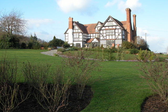
Pool House, Worcestershire

Pool House is a Grade II* listed house in Astley, in the county of Worcestershire, England.In the area close to Stourport-on-Severn, there are several...

Nearby Amenities

Located within 500m of 52.294648,-2.312884
Power: pole
Lat/Long: 52.2984346/-2.3141673
Power: pole
Lat/Long: 52.2978801/-2.3148137
Power: pole
Lat/Long: 52.2987216/-2.3148352
Power: pole
Lat/Long: 52.2980835/-2.3174663
Power: pole
Lat/Long: 52.2927853/-2.3151544
Power: pole
Lat/Long: 52.2914333/-2.3150579
Power: pole
Lat/Long: 52.2973176/-2.3154949
Power: pole
Lat/Long: 52.295628/-2.3153662
Power: pole
Lat/Long: 52.2947079/-2.3182762
Power: pole
Lat/Long: 52.2946048/-2.3153243
Power: pole
Lat/Long: 52.2946618/-2.3164793
Power: pole
Lat/Long: 52.2947675/-2.320033
The data included in this document is from www.openstreetmap.org. The data is made available under ODbL.

Have you been to Nutnell Pool?

Leave your review of Nutnell Pool below (or comments, questions and feedback).