Madam's Pool

Lake, Pool, Pond, Freshwater Marsh in Gloucestershire Stroud

England

Madam's Pool

Hardwicke Court Hardwicke Court is a private country house and a member of the HHA (Historic Houses Association) and occasionally open to the public.
Hardwicke Court Credit: Philip Halling

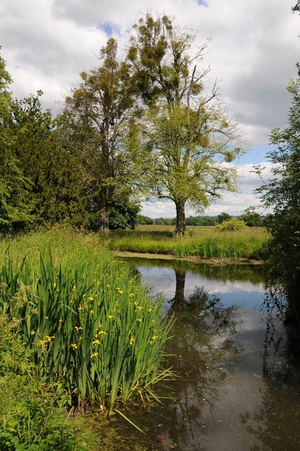
Madam's Pool, located in Gloucestershire, is a picturesque freshwater marsh that encompasses an area of serene beauty. Nestled amidst the idyllic countryside, this pool boasts a rich history and diverse ecosystem, making it a popular destination for nature enthusiasts and visitors seeking tranquility.

Covering a modest area, Madam's Pool is primarily characterized by its calm and still waters. It is believed to have formed centuries ago, possibly as a result of glacial activity or natural springs. Surrounded by lush vegetation, the pool is a haven for various species of plants and animals.

The pool's surroundings are dominated by reeds, rushes, and other aquatic plants, providing a vital habitat for a wide range of wildlife. Numerous birds, including ducks, geese, and herons, can often be spotted gracefully gliding across the water or foraging along the marshy edges. Additionally, the pool is home to various amphibians, such as frogs and newts, which thrive in its shallow depths.

The tranquil ambiance of Madam's Pool makes it an ideal spot for relaxation and contemplation. Visitors can enjoy leisurely walks along its banks, observing the diverse flora and fauna, or simply sit back and immerse themselves in the serenity of the surroundings. The pool's calm waters also make it a popular spot for fishing, attracting anglers in search of a peaceful angling experience.

Madam's Pool offers a unique opportunity to connect with nature and appreciate the beauty of Gloucestershire's countryside. Its rich biodiversity and tranquil atmosphere make it a hidden gem for those seeking a peaceful retreat amidst the hustle and bustle of everyday life.

If you have any feedback on the listing, please let us know in the comments section below.
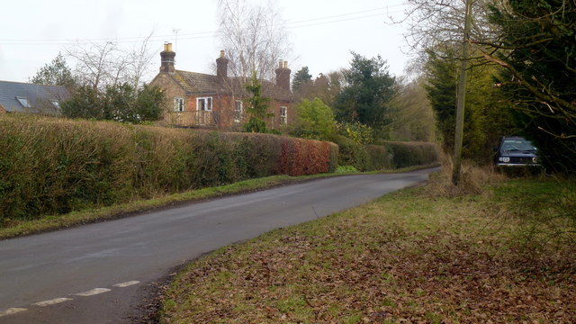
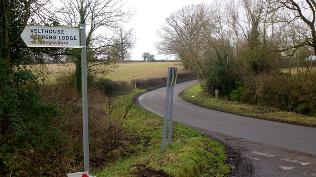
Madam's Pool Images

Images are sourced within 2km of 51.815216/-2.3280457 or Grid Reference SO7713. Thanks to Geograph Open Source API. All images are credited.

Hardwicke Court Hardwicke Court is a private country house and a member of the HHA (Historic Houses Association) and occasionally open to the public.
Hardwicke Court
Hardwicke Court is a private country house and a member of the HHA (Historic Houses Association) and occasionally open to the public.
Hardwicke Court Hardwicke Court is a private country house and a member of the HHA (Historic Houses Association) and occasionally open to the public.
Hardwicke Court
Hardwicke Court is a private country house and a member of the HHA (Historic Houses Association) and occasionally open to the public.
Hardwicke Court Hardwicke Court is a private country house and a member of the HHA (Historic Houses Association) and occasionally open to the public.
Hardwicke Court
Hardwicke Court is a private country house and a member of the HHA (Historic Houses Association) and occasionally open to the public.
Canal in the grounds of Hardwicke Court Ornamental canal in the grounds of Hardwicke Court, a private country house and a member of the HHA (Historic Houses Association) and occasionally open to the public.
Canal in the grounds of Hardwicke Court
Ornamental canal in the grounds of Hardwicke Court, a private country house and a member of the HHA (Historic Houses Association) and occasionally open to the public.
Trees and canal, Hardwicke Court Trees reflected in an ornamental canal in the gardens of Hardwicke Court.
Trees and canal, Hardwicke Court
Trees reflected in an ornamental canal in the gardens of Hardwicke Court.
Hardwicke Court View of Hardwicke Court from the end of the ornamental canal in the gardens.
Hardwicke Court
View of Hardwicke Court from the end of the ornamental canal in the gardens.
Gardens at Hardwicke Court Trees in the garden beside the canal at Hardwicke Court.
Gardens at Hardwicke Court
Trees in the garden beside the canal at Hardwicke Court.
Gardens of Hardwicke Court Trees reflected in an ornamental canal in the gardens of Hardwicke Court.
Gardens of Hardwicke Court
Trees reflected in an ornamental canal in the gardens of Hardwicke Court.
Hardwicke Court Hardwicke Court is a private country house and a member of the HHA (Historic Houses Association) and occasionally open to the public.
Hardwicke Court
Hardwicke Court is a private country house and a member of the HHA (Historic Houses Association) and occasionally open to the public.
Dead end lane to Velthouse A branch to the left heads south-east to Keeper's Lodge.
Dead end lane to Velthouse
A branch to the left heads south-east to Keeper's Lodge.
Kenton Green, Elmore, 1 By the junction with Velthouse Lane, looking east towards Gloucester.
Kenton Green, Elmore, 1
By the junction with Velthouse Lane, looking east towards Gloucester.
Kenton Green, Elmore, 2 Looking west towards Elmore church.
Kenton Green, Elmore, 2
Looking west towards Elmore church.
Lane to Castle End, Longney One of many scattered farms hereabouts.
Lane to Castle End, Longney
One of many scattered farms hereabouts.
View to Monk's Hill A 41m mountain with a trig point yet to be photographed for Geograph. It lies well away from public access so permission would need to be sought.
See Phil's identical shot from 2008; <a href="https://www.geograph.org.uk/photo/784586">SO7613 : Monks' Hill, Longney</a>.
View to Monk's Hill
A 41m mountain with a trig point yet to be photographed for Geograph. It lies well away from public access so permission would need to be sought. See Phil's identical shot from 2008; SO7613 : Monks' Hill, Longney.
Oakey Farm Farm set just above the flood line between the Severn and the Gloucester and Sharpness Canal. Accessed by private track and public path.
Oakey Farm
Farm set just above the flood line between the Severn and the Gloucester and Sharpness Canal. Accessed by private track and public path.
Church Farm, Hardwicke The tower of St. Nicholas' church centre left distance.
Church Farm, Hardwicke
The tower of St. Nicholas' church centre left distance.
St. Nicholas' church, Hardwicke Taken from the entrance to Church Farm.
St. Nicholas' church, Hardwicke
Taken from the entrance to Church Farm.
House by the Gloucester and Sharpness Canal At the end of Stank Lane.
House by the Gloucester and Sharpness Canal
At the end of Stank Lane.
Show me another place!

Madam's Pool is located at Grid Ref: SO7713 (Lat: 51.815216, Lng: -2.3280457)

Administrative County: Gloucestershire

District: Stroud

Police Authority: Gloucestershire

What 3 Words

///flight.duty.tags. Near Frampton on Severn, Gloucestershire

Nearby Locations

Madam's Pool

Related Wikis

Longney

Longney is a village on the River Severn 5 miles south-west of Gloucester, Gloucestershire, England, within the parish of Longney and Epney. The parish...

St Nicholas Church, Hardwicke

Saint Nicholas Church is a grade I listed building located in Hardwicke, Gloucestershire. It practices Christianity through the Church of England denomination...
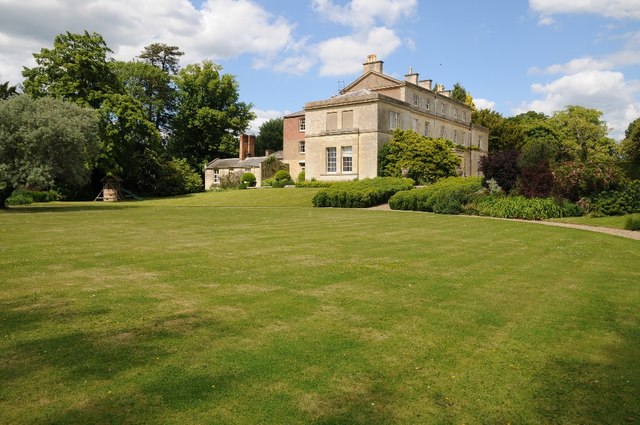
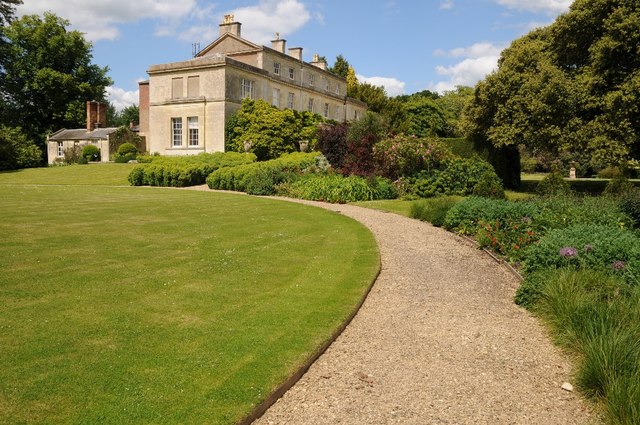
Hardwicke Court

Hardwicke Court is a Grade II* listed country house in Hardwicke, Gloucestershire, England. The house is Late Georgian in style. It was designed by Sir...

Severn FM

Severn FM is an internet radio station in the United Kingdom, which started broadcasting online in June 2011, and officially launched from its studio in...

Nearby Amenities

Located within 500m of 51.815216,-2.3280457
Post Box
Brand: Royal Mail
Brand Wikidata: Q638098
Mapillary: 221718596055618
Operator: Royal Mail
Operator Wikidata: Q638098
Post Box Mounting: pier
Post Box Type: lamp
Postal Code: GL2
Ref: GL2 347
Survey Date: 2020-06-22
Lat/Long: 51.8172795/-2.325547
Bus Stop
Madam's End Farm
Naptan AtcoCode: 1600GLS1041
Naptan Bearing: SW
Naptan CommonName: Madam's End Farm
Naptan NaptanCode: gloatdtw
Naptan Street: Longney Rd
Naptan Verified: no
Source: naptan_import
Lat/Long: 51.8154332/-2.3282631
Bus Stop
Madam's End Farm
Naptan AtcoCode: 1600GLS1042
Naptan Bearing: NE
Naptan CommonName: Madam's End Farm
Naptan NaptanCode: gloatdtp
Naptan Street: Longney Rd
Naptan Verified: no
Source: naptan_import
Lat/Long: 51.8153967/-2.3284514
Bus Stop
Clarks Farm
Bus: yes
Naptan AtcoCode: 1600GLS1045
Naptan Bearing: SW
Naptan CommonName: Clarks Farm
Naptan NaptanCode: gloatgag
Naptan Street: N/A
Naptan Verified: no
Public Transport: platform
Source: naptan_import
Lat/Long: 51.8168857/-2.3264892
Bus Stop
Clarks Farm
Naptan AtcoCode: 1600GLS1046
Naptan Bearing: NE
Naptan CommonName: Clarks Farm
Naptan NaptanCode: gloatgad
Naptan Street: N/A
Naptan Verified: no
Source: naptan_import
Lat/Long: 51.8169935/-2.326519
Clarks Farm
Alt Name: Clarkes Farm
Source: NPE
Source Name: NaPTAN
Lat/Long: 51.8175742/-2.3265289
Clarke's Farm
Landuse: farm
Note Retag: CS #48756035
Source: OS Opendata streetview
Lat/Long: 51.8170912/-2.3250291
The data included in this document is from www.openstreetmap.org. The data is made available under ODbL.

Have you been to Madam's Pool?

Leave your review of Madam's Pool below (or comments, questions and feedback).