Garden Lake

Lake, Pool, Pond, Freshwater Marsh in Wiltshire

England

Garden Lake

Looking from the woods across the pool above the Lily Pond
Looking from the woods across the pool above the Lily Pond Credit: Rod Allday

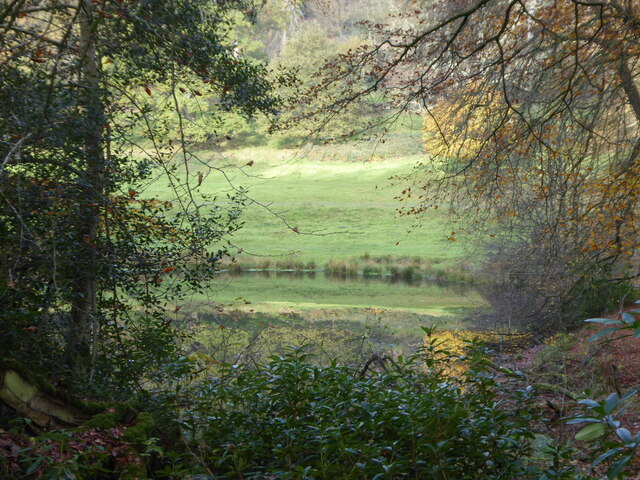
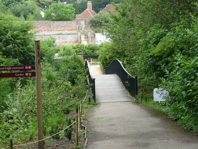
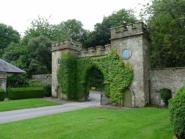
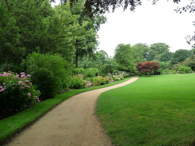
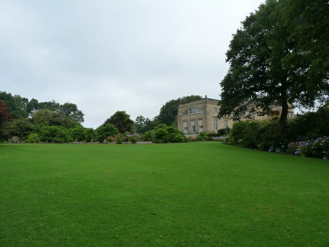
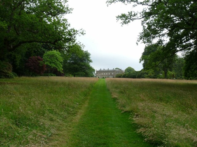
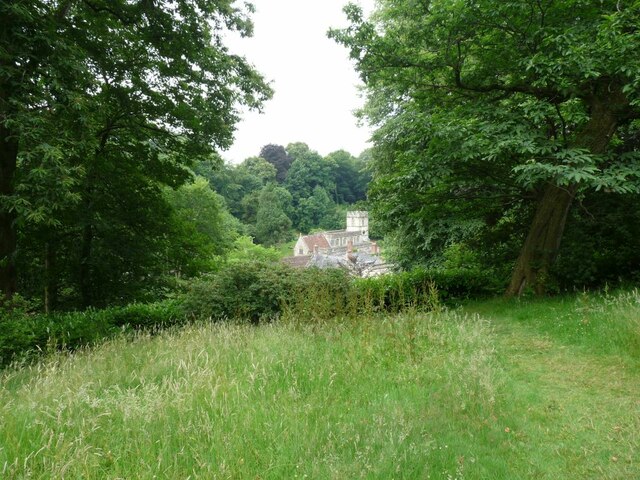
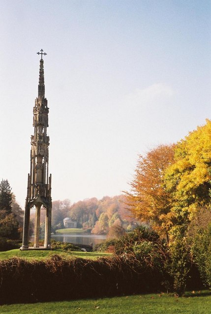
Garden Lake is a picturesque freshwater marsh located in the county of Wiltshire, England. Situated amidst the beautiful countryside, this enchanting water body is a hidden gem for nature lovers and outdoor enthusiasts alike. Spanning across a vast area, Garden Lake is a combination of a lake, pool, pond, and freshwater marsh, making it a unique ecosystem that supports a diverse range of flora and fauna.

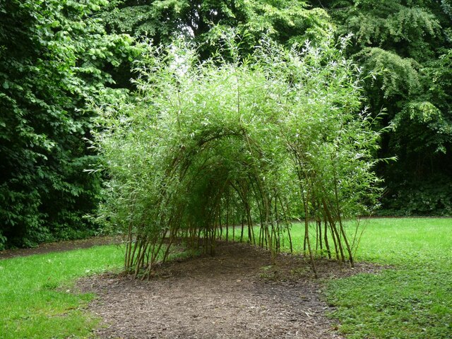
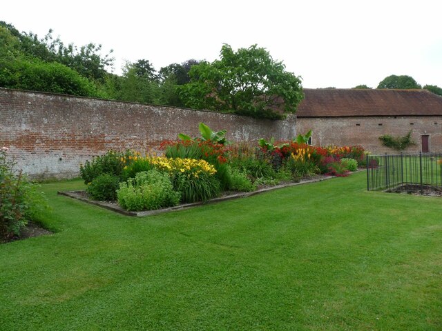
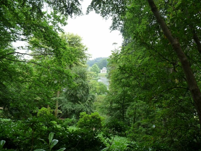
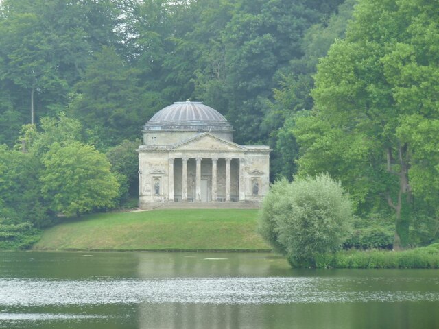
The lake itself is surrounded by lush greenery, with tall reeds and colorful wildflowers adorning its banks. The crystal-clear water reflects the surrounding landscape, creating a serene and tranquil atmosphere. The pool and pond areas provide a habitat for various aquatic plants and animals, including water lilies, dragonflies, and small fish.

Garden Lake is home to a wide variety of bird species, making it a paradise for birdwatchers. Visitors can spot majestic herons, graceful swans, and a plethora of other waterfowl, which thrive in this idyllic setting. The marshy areas are teeming with life, attracting amphibians such as frogs and toads, as well as insects like butterflies and damselflies.

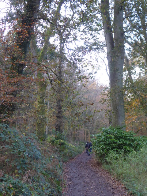
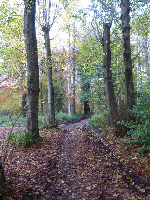
For those seeking a peaceful retreat, Garden Lake offers several walking trails and picnic spots, allowing visitors to immerse themselves in the tranquility of nature. The lush vegetation and gentle sound of rustling leaves create a soothing ambiance, perfect for relaxation or meditation.

Overall, Garden Lake is a natural haven that showcases the beauty and abundance of Wiltshire's countryside. Its diverse ecosystem, scenic surroundings, and peaceful atmosphere make it a popular destination for nature enthusiasts and a must-visit spot for anyone looking to reconnect with nature.

If you have any feedback on the listing, please let us know in the comments section below.

Garden Lake Images

Images are sourced within 2km of 51.1055/-2.326335 or Grid Reference ST7734. Thanks to Geograph Open Source API. All images are credited.

Looking from the woods across the pool above the Lily Pond
Path through the woods by Six Wells Bottom
Path through the woods west of Iron Bridge
Willow Sculpture Tunnel made from Willows at Stourhead Park.
Willow Sculpture
Tunnel made from Willows at Stourhead Park.
Footbridge near the Eagle Courtyard Part of the N.T. property at Stourhead.
Footbridge near the Eagle Courtyard
Part of the N.T. property at Stourhead.
Gate House at Stourhead The entrance to Stourhead House.
Gate House at Stourhead
The entrance to Stourhead House.
The Gate keeper's Cottage By the entrance to Stourhead House.
The Gate keeper's Cottage
By the entrance to Stourhead House.
Stourhead House 18th C. Palladian mansion, with extensive parkland and gardens.
Stourhead House
18th C. Palladian mansion, with extensive parkland and gardens.
Hydrangeas in the border at Stourhead Pink Hydrangeas.
Hydrangeas in the border at Stourhead
Pink Hydrangeas.
Across the lawn to Stourhead House View is of the side of the House.
Across the lawn to Stourhead House
View is of the side of the House.
The Ice House at Stourhead House Ice from the lakes was stored here for Summer use.
The Ice House at Stourhead House
Ice from the lakes was stored here for Summer use.
Herbaceous flower bed at Stourhead House Taken in the Walled Garden.
Herbaceous flower bed at Stourhead House
Taken in the Walled Garden.
Grass path down to Stourhead House Looking at the rear of the property.
Grass path down to Stourhead House
Looking at the rear of the property.
St. Peter's church View through the trees to the Church.
St. Peter's church
View through the trees to the Church.
View through the trees to The Pantheon One of a number of stone structures built around the lake. Modelled on the Pantheon in Rome, it was originally called the Temple of Hercules as it was home to a statue of Hercules created by Rysbrack. It was renamed the Pantheon when statues including Diana, Flora, Isis and St Susanna were added in the 1760s. Famous architect Henry Flitcroft designed the structure.
View through the trees to The Pantheon
One of a number of stone structures built around the lake. Modelled on the Pantheon in Rome, it was originally called the Temple of Hercules as it was home to a statue of Hercules created by Rysbrack. It was renamed the Pantheon when statues including Diana, Flora, Isis and St Susanna were added in the 1760s. Famous architect Henry Flitcroft designed the structure.
The Pantheon Viewed from across the lake.
The Pantheon
Viewed from across the lake.
The Palladian Bridge Inspired by the work of 16th-century architect Palladio, this five-arched stone bridge was built in 1762. Although ornamental, the bridge was intended to look practical. It was designed to create the illusion that a river flows through the village and under the bridge.
The Palladian Bridge
Inspired by the work of 16th-century architect Palladio, this five-arched stone bridge was built in 1762. Although ornamental, the bridge was intended to look practical. It was designed to create the illusion that a river flows through the village and under the bridge.
St. Peter's Church Stourhead The medieval church of St Peter stands immediately outside Stourhead Gardens.
St. Peter's Church Stourhead
The medieval church of St Peter stands immediately outside Stourhead Gardens.
Show me another place!

Garden Lake is located at Grid Ref: ST7734 (Lat: 51.1055, Lng: -2.326335)

Unitary Authority: Wiltshire

Police Authority: Wiltshire

What 3 Words

///umbrellas.thinks.scarf. Near Kilmington, Wiltshire

Related Wikis

Bristol High Cross

Bristol High Cross is a monumental market cross erected in 1373 in the centre of Bristol. It was built in Decorated Gothic style on the site of an earlier...

Stourhead

Stourhead () is a 1,072-hectare (2,650-acre) estate at the source of the River Stour in the southwest of the English county of Wiltshire, extending into...

Stourton with Gasper

Stourton with Gasper is a civil parish in the southwest of the English county of Wiltshire. Its main settlement is the village of Stourton, along with...

RAF Zeals

Royal Air Force Zeals, or more simply RAF Zeals, is a former Royal Air Force station in Wiltshire, sited to the north of the village of Zeals, next to...

Nearby Amenities

Located within 500m of 51.1055,-2.326335
Stourhead Gardens
Addr City: Warminster
Addr Place: Stourton
Addr Postcode: BA12 6QD
Name Ru: Стоурхедские сады
Operator: National Trust
Phone: +44 1747 841152
Tourism: attraction
Website: https://www.nationaltrust.org.uk/stourhead/
Wikidata: Q301338
Wikipedia: en:Stourhead
Lat/Long: 51.1046699/-2.3234658
Stourhead Obelisk
Historic: monument
Name Ru: Стоурхедский обелиск
Wikidata: Q17529862
Lat/Long: 51.1093232/-2.3253072
Direction: 180-0
Tourism: viewpoint
Lat/Long: 51.1064237/-2.3239429
Pub
The Spread Eagle
Real Ale: yes
Wikidata: Q26424057
Lat/Long: 51.1047626/-2.320715
Community Centre
Stourton Village Hall
Addr City: Stourton
Addr Street: High Street
Check Date Opening Hours: 2023-01-02
Community Centre: village_hall
Opening Hours Signed: no
Lat/Long: 51.1049421/-2.3203284
Stourton
Name Ru: Стоуртон
Place: village
Postal Code: BA12 6
Source: NPE
Wikidata: Q7620599
Lat/Long: 51.1043292/-2.3213298
Tourism: viewpoint
Lat/Long: 51.1084025/-2.3280496
Barrier: stile
Material: wood
Source: Bing
Step Count: 1
Stile: stepover
Lat/Long: 51.1039841/-2.3203492
Fixme: Possible weir or tunnel? Survey needed
Lat/Long: 51.1015853/-2.3295053
Tourism: viewpoint
Lat/Long: 51.1057436/-2.3274937
Bristol Cross
Historic: wayside_cross
Name Ru: Бристольский крест
Wikidata: Q4968924
Wikipedia: en:Bristol High Cross
Lat/Long: 51.1045125/-2.3220068
Toilets
Changing Table: yes
Check Date: 2022-11-12
Fee: no
Wheelchair: yes
Lat/Long: 51.1047287/-2.3203018
Direction: SW
Tourism: viewpoint
Lat/Long: 51.1053218/-2.3224553
Board Type: technology
Information: board
Tourism: information
Lat/Long: 51.1035299/-2.3266115
Noexit: yes
Lat/Long: 51.1035246/-2.3266153
Bench
Lat/Long: 51.1053036/-2.3225087
Tourism: viewpoint
Lat/Long: 51.1035903/-2.3289436
Direction: 270-90
Tourism: viewpoint
Lat/Long: 51.1033822/-2.3243782
The data included in this document is from www.openstreetmap.org. The data is made available under ODbL.

Have you been to Garden Lake?

Leave your review of Garden Lake below (or comments, questions and feedback).