Farm Lodge Reservoir

Lake, Pool, Pond, Freshwater Marsh in Lancashire

England

Farm Lodge Reservoir

Manchester, Bolton and Bury Canal, Angling Lodge at Radcliffe Formerly a lodge serving the Water Lane Mill at Radcliffe. Now used by anglers.
Manchester, Bolton and Bury Canal, Angling Lodge at Radcliffe Credit: David Dixon

Farm Lodge Reservoir, located in Lancashire, is a picturesque freshwater body encompassing an area of approximately 10 acres. Nestled amidst serene surroundings, this reservoir serves as a tranquil haven for both wildlife and visitors alike.

The reservoir is primarily known for its diverse ecosystem, comprising of a lake, pool, pond, and freshwater marsh. The lake, with its crystal-clear waters, spans a significant portion of the reservoir. It offers a mesmerizing sight, especially during the summer months when lilies bloom, creating a vibrant burst of colors across the water's surface.

Adjacent to the lake, the pool and pond areas provide a habitat for numerous aquatic species. These areas teem with life, hosting an array of fish species, including carp, pike, and perch. Anglers, drawn by the abundant fish population, often frequent these sections of the reservoir, casting their lines in hopes of landing a prized catch.

On the fringes of the reservoir lies the freshwater marsh, an important breeding ground for various bird species. This marshland is a haven for waterfowl, such as ducks, geese, and swans, which thrive in its reedy and marshy environment.

Farm Lodge Reservoir is not only a sanctuary for wildlife but also a popular recreational spot. Visitors can enjoy leisurely walks along the reservoir's pathways, taking in the breathtaking scenery and observing the diverse flora and fauna. The peaceful atmosphere and natural beauty make this reservoir a perfect destination for nature enthusiasts and those seeking a serene escape from the bustle of everyday life.

In summary, Farm Lodge Reservoir in Lancashire offers a diverse and vibrant ecosystem, boasting a lake, pool, pond, and freshwater marsh. This idyllic location serves as a haven for wildlife, particularly fish and waterfowl, while also providing visitors with an opportunity to immerse themselves in the beauty of nature.

If you have any feedback on the listing, please let us know in the comments section below.

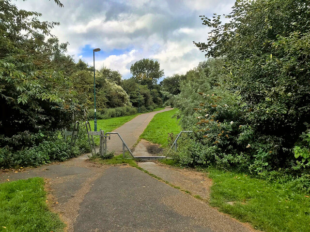
Farm Lodge Reservoir Images

Images are sourced within 2km of 53.558213/-2.3483433 or Grid Reference SD7706. Thanks to Geograph Open Source API. All images are credited.

Manchester, Bolton and Bury Canal, Angling Lodge at Radcliffe Formerly a lodge serving the Water Lane Mill at Radcliffe. Now used by anglers.
Manchester, Bolton and Bury Canal, Angling Lodge at Radcliffe
Formerly a lodge serving the Water Lane Mill at Radcliffe. Now used by anglers.
Radcliffe, Church Street
Radcliffe, Water Street
Footbridge over Pilkington Way
Greenbank Road Part of a housing development from the 1990s.
Greenbank Road
Part of a housing development from the 1990s.
Radcliffe, Pavilion Walk Bungalows outside the cricket ground.
Radcliffe, Pavilion Walk
Bungalows outside the cricket ground.
Robert Street Car Park
Radcliffe, Robertson Street
WWII Lancashire: Ghost Signs of the Home Front  (5) -
Constellation Mill, Ainsworth Road, Radcliffe

"Gas Cleansing Centre"

The fear of poison gas or of chemical weapons being used by the enemy was a very real threat in 1940. In preparation for this eventuality Decontamination Centres were set up throughout the country; this building on Ainsworth Road, Radcliffe was such a centre during the war, it retains its old sign, proclaiming "Gas Cleansing Centre".

<a href="https://www.geograph.org.uk/photo/6945038">SD7708 : WWII Lancashire: Ghost Signs of the Home Front  (6)</a>
WWII Lancashire: Ghost Signs of the Home Front (5)
- Constellation Mill, Ainsworth Road, Radcliffe "Gas Cleansing Centre" The fear of poison gas or of chemical weapons being used by the enemy was a very real threat in 1940. In preparation for this eventuality Decontamination Centres were set up throughout the country; this building on Ainsworth Road, Radcliffe was such a centre during the war, it retains its old sign, proclaiming "Gas Cleansing Centre". SD7708 : WWII Lancashire: Ghost Signs of the Home Front (6)
WWII Lancashire: Ghost Signs of the Home Front  (6) -
Constellation Mill, Ainsworth Road, Radcliffe

"Gas Cleansing Centre"

<a href="https://www.geograph.org.uk/photo/6945041">SD7708 : WWII Lancashire: Ghost Signs of the Home Front  (7)</a>
WWII Lancashire: Ghost Signs of the Home Front (6)
- Constellation Mill, Ainsworth Road, Radcliffe "Gas Cleansing Centre" SD7708 : WWII Lancashire: Ghost Signs of the Home Front (7)
WWII Lancashire: Ghost Signs of the Home Front  (7) -
Constellation Mill, Ainsworth Road, Radcliffe

"Gas Cleansing Centre". A fine example of the signwriters' art.

<a href="https://www.geograph.org.uk/photo/6945052">SD8110 : WWII Lancashire: Ghost Signs of the Home Front  (8)</a>
WWII Lancashire: Ghost Signs of the Home Front (7)
- Constellation Mill, Ainsworth Road, Radcliffe "Gas Cleansing Centre". A fine example of the signwriters' art. SD8110 : WWII Lancashire: Ghost Signs of the Home Front (8)
Banana Path The footpath running from Cemetery Road/Greenbank Road to Belgrave Street/Chestnut Fold. Behind the bushes to the left of the photograph are the houses of Shetland Way; behind those on the right, is the "Cemetery Road Household Waste Recycling Centre" (aka "Radcliffe Tip").
Banana Path
The footpath running from Cemetery Road/Greenbank Road to Belgrave Street/Chestnut Fold. Behind the bushes to the left of the photograph are the houses of Shetland Way; behind those on the right, is the "Cemetery Road Household Waste Recycling Centre" (aka "Radcliffe Tip").
Bee on Lavender
Bee on Lavender
Evening on the Canal The Manchester Bolton & Bury Canal is a disused canal, built to link Bolton and Bury with Manchester. The canal, when fully completed in 1796, was 15 miles long. It was connected  with the River Irwell in Salford, in 1808.

From Salford the canal ran up the Irwell valley to reach Nob End, where it climbed the  Prestolee Locks, and then split  into two branches leading to Bolton and Bury. The canal was built principally to serve the many collieries in the area, as well as to transport other cargo such as stone and timber. 

By 1846 a parallel railway had been built to Bury, and the canal went into decline. The Bolton arm went out of use in 1924, though with some minor use until 1947. The Bury arm was breached just above Nob End in 1936, but the then isolated Bury arm continued to be used until 1951, principally between the canalside Ladyshore Colliery and Bury. The final section of the canal was officially closed in 1961, and much of it was filled in.
.

<span class="nowrap"><a title="http://www.mangeogsoc.org.uk/egm/3_3.pdf" rel="nofollow ugc noopener" href="http://www.mangeogsoc.org.uk/egm/3_3.pdf">Link</a><img style="margin-left:2px;" alt="External link" title="External link - shift click to open in new window" src="https://s1.geograph.org.uk/img/external.png" width="10" height="10"/></span>  Exploring Greater Manchester, a fieldwork guide (web edition); edited by Paul Hindle, Manchester Geographical Society
<span class="nowrap"><a title="http://en.wikipedia.org/wiki/Manchester_Bolton_%26_Bury_Canal" rel="nofollow ugc noopener" href="http://en.wikipedia.org/wiki/Manchester_Bolton_%26_Bury_Canal">Link</a><img style="margin-left:2px;" alt="External link" title="External link - shift click to open in new window" src="https://s1.geograph.org.uk/img/external.png" width="10" height="10"/></span> Wikipedia article
<span class="nowrap"><a title="http://www.mbbcs.org.uk/" rel="nofollow ugc noopener" href="http://www.mbbcs.org.uk/">Link</a><img style="margin-left:2px;" alt="External link" title="External link - shift click to open in new window" src="https://s1.geograph.org.uk/img/external.png" width="10" height="10"/></span> Manchester Bolton & Bury Canal Society website
<span class="nowrap"><a title="http://www.penninewaterways.co.uk/mbb/index.htm" rel="nofollow ugc noopener" href="http://www.penninewaterways.co.uk/mbb/index.htm">Link</a><img style="margin-left:2px;" alt="External link" title="External link - shift click to open in new window" src="https://s1.geograph.org.uk/img/external.png" width="10" height="10"/></span>  Manchester, Bolton and Bury Canal, Pennine Waterways
Evening on the Canal
The Manchester Bolton & Bury Canal is a disused canal, built to link Bolton and Bury with Manchester. The canal, when fully completed in 1796, was 15 miles long. It was connected with the River Irwell in Salford, in 1808. From Salford the canal ran up the Irwell valley to reach Nob End, where it climbed the Prestolee Locks, and then split into two branches leading to Bolton and Bury. The canal was built principally to serve the many collieries in the area, as well as to transport other cargo such as stone and timber. By 1846 a parallel railway had been built to Bury, and the canal went into decline. The Bolton arm went out of use in 1924, though with some minor use until 1947. The Bury arm was breached just above Nob End in 1936, but the then isolated Bury arm continued to be used until 1951, principally between the canalside Ladyshore Colliery and Bury. The final section of the canal was officially closed in 1961, and much of it was filled in. . LinkExternal link Exploring Greater Manchester, a fieldwork guide (web edition); edited by Paul Hindle, Manchester Geographical Society LinkExternal link Wikipedia article LinkExternal link Manchester Bolton & Bury Canal Society website LinkExternal link Manchester, Bolton and Bury Canal, Pennine Waterways
Banana Path, Radcliffe
Radcliffe, Sheaf Field Walk
Radcliffe Bridge Blackburn Street/Stand Lane crossing the River Irwell. The first bridge here was probably built in mediaeval times at the site of a ford where the Manchester to Blackburn packhorse route (now Blackburn Street) passed through the hamlet which became known as Radcliffe Bridge. The present bridge dates from the first half of the nineteenth century (or earlier); the earliest known photograph of the bridge (<span class="nowrap"><a title="https://en.wikipedia.org/wiki/File:Radcliffe_Bridge.jpg" rel="nofollow ugc noopener" href="https://en.wikipedia.org/wiki/File:Radcliffe_Bridge.jpg">Link</a><img style="margin-left:2px;" alt="External link" title="External link - shift click to open in new window" src="https://s1.geograph.org.uk/img/external.png" width="10" height="10"/></span> Wikimedia Commons) is from ca1854.

The floral tributes and soft toys at the base of the parapet relate to a tragic incident that occurred on 11th September 2019 (<span class="nowrap"><a title="https://www.manchestereveningnews.co.uk/news/greater-manchester-news/radcliffe-baby-river-irwell-live-16904265" rel="nofollow ugc noopener" href="https://www.manchestereveningnews.co.uk/news/greater-manchester-news/radcliffe-baby-river-irwell-live-16904265">Link</a><img style="margin-left:2px;" alt="External link" title="External link - shift click to open in new window" src="https://s1.geograph.org.uk/img/external.png" width="10" height="10"/></span> Manchester Evening News report).
Radcliffe Bridge
Blackburn Street/Stand Lane crossing the River Irwell. The first bridge here was probably built in mediaeval times at the site of a ford where the Manchester to Blackburn packhorse route (now Blackburn Street) passed through the hamlet which became known as Radcliffe Bridge. The present bridge dates from the first half of the nineteenth century (or earlier); the earliest known photograph of the bridge (LinkExternal link Wikimedia Commons) is from ca1854. The floral tributes and soft toys at the base of the parapet relate to a tragic incident that occurred on 11th September 2019 (LinkExternal link Manchester Evening News report).
Dale Street, Radcliffe Bus Station Looking across Dale Street towards the bus station and, beyond that, the Lidl supermarket.
Dale Street, Radcliffe Bus Station
Looking across Dale Street towards the bus station and, beyond that, the Lidl supermarket.
Show me another place!

Farm Lodge Reservoir is located at Grid Ref: SD7706 (Lat: 53.558213, Lng: -2.3483433)

Unitary Authority: Bury

Police Authority: Greater Manchester

What 3 Words

///focus.certified.bridge. Near Radcliffe, Manchester

Nearby Locations

Farm Lodge Reservoir

Related Wikis

Radcliffe Power Station

Radcliffe Power Station was a coal-fired power station in Radcliffe, Greater Manchester, England. == History == The station was opened on 9 October 1905...

Ladyshore Colliery

Ladyshore Colliery, originally named Back o' th Barn, was situated on the Irwell Valley fault on the Manchester Coalfield in Little Lever, then in the...

Lever Bank Bleach Works

Lever Bank Bleach Works was a Bleach Works at Ladyshore, near Little Lever, Bolton. The works was owned by Thomas Ridgway & Sons. Former British Prime...

Outwood Viaduct

Outwood Viaduct is a Grade II listed railway viaduct crossing the River Irwell in Radcliffe, Greater Manchester. Following a period of disuse, it was...

Nearby Amenities

Located within 500m of 53.558213,-2.3483433
Traffic Calming: chicane
Lat/Long: 53.5608358/-2.3484344
Noexit: yes
Lat/Long: 53.5607074/-2.342082
Power: tower
Lat/Long: 53.5602837/-2.3545834
Power: tower
Lat/Long: 53.557799/-2.3556558
Power: tower
Lat/Long: 53.5604564/-2.3533276
Power: tower
Lat/Long: 53.5577416/-2.3510638
Traffic Calming: chicane
Lat/Long: 53.5608055/-2.3443975
Barrier: bollard
Lat/Long: 53.5549715/-2.3438612
Mount Sion Steam Crane
Man Made: crane
Lat/Long: 53.5575046/-2.3526397
Power: pole
Lat/Long: 53.5573795/-2.353992
Power: pole
Lat/Long: 53.5580233/-2.3536086
Power: pole
Lat/Long: 53.5590438/-2.3530323
Power: pole
Lat/Long: 53.5597301/-2.3526793
Power: pole
Lat/Long: 53.5600472/-2.3524813
Traffic Calming: chicane
Lat/Long: 53.561869/-2.3494871
Noexit: yes
Lat/Long: 53.5617968/-2.3455487
Barrier: cycle_barrier
Lat/Long: 53.5601017/-2.3421479
Traffic Calming: chicane
Lat/Long: 53.5600682/-2.3461016
Generator Method: photovoltaic
Generator Output Electricity: yes
Generator Source: solar
Generator Type: solar_photovoltaic_panel
Location: roof
Power: generator
Lat/Long: 53.5620314/-2.3502095
Generator Method: photovoltaic
Generator Output Electricity: yes
Generator Source: solar
Generator Type: solar_photovoltaic_panel
Location: roof
Power: generator
Lat/Long: 53.5604861/-2.3493753
Generator Method: photovoltaic
Generator Output Electricity: yes
Generator Source: solar
Generator Type: solar_photovoltaic_panel
Location: roof
Power: generator
Lat/Long: 53.5592785/-2.3448021
Generator Method: photovoltaic
Generator Output Electricity: yes
Generator Source: solar
Generator Type: solar_photovoltaic_panel
Location: roof
Power: generator
Lat/Long: 53.5597389/-2.3437775
Generator Method: photovoltaic
Generator Output Electricity: yes
Generator Source: solar
Generator Type: solar_photovoltaic_panel
Location: roof
Power: generator
Lat/Long: 53.5600002/-2.3438795
Generator Method: photovoltaic
Generator Output Electricity: yes
Generator Source: solar
Generator Type: solar_photovoltaic_panel
Location: roof
Power: generator
Lat/Long: 53.5600496/-2.3443569
Generator Method: photovoltaic
Generator Output Electricity: yes
Generator Source: solar
Generator Type: solar_photovoltaic_panel
Location: roof
Power: generator
Lat/Long: 53.5600448/-2.3444374
Generator Method: photovoltaic
Generator Output Electricity: yes
Generator Source: solar
Generator Type: solar_photovoltaic_panel
Location: roof
Power: generator
Lat/Long: 53.5615041/-2.3441155
Generator Method: photovoltaic
Generator Output Electricity: yes
Generator Source: solar
Generator Type: solar_photovoltaic_panel
Location: roof
Power: generator
Lat/Long: 53.5613034/-2.3444897
Generator Method: photovoltaic
Generator Output Electricity: yes
Generator Source: solar
Generator Type: solar_photovoltaic_panel
Location: roof
Power: generator
Lat/Long: 53.5610752/-2.3452729
Generator Method: photovoltaic
Generator Output Electricity: yes
Generator Source: solar
Generator Type: solar_photovoltaic_panel
Location: roof
Power: generator
Lat/Long: 53.5614129/-2.3496207
Generator Method: photovoltaic
Generator Output Electricity: yes
Generator Source: solar
Generator Type: solar_photovoltaic_panel
Location: roof
Power: generator
Lat/Long: 53.5613309/-2.3500432
Generator Method: photovoltaic
Generator Output Electricity: yes
Generator Source: solar
Generator Type: solar_photovoltaic_panel
Location: roof
Power: generator
Lat/Long: 53.5619709/-2.3480785
Generator Method: photovoltaic
Generator Output Electricity: yes
Generator Source: solar
Generator Type: solar_photovoltaic_panel
Location: roof
Power: generator
Lat/Long: 53.5610947/-2.3428535
Generator Method: photovoltaic
Generator Output Electricity: yes
Generator Source: solar
Generator Type: solar_photovoltaic_panel
Location: roof
Power: generator
Lat/Long: 53.5606068/-2.3431271
Generator Method: photovoltaic
Generator Output Electricity: yes
Generator Source: solar
Generator Type: solar_photovoltaic_panel
Location: roof
Power: generator
Lat/Long: 53.5603105/-2.3434972
Generator Method: photovoltaic
Generator Output Electricity: yes
Generator Source: solar
Generator Type: solar_photovoltaic_panel
Location: roof
Power: generator
Lat/Long: 53.5603152/-2.3433631
Generator Method: photovoltaic
Generator Output Electricity: yes
Generator Source: solar
Generator Type: solar_photovoltaic_panel
Location: roof
Power: generator
Lat/Long: 53.5600046/-2.3433095
Generator Method: photovoltaic
Generator Output Electricity: yes
Generator Source: solar
Generator Type: solar_photovoltaic_panel
Location: roof
Power: generator
Lat/Long: 53.5597501/-2.3429823
Generator Method: photovoltaic
Generator Output Electricity: yes
Generator Source: solar
Generator Type: solar_photovoltaic_panel
Location: roof
Power: generator
Lat/Long: 53.5594235/-2.343406
Generator Method: photovoltaic
Generator Output Electricity: yes
Generator Source: solar
Generator Type: solar_photovoltaic_panel
Location: roof
Power: generator
Lat/Long: 53.5591642/-2.3436743
Generator Method: photovoltaic
Generator Output Electricity: yes
Generator Source: solar
Generator Type: solar_photovoltaic_panel
Location: roof
Power: generator
Lat/Long: 53.5591805/-2.3442147
Generator Method: photovoltaic
Generator Output Electricity: yes
Generator Source: solar
Generator Type: solar_photovoltaic_panel
Location: roof
Power: generator
Lat/Long: 53.5592793/-2.345124
Generator Method: photovoltaic
Generator Output Electricity: yes
Generator Source: solar
Generator Type: solar_photovoltaic_panel
Location: roof
Power: generator
Lat/Long: 53.5592689/-2.3449738
Generator Method: photovoltaic
Generator Output Electricity: yes
Generator Source: solar
Generator Type: solar_photovoltaic_panel
Location: roof
Power: generator
Lat/Long: 53.5596495/-2.345331
Power: pole
Lat/Long: 53.5607855/-2.3527354
Power: pole
Lat/Long: 53.5615352/-2.3529676
Power: pole
Lat/Long: 53.5616701/-2.3517254
Power: pole
Lat/Long: 53.5609941/-2.3510158
Mount Sion Beam Pump
Listed Status: Grade II
Man Made: pumping_station
Url: https://historicengland.org.uk/listing/the-list/list-entry/1393833
Lat/Long: 53.5552346/-2.3511838
Distance: 9 Miles to Manchester
Waterway: milestone
Lat/Long: 53.5575361/-2.3524706
Distance: 9 1/2 Miles to Manchester
Waterway: milestone
Lat/Long: 53.5564515/-2.3424483
Distance: 9 1/4 Miles to Manchester
Waterway: milestone
Lat/Long: 53.555868/-2.3475189
The data included in this document is from www.openstreetmap.org. The data is made available under ODbL.

Have you been to Farm Lodge Reservoir?

Leave your review of Farm Lodge Reservoir below (or comments, questions and feedback).