Hoccum Pool

Lake, Pool, Pond, Freshwater Marsh in Shropshire

England

Hoccum Pool

Stanmore Hall Touring Park A very high class site set among mature trees and with a 2 acre lake.
Stanmore Hall Touring Park Credit: Ken Walton

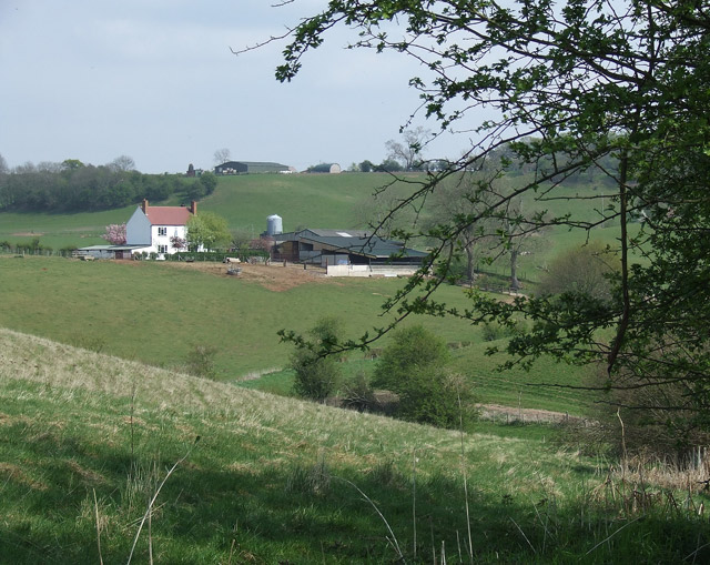
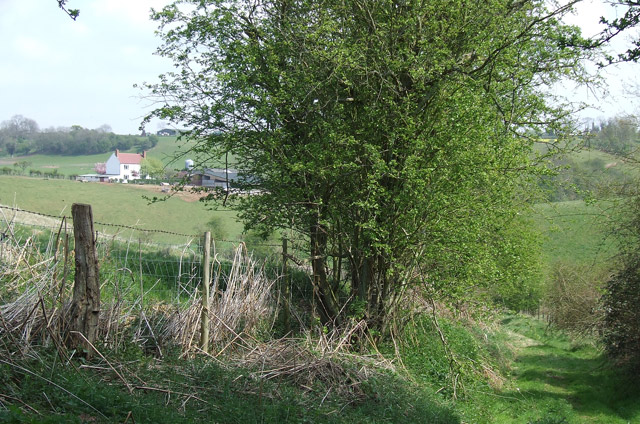
Hoccum Pool, located in Shropshire, England, is a picturesque freshwater marsh that has long been a favorite spot for locals and tourists alike. Nestled amidst the rolling hills and lush greenery, this natural wonder offers a tranquil and serene environment for visitors to enjoy.

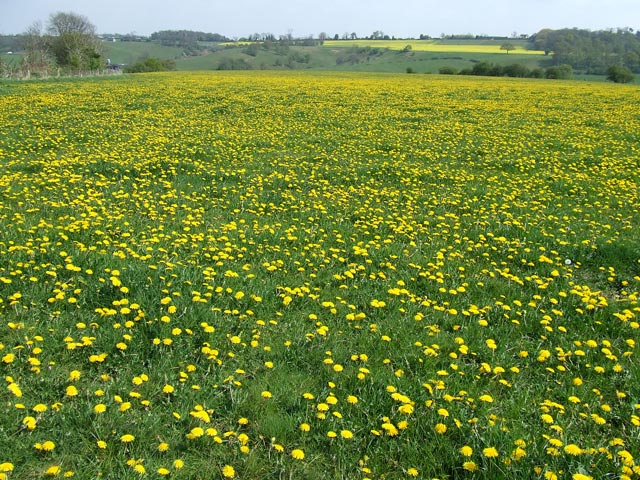
Covering an area of approximately 10 acres, Hoccum Pool is a beautiful body of water that resembles a small lake or pond. It boasts crystal-clear, freshwater that supports a diverse ecosystem of aquatic plants and animals. The pool is fed by natural springs and rainfall, ensuring a constant flow of clean water throughout the year.

Surrounded by reed beds, marsh grasses, and a variety of wildflowers, Hoccum Pool provides a haven for numerous bird species, making it a paradise for birdwatchers. Common sightings include the majestic heron, the colorful kingfisher, and the elusive bittern. The pool also attracts other wildlife such as otters, water voles, and dragonflies, adding to its ecological significance.

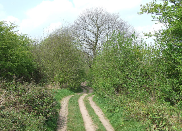
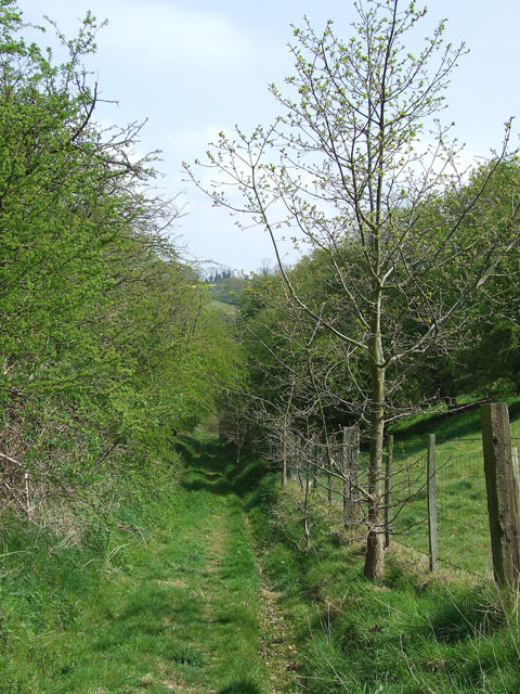
Visitors to Hoccum Pool can explore the area through a network of well-maintained walking trails that wind their way around the pool and through the surrounding wetlands. These trails offer breathtaking views of the pool and the surrounding countryside, making it ideal for nature lovers and photographers.

Hoccum Pool is easily accessible, with ample parking facilities and nearby amenities. The site is popular for activities such as fishing, picnicking, and wildlife observation. It also serves as an educational resource, with guided nature walks and informative signage highlighting the importance of wetland conservation.

In conclusion, Hoccum Pool in Shropshire is a stunning freshwater marsh that showcases the beauty and diversity of the natural world. Its tranquil atmosphere, abundant wildlife, and scenic trails make it a must-visit destination for anyone seeking a peaceful retreat in the heart of nature.

If you have any feedback on the listing, please let us know in the comments section below.

Hoccum Pool Images

Images are sourced within 2km of 52.532483/-2.3710486 or Grid Reference SO7492. Thanks to Geograph Open Source API. All images are credited.

Stanmore Hall Touring Park A very high class site set among mature trees and with a 2 acre lake.
Stanmore Hall Touring Park
A very high class site set among mature trees and with a 2 acre lake.
Old Lodge Farm
Old Lodge Farm
Cottages, Roughton
Cottages, Roughton
Near Lower Lodge Farm
Barnsley Lane Landfill
Crop fields near Barnsley in Shropshire The gently undulating nature of much of the land is ideal for crops of many sorts.
Crop fields near Barnsley in Shropshire
The gently undulating nature of much of the land is ideal for crops of many sorts.
Shropshire pasture and Rowdale House Farm near Woundale The hilly nature of this area and its sandy subsoil mean the land is best kept under grass.
Shropshire pasture and Rowdale House Farm near Woundale
The hilly nature of this area and its sandy subsoil mean the land is best kept under grass.
Byway near Upper Farmcote in Shropshire Looking north, there is mixed woodland (Bridal Coppice and Morfe Covert) off to the left, and pasture off to the right of this tree lined byway.
Byway near Upper Farmcote in Shropshire
Looking north, there is mixed woodland (Bridal Coppice and Morfe Covert) off to the left, and pasture off to the right of this tree lined byway.
Public Footpath, Barnsley, Shropshire A very attractive rural pathway between the fields.
Public Footpath, Barnsley, Shropshire
A very attractive rural pathway between the fields.
Public Footpath, Barnsley, Shropshire The path dips down here, towards Rowdale House Farm (left of hedge).
Public Footpath, Barnsley, Shropshire
The path dips down here, towards Rowdale House Farm (left of hedge).
Dead Football Ground with Dandelions, Barnsley, Shropshire The building is the former changing rooms (home team this end, please!). A set of goal posts still leans against one wall. Dandelion wine makers, please take note.
Dead Football Ground with Dandelions, Barnsley, Shropshire
The building is the former changing rooms (home team this end, please!). A set of goal posts still leans against one wall. Dandelion wine makers, please take note.
Yet ANOTHER Field of Yellow! Barnsley, Shropshire ........but this time a whole field of dandelions for a change! The field used to be a football ground. The former changing rooms in the north-western corner are marked on this 1:50000 map, but not on the 1:25000 maps of 1999 or 2006.
Yet ANOTHER Field of Yellow! Barnsley, Shropshire
........but this time a whole field of dandelions for a change! The field used to be a football ground. The former changing rooms in the north-western corner are marked on this 1:50000 map, but not on the 1:25000 maps of 1999 or 2006.
The Hobbins Post Office The Hobbins is an isolated estate of former RAF married quarters at Stanmore near Bridgnorth.
The Hobbins Post Office
The Hobbins is an isolated estate of former RAF married quarters at Stanmore near Bridgnorth.
Chapel Lane, near Quatford, Shropshire Very attractive deciduous woodland extends to the left, and crop fields to the right. (Looking towards Stanmore, one kilometre).
Chapel Lane, near Quatford, Shropshire
Very attractive deciduous woodland extends to the left, and crop fields to the right. (Looking towards Stanmore, one kilometre).
Field, and Quatford House, Shropshire Taken from the fringe of the woodland to the east. A rectangular walled garden is  situated to the right of the house.
Field, and Quatford House, Shropshire
Taken from the fringe of the woodland to the east. A rectangular walled garden is situated to the right of the house.
The road to Hoccum In fact the road is not fit for anything other than pedestrians and horses as it swiftly narrows to a single track after the first bend.
The road to Hoccum
In fact the road is not fit for anything other than pedestrians and horses as it swiftly narrows to a single track after the first bend.
The White and Yellow of May. Near Stanmore, Shropshire Hawthorn blossom in the hedges contrasts beautifully with the yellow of the rape crop. Hermitage Farm is central on the skyline.
The White and Yellow of May. Near Stanmore, Shropshire
Hawthorn blossom in the hedges contrasts beautifully with the yellow of the rape crop. Hermitage Farm is central on the skyline.
Strange neighbours The industrial estate and country park both occupy parts of the former RAF Training Camp at Stanmore near Bridgnorth.

The ground rises gently up to a narrow band of woodland on a sandstone ridge above the River Severn.
Strange neighbours
The industrial estate and country park both occupy parts of the former RAF Training Camp at Stanmore near Bridgnorth. The ground rises gently up to a narrow band of woodland on a sandstone ridge above the River Severn.
Show me another place!

Hoccum Pool is located at Grid Ref: SO7492 (Lat: 52.532483, Lng: -2.3710486)

Unitary Authority: Shropshire

Police Authority: West Mercia

What 3 Words

///unfocused.knowledge.pegs. Near Bridgnorth, Shropshire

Nearby Locations

Hoccum Pool Stanmore

Related Wikis

Barnsley, Shropshire

Barnsley is a village in Shropshire, England. == External links == Media related to Barnsley, Shropshire at Wikimedia Commons

RAF Bridgnorth

Royal Air Force Bridgnorth or more simply RAF Bridgnorth is a former Royal Air Force station, created after the outbreak of the Second World War on 6 November...

Stanmore Country Park, Bridgnorth

Stanmore Country Park (officially Stanmore Camp Countryside Site) is a 100-acre (40 ha) country park in Stanmore, Shropshire, 1.2 miles (2 km) east of...

Burcote

Burcote is a village near Bridgnorth in Shropshire, England. == External links == Media related to Burcote at Wikimedia Commons

Nearby Amenities

Located within 500m of 52.532483,-2.3710486
Marker: aerial
Operator: CLH
Operator Old: GPSS
Utility: oil
Lat/Long: 52.53676/-2.3730187
Marker: aerial
Operator: CLH
Operator Old: GPSS
Ref: MP 2880
Ref GPSS: 18043
Utility: oil
Lat/Long: 52.5331695/-2.3726962
The data included in this document is from www.openstreetmap.org. The data is made available under ODbL.

Have you been to Hoccum Pool?

Leave your review of Hoccum Pool below (or comments, questions and feedback).