Chatwell, Great

Settlement in Staffordshire South Staffordshire

England

Chatwell, Great

View east of the B5314 at Plough Bank The large building in the middle distance is a centre for the distribution of agricultural produce.
View east of the B5314 at Plough Bank Credit: Christopher Hilton

Chatwell is a small village located in the county of Staffordshire, England. It is situated in the district of Great, which is known for its picturesque landscapes and charming rural communities. With a population of around 300 residents, Chatwell offers a peaceful and idyllic setting for those seeking a tranquil lifestyle.

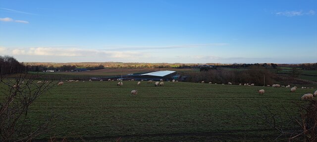
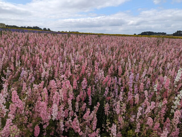
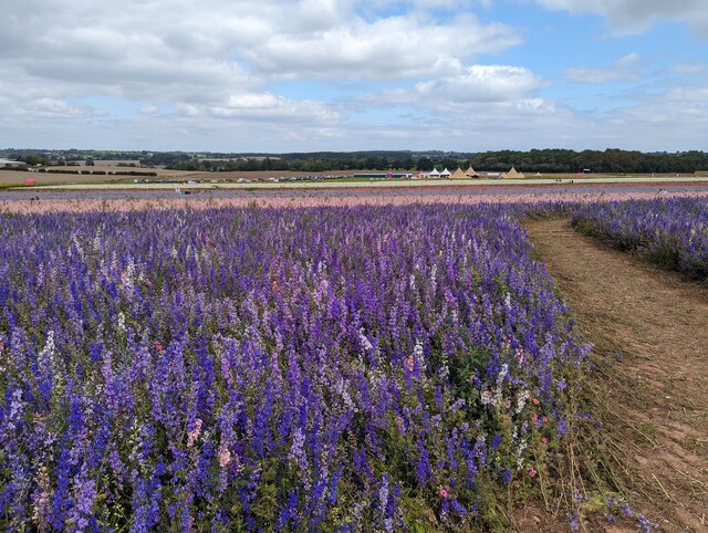
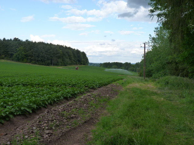
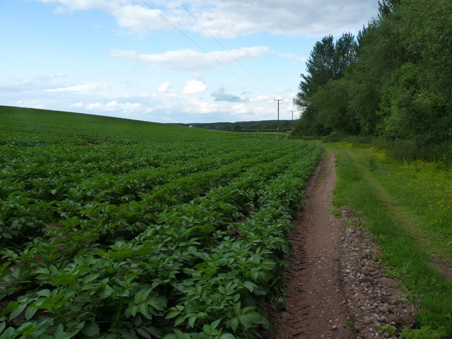
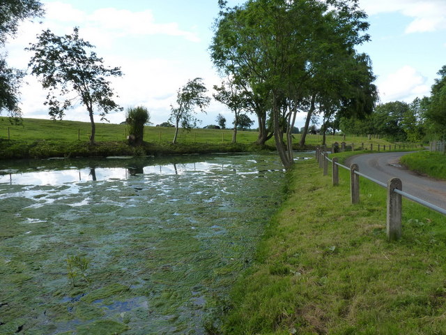
The village is surrounded by rolling hills and lush green fields, creating a breathtaking backdrop for its residents. It boasts a close-knit community where neighbors often come together to organize events and social gatherings. The village is known for its friendly atmosphere and welcoming locals.

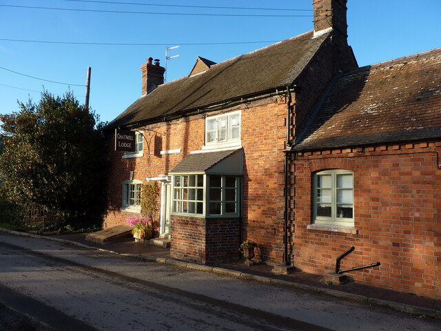
Despite its small size, Chatwell has a rich history that can be traced back to medieval times. The village is home to several historic buildings, including a beautiful church that dates back to the 13th century. These architectural gems give the village a sense of character and charm.

In terms of amenities, Chatwell is well-equipped to cater to the needs of its residents. The village has a local pub, which serves as a hub for socializing and enjoying traditional British cuisine. Additionally, there are a few small businesses and shops that provide essential goods and services.

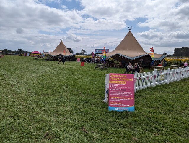
For outdoor enthusiasts, Chatwell offers ample opportunities for exploring the surrounding countryside. The village is located near several walking and cycling trails, allowing residents to immerse themselves in the natural beauty of Staffordshire.

Overall, Chatwell is a peaceful and picturesque village that offers a tight-knit community, beautiful landscapes, and a rich history. It is an ideal place for those who seek a tranquil and rural lifestyle in the heart of Staffordshire.

If you have any feedback on the listing, please let us know in the comments section below.

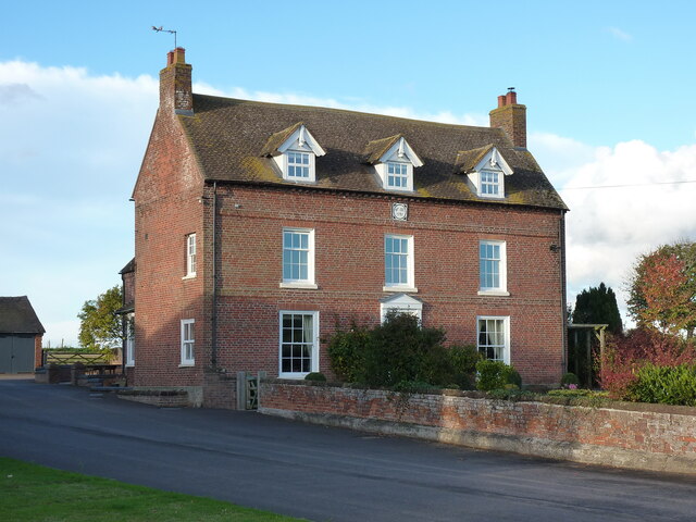
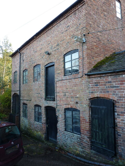
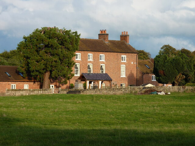
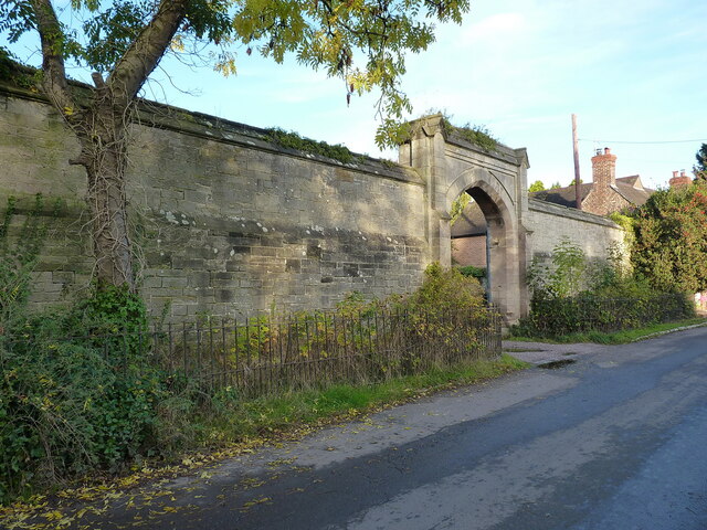
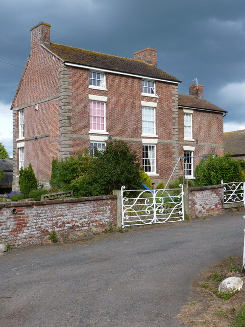
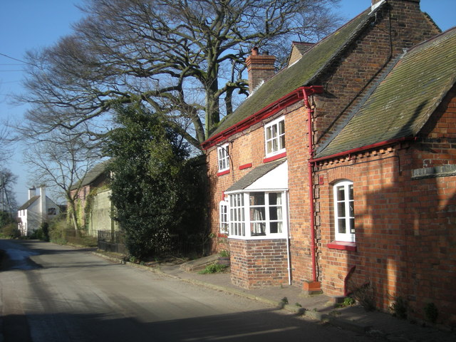
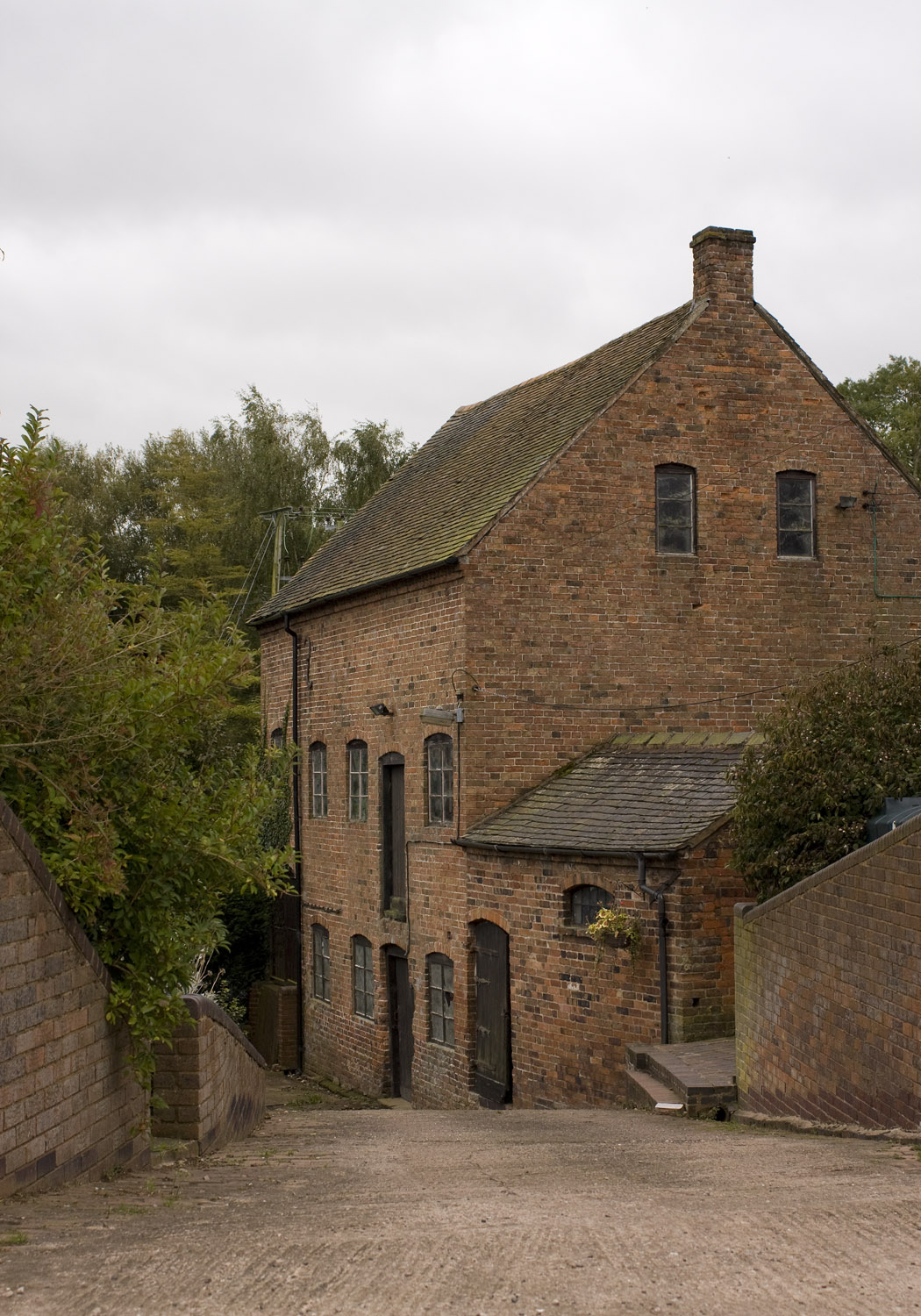
Chatwell, Great Images

Images are sourced within 2km of 52.726827/-2.305 or Grid Reference SJ7914. Thanks to Geograph Open Source API. All images are credited.

View east of the B5314 at Plough Bank The large building in the middle distance is a centre for the distribution of agricultural produce.
View east of the B5314 at Plough Bank
The large building in the middle distance is a centre for the distribution of agricultural produce.
Teepees set up for the Shropshire Petal Fields event The Shropshire Petal Fields is an event which this year is open for just one week, from 4 August to 13 August, allowing people to walk around the flower-filled fields which are grown for Confetti.
Teepees set up for the Shropshire Petal Fields event
The Shropshire Petal Fields is an event which this year is open for just one week, from 4 August to 13 August, allowing people to walk around the flower-filled fields which are grown for Confetti.
Field of pink flowers The Shropshire Petal Fields is an event which this year is open for just one week, from 4 August to 13 August, allowing people to walk around the flower-filled fields which are grown for Confetti.
Field of pink flowers
The Shropshire Petal Fields is an event which this year is open for just one week, from 4 August to 13 August, allowing people to walk around the flower-filled fields which are grown for Confetti.
Field of purple flowers The Shropshire Petal Fields is an event which this year is open for just one week, from 4 August to 13 August, allowing people to walk around the flower-filled fields which are grown for Confetti.
Field of purple flowers
The Shropshire Petal Fields is an event which this year is open for just one week, from 4 August to 13 August, allowing people to walk around the flower-filled fields which are grown for Confetti.
Sign in a field of purple flowers The Shropshire Petal Fields is an event which this year is open for just one week, from 4 August to 13 August, allowing people to walk around the flower-filled fields which are grown for Confetti.
Sign in a field of purple flowers
The Shropshire Petal Fields is an event which this year is open for just one week, from 4 August to 13 August, allowing people to walk around the flower-filled fields which are grown for Confetti.
Harvesting the crops
Shropshire Petal Fields The Shropshire Petal Fields is an event which this year is open for just one week, from 4 August to 13 August, allowing people to walk around the flower-filled fields which are grown for Confetti.
Shropshire Petal Fields
The Shropshire Petal Fields is an event which this year is open for just one week, from 4 August to 13 August, allowing people to walk around the flower-filled fields which are grown for Confetti.
Byre and hayloft at Court Farm, Chatwell A building of two distinct vintages. The far end, timber-framed, is 17th century whilst the nearer part is much more like 19th century in origin, and has been more changed over the years. The whole structure was Grade II listed <span class="nowrap"><a title="https://historicengland.org.uk/listing/the-list/list-entry/1053644" rel="nofollow ugc noopener" href="https://historicengland.org.uk/listing/the-list/list-entry/1053644">Link</a><img style="margin-left:2px;" alt="External link" title="External link - shift click to open in new window" src="https://s1.geograph.org.uk/img/external.png" width="10" height="10"/></span> & <span class="nowrap"><a title="https://britishlistedbuildings.co.uk/101053644-byre-and-hayloft-approximately-20-metres-to-south-east-of-court-farmhouse-sheriffhales" rel="nofollow ugc noopener" href="https://britishlistedbuildings.co.uk/101053644-byre-and-hayloft-approximately-20-metres-to-south-east-of-court-farmhouse-sheriffhales">Link</a><img style="margin-left:2px;" alt="External link" title="External link - shift click to open in new window" src="https://s1.geograph.org.uk/img/external.png" width="10" height="10"/></span> in 1984.
Byre and hayloft at Court Farm, Chatwell
A building of two distinct vintages. The far end, timber-framed, is 17th century whilst the nearer part is much more like 19th century in origin, and has been more changed over the years. The whole structure was Grade II listed LinkExternal link & LinkExternal link in 1984.
Grange Farmhouse near Chatwell Beneath the 19th century brick refacing lies a much older (17th century?) timber framed farmhouse, which was extended in the 1730s. It was Grade II listed <span class="nowrap"><a title="https://historicengland.org.uk/listing/the-list/list-entry/1053643" rel="nofollow ugc noopener" href="https://historicengland.org.uk/listing/the-list/list-entry/1053643">Link</a><img style="margin-left:2px;" alt="External link" title="External link - shift click to open in new window" src="https://s1.geograph.org.uk/img/external.png" width="10" height="10"/></span> & <span class="nowrap"><a title="https://britishlistedbuildings.co.uk/101053643-grange-farmhouse-sheriffhales" rel="nofollow ugc noopener" href="https://britishlistedbuildings.co.uk/101053643-grange-farmhouse-sheriffhales">Link</a><img style="margin-left:2px;" alt="External link" title="External link - shift click to open in new window" src="https://s1.geograph.org.uk/img/external.png" width="10" height="10"/></span> in 1984.
Grange Farmhouse near Chatwell
Beneath the 19th century brick refacing lies a much older (17th century?) timber framed farmhouse, which was extended in the 1730s. It was Grade II listed LinkExternal link & LinkExternal link in 1984.
Chadwell Mill building A 19th century water-driven grain mill, currently containing a remarkably-complete set of interior machinery and waterwheel. It was Grade II listed <span class="nowrap"><a title="https://britishlistedbuildings.co.uk/101367627-chadwell-mill-sheriffhales" rel="nofollow ugc noopener" href="https://britishlistedbuildings.co.uk/101367627-chadwell-mill-sheriffhales">Link</a><img style="margin-left:2px;" alt="External link" title="External link - shift click to open in new window" src="https://s1.geograph.org.uk/img/external.png" width="10" height="10"/></span> & <span class="nowrap"><a title="https://historicengland.org.uk/listing/the-list/list-entry/1367627" rel="nofollow ugc noopener" href="https://historicengland.org.uk/listing/the-list/list-entry/1367627">Link</a><img style="margin-left:2px;" alt="External link" title="External link - shift click to open in new window" src="https://s1.geograph.org.uk/img/external.png" width="10" height="10"/></span> in 1984, and at the time of my visit in late 2022 the owner said it had been recently bought for conversion to a home. Hopefully much/all of the surviving machinery, which is mentioned in the listing, will be turned into interior features.
Chadwell Mill building
A 19th century water-driven grain mill, currently containing a remarkably-complete set of interior machinery and waterwheel. It was Grade II listed LinkExternal link & LinkExternal link in 1984, and at the time of my visit in late 2022 the owner said it had been recently bought for conversion to a home. Hopefully much/all of the surviving machinery, which is mentioned in the listing, will be turned into interior features.
Great Chatwell House farmhouse The core of this substantial rural farmhouse is 18th century, with a later additional bay on the right. It was Grade II listed <span class="nowrap"><a title="https://historicengland.org.uk/listing/the-list/list-entry/1178111" rel="nofollow ugc noopener" href="https://historicengland.org.uk/listing/the-list/list-entry/1178111">Link</a><img style="margin-left:2px;" alt="External link" title="External link - shift click to open in new window" src="https://s1.geograph.org.uk/img/external.png" width="10" height="10"/></span> & <span class="nowrap"><a title="https://britishlistedbuildings.co.uk/101178111-great-chatwell-house-farmhouse-and-attached-implement-shed-blymhill-and-weston-under-lizard" rel="nofollow ugc noopener" href="https://britishlistedbuildings.co.uk/101178111-great-chatwell-house-farmhouse-and-attached-implement-shed-blymhill-and-weston-under-lizard">Link</a><img style="margin-left:2px;" alt="External link" title="External link - shift click to open in new window" src="https://s1.geograph.org.uk/img/external.png" width="10" height="10"/></span> in 1985, along with the single-storey implement shed seen here to its left (which looks to have been converted to residential use)
Great Chatwell House farmhouse
The core of this substantial rural farmhouse is 18th century, with a later additional bay on the right. It was Grade II listed LinkExternal link & LinkExternal link in 1985, along with the single-storey implement shed seen here to its left (which looks to have been converted to residential use)
Chatwell Court screen and entrance wall This mid 19th century construction is thought to incorporate a section of an earlier house, but was mainly built to smarten up the approach to Chatwell Court house a distance to the rear. It was Grade II listed <span class="nowrap"><a title="https://britishlistedbuildings.co.uk/101374056-screen-and-entrance-wall-to-chatwell-court-driveway-blymhill-and-weston-under-lizard" rel="nofollow ugc noopener" href="https://britishlistedbuildings.co.uk/101374056-screen-and-entrance-wall-to-chatwell-court-driveway-blymhill-and-weston-under-lizard">Link</a><img style="margin-left:2px;" alt="External link" title="External link - shift click to open in new window" src="https://s1.geograph.org.uk/img/external.png" width="10" height="10"/></span> & <span class="nowrap"><a title="https://historicengland.org.uk/listing/the-list/list-entry/1374056" rel="nofollow ugc noopener" href="https://historicengland.org.uk/listing/the-list/list-entry/1374056">Link</a><img style="margin-left:2px;" alt="External link" title="External link - shift click to open in new window" src="https://s1.geograph.org.uk/img/external.png" width="10" height="10"/></span> in 1985, and has recently been opened up by the removal of the large tree that overhung it a few years ago <a href="https://www.geograph.org.uk/photo/2462206">SJ7914 : A grand entrance</a>
Chatwell Court screen and entrance wall
This mid 19th century construction is thought to incorporate a section of an earlier house, but was mainly built to smarten up the approach to Chatwell Court house a distance to the rear. It was Grade II listed LinkExternal link & LinkExternal link in 1985, and has recently been opened up by the removal of the large tree that overhung it a few years ago SJ7914 : A grand entrance
Chadwell/Chatwell Lodge The maps and other sources are in slight disagreement about the exact spelling, but either way this was once The Cock Inn, lying pretty much right opposite <a href="https://www.geograph.org.uk/photo/5235506">SJ7914 : The Red Lion, Great Chatwell</a>. It dates from the early 18th century, with later alterations, and was Grade II listed <span class="nowrap"><a title="https://britishlistedbuildings.co.uk/101374055-chatwell-lodge-blymhill-and-weston-under-lizard" rel="nofollow ugc noopener" href="https://britishlistedbuildings.co.uk/101374055-chatwell-lodge-blymhill-and-weston-under-lizard">Link</a><img style="margin-left:2px;" alt="External link" title="External link - shift click to open in new window" src="https://s1.geograph.org.uk/img/external.png" width="10" height="10"/></span> & <span class="nowrap"><a title="https://historicengland.org.uk/listing/the-list/list-entry/1374055" rel="nofollow ugc noopener" href="https://historicengland.org.uk/listing/the-list/list-entry/1374055">Link</a><img style="margin-left:2px;" alt="External link" title="External link - shift click to open in new window" src="https://s1.geograph.org.uk/img/external.png" width="10" height="10"/></span> in 1985.
Chadwell/Chatwell Lodge
The maps and other sources are in slight disagreement about the exact spelling, but either way this was once The Cock Inn, lying pretty much right opposite SJ7914 : The Red Lion, Great Chatwell. It dates from the early 18th century, with later alterations, and was Grade II listed LinkExternal link & LinkExternal link in 1985.
The footpath is about to get muddy And it did - the rain gun watering the tatties made sure of that.
The footpath is about to get muddy
And it did - the rain gun watering the tatties made sure of that.
Footpath near The Roundabout The squarish copse to the north of this path alongside the potato field is called The Roundabout; no idea why. The valley that the path run in also forms the boundary between Shropshire Council and the Telford & Wrekin Unitary Authority.
Footpath near The Roundabout
The squarish copse to the north of this path alongside the potato field is called The Roundabout; no idea why. The valley that the path run in also forms the boundary between Shropshire Council and the Telford & Wrekin Unitary Authority.
Bolamsbrook cottages
The upper millpool at Chadwell The lower, larger pool is blessed hard to get to - surrounded by dense vegetation, and fenced off from the road to boot.
The upper millpool at Chadwell
The lower, larger pool is blessed hard to get to - surrounded by dense vegetation, and fenced off from the road to boot.
Chadwell Court A large and well-kept Georgian farmhouse at Chadwell; it dates from the mid 18th century and was Grade II listed <span class="nowrap"><a title="https://britishlistedbuildings.co.uk/101367626-court-farmhouse-sheriffhales" rel="nofollow ugc noopener" href="https://britishlistedbuildings.co.uk/101367626-court-farmhouse-sheriffhales">Link</a><img style="margin-left:2px;" alt="External link" title="External link - shift click to open in new window" src="https://s1.geograph.org.uk/img/external.png" width="10" height="10"/></span> & <span class="nowrap"><a title="https://historicengland.org.uk/listing/the-list/list-entry/1367626" rel="nofollow ugc noopener" href="https://historicengland.org.uk/listing/the-list/list-entry/1367626">Link</a><img style="margin-left:2px;" alt="External link" title="External link - shift click to open in new window" src="https://s1.geograph.org.uk/img/external.png" width="10" height="10"/></span> in 1984.
Chadwell Court
A large and well-kept Georgian farmhouse at Chadwell; it dates from the mid 18th century and was Grade II listed LinkExternal link & LinkExternal link in 1984.
Show me another place!

Chatwell, Great is located at Grid Ref: SJ7914 (Lat: 52.726827, Lng: -2.305)

Administrative County: Staffordshire

District: South Staffordshire

Police Authority: Staffordshire

What 3 Words

///missions.quiz.skinning. Near Woodcote, Shropshire

Related Wikis

Great Chatwell

Great Chatwell is a small village within the civil parish of Blymhill and Weston-under-Lizard, in the South Staffordshire district of Staffordshire, England...

Chadwell, Shropshire

Chadwell is a hamlet in the county of Shropshire, England. It lies 1/2 mile west of the village of Great Chatwell over the Staffordshire border and comprises...

Orslow

Orslow is an upland hamlet in Staffordshire, England, 0.75 miles (1.21 km) north-east of Great Chatwell. Its Anglo-Saxon name means 'Horsa's burial mound...

White Sitch

White Sitch is a 19th Century designed landscape by John Webb containing a picturesque reservoir in the middle, one mile west of Blymhill in Staffordshire...

Nearby Amenities

Located within 500m of 52.726827,-2.305
Great Chatwell
Created By: Potlatch 0.10f
Place: hamlet
Wikidata: Q5598958
Lat/Long: 52.728035/-2.3088151
Bus Stop
Red Lion Inn PH
Bus: yes
Naptan AtcoCode: 3800C604600
Naptan Bearing: W
Naptan CommonName: Red Lion Inn PH
Naptan Indicator: Adj
Naptan Landmark: Red Lion Inn PH
Naptan Street: Main Road
Naptan Verified: no
Public Transport: platform
Source: naptan_import
Lat/Long: 52.7268374/-2.3071756
Bus Stop
Red Lion Inn PH
Bus: yes
Naptan AtcoCode: 3800C604601
Naptan Bearing: E
Naptan CommonName: Red Lion Inn PH
Naptan Indicator: Opp
Naptan Landmark: Red Lion Inn PH
Naptan Street: Main Rd
Naptan Verified: no
Public Transport: platform
Source: naptan_import
Lat/Long: 52.7268821/-2.3071399
Barrier: stile
Lat/Long: 52.7256898/-2.3002644
Barrier: yes
Lat/Long: 52.7283591/-2.3083479
Generator Method: photovoltaic
Generator Output Electricity: yes
Generator Solar Modules: 16
Generator Source: solar
Generator Type: solar_photovoltaic_panel
Location: roof
Power: generator
Lat/Long: 52.7283234/-2.3073167
The data included in this document is from www.openstreetmap.org. The data is made available under ODbL.

Have you been to Chatwell, Great?

Leave your review of Chatwell, Great below (or comments, questions and feedback).