Grange Pool

Lake, Pool, Pond, Freshwater Marsh in Shropshire

England

Grange Pool

Holmer Lake from the A442, Queenway
Holmer Lake from the A442, Queenway Credit: Ian S

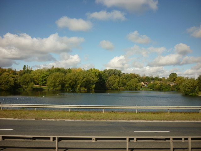
Grange Pool is a picturesque freshwater lake located in the county of Shropshire, England. Nestled within a serene natural setting, this body of water offers a tranquil retreat for both locals and visitors alike. Spanning an area of approximately 30 acres, the pool is surrounded by lush greenery, creating a scenic and idyllic atmosphere.

The pool boasts crystal-clear waters, reflecting the beauty of the surrounding landscape. It is fed by various natural springs, ensuring a constant flow of fresh water. The depth of the lake varies across its expanse, ranging from shallow areas perfect for wading to deeper sections ideal for swimming or fishing.

Grange Pool is renowned for its diverse aquatic ecosystem. The lake supports a wide array of fish species, including carp, pike, and perch, making it a popular destination for anglers. Additionally, the pool is home to various waterfowl, such as ducks and swans, which can often be seen gliding gracefully across the water's surface.

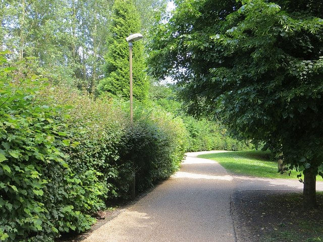
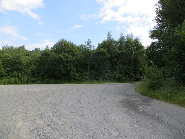
Surrounding the lake, visitors can find well-maintained footpaths that allow for leisurely strolls or hiking. The paths wind through a freshwater marsh, adding to the area's natural charm. Grange Pool also offers several designated picnic spots, where visitors can relax and enjoy a meal while immersing themselves in the serene ambiance.

For those seeking a more active experience, the lake provides opportunities for canoeing and kayaking. The calm waters and scenic surroundings make it an excellent spot for water-based activities. Additionally, the pool is equipped with a small boathouse, offering boat rental services for those interested in exploring the lake further.

Overall, Grange Pool is a haven of natural beauty and tranquility. Whether it's fishing, bird-watching, or simply enjoying a peaceful day in nature, this Shropshire gem has something to offer for everyone.

If you have any feedback on the listing, please let us know in the comments section below.

Grange Pool Images

Images are sourced within 2km of 52.659542/-2.4426166 or Grid Reference SJ7006. Thanks to Geograph Open Source API. All images are credited.

Holmer Lake from the A442, Queenway
Telford International Hotel Typical modern sleeping facility.
Telford International Hotel
Typical modern sleeping facility.
St. Quentin Roundabout Taken from the entrance to the nearby hotel.
St. Quentin Roundabout
Taken from the entrance to the nearby hotel.
Nedge Lane, Telford Leading under the A442 towards Nedge Farm.
Nedge Lane, Telford
Leading under the A442 towards Nedge Farm.
A464 nears Randlay Roundabout
A442 nears Tweedale Interchange
Site of a one-time OS benchmark This recently-rendered house (Oak House, I think is the name) originally had an OS benchmark on this wall. It's no longer visible, if indeed it survives under the rendering.
Site of a one-time OS benchmark
This recently-rendered house (Oak House, I think is the name) originally had an OS benchmark on this wall. It's no longer visible, if indeed it survives under the rendering.
OS benchmark - Hollinswood, Garage behind no 66 Deercote A relatively modern OS cutmark in the brickwork of a garage on the Hollinswood estate; originally levelled in 1986 at 136.773m above Ordnance Datum Newlyn.
OS benchmark - Hollinswood, Garage behind no 66 Deercote
A relatively modern OS cutmark in the brickwork of a garage on the Hollinswood estate; originally levelled in 1986 at 136.773m above Ordnance Datum Newlyn.
OS benchmark - Hollinswood, no 65 Duffryn An OS cutmark on a garden wall belonging to no 65 Duffryn; originally levelled in 1984 at 136.598m above Ordnance Datum Newlyn.
OS benchmark - Hollinswood, no 65 Duffryn
An OS cutmark on a garden wall belonging to no 65 Duffryn; originally levelled in 1984 at 136.598m above Ordnance Datum Newlyn.
OS rivet - Hollinswood, bridge over Queensway An OS cutmark and rivet on the concrete parapet of the footbridge over the A442 Queensway dual carriageway; originally levelled in 1986 at 147.451m above Ordnance Datum Newlyn.
OS rivet - Hollinswood, bridge over Queensway
An OS cutmark and rivet on the concrete parapet of the footbridge over the A442 Queensway dual carriageway; originally levelled in 1986 at 147.451m above Ordnance Datum Newlyn.
OS benchmark - Hollinswood, rear of 133 Dunsheath An OS benchmark in the bricks of the garden wall at the rear of 133 Dunsheath, facing onto Dale Acre Way. Originally levelled in 1984 at 150.697m above Ordnance Datum Newlyn.
OS benchmark - Hollinswood, rear of 133 Dunsheath
An OS benchmark in the bricks of the garden wall at the rear of 133 Dunsheath, facing onto Dale Acre Way. Originally levelled in 1984 at 150.697m above Ordnance Datum Newlyn.
OS benchmark - Hollinswood, rear of 19 Dunsheath OS cutmark in the garden wall at the rear of no 19 Dunsheath; originally levelled in 1984 at 139.933m above Ordnance Datum Newlyn.
OS benchmark - Hollinswood, rear of 19 Dunsheath
OS cutmark in the garden wall at the rear of no 19 Dunsheath; originally levelled in 1984 at 139.933m above Ordnance Datum Newlyn.
Car Park
Car Park
Two houses under construction
Grange Fencing, Halesfield Grange Fencing are a large manufacturer of wooden garden products, and occupy a couple of sites on either side of the road through the Halesfield industrial estate.
Grange Fencing, Halesfield
Grange Fencing are a large manufacturer of wooden garden products, and occupy a couple of sites on either side of the road through the Halesfield industrial estate.
Unit 4, Heslop One of the older industrial buildings on the Heslop/Halesfield estate. This one was formerly the materials testing laboratory of the Telford Development Corporation, which undertook quality assessments on the various building materials being supplied to, and used by, the firms building the Telford New Town in the late 1960s and early 1970s. My father ran the place through much of that period. It is now occupied by car repair workshops and other light industrial uses.
Unit 4, Heslop
One of the older industrial buildings on the Heslop/Halesfield estate. This one was formerly the materials testing laboratory of the Telford Development Corporation, which undertook quality assessments on the various building materials being supplied to, and used by, the firms building the Telford New Town in the late 1960s and early 1970s. My father ran the place through much of that period. It is now occupied by car repair workshops and other light industrial uses.
Telford Town Park A more formal part of the park on landscaped colliery sites.
Telford Town Park
A more formal part of the park on landscaped colliery sites.
Car park, Telford Town Park
Show me another place!

Grange Pool is located at Grid Ref: SJ7006 (Lat: 52.659542, Lng: -2.4426166)

Unitary Authority: Telford and Wrekin

Police Authority: West Mercia

What 3 Words

///retina.swanky.enveloped. Near Telford, Shropshire

Related Wikis

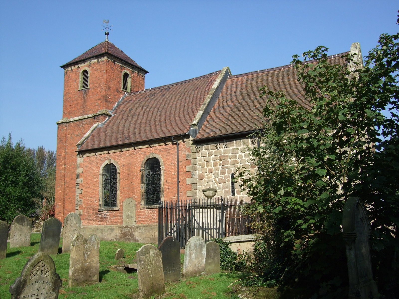
St James' Church, Stirchley

St James' Church is a redundant Anglican church in Stirchley, Shropshire, England. The church is recorded in the National Heritage List for England as...
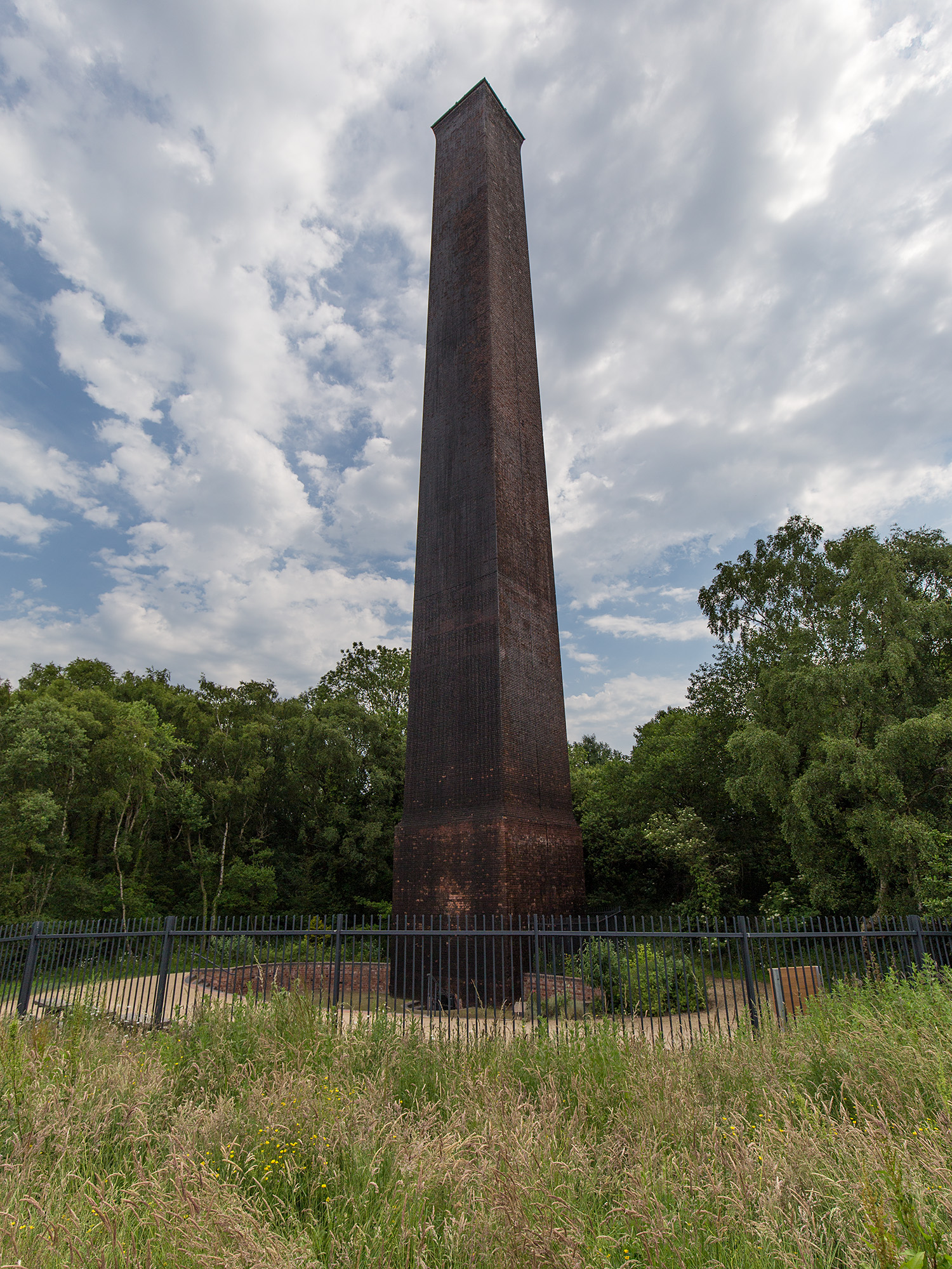
Stirchley Chimney

Stirchley Chimney is a chimney located in Telford Town Park. The chimney also marks a notable waypoint on the South Telford Heritage Trail. Measuring 209...
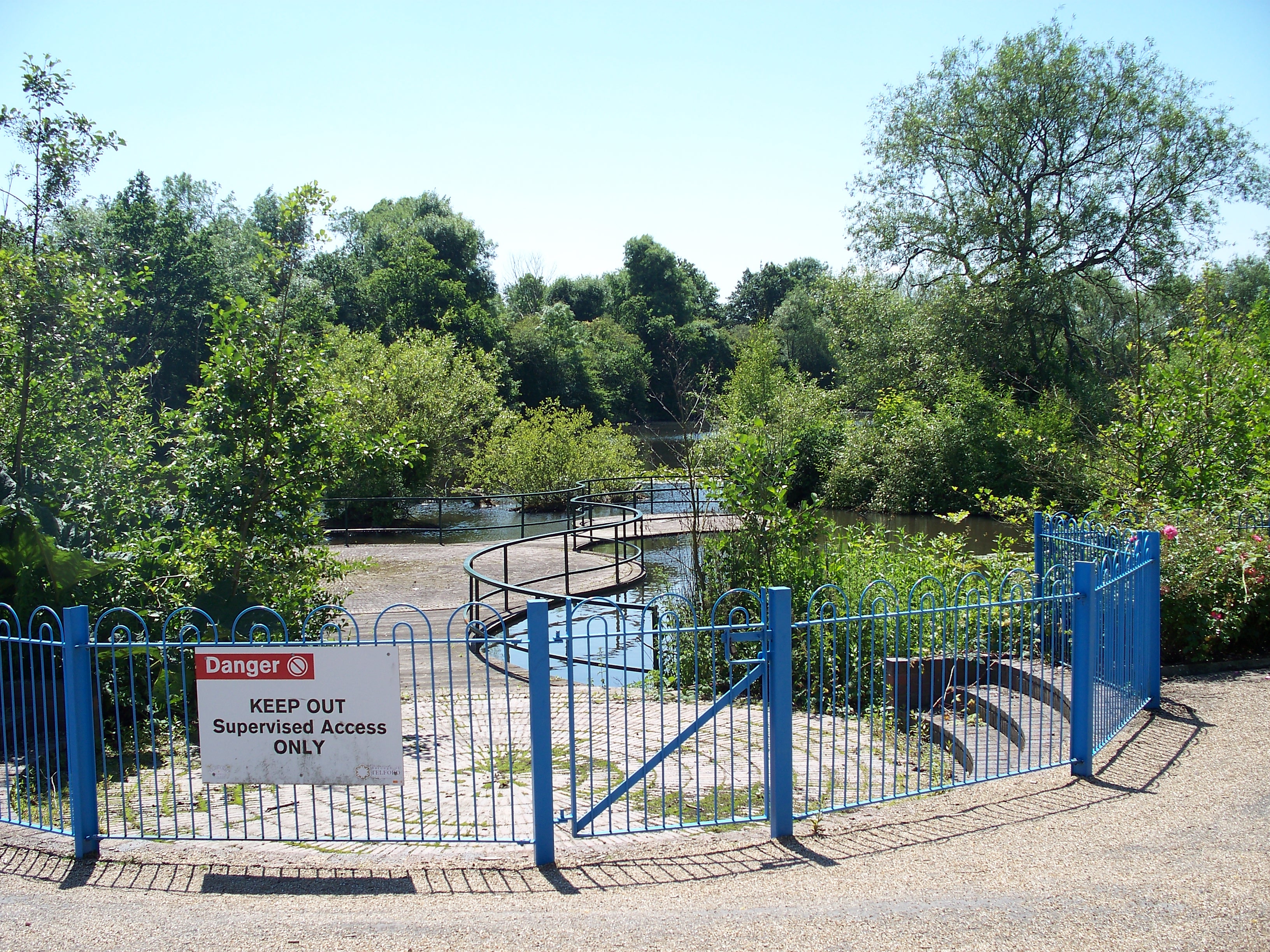
Telford Town Park

Telford Town Park is a park and Local Nature Reserve in Telford in Shropshire. In 2015, it was voted "UK's Best Park" in the inaugural public competition...

Dawley and Stirchley railway station

Dawley and Stirchley railway station was a station in Dawley, Shropshire, England. The station was opened in 1861 and closed in 1952. == References... ==

Telford Park School

The Telford Park School is a coeducational secondary school located in Stirchley, Telford, Shropshire, England. The school grounds was first established...

Brookside, Telford

Brookside is a housing estate and borough and parish council ward in Telford, Shropshire, England. The original settlement of Brookside is a Radburn estate...

Stirchley, Shropshire

Stirchley is a large village and suburb of Telford, in the borough of Telford and Wrekin and ceremonial county of Shropshire, England. Stirchley lies just...

South Telford Heritage Trail

The South Telford Heritage Trail is a circular, waymarked walking route that passes by forty-nine heritage sites in the English town of Telford. ��2�...

Nearby Amenities

Located within 500m of 52.659542,-2.4426166
Bench
Source: survey
Lat/Long: 52.6631173/-2.4439958
Fletcher's Pool
Information: nature
Source: survey
Tourism: information
Lat/Long: 52.6609464/-2.4460212
Noexit: yes
Lat/Long: 52.6603648/-2.4449366
Stirchley
Place: suburb
Lat/Long: 52.6571088/-2.4464701
Addr Country: GB
Addr Housenumber: 1
Addr Street: Northwood Terrace
Source: survey
Lat/Long: 52.660101/-2.4462292
Addr Country: GB
Addr Housenumber: 5
Addr Street: Northwood Terrace
Source: survey
Lat/Long: 52.6597846/-2.4461732
Post Box
Brand: Royal Mail
Brand Wikidata: Q638098
Collection Times: Mo-Fr 09:00; Sa 07:00
Operator: Royal Mail
Operator Wikidata: Q638098
Post Box Mounting: pier
Post Box Type: lamp
Ref: TF3 167D
Royal Cypher: EIIR
Royal Cypher Wikidata: Q33102113
Lat/Long: 52.6573854/-2.445965
Parking
Parking: surface
Source: OS_OpenData_StreetView
Lat/Long: 52.660083/-2.4422685
Generator Method: photovoltaic
Generator Output Electricity: yes
Generator Source: solar
Generator Type: solar_photovoltaic_panel
Location: roof
Power: generator
Lat/Long: 52.6632008/-2.4426502
Generator Method: photovoltaic
Generator Output Electricity: yes
Generator Source: solar
Generator Type: solar_photovoltaic_panel
Location: roof
Power: generator
Lat/Long: 52.6603067/-2.4402416
Generator Method: photovoltaic
Generator Output Electricity: yes
Generator Source: solar
Generator Type: solar_photovoltaic_panel
Location: roof
Power: generator
Lat/Long: 52.6603002/-2.4401075
Generator Method: photovoltaic
Generator Output Electricity: yes
Generator Source: solar
Generator Type: solar_photovoltaic_panel
Location: roof
Power: generator
Lat/Long: 52.6613983/-2.4400806
Generator Method: photovoltaic
Generator Output Electricity: yes
Generator Source: solar
Generator Type: solar_photovoltaic_panel
Location: roof
Power: generator
Lat/Long: 52.661356/-2.4399546
Generator Method: photovoltaic
Generator Output Electricity: yes
Generator Source: solar
Generator Type: solar_photovoltaic_panel
Location: roof
Power: generator
Lat/Long: 52.6605898/-2.4375567
Generator Method: photovoltaic
Generator Output Electricity: yes
Generator Source: solar
Generator Type: solar_photovoltaic_panel
Location: roof
Power: generator
Lat/Long: 52.6606272/-2.4374279
Generator Method: photovoltaic
Generator Output Electricity: yes
Generator Source: solar
Generator Type: solar_photovoltaic_panel
Location: roof
Power: generator
Lat/Long: 52.6604564/-2.4367386
Generator Method: photovoltaic
Generator Output Electricity: yes
Generator Source: solar
Generator Type: solar_photovoltaic_panel
Location: roof
Power: generator
Lat/Long: 52.6605068/-2.4357864
Generator Method: photovoltaic
Generator Output Electricity: yes
Generator Source: solar
Generator Type: solar_photovoltaic_panel
Location: roof
Power: generator
Lat/Long: 52.6609412/-2.4360815
Crossing
Lat/Long: 52.6618984/-2.4388176
Generator Method: photovoltaic
Generator Output Electricity: yes
Generator Source: solar
Generator Type: solar_photovoltaic_panel
Location: roof
Power: generator
Lat/Long: 52.6601489/-2.439284
Generator Method: photovoltaic
Generator Output Electricity: yes
Generator Source: solar
Generator Type: solar_photovoltaic_panel
Location: roof
Power: generator
Lat/Long: 52.6601489/-2.4392277
Generator Method: photovoltaic
Generator Output Electricity: yes
Generator Source: solar
Generator Type: solar_photovoltaic_panel
Location: roof
Power: generator
Lat/Long: 52.6603328/-2.4384767
Generator Method: photovoltaic
Generator Output Electricity: yes
Generator Source: solar
Generator Type: solar_photovoltaic_panel
Location: roof
Power: generator
Lat/Long: 52.6588474/-2.435655
Generator Method: photovoltaic
Generator Output Electricity: yes
Generator Source: solar
Generator Type: solar_photovoltaic_panel
Location: roof
Power: generator
Lat/Long: 52.6585318/-2.4369478
Generator Method: photovoltaic
Generator Output Electricity: yes
Generator Source: solar
Generator Type: solar_photovoltaic_panel
Location: roof
Power: generator
Lat/Long: 52.6591305/-2.4357569
Generator Method: photovoltaic
Generator Output Electricity: yes
Generator Source: solar
Generator Type: solar_photovoltaic_panel
Location: roof
Power: generator
Lat/Long: 52.6590605/-2.4358267
Generator Method: photovoltaic
Generator Output Electricity: yes
Generator Source: solar
Generator Type: solar_photovoltaic_panel
Location: roof
Power: generator
Lat/Long: 52.6595405/-2.4382407
Generator Method: photovoltaic
Generator Output Electricity: yes
Generator Source: solar
Generator Type: solar_photovoltaic_panel
Location: roof
Power: generator
Lat/Long: 52.6554307/-2.4422479
Generator Method: photovoltaic
Generator Output Electricity: yes
Generator Source: solar
Generator Type: solar_photovoltaic_panel
Location: roof
Power: generator
Lat/Long: 52.6555121/-2.4428567
Generator Method: photovoltaic
Generator Output Electricity: yes
Generator Source: solar
Generator Type: solar_photovoltaic_panel
Location: roof
Power: generator
Lat/Long: 52.6556862/-2.4432591
Generator Method: photovoltaic
Generator Output Electricity: yes
Generator Source: solar
Generator Type: solar_photovoltaic_panel
Location: roof
Power: generator
Lat/Long: 52.6560669/-2.4445117
Generator Method: photovoltaic
Generator Output Electricity: yes
Generator Source: solar
Generator Type: solar_photovoltaic_panel
Location: roof
Power: generator
Lat/Long: 52.6557415/-2.445901
Generator Method: photovoltaic
Generator Output Electricity: yes
Generator Source: solar
Generator Type: solar_photovoltaic_panel
Location: roof
Power: generator
Lat/Long: 52.6558782/-2.4455363
Generator Method: photovoltaic
Generator Output Electricity: yes
Generator Source: solar
Generator Type: solar_photovoltaic_panel
Location: roof
Power: generator
Lat/Long: 52.6558326/-2.4460298
Crossing
Lat/Long: 52.657542/-2.4370069
Crossing
Lat/Long: 52.6580646/-2.4375734
Crossing
Lat/Long: 52.6600955/-2.4380258
Crossing
Lat/Long: 52.6585497/-2.4381358
Crossing
Lat/Long: 52.659552/-2.4385862
Give Way
Direction: forward
Lat/Long: 52.6569166/-2.436765
Crossing
Lat/Long: 52.6569365/-2.4367071
Barrier: stile
Lat/Long: 52.6566903/-2.4476405
Barrier: kissing_gate
Lat/Long: 52.6626302/-2.4432093
Direction: both
Traffic Calming: hump
Lat/Long: 52.6575315/-2.4464496
Direction: both
Traffic Calming: hump
Lat/Long: 52.6578085/-2.445915
Direction: both
Surface: paving_stones
Traffic Calming: bump
Lat/Long: 52.6588364/-2.4423541
Direction: both
Traffic Calming: hump
Lat/Long: 52.6589022/-2.4411885
Direction: both
Traffic Calming: hump
Lat/Long: 52.6589602/-2.4399012
Direction: both
Traffic Calming: hump
Lat/Long: 52.6570128/-2.4471038
Mini Roundabout
Lat/Long: 52.6602913/-2.4377293
Give Way
Direction: backward
Lat/Long: 52.6602285/-2.4375776
Give Way
Direction: forward
Lat/Long: 52.6603581/-2.4378249
The data included in this document is from www.openstreetmap.org. The data is made available under ODbL.

Have you been to Grange Pool?

Leave your review of Grange Pool below (or comments, questions and feedback).