Back Dub

Lake, Pool, Pond, Freshwater Marsh in Westmorland Eden

England

Back Dub

Sheep in field near High Dubbs A farm and a field to the west of Newbiggin-on-Lune.
The northern slopes of the Howgill Fells rise in the distance.
Sheep in field near High Dubbs Credit: Trevor Littlewood

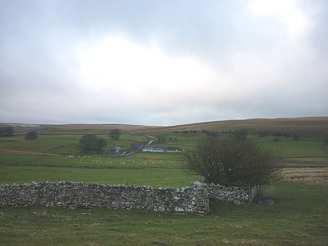
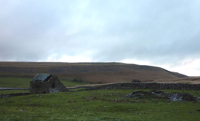
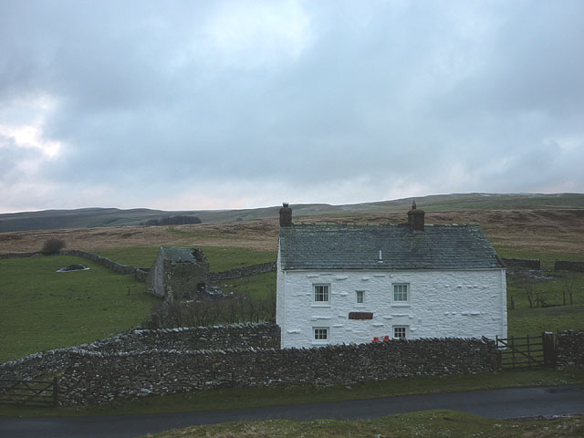
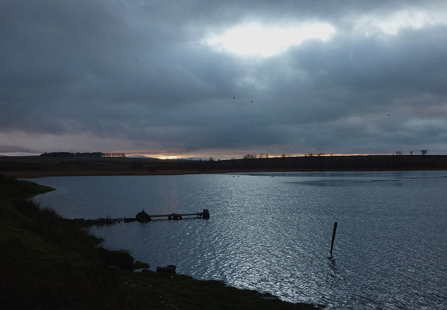
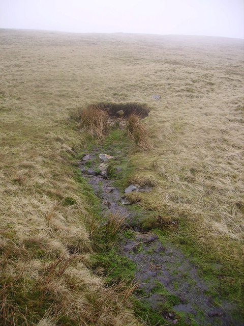
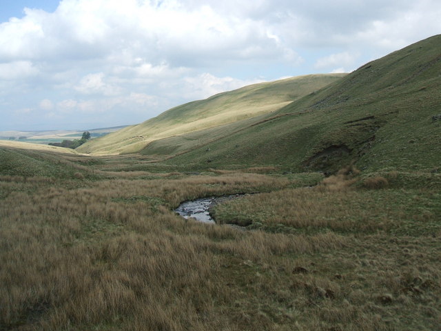
Back Dub is a small body of water located in the rural area of Westmorland, England. It is nestled within a picturesque landscape, surrounded by lush greenery and rolling hills. The term "Dub" is a local dialect word, denoting a small, natural water feature often found in this region.

Covering an area of approximately 1.5 acres, Back Dub is classified as a lake, although its size and depth classify it more accurately as a large pond. The water is sourced mainly from rainfall and natural springs in the vicinity, ensuring a constant supply of freshwater throughout the year. The water is crystal clear and exhibits a slight bluish hue, adding to the serene ambiance of the area.

The surrounding vegetation consists of a mix of reeds, grasses, and small shrubs, creating a diverse ecosystem that supports a variety of bird and aquatic life. The lake provides a habitat for various fish species, such as perch and roach, attracting anglers from the local community.

Back Dub also features a small freshwater marsh at one end, characterized by its dense growth of cattails and sedges. This marshland acts as a natural filter, purifying the water and providing a habitat for numerous species of birds, insects, and amphibians.

The lake is a popular spot for recreational activities such as fishing, birdwatching, and picnicking. The tranquil atmosphere and stunning surroundings make Back Dub an ideal destination for nature enthusiasts seeking a peaceful escape from the hustle and bustle of city life.

If you have any feedback on the listing, please let us know in the comments section below.

Back Dub Images

Images are sourced within 2km of 54.45043/-2.4820032 or Grid Reference NY6806. Thanks to Geograph Open Source API. All images are credited.

Sheep in field near High Dubbs A farm and a field to the west of Newbiggin-on-Lune.
The northern slopes of the Howgill Fells rise in the distance.
Sheep in field near High Dubbs
A farm and a field to the west of Newbiggin-on-Lune. The northern slopes of the Howgill Fells rise in the distance.
Road junction above Wath The junction is of minor roads in the valley of the River Lune, west of Newbiggin-on-Lune.
The Howgill Fells are rising at the left side of the image.
Road junction above Wath
The junction is of minor roads in the valley of the River Lune, west of Newbiggin-on-Lune. The Howgill Fells are rising at the left side of the image.
Weasdale Beck Ford This irish bridge ford on the Weasdale Beck has been substantially washed away.
Weasdale Beck Ford
This irish bridge ford on the Weasdale Beck has been substantially washed away.
Sheep near Newbiggin-on-Lune Looking across upper Lunesdale to the Howgill Fells.
Sheep near Newbiggin-on-Lune
Looking across upper Lunesdale to the Howgill Fells.
Sheep at Wath, upper Lunesdale Looking to the Howgill Fells above Weasdale and Bowderdale.
Sheep at Wath, upper Lunesdale
Looking to the Howgill Fells above Weasdale and Bowderdale.
Disused limestone quarry above Wath The rock is quite thinly bedded, no good at all for climbing.
Disused limestone quarry above Wath
The rock is quite thinly bedded, no good at all for climbing.
Boundary stone This lies on the parish boundary between Ravenstonedale and Tebay. I pulled the grass aside but couldn't make out any markings.
Boundary stone
This lies on the parish boundary between Ravenstonedale and Tebay. I pulled the grass aside but couldn't make out any markings.
Boundary wall, upper Lunesdale The cattle are grazing in Ravenstonedale parish, the Tebay cattle are nowhere to be seen. Beyond are the Howgill Fells.
Boundary wall, upper Lunesdale
The cattle are grazing in Ravenstonedale parish, the Tebay cattle are nowhere to be seen. Beyond are the Howgill Fells.
Pastures, Potlands Looking across upper Lunesdale to the Howgill fells above Bowderdale.
Pastures, Potlands
Looking across upper Lunesdale to the Howgill fells above Bowderdale.
Sunbiggin Tarn and the Howgill Fells The south end of the tarn with snow on the fells beyond.
Sunbiggin Tarn and the Howgill Fells
The south end of the tarn with snow on the fells beyond.
Wall corner at Fell Head Looking towards Mazon Wath.
Wall corner at Fell Head
Looking towards Mazon Wath.
Decrepit barn at Fell Head Looking towards Potts Valley.
Decrepit barn at Fell Head
Looking towards Potts Valley.
Fell Head No noisy neighbours here.
Fell Head
No noisy neighbours here.
Dusk at Sunbiggin Tarn The sun was low in the sky and obscured but a hole in the clouds allowed a curious bluish light to illuminate the tarn. It was almost like a moonlit night.
Dusk at Sunbiggin Tarn
The sun was low in the sky and obscured but a hole in the clouds allowed a curious bluish light to illuminate the tarn. It was almost like a moonlit night.
Burnt down hut at Sunbiggin Tarn Judging by the debris and damage to the surrounding ground this seems to have burnt down quite recently. I'm sure the hut was here in 2009 when I last visited. Here it is in 2008 <a title="https://www.geograph.org.uk/photo/1107379" href="https://www.geograph.org.uk/photo/1107379">Link</a> Deliberate arson?
Burnt down hut at Sunbiggin Tarn
Judging by the debris and damage to the surrounding ground this seems to have burnt down quite recently. I'm sure the hut was here in 2009 when I last visited. Here it is in 2008 Link Deliberate arson?
A685 approaching cutting above Bowderdale
Stream just east of Wath From A685 bridge
Stream just east of Wath
From A685 bridge
Wath and Bowderdale junction off A685
Show me another place!

Back Dub is located at Grid Ref: NY6806 (Lat: 54.45043, Lng: -2.4820032)

Administrative County: Cumbria

District: Eden

Police Authority: Cumbria

What 3 Words

///congas.hothouse.unzipped. Near Kirkby Stephen, Cumbria

Related Wikis

Sandwath Beck

Sandwath Beck is a river running through Cumbria in England. The beck rises beneath Green Bell in Ravenstonedale as Dale Gill, changing its designation...

Weasdale Beck

Weasdale Beck is a stream in Cumbria, England. The Beck rises in Ravenstonedale and drains Leathgill Bridge on Randygill Top and Great Swindale, below...

Ravenstonedale railway station

Ravenstonedale railway station was situated on the South Durham & Lancashire Union Railway (SD&LUR) between Tebay and Kirkby Stephen East. It served the...

Brownber

Brownber is a hamlet surrounding Brownber Hall near Newbiggin-on-Lune in Cumbria, England.

Bowderdale

Bowderdale is a hamlet in Cumbria, England, 6 miles (10 km) southwest of Kirkby Stephen. It is also the name of a dale in the Howgill Fells, the valley...

Sunbiggin Tarn

Sunbiggin Tarn is a tarn near Sunbiggin in Cumbria. It is in a Site of Special Scientific Interest (SSSI) which also includes the surrounding moorland...

Newbiggin-on-Lune

Newbiggin-on-Lune is a village in the Eden district of Cumbria, England. Historically in Westmorland it is about 4 miles (6.4 km) south west of Kirkby...

Weasdale

Weasdale is a small hamlet in Cumbria, England, 850 feet (260 m) above sea-level on the northern flanks of the Howgill Fells. It is located approximately...

Nearby Amenities

Located within 500m of 54.45043,-2.4820032
Ravenstonedale Moor
Place: locality
Lat/Long: 54.4525012/-2.4885505
Power: pole
Lat/Long: 54.4470028/-2.4775887
Power: pole
Lat/Long: 54.4470659/-2.4786642
Power: pole
Lat/Long: 54.4471416/-2.4799651
Power: pole
Lat/Long: 54.4472289/-2.4812767
Power: pole
Lat/Long: 54.4469123/-2.4824917
Power: pole
Lat/Long: 54.4466363/-2.4837121
Power: pole
Lat/Long: 54.4463353/-2.4848655
The data included in this document is from www.openstreetmap.org. The data is made available under ODbL.

Have you been to Back Dub?

Leave your review of Back Dub below (or comments, questions and feedback).