Holcombe Pond

Lake, Pool, Pond, Freshwater Marsh in Somerset Mendip

England

Holcombe Pond

Direction Sign – Signpost at Church Farm, Stratton on the Fosse parish Located at Church Farm on the northwest side of the junction of Church Lane, Stratton Road and Watery Lane in Stratton on the Fosse parish. 4 arms and pyramid finial.

Milestone Society National ID: SO_ST6650
Direction Sign – Signpost at Church Farm, Stratton on the Fosse parish Credit: J Dowding

Holcombe Pond is a picturesque freshwater pond located in Somerset, England. Spanning an area of approximately 5 acres, it is nestled within the tranquil surroundings of the Holcombe Moor Nature Reserve. The pond is often referred to as a lake due to its relatively large size compared to traditional ponds.

Surrounded by lush greenery, Holcombe Pond offers a serene and idyllic setting for visitors to enjoy. The crystal-clear waters of the pond are fed by natural springs and are home to a diverse range of aquatic flora and fauna. The surface of the pond is adorned with water lilies, creating a beautiful sight during the summer months.

The pond also serves as a habitat for various species of fish, including carp, perch, and roach, making it a popular spot for fishing enthusiasts. Anglers can be seen lining the banks of the pond, patiently waiting for a bite.

The surrounding area of Holcombe Pond is abundant in wildlife, with numerous bird species, such as swans, ducks, and herons, frequently seen in and around the water. The adjacent freshwater marsh provides a habitat for various wetland plants and creatures, including reed beds and dragonflies.

Holcombe Pond offers a peaceful retreat for nature lovers and those seeking a calm and tranquil environment. Visitors can enjoy leisurely walks around the pond, observing the rich biodiversity it supports. Whether it's fishing, bird-watching, or simply appreciating the natural beauty, Holcombe Pond has something for everyone.

If you have any feedback on the listing, please let us know in the comments section below.

Holcombe Pond Images

Images are sourced within 2km of 51.251471/-2.4681449 or Grid Reference ST6750. Thanks to Geograph Open Source API. All images are credited.

Direction Sign – Signpost at Church Farm, Stratton on the Fosse parish Located at Church Farm on the northwest side of the junction of Church Lane, Stratton Road and Watery Lane in Stratton on the Fosse parish. 4 arms and pyramid finial.

Milestone Society National ID: SO_ST6650
Direction Sign – Signpost at Church Farm, Stratton on the Fosse parish
Located at Church Farm on the northwest side of the junction of Church Lane, Stratton Road and Watery Lane in Stratton on the Fosse parish. 4 arms and pyramid finial. Milestone Society National ID: SO_ST6650
Downside Abbey Despite appearances, most of this abbey was built in the 20th century (see <a href="https://www.geograph.org.uk/photo/4261979">ST6550 : Downside Abbey</a> for full description). The remaining Benedictine monks who have been at Downside since 1814 plan to leave in March 2022.
Downside Abbey
Despite appearances, most of this abbey was built in the 20th century (see ST6550 : Downside Abbey for full description). The remaining Benedictine monks who have been at Downside since 1814 plan to leave in March 2022.
Turning for Chilcompton from the A367
The church of St Andrew, Holcombe
The church of St Vigor at Stratton-on-the-Fosse One of only two churches named after St Vigor.
The church of St Vigor at Stratton-on-the-Fosse
One of only two churches named after St Vigor.
Ordnance Survey Cut Mark This mark can be found on the wall of St Andrew's Church.
For more detail see : <span class="nowrap"><a title="http://www.bench-marks.org.uk/bm47754" rel="nofollow ugc noopener" href="http://www.bench-marks.org.uk/bm47754">Link</a><img style="margin-left:2px;" alt="External link" title="External link - shift click to open in new window" src="https://s1.geograph.org.uk/img/external.png" width="10" height="10"/></span>
Ordnance Survey Cut Mark
This mark can be found on the wall of St Andrew's Church. For more detail see : LinkExternal link
South porch of Old St Andrew's Church, Holcombe The late Lella Raymond, in her 1996 guide written for the Churches Conservation Trust, tells us that "the south porch holds fascinating evidence of antiquity.  The cut stone is Doulting limestone, used for Bath, Glastonbury and Wells.  The gable incorporates a Norman arch, with zigzag around it and short rolls inserted at intervals in the hollow beneath the hood.  Above the arch, in place of the keystone, is a 16th-century carved angel with wings outstretched and arms folded.  The chevron at the apex of the gable could have been carved from the tympanum ...  The walls of the porch are blind, with plain stone benches each side, one inscribed D C 1743.  The inner doorway was continuous quarter-round moulding round a four-centred arch. The door itself is a fine medieval example."
South porch of Old St Andrew's Church, Holcombe
The late Lella Raymond, in her 1996 guide written for the Churches Conservation Trust, tells us that "the south porch holds fascinating evidence of antiquity. The cut stone is Doulting limestone, used for Bath, Glastonbury and Wells. The gable incorporates a Norman arch, with zigzag around it and short rolls inserted at intervals in the hollow beneath the hood. Above the arch, in place of the keystone, is a 16th-century carved angel with wings outstretched and arms folded. The chevron at the apex of the gable could have been carved from the tympanum ... The walls of the porch are blind, with plain stone benches each side, one inscribed D C 1743. The inner doorway was continuous quarter-round moulding round a four-centred arch. The door itself is a fine medieval example."
Old St Andrew's Church, Holcombe In parkland a mile north of the village, the old church ceased to be used for regular worship when the new church in the village centre <a href="https://www.geograph.org.uk/photo/137605">ST6749 : Holcombe St Andrew</a> was opened in 1884.  It is now vested in the Churches Conservation Trust.  The 14th-century west tower shows the emerging Perpendicular style and is unbuttressed. To its west can be seen one of an avenue of Lawson cypresses.
Old St Andrew's Church, Holcombe
In parkland a mile north of the village, the old church ceased to be used for regular worship when the new church in the village centre ST6749 : Holcombe St Andrew was opened in 1884. It is now vested in the Churches Conservation Trust. The 14th-century west tower shows the emerging Perpendicular style and is unbuttressed. To its west can be seen one of an avenue of Lawson cypresses.
Downside Abbey The Basilica of St Gregory the Great is the largest neo-Gothic church, not a cathedral, in England and home to the senior community of English Benedictines.  The brothers came to Downside from Douai in northern France in 1814, as refugees from the Napoleonic regime, but most of what we see today was built in the 20th century. The cluster of eastern chapels and the transept were constructed between 1882 and 1890, the architects being Archibald Dunn and Edward Hansom.  The quire was designed by Thomas Garner and completed in 1905; the tower beyond, placed over the south transept rather than the central crossing, was completed by Sir Giles Gilbert Scott in 1938.  At 166 feet it is the tallest tower in Somerset after Wells Cathedral at 182 ft (Bath Abbey's tower is 162 ft). The great church is 74 feet high (Bath 75 ft, Exeter Cathedral 69 ft, Wells 73 ft)  and 328 feet long at present (Bristol Cathedral 338 ft), but Scott's nave still awaits its final two western bays.
Downside Abbey
The Basilica of St Gregory the Great is the largest neo-Gothic church, not a cathedral, in England and home to the senior community of English Benedictines. The brothers came to Downside from Douai in northern France in 1814, as refugees from the Napoleonic regime, but most of what we see today was built in the 20th century. The cluster of eastern chapels and the transept were constructed between 1882 and 1890, the architects being Archibald Dunn and Edward Hansom. The quire was designed by Thomas Garner and completed in 1905; the tower beyond, placed over the south transept rather than the central crossing, was completed by Sir Giles Gilbert Scott in 1938. At 166 feet it is the tallest tower in Somerset after Wells Cathedral at 182 ft (Bath Abbey's tower is 162 ft). The great church is 74 feet high (Bath 75 ft, Exeter Cathedral 69 ft, Wells 73 ft) and 328 feet long at present (Bristol Cathedral 338 ft), but Scott's nave still awaits its final two western bays.
Humped zebra Not a cross of some African animals but a speed-reducing measure along Anchor Road in Highbury.
Humped zebra
Not a cross of some African animals but a speed-reducing measure along Anchor Road in Highbury.
The Crossways garage is crushed No more petrol at this station. Having been declared redundant it has been demolished to make room for a new store and a house.
The Crossways garage is crushed
No more petrol at this station. Having been declared redundant it has been demolished to make room for a new store and a house.
A village that remembers Coleford's village signpost also provides room for a silhouette of a soldier. See <a href="https://www.geograph.org.uk/photo/7059790">ST6849 : Welcome to Coleford</a> for a better look at the hanpainted sign. The bench seat beyond marks the  Queen's Diamond Jubilee, 2012.
A village that remembers
Coleford's village signpost also provides room for a silhouette of a soldier. See ST6849 : Welcome to Coleford for a better look at the hanpainted sign. The bench seat beyond marks the Queen's Diamond Jubilee, 2012.
Welcome to Coleford A hand-painted village sign; pity the elements have taken the shine off it as it looks rather fetching. See <a href="https://www.geograph.org.uk/photo/7059781">ST6849 : A village that remembers</a> for a wider view of the roadside position.
Welcome to Coleford
A hand-painted village sign; pity the elements have taken the shine off it as it looks rather fetching. See ST6849 : A village that remembers for a wider view of the roadside position.
A post box remains The village post office was here up until quite recently, but the premises are now a piano shop. However, the postbox and a notice board remain on site.
A post box remains
The village post office was here up until quite recently, but the premises are now a piano shop. However, the postbox and a notice board remain on site.
Coleford Royal British Legion hall The hall was built in 1956, with later extensions. See <a href="https://www.geograph.org.uk/photo/7059810">ST6849 : The Legion scroll</a> for a look at the front sign and legend.
Coleford Royal British Legion hall
The hall was built in 1956, with later extensions. See ST6849 : The Legion scroll for a look at the front sign and legend.
The Legion scroll Coleford Royal British Legion hall has this stone plaque on the front that records the fallen of both world wars. It seems such an obvious place to have a war memorial, yet not many do. See <a href="https://www.geograph.org.uk/photo/7059804">ST6849 : Coleford Royal British Legion hall</a> for a location view.
The Legion scroll
Coleford Royal British Legion hall has this stone plaque on the front that records the fallen of both world wars. It seems such an obvious place to have a war memorial, yet not many do. See ST6849 : Coleford Royal British Legion hall for a location view.
Coleford Gospel Hall The village had held some meetings in various places before a worshipper, Harry Beer, drove a horse and cart to Devizes to purchase an old army hut. The corrugated hut became the first hall for the community by 1920. Later meetings were also held under canvas as the needs outgrew. Today this spacious modern hall welcomes all.
Coleford Gospel Hall
The village had held some meetings in various places before a worshipper, Harry Beer, drove a horse and cart to Devizes to purchase an old army hut. The corrugated hut became the first hall for the community by 1920. Later meetings were also held under canvas as the needs outgrew. Today this spacious modern hall welcomes all.
Coleford and Highbury signpost At the junction of Anchor Road and Church Street. Coleford is nowhere near the sea but presumably Anchor Road is named after the Anchor Inn further up the way.
Coleford and Highbury signpost
At the junction of Anchor Road and Church Street. Coleford is nowhere near the sea but presumably Anchor Road is named after the Anchor Inn further up the way.
Show me another place!

Holcombe Pond is located at Grid Ref: ST6750 (Lat: 51.251471, Lng: -2.4681449)

Administrative County: Somerset

District: Mendip

Police Authority: Avon and Somerset

What 3 Words

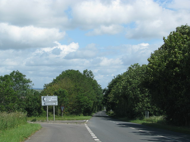
///tortoises.pilots.slate. Near Chilcompton, Somerset

Related Wikis

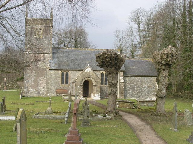
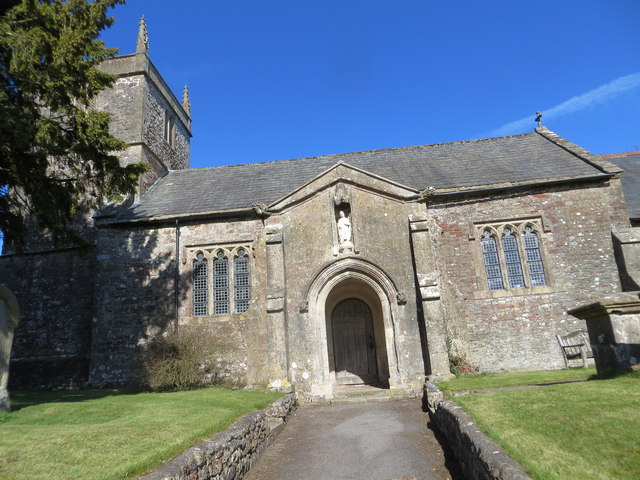
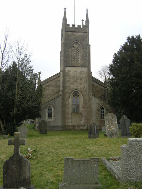
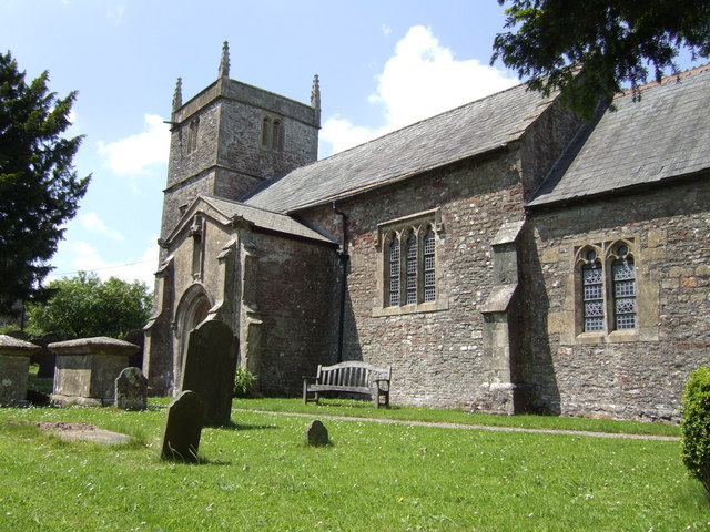
Church of St Andrew, Holcombe

The Church of St. Andrew close to Downside Abbey in Holcombe, Somerset, England has late Saxon-early Norman origins and was rebuilt in the 16th century...

Holcombe, Somerset

Holcombe is a small village and civil parish (population 936) in the Mendip local government district of Somerset, England. The parish contains the hamlets...

Coleford, Somerset

Coleford is a village and civil parish in Somerset, England, situated on the Mells River in the Mendip Hills five miles west of Frome. The parish has a...

Downside School

Downside School is a co-educational Catholic independent boarding and day school in the English public school tradition for pupils aged 11 to 18. It is...

Stratton-on-the-Fosse

Stratton-on-the-Fosse is a village and civil parish located on the edge of the Mendip Hills, 2 miles (3 km) south-west of Westfield, 6 miles (10 km) north...
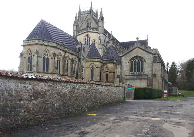
Downside Abbey

Downside Abbey is a Benedictine monastery in England and the senior community of the English Benedictine Congregation. Until 2019, the community had close...

Edford Woods and Meadows

Edford Woods and Meadows (grid reference ST665485) is a 54.3 hectare (134.1 acre) biological Site of Special Scientific Interest, between Nettlebridge...

Cook's Wood Quarry

Cook's Wood Quarry also known as Holcombe Quarry (grid reference ST669479) is a 0.8-hectare (2.0-acre) geological Site of Special Scientific Interest near...

Nearby Amenities

Located within 500m of 51.251471,-2.4681449
Barrier: kissing_gate
Lat/Long: 51.2478688/-2.471647
Power: pole
Lat/Long: 51.25048/-2.4719802
Power: pole
Lat/Long: 51.249978/-2.473619
Power: pole
Lat/Long: 51.2487155/-2.4734178
Power: pole
Lat/Long: 51.249147/-2.472648
Power: pole
Lat/Long: 51.2507805/-2.4693704
Power: pole
Lat/Long: 51.2509518/-2.4676967
Power: pole
Lat/Long: 51.2511113/-2.4661785
Power: pole
Lat/Long: 51.2512825/-2.4646604
Power: pole
Lat/Long: 51.2514554/-2.4629492
Power: pole
Lat/Long: 51.2509014/-2.4616751
The data included in this document is from www.openstreetmap.org. The data is made available under ODbL.

Have you been to Holcombe Pond?

Leave your review of Holcombe Pond below (or comments, questions and feedback).