Bromley, Great

Settlement in Essex Tendring

England

Bromley, Great

School Gate Revisited 13 years ago the hedge had only just been planted, see <a href="https://www.geograph.org.uk/photo/2079772">TM0725 : School Gate!</a>, the giant pencils are long gone and it is entirely possible the second generation of children are now being introduced to nature at the Woodland Trust's Elmstead Market site <span class="nowrap"><a title="https://www.woodlandtrust.org.uk/visiting-woods/woods/elmstead-market/?gclid=EAIaIQobChMIzqy5yKr_gAMVQ-7tCh3swgw2EAAYASAAEgKBmfD_BwE&gclsrc=aw.ds" rel="nofollow ugc noopener" href="https://www.woodlandtrust.org.uk/visiting-woods/woods/elmstead-market/?gclid=EAIaIQobChMIzqy5yKr_gAMVQ-7tCh3swgw2EAAYASAAEgKBmfD_BwE&gclsrc=aw.ds">Link</a><img style="margin-left:2px;" alt="External link" title="External link - shift click to open in new window" src="https://s1.geograph.org.uk/img/external.png" width="10" height="10"/></span>
School Gate Revisited Credit: Glyn Baker

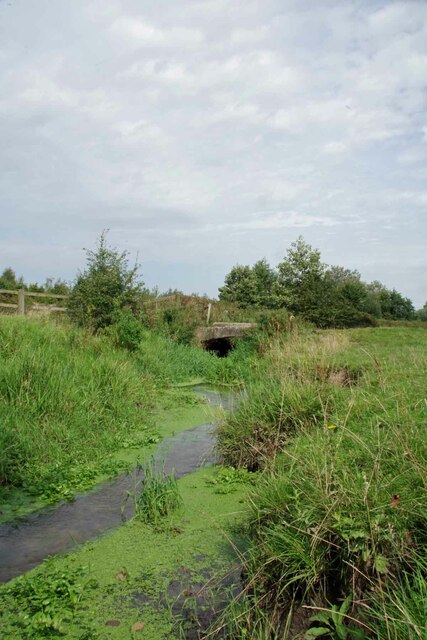
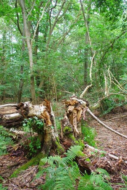
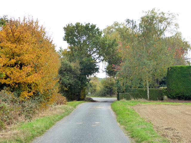
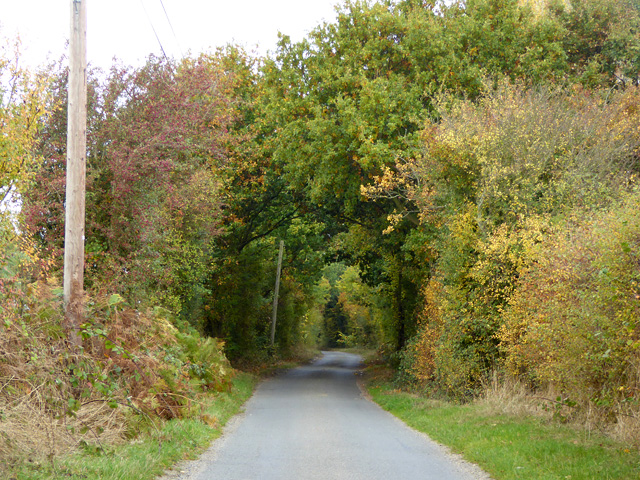
Bromley is a small village located in the county of Essex, in the eastern part of England. Situated approximately 40 miles northeast of London, Bromley is part of the district of Uttlesford and falls within the parliamentary constituency of Saffron Walden. The village is surrounded by picturesque countryside, characterized by rolling hills, green fields, and charming woodlands.

Bromley is a quintessential English village, known for its quaint and peaceful atmosphere. The village is home to a close-knit community, with a population of around 500 residents. The village center features a few essential amenities, including a local pub, a village hall, and a small convenience store. The local primary school serves the educational needs of the village and surrounding area.

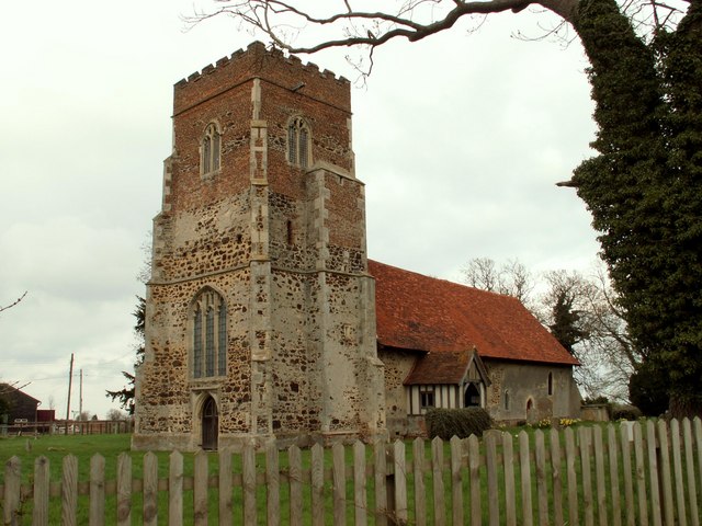
One of the highlights of Bromley is its beautiful medieval church, St. Mary the Virgin. This historic building, constructed in the 12th century, is a prominent feature of the village's skyline and attracts visitors with its stunning architecture and rich history.

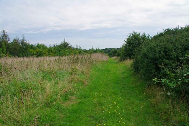
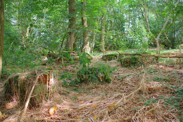
For outdoor enthusiasts, Bromley offers ample opportunities to explore the surrounding countryside. The village is surrounded by numerous footpaths and bridleways, making it an ideal destination for hikers, cyclists, and nature lovers. The nearby Flitch Way, a former railway line converted into a trail, is a popular route for walkers and cyclists alike.

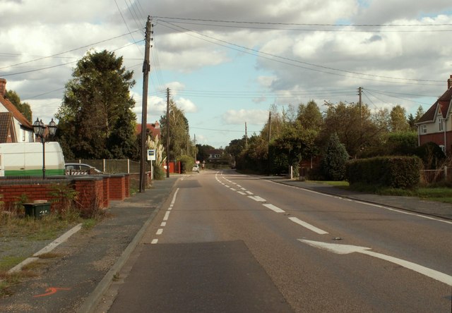
Despite its tranquil setting, Bromley benefits from its proximity to larger towns and cities. The village is well-connected by road, with easy access to the nearby towns of Saffron Walden, Bishop's Stortford, and the city of Cambridge.

Overall, Bromley is a picturesque village in the heart of rural Essex, offering a peaceful and idyllic lifestyle for its residents, while also providing convenient access to nearby amenities and attractions.

If you have any feedback on the listing, please let us know in the comments section below.

Bromley, Great Images

Images are sourced within 2km of 51.895061/1.026981 or Grid Reference TM0826. Thanks to Geograph Open Source API. All images are credited.

School Gate Revisited 13 years ago the hedge had only just been planted, see <a href="https://www.geograph.org.uk/photo/2079772">TM0725 : School Gate!</a>, the giant pencils are long gone and it is entirely possible the second generation of children are now being introduced to nature at the Woodland Trust's Elmstead Market site <span class="nowrap"><a title="https://www.woodlandtrust.org.uk/visiting-woods/woods/elmstead-market/?gclid=EAIaIQobChMIzqy5yKr_gAMVQ-7tCh3swgw2EAAYASAAEgKBmfD_BwE&gclsrc=aw.ds" rel="nofollow ugc noopener" href="https://www.woodlandtrust.org.uk/visiting-woods/woods/elmstead-market/?gclid=EAIaIQobChMIzqy5yKr_gAMVQ-7tCh3swgw2EAAYASAAEgKBmfD_BwE&gclsrc=aw.ds">Link</a><img style="margin-left:2px;" alt="External link" title="External link - shift click to open in new window" src="https://s1.geograph.org.uk/img/external.png" width="10" height="10"/></span>
School Gate Revisited
13 years ago the hedge had only just been planted, see TM0725 : School Gate!, the giant pencils are long gone and it is entirely possible the second generation of children are now being introduced to nature at the Woodland Trust's Elmstead Market site LinkExternal link
School Sculpture Revisited Since I last visited the site, seats have been incorporated into the  <a href="https://www.geograph.org.uk/photo/2081744">TM0725 : School Sculpture</a>.
School Sculpture Revisited
Since I last visited the site, seats have been incorporated into the TM0725 : School Sculpture.
Outdoor Learning Centre Revisited The trees have clearly thrived over the past 13 years see <a href="https://www.geograph.org.uk/photo/2079760">TM0725 : Outdoor Learning Centre</a>.
Outdoor Learning Centre Revisited
The trees have clearly thrived over the past 13 years see TM0725 : Outdoor Learning Centre.
Learning to Nurture Nature An outdoor classroom at the Woodland Trust's Elmstead Market site. The sculptures have weathered in a bit since my last visit. See <a href="https://www.geograph.org.uk/photo/2081744">TM0725 : School Sculpture</a>
Learning to Nurture Nature
An outdoor classroom at the Woodland Trust's Elmstead Market site. The sculptures have weathered in a bit since my last visit. See TM0725 : School Sculpture
Teachers Chair & Wise Old Owl Part of the <a href="https://www.geograph.org.uk/photo/2079760">TM0725 : Outdoor Learning Centre</a> at the Woodland Trust's <span class="nowrap"><a title="https://www.woodlandtrust.org.uk/" rel="nofollow ugc noopener" href="https://www.woodlandtrust.org.uk/">Link</a><img style="margin-left:2px;" alt="External link" title="External link - shift click to open in new window" src="https://s1.geograph.org.uk/img/external.png" width="10" height="10"/></span>  Elmstead Market site.
Teachers Chair & Wise Old Owl
Part of the TM0725 : Outdoor Learning Centre at the Woodland Trust's LinkExternal link Elmstead Market site.
Youthful Wood Things have grown a bit since I took <a href="https://www.geograph.org.uk/photo/2079725">TM0725 : Birth of a Wood</a>.
Youthful Wood
Things have grown a bit since I took TM0725 : Birth of a Wood.
Raptor Box and Youthful Wood Part of the Woodland Trust's 42 Ha Elmstead Market site <span class="nowrap"><a title="https://www.woodlandtrust.org.uk/" rel="nofollow ugc noopener" href="https://www.woodlandtrust.org.uk/">Link</a><img style="margin-left:2px;" alt="External link" title="External link - shift click to open in new window" src="https://s1.geograph.org.uk/img/external.png" width="10" height="10"/></span>. Planting began in 2009 although the adjacent Mill Wood dates back hundreds of years.
Raptor Box and Youthful Wood
Part of the Woodland Trust's 42 Ha Elmstead Market site LinkExternal link. Planting began in 2009 although the adjacent Mill Wood dates back hundreds of years.
Ride to Mill Wood The paths in The Woodland Trust's Elmstead Market wood are mowed about 3 times a year to keep them passable. Beside this one you can see <a href="https://www.geograph.org.uk/photo/7580638">TM0725 : Toadflax & Black knapweed</a> growing.
Ride to Mill Wood
The paths in The Woodland Trust's Elmstead Market wood are mowed about 3 times a year to keep them passable. Beside this one you can see TM0725 : Toadflax & Black knapweed growing.
Toadflax & Black knapweed Just a sample of the wild flowers growing in the Woodland Trust's Elmstead Market site.
Toadflax & Black knapweed
Just a sample of the wild flowers growing in the Woodland Trust's Elmstead Market site.
Bridge over Tenpenny Brook Looking upstream towards where this water course would be Bromley Brook. I am not exactly sure which confluence precipitates the name change.
Bridge over Tenpenny Brook
Looking upstream towards where this water course would be Bromley Brook. I am not exactly sure which confluence precipitates the name change.
Mill Wood Mill Wood is managed with a light touch by the Woodland Trust <span class="nowrap"><a title="https://www.woodlandtrust.org.uk/" rel="nofollow ugc noopener" href="https://www.woodlandtrust.org.uk/">Link</a><img style="margin-left:2px;" alt="External link" title="External link - shift click to open in new window" src="https://s1.geograph.org.uk/img/external.png" width="10" height="10"/></span>.
Mill Wood
Mill Wood is managed with a light touch by the Woodland Trust LinkExternal link.
Mullered Mercedes in Mill Wood This pile of scrap long predates the Woodland Trusts stewardship of Mill Wood. At first I thought the remains of the car were a 1950's Vauxhall until I spied the iconic three pointed star engraved on the remains of the wiper motor.
Mullered Mercedes in Mill Wood
This pile of scrap long predates the Woodland Trusts stewardship of Mill Wood. At first I thought the remains of the car were a 1950's Vauxhall until I spied the iconic three pointed star engraved on the remains of the wiper motor.
Remains of a Brick Structure in Mill Wood I assume this was once a barn or livestock shed in Mill Wood., just the footings of the walls remain.
Remains of a Brick Structure in Mill Wood
I assume this was once a barn or livestock shed in Mill Wood., just the footings of the walls remain.
Cattle by Mill Wood Grassland management in the Woodland Trust's Elmstead Market site.
Cattle by Mill Wood
Grassland management in the Woodland Trust's Elmstead Market site.
Photobombed on Footpath 14 I was just Geographing Elmstead Market Footpath 14 when I was photobombed by the <a href="https://www.geograph.org.uk/photo/7580679">TM0725 : BBMF</a>.
Photobombed on Footpath 14
I was just Geographing Elmstead Market Footpath 14 when I was photobombed by the TM0725 : BBMF.
BBMF The Battle of Britain Memorial Flight heading for the 2023 Clacton Airshow
BBMF
The Battle of Britain Memorial Flight heading for the 2023 Clacton Airshow
Honeypot Lane Nearing its eastern end. Despite what map makers maintain, this lane is signed as Honeypot Lane from the right angled bend where the bridleway Cock Lane strikes off, up to the junction ahead.
Honeypot Lane
Nearing its eastern end. Despite what map makers maintain, this lane is signed as Honeypot Lane from the right angled bend where the bridleway Cock Lane strikes off, up to the junction ahead.
Hilliards Road Heading north.
Hilliards Road
Heading north.
Show me another place!

Bromley, Great is located at Grid Ref: TM0826 (Lat: 51.895061, Lng: 1.026981)

Administrative County: Essex

District: Tendring

Police Authority: Essex

What 3 Words

///scooter.engraving.informs. Near Elmstead Market, Essex

Related Wikis

Great Bromley

Great Bromley is a village and civil parish in the Tendring district of Essex, England. It lies 6 kilometres (4 mi) south of Manningtree and 9 kilometres...

Hare Green

Hare Green is a hamlet on Harwich Road, in the Tendring district, in the English county of Essex. In 2018 it had an estimated population of 707. Hare Green...

St Mary the Virgin's Church, Little Bromley

St Mary the Virgin's Church is a former Anglican church near the village of Little Bromley, Essex, England. It is recorded in the National Heritage List...

Beth Chatto Gardens

The Beth Chatto Gardens, now known as Beth Chatto's Plants & Gardens, are an informal collection of historically significant gardens, with National Heritage...

Little Bromley

Little Bromley is a village and civil parish in the Tendring district of Essex, England. The name "Bromley" is Old English for "broomy wood/clearing"....

Elmstead Market

Elmstead Market is a village in the civil parish of Elmstead, in the Tendring district of Essex, England. It lies 3 km north-east of Wivenhoe and 6 km...

Harwich and North Essex (UK Parliament constituency)

Harwich and North Essex is a constituency represented in the House of Commons of the UK Parliament by Bernard Jenkin of the Conservative Party since its...
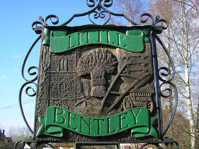
Little Bentley

Little Bentley is a village and civil parish in the Tendring district of Essex, England. It sits on rising ground just to the west of the Holland Brook...

Nearby Amenities

Located within 500m of 51.895061,1.026981
Great Bromley
Place: village
Source: NPE
Wikidata: Q3204924
Wikipedia: en:Great Bromley
Lat/Long: 51.8956339/1.02767
Post Box
Mapillary: 1222333261901891
Post Box Mounting: pier
Post Box Type: lamp
Ref: CO7 219
Survey Date: 2022-08-06
Lat/Long: 51.8942001/1.0269763
Great Bromley School
Naptan AtcoCode: 1500JMD025
Naptan Bearing: S
Naptan BusStopType: CUS
Naptan CommonName: Great Bromley School
Naptan Indicator: o/s
Naptan Landmark: Great Bromley School
Naptan NaptanCode: esxjdajw
Naptan Street: Brook Street
Naptan Verified: no
Public Transport: platform
Source: naptan_import
Lat/Long: 51.8947681/1.027101
Great Bromley School
Naptan AtcoCode: 1500JMD025B
Naptan Bearing: N
Naptan BusStopType: CUS
Naptan CommonName: Great Bromley School
Naptan Indicator: Opp
Naptan Landmark: Great Bromley School
Naptan NaptanCode: esxjdajp
Naptan Street: Brook Street
Naptan Verified: no
Public Transport: platform
Source: naptan_import
Lat/Long: 51.8948906/1.0269453
Recycling
Lat/Long: 51.8954096/1.0268248
Historic: memorial
Memorial: war_memorial
Lat/Long: 51.8952917/1.0269459
Power: pole
Lat/Long: 51.8971973/1.0208082
Power: pole
Lat/Long: 51.8969748/1.0217801
Power: pole
Transformer: distribution
Lat/Long: 51.8968068/1.0224869
Turning Circle
Lat/Long: 51.8923358/1.0295002
Turning Circle
Lat/Long: 51.8924707/1.0294425
The data included in this document is from www.openstreetmap.org. The data is made available under ODbL.

Have you been to Bromley, Great?

Leave your review of Bromley, Great below (or comments, questions and feedback).