Lords' Dub Loups

Lake, Pool, Pond, Freshwater Marsh in Yorkshire South Lakeland

England

Lords' Dub Loups

Middleton Bridge, over the River Rawthey
Middleton Bridge, over the River Rawthey Credit: David Smith

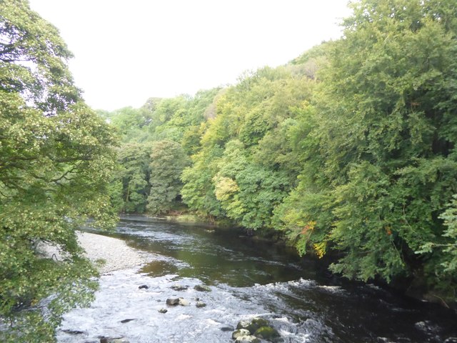
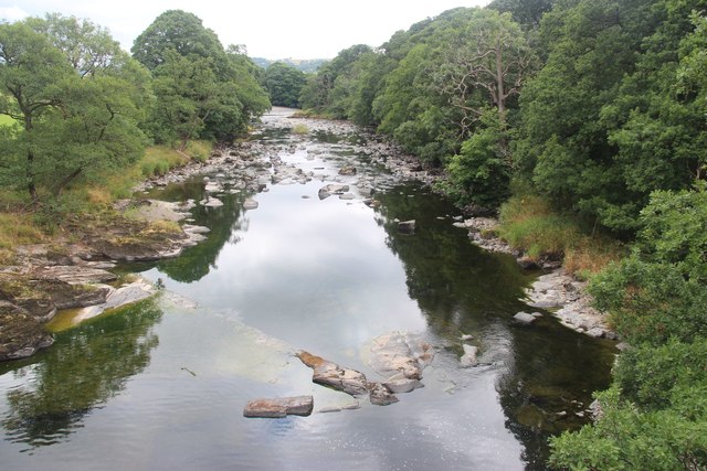
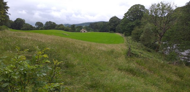
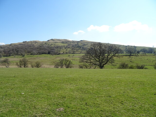
Lords' Dub Loups is a picturesque freshwater marsh located in Yorkshire, England. Situated amidst the serene countryside, this natural aquatic habitat is renowned for its diverse wildlife and tranquil ambiance. Spanning over an area of approximately 10 acres, Lords' Dub Loups offers a unique blend of lake, pool, pond, and marsh ecosystems.

The main feature of Lords' Dub Loups is its shimmering lake, which stretches across the central part of the marsh. This expansive body of water is surrounded by lush vegetation, including reeds and water lilies, providing a haven for numerous species of birds, insects, and aquatic plants.

To the west of the lake lies a smaller, secluded pool, which serves as a breeding ground for amphibians such as frogs and newts. This pool is characterized by its shallow depth and abundance of floating plants, creating an ideal habitat for these fascinating creatures.

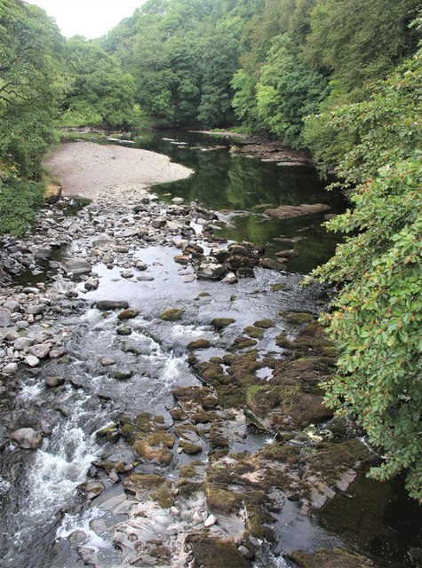
Towards the eastern side of Lords' Dub Loups, a peaceful pond can be found. This pond is teeming with life, hosting a variety of fish species such as perch and carp. Anglers often visit this spot, attracted by the opportunity to catch these prized freshwater fish.

Surrounding the lake, pool, and pond is a sprawling freshwater marsh, characterized by its damp and marshy terrain. This marsh provides a fertile habitat for a rich array of plant species, including sedges, rushes, and various types of marsh grasses. These plants, in turn, attract an array of insects, birds, and small mammals, making the marsh a hub of biodiversity.

Overall, Lords' Dub Loups offers a captivating natural landscape, combining the beauty of a lake, pool, pond, and freshwater marsh. Its diverse ecosystems provide a sanctuary for a wide range of flora and fauna, making it a must-visit destination for nature enthusiasts and wildlife lovers alike.

If you have any feedback on the listing, please let us know in the comments section below.

Lords' Dub Loups Images

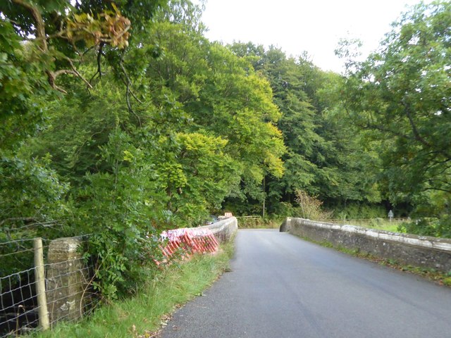
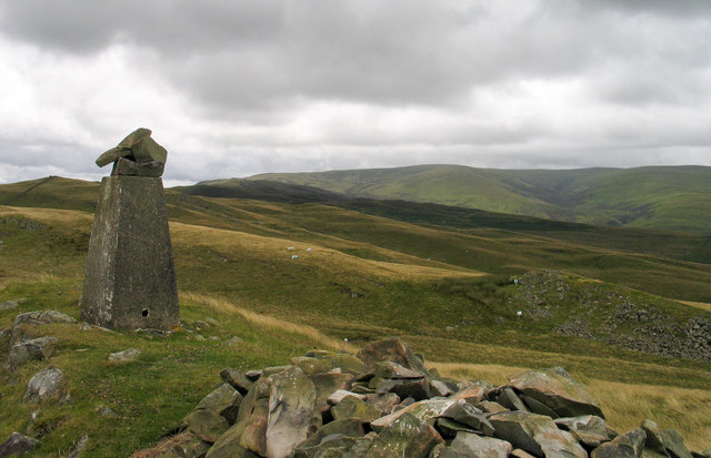
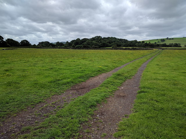
Images are sourced within 2km of 54.314473/-2.5569465 or Grid Reference SD6391. Thanks to Geograph Open Source API. All images are credited.

Middleton Bridge, over the River Rawthey
The River Rawthey from Middleton Bridge
Trig point at summit of Holme Knott Part of the summit area of Holme Knott with Calf Top in the distance.
Trig point at summit of Holme Knott
Part of the summit area of Holme Knott with Calf Top in the distance.
Track heading across a field
River Rawthey At Middleton Bridge.
River Rawthey
At Middleton Bridge.
River Rawthey At Middleton Bridge.
River Rawthey
At Middleton Bridge.
Old Milestone by the A683, south of Middleton Bridge, Middleton parish Carved stone post by the A683, in parish of MIDDLETON (SOUTH LAKELAND District), 320m South of Middleton Bridge, half mile South of Four Lane Ends, on the verge, on West side of road. Sedbergh SKL stone, erected by the Sedbergh turnpike trust in the 19th century. 

Inscription reads:-
: S / 3 : :  K.L. / 7¾ :
(To Sedbergh and Kirkby Lonsdale)
Carved benchmark and rivet on top left.

Grade II listed.  
List Entry Number: 1086863 <span class="nowrap"><a title="https://historicengland.org.uk/listing/the-list/list-entry/1086863" rel="nofollow ugc noopener" href="https://historicengland.org.uk/listing/the-list/list-entry/1086863">Link</a><img style="margin-left:2px;" alt="External link" title="External link - shift click to open in new window" src="https://s1.geograph.org.uk/img/external.png" width="10" height="10"/></span>

Milestone Society National ID: WE_SBKL03.
Old Milestone by the A683, south of Middleton Bridge, Middleton parish
Carved stone post by the A683, in parish of MIDDLETON (SOUTH LAKELAND District), 320m South of Middleton Bridge, half mile South of Four Lane Ends, on the verge, on West side of road. Sedbergh SKL stone, erected by the Sedbergh turnpike trust in the 19th century. Inscription reads:- : S / 3 : : K.L. / 7¾ : (To Sedbergh and Kirkby Lonsdale) Carved benchmark and rivet on top left. Grade II listed. List Entry Number: 1086863 LinkExternal link Milestone Society National ID: WE_SBKL03.
The River Rawthey from Middleton Bridge
Near Middleton Bridge Stone barn in field near Middleton Bridge.
Near Middleton Bridge
Stone barn in field near Middleton Bridge.
Grazing off Jordan Lane
Jordan Lane towards Catholes
Jordan Lane railway bridge The railway was the LMS route between the 'Little North Western' line at Clapham and their main line to Scotland at Lowgill, via Ingleton. The last passenger train ran in 1954 and the line was lifted around 1967. See <a href="https://www.geograph.org.uk/photo/3534909">SD6390 : Bridge of dismantled railway over Jordan Lane</a> for the other side.
Jordan Lane railway bridge
The railway was the LMS route between the 'Little North Western' line at Clapham and their main line to Scotland at Lowgill, via Ingleton. The last passenger train ran in 1954 and the line was lifted around 1967. See SD6390 : Bridge of dismantled railway over Jordan Lane for the other side.
Holme Farm Described as an 'open' farm in the sense that they run activities for the public, as well as a campsite. This track through the farmyard is also open in the sense of being a public bridleway.
Holme Farm
Described as an 'open' farm in the sense that they run activities for the public, as well as a campsite. This track through the farmyard is also open in the sense of being a public bridleway.
Railway formation north-east of Jordan Lane The railway was the LMS route between the 'Little North Western' line at Clapham and their main line to Scotland at Lowgill, via Ingleton. The last passenger train ran in 1954 and the line was lifted around 1967.
Railway formation north-east of Jordan Lane
The railway was the LMS route between the 'Little North Western' line at Clapham and their main line to Scotland at Lowgill, via Ingleton. The last passenger train ran in 1954 and the line was lifted around 1967.
Railway bridge, Jordan Lane The bridge carried the lane over the LMS route between the 'Little North Western' line at Clapham and their main line to Scotland at Lowgill, via Ingleton <a href="https://www.geograph.org.uk/photo/6984025">SD6390 : Railway formation north-east of Jordan Lane</a>. The last passenger train ran in 1954 and the line was lifted around 1967. Beyond the bridge, a gate gives access to an unfenced road across Holme Fell.
Railway bridge, Jordan Lane
The bridge carried the lane over the LMS route between the 'Little North Western' line at Clapham and their main line to Scotland at Lowgill, via Ingleton SD6390 : Railway formation north-east of Jordan Lane. The last passenger train ran in 1954 and the line was lifted around 1967. Beyond the bridge, a gate gives access to an unfenced road across Holme Fell.
Bench overlooking Sedbergh The bench is conveniently situated at roughly the highest point of the minor road over Holme Fell. See also <a href="https://www.geograph.org.uk/photo/2675922">SD6490 : Memorial bench above Abbot Holme</a> which gives the text of an inscription on the bench.
Bench overlooking Sedbergh
The bench is conveniently situated at roughly the highest point of the minor road over Holme Fell. See also SD6490 : Memorial bench above Abbot Holme which gives the text of an inscription on the bench.
Catholes near Sedbergh The building in the centre of the photo is the clubhouse of Sedbergh Golf Club. Beyond it is the 'pepperpot' monument on the Dales Way <span class="nowrap"><a title="https://www.sedberghschool.org/senior/information/foundation/pepperpot" rel="nofollow ugc noopener" href="https://www.sedberghschool.org/senior/information/foundation/pepperpot">Link</a><img style="margin-left:2px;" alt="External link" title="External link - shift click to open in new window" src="https://s1.geograph.org.uk/img/external.png" width="10" height="10"/></span> - see <a href="https://www.geograph.org.uk/photo/6334001">SD6591 : Restored Pepperpot on Akay Estate, Sedbergh</a> for a closer view.
Catholes near Sedbergh
The building in the centre of the photo is the clubhouse of Sedbergh Golf Club. Beyond it is the 'pepperpot' monument on the Dales Way LinkExternal link - see SD6591 : Restored Pepperpot on Akay Estate, Sedbergh for a closer view.
River Lune at Killington New Bridge
Show me another place!

Lords' Dub Loups is located at Grid Ref: SD6391 (Lat: 54.314473, Lng: -2.5569465)

Division: West Riding

Administrative County: Cumbria

District: South Lakeland

Police Authority: Cumbria

What 3 Words

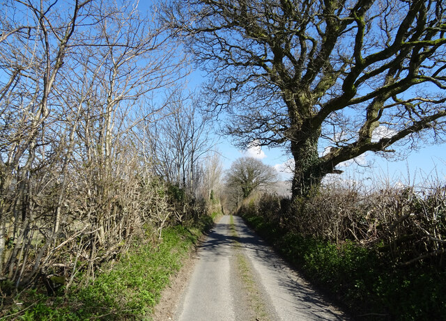
///examine.rattler.simulates. Near Sedbergh, Cumbria

Related Wikis

Brigflatts Meeting House

Brigflatts Meeting House or Briggflatts Meeting House is a Friends Meeting House of the Religious Society of Friends (Quakers), near Sedbergh, Cumbria...

Ingmire Hall

Ingmire Hall is a grade II listed 16th century country house built around the remains of a pele tower some 2 miles west of Sedbergh, Cumbria, England.The...

Sedbergh railway station

Sedbergh railway station was located in the West Riding of Yorkshire, serving the town and locale of Sedbergh on the Ingleton Branch Line. The town now...
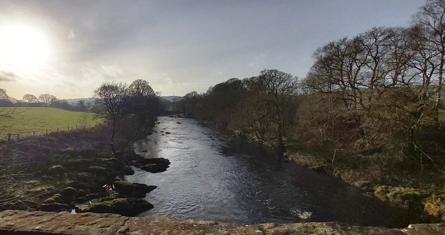
River Dee, Cumbria

The River Dee is a river running through the extreme south east of Cumbria, a part of the Craven region traditionally part of the West Riding of Yorkshire...

Nearby Amenities

Located within 500m of 54.314473,-2.5569465
Post Box
Postal Code: LA10
Ref: LA10 183
Lat/Long: 54.3163865/-2.5536172
Briggflatts
Place: hamlet
Lat/Long: 54.3148965/-2.5538215
Holme
Place: hamlet
Lat/Long: 54.3108937/-2.5608779
Power: pole
Lat/Long: 54.3105916/-2.5592566
Power: pole
Lat/Long: 54.3110579/-2.558291
Power: pole
Lat/Long: 54.3122893/-2.5557536
Power: pole
Lat/Long: 54.3136217/-2.5530352
Power: pole
Lat/Long: 54.314414/-2.5514291
Power: pole
Lat/Long: 54.315004/-2.5501639
Power: pole
Lat/Long: 54.3168972/-2.552712
Power: pole
Lat/Long: 54.3185289/-2.5543803
Fixme: continue
Noexit: no
Lat/Long: 54.3148617/-2.5626281
Hiking: yes
Information: guidepost
Source: GPS survey
Tourism: information
Lat/Long: 54.3149688/-2.5626026
Hiking: yes
Information: guidepost
Source: GPS survey
Tourism: information
Lat/Long: 54.3154676/-2.5599406
Barrier: kissing_gate
Image: https://www.geograph.org.uk/photo/3198569
Lat/Long: 54.3154578/-2.559899
Cafe
Ewe Tree Cafe
Addr City: Middleton
Addr Housename: Holme Farm
Addr Postcode: LA10 5ET
Fhrs Id: 299937
Fixme: Actual building/location on site unknown
Website: http://www.holmeopenfarm.co.uk/ewetreecafe.html
Lat/Long: 54.3112321/-2.5617879
Power: pole
Lat/Long: 54.31665/-2.5519167
Ford: yes
Lat/Long: 54.3126596/-2.5631196
Power: pole
Lat/Long: 54.3152826/-2.5519868
Man Made: utility_pole
Lat/Long: 54.3140785/-2.5530327
Entrance: main
Lat/Long: 54.3146789/-2.5535663
Generator Method: photovoltaic
Generator Output Electricity: yes
Generator Source: solar
Generator Type: solar_photovoltaic_panel
Location: roof
Power: generator
Lat/Long: 54.3138336/-2.5538332
Fixme: Confirm location
Man Made: monitoring_station
Monitoring Water Velocity: yes
Operator: Environment Agency
Ref: 72011
Lat/Long: 54.3138791/-2.5548014
Power: pole
Lat/Long: 54.3154327/-2.5577036
Power: pole
Lat/Long: 54.315636/-2.5555709
Power: pole
Lat/Long: 54.3157969/-2.5537392
The data included in this document is from www.openstreetmap.org. The data is made available under ODbL.

Have you been to Lords' Dub Loups?

Leave your review of Lords' Dub Loups below (or comments, questions and feedback).