Bradley, Great

Settlement in Suffolk West Suffolk

England

Bradley, Great

East Green: Three Tuns As its name suggests, this house on the road from Cowlinge to Great Bradley (right) was once a public house. <a href="https://www.geograph.org.uk/photo/47860">TL6853 : Former 'Three Tuns' pub, East Green, Great Bradley, Suffolk</a> (2004) shows the previous roof.
East Green: Three Tuns Credit: John Sutton

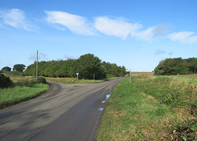
Bradley is a small village located in the county of Suffolk, England. It is part of the larger civil parish of Bradley Great and Little. The village is situated approximately 9 miles southwest of the town of Bury St Edmunds.

Bradley is a picturesque village with a mix of traditional thatched cottages and more modern homes. The village is surrounded by beautiful countryside, making it an ideal location for those who enjoy outdoor activities such as walking, cycling, and birdwatching.

The village has a close-knit community and a strong sense of local pride. There is a village hall that hosts various events and activities throughout the year, bringing residents together.

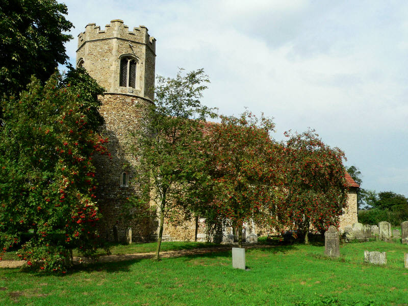
In terms of amenities, Bradley has a primary school, a church, and a pub, providing essential services for the local population. The village is well-connected by road, with the A143 running nearby, providing easy access to nearby towns and cities.

Overall, Bradley is a charming and peaceful village, perfect for those looking to escape the hustle and bustle of city life and enjoy the tranquility of rural England.

If you have any feedback on the listing, please let us know in the comments section below.

Bradley, Great Images

Images are sourced within 2km of 52.151762/0.43629154 or Grid Reference TL6653. Thanks to Geograph Open Source API. All images are credited.

East Green: Three Tuns As its name suggests, this house on the road from Cowlinge to Great Bradley (right) was once a public house. <a href="https://www.geograph.org.uk/photo/47860">TL6853 : Former 'Three Tuns' pub, East Green, Great Bradley, Suffolk</a> (2004) shows the previous roof.
East Green: Three Tuns
As its name suggests, this house on the road from Cowlinge to Great Bradley (right) was once a public house. TL6853 : Former 'Three Tuns' pub, East Green, Great Bradley, Suffolk (2004) shows the previous roof.
East Green: the end of the road The tarmac road at East Green ends here. The concrete farm track serves Morgan-Evans Equestrian and continues as a bridle path past Bradley Park Wood which is part of a network of tracks and paths between Great Bradley and Kirtling.
East Green: the end of the road
The tarmac road at East Green ends here. The concrete farm track serves Morgan-Evans Equestrian and continues as a bridle path past Bradley Park Wood which is part of a network of tracks and paths between Great Bradley and Kirtling.
At East Green A hamlet east of Great Bradley, reached along a dead-end lane.
At East Green
A hamlet east of Great Bradley, reached along a dead-end lane.
Farm track and footpath near Great Bradley The notice at the start of this track in the shallow valley of the infant River Stour forbids vehicles, cycles and horses. The smaller notice asks that dogs be kept under close control as this is a conservation area.
Farm track and footpath near Great Bradley
The notice at the start of this track in the shallow valley of the infant River Stour forbids vehicles, cycles and horses. The smaller notice asks that dogs be kept under close control as this is a conservation area.
Great Bradley: the south side of St Mary's Church "Perp W tower ... Early Tudor S porch of brick with a stepped gable containing six niches. Brick porch windows" (Nikolaus Pevsner).
Great Bradley: the south side of St Mary's Church
"Perp W tower ... Early Tudor S porch of brick with a stepped gable containing six niches. Brick porch windows" (Nikolaus Pevsner).
Great Bradley: The Fox As the name suggests, this was once a public house. The Grade II listed building is older than it looks. Nineteenth-century brick cladding cases a 17th-century  timber frame.
Great Bradley: The Fox
As the name suggests, this was once a public house. The Grade II listed building is older than it looks. Nineteenth-century brick cladding cases a 17th-century timber frame.
Great Bradley: pantiles on the corner Red and buff pantiles on a plain cottage.
Great Bradley: pantiles on the corner
Red and buff pantiles on a plain cottage.
Great Bradley: houses on the main road There is a mixture of timber-framed and more modern houses.
Great Bradley: houses on the main road
There is a mixture of timber-framed and more modern houses.
Across the Stour Valley Looking across the shallow valley of the infant River Stour from the B1061 at Lower Hill Farm near Great Bradley. Though principally a Suffolk river, the Stour rises not far from here, near Weston Green in Cambridgeshire. Plunder Wood is on the skyline behind the barn.
Across the Stour Valley
Looking across the shallow valley of the infant River Stour from the B1061 at Lower Hill Farm near Great Bradley. Though principally a Suffolk river, the Stour rises not far from here, near Weston Green in Cambridgeshire. Plunder Wood is on the skyline behind the barn.
Into Suffolk on a September morning This picture, taken against the light on a fine late-summer morning, shows the junction where the lane from Carlton joins the B1061 half way between Burrough Green and Great Bradley (ahead).
Into Suffolk on a September morning
This picture, taken against the light on a fine late-summer morning, shows the junction where the lane from Carlton joins the B1061 half way between Burrough Green and Great Bradley (ahead).
Left turn to Brinkley The B1061, whose southern end is at Sturmer, near Haverhill, carries on to Burrough Green, Dullingham and Newmarket.
Left turn to Brinkley
The B1061, whose southern end is at Sturmer, near Haverhill, carries on to Burrough Green, Dullingham and Newmarket.
Evergreen Lane, Great Bradley
St Mary's Church, Great Bradley
House on Hall Road, East Green
Hall Road, East Green
Great Bradley: St Mary The fifteenth-century tower is rendered, the sixteenth-century porch of brick.
Great Bradley: St Mary
The fifteenth-century tower is rendered, the sixteenth-century porch of brick.
Acre Road leaving Carlton
Show me another place!

Bradley, Great is located at Grid Ref: TL6653 (Lat: 52.151762, Lng: 0.43629154)

Administrative County: Suffolk

District: West Suffolk

Police Authority: Suffolk

What 3 Words

///reported.cheerily.rooting. Near Kedington, Suffolk

Related Wikis

Great Bradley

Great Bradley is a village and civil parish in the West Suffolk district of Suffolk in eastern England. According to Eilert Ekwall the meaning of the village...

Castle Newnham School

Castle Newnham School is a coeducational all-through school located over two sites in Bedford, Bedfordshire, England.The school was formed in January 2016...
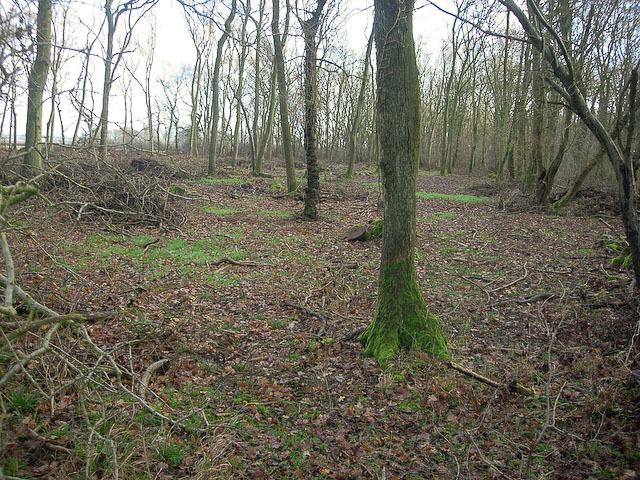
Carlton Wood

Carlton Wood is a 10.4-hectare (26-acre) biological Site of Special Scientific Interest on the eastern boundary of Cambridgeshire, and west of Great Bradley...

Little Bradley

Little Bradley is a small village and civil parish in the West Suffolk district, in the county of Suffolk, England. According to Eilert Ekwall, the meaning...

Nearby Amenities

Located within 500m of 52.151762,0.43629154
Great Bradley
Created By: Potlatch 0.4a
Is In: Suffolk,England,UK
Place: village
Wikidata: Q1809293
Lat/Long: 52.1513868/0.4375921
Public Building
Great Bradley Village Hall
Lat/Long: 52.151643/0.4369356
Post Box
Collection Times: Mo-Fr 16:00; Sa 10:00
Operator: Royal Mail
Post Box Type: lamp
Ref: CB8 113
Royal Cypher: EIIR
Royal Cypher Wikidata: Q33102113
Source: survey
Lat/Long: 52.1519786/0.4357099
Bus Stop
Fox Green
Naptan AtcoCode: 390050034
Naptan Bearing: S
Naptan BusStopType: CUS
Naptan CommonName: Fox Green
Naptan Indicator: adj
Naptan Landmark: Fox Green
Naptan NaptanCode: sufgdawg
Naptan Street: The Street
Naptan Verified: no
Source: naptan_import
Lat/Long: 52.1508187/0.4400058
Bus Stop
Fox Green
Naptan AtcoCode: 390050035
Naptan Bearing: N
Naptan BusStopType: CUS
Naptan CommonName: Fox Green
Naptan Indicator: opp
Naptan Landmark: Fox Green
Naptan NaptanCode: sufgdawj
Naptan Street: The Street
Naptan Verified: no
Source: naptan_import
Lat/Long: 52.1503865/0.4387033
Bus Stop
Telephone Box
Naptan AtcoCode: 390050996
Naptan Bearing: SE
Naptan BusStopType: CUS
Naptan CommonName: Telephone Box
Naptan Indicator: o/s
Naptan Landmark: Telephone Box
Naptan NaptanCode: sufgmgjt
Naptan Street: Clarendale Estate
Naptan Verified: no
Source: naptan_import
Lat/Long: 52.1508658/0.4350768
Bus Stop
Evergreen Lane
Naptan AtcoCode: 390050997
Naptan Bearing: SW
Naptan BusStopType: CUS
Naptan CommonName: Evergreen Lane
Naptan Indicator: adj
Naptan Landmark: Evergreen Lane
Naptan NaptanCode: sufgmgjw
Naptan Street: Matthews Lane
Naptan Verified: no
Source: naptan_import
Lat/Long: 52.1513151/0.4355741
Bus Stop
Evergreen Lane
Naptan AtcoCode: 390050998
Naptan Bearing: NE
Naptan BusStopType: CUS
Naptan CommonName: Evergreen Lane
Naptan Indicator: opp
Naptan Landmark: Evergreen Lane
Naptan NaptanCode: sufgmgma
Naptan Street: Matthews Lane
Naptan Verified: no
Source: naptan_import
Lat/Long: 52.1513756/0.4352558
Bus Stop
Hall Cottages
Naptan AtcoCode: 390050999
Naptan Bearing: E
Naptan BusStopType: CUS
Naptan CommonName: Hall Cottages
Naptan Indicator: adj
Naptan Landmark: Hall Cottages
Naptan NaptanCode: sufgmgmd
Naptan Street: Hall Road
Naptan Verified: no
Source: naptan_import
Lat/Long: 52.1507076/0.4419002
Bus Stop
Hall Cottages
Naptan AtcoCode: 390051000
Naptan Bearing: W
Naptan BusStopType: CUS
Naptan CommonName: Hall Cottages
Naptan Indicator: opp
Naptan Landmark: Hall Cottages
Naptan NaptanCode: sufgmgmg
Naptan Street: Hall Road
Naptan Verified: no
Source: naptan_import
Lat/Long: 52.1505025/0.4413768
Bus Stop
Old Post Office
Naptan AtcoCode: 390051220
Naptan Bearing: NW
Naptan BusStopType: CUS
Naptan CommonName: Old Post Office
Naptan Indicator: adj
Naptan Landmark: Old Post Office
Naptan NaptanCode: sufjtdpg
Naptan Street: The Street
Naptan Verified: no
Source: naptan_import
Lat/Long: 52.1520088/0.4355097
Bus Stop
Old Post Office
Naptan AtcoCode: 390051221
Naptan Bearing: SE
Naptan BusStopType: CUS
Naptan CommonName: Old Post Office
Naptan Indicator: opp
Naptan Landmark: Old Post Office
Naptan NaptanCode: sufjtdpj
Naptan Street: The Street
Naptan Verified: no
Source: naptan_import
Lat/Long: 52.1521127/0.4357054
Former Fox pub
Check Date: 2011-02-08
Disused Amenity: pub
Wikidata: Q26573622
Lat/Long: 52.1502173/0.4400559
The former Crown pub (now a private house)
Lat/Long: 52.1520079/0.4352708
The data included in this document is from www.openstreetmap.org. The data is made available under ODbL.

Have you been to Bradley, Great?

Leave your review of Bradley, Great below (or comments, questions and feedback).