Worthington Reservoir

Lake, Pool, Pond, Freshwater Marsh in Lancashire

England

Worthington Reservoir

Kilhey Court Hotel This is the view from the car park towards the main building in a shower of rain.
Kilhey Court Hotel Credit: Malcolm Neal

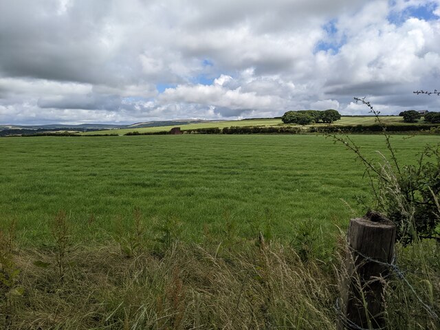
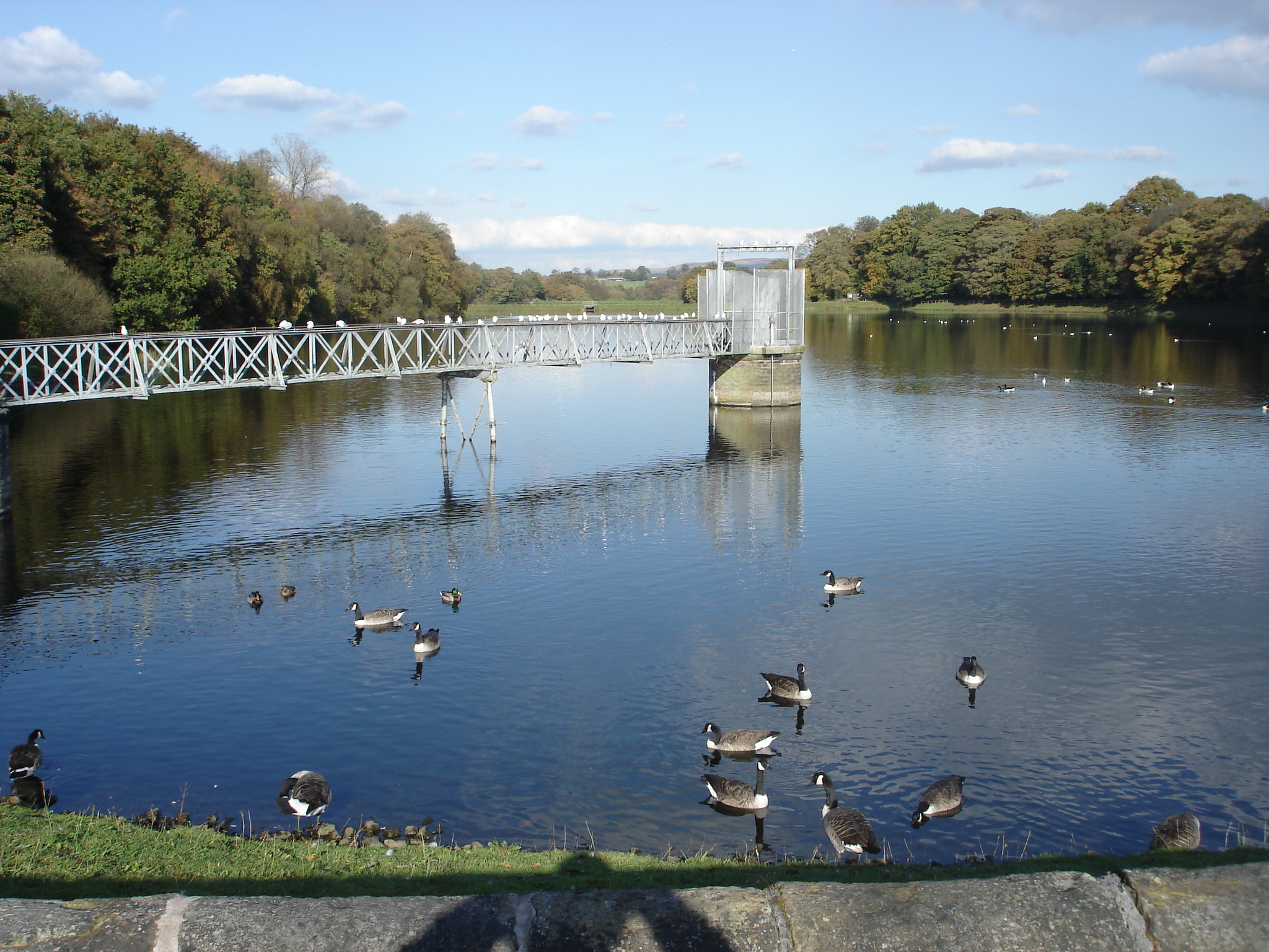
Worthington Reservoir, located in the county of Lancashire, is a freshwater body which serves as a vital water supply reservoir for the surrounding areas. The reservoir covers an area of approximately 40 hectares and is situated near the village of Standish, within the larger borough of Chorley.

Originally constructed in the late 19th century, Worthington Reservoir was built by the West Lancashire Water Board to provide a reliable water source for domestic and industrial use. The reservoir is fed by various streams and natural springs in the vicinity, ensuring a constant flow of freshwater.

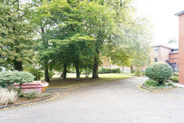
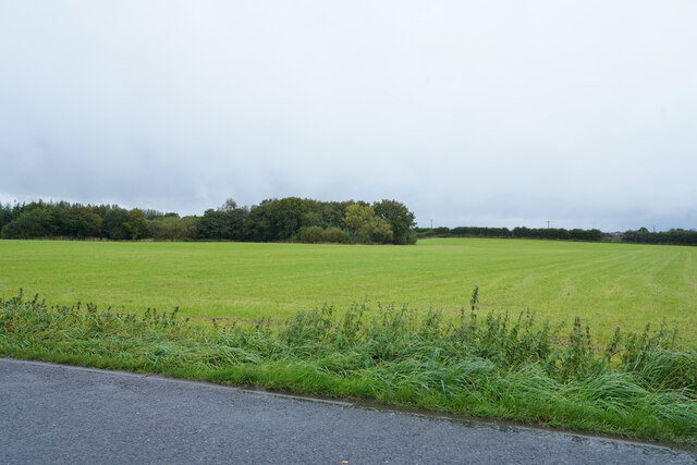
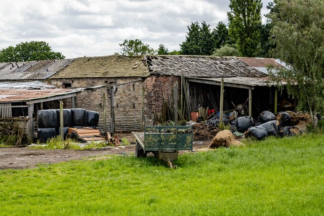
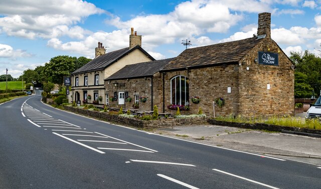
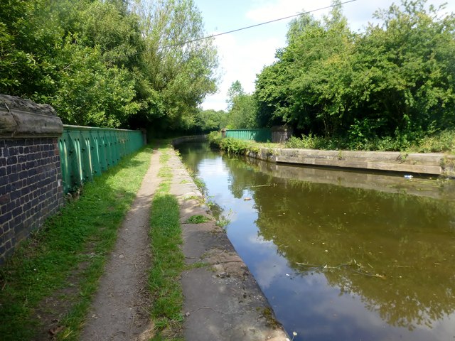
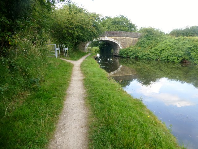
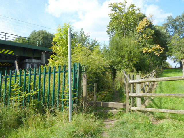
Surrounded by picturesque countryside, the reservoir offers a tranquil setting for visitors and nature enthusiasts alike. The body of water is flanked by grassy banks, providing ample space for picnicking, leisurely walks, or fishing. Anglers are attracted to Worthington Reservoir due to its abundance of coarse fish, including perch, roach, and bream.

The reservoir also plays a crucial role in supporting local wildlife. Its diverse ecosystem supports a variety of bird species, such as ducks, herons, and swans, making it a popular spot for birdwatching. Additionally, the surrounding marshland provides a habitat for various aquatic plants and small mammals.

Visitors to Worthington Reservoir can enjoy the serene atmosphere and engage in recreational activities such as sailing and canoeing. However, it is important to note that these activities may require permission or permits from the relevant authorities.

Overall, Worthington Reservoir offers a beautiful natural retreat and serves as an integral part of Lancashire's water infrastructure, providing both a functional purpose and a haven for wildlife and visitors alike.

If you have any feedback on the listing, please let us know in the comments section below.

Worthington Reservoir Images

Images are sourced within 2km of 53.589842/-2.6332996 or Grid Reference SD5810. Thanks to Geograph Open Source API. All images are credited.

Kilhey Court Hotel This is the view from the car park towards the main building in a shower of rain.
Kilhey Court Hotel
This is the view from the car park towards the main building in a shower of rain.
A green field in the rain This might be grass in the field or an Autumn planted crop of some sort of cereal.
A green field in the rain
This might be grass in the field or an Autumn planted crop of some sort of cereal.
Cottages in the country An interesting row of cottages with one very large door which might have been a coach entrance.
Cottages in the country
An interesting row of cottages with one very large door which might have been a coach entrance.
Bradley Lane We have just passed the industrial estate and are about to enter the village of Standish.
Bradley Lane
We have just passed the industrial estate and are about to enter the village of Standish.
Worthington Hall Farm buildings at Worthington Hall.
Worthington Hall
Farm buildings at Worthington Hall.
Standish Market place in Standish.
Standish
Market place in Standish.
Disused Tip Reclamation work on a disused tip at Standish.
Disused Tip
Reclamation work on a disused tip at Standish.
Standish Leisure Centre
Old Chapel Old chapel in Standish.
Old Chapel
Old chapel in Standish.
White Crow Hotel
White Crow Hotel
Old Milepost by the A5106, Chorley Road, Standish parish Cast iron post by the A5106, in parish of STANDISH (WIGAN District), Chorley Road; Worthington; opposite junction with Devon Drive, on grassed area, on East side of road. Wigan fan iron casting, erected by the Wigan & Preston (south of Yarrow) turnpike trust in the 19th century. An earlier photograph can be found here <a title="https://www.geograph.org.uk/photo/6049856" href="https://www.geograph.org.uk/photo/6049856">Link</a>.

Inscription reads:-
LANGTREE.
3 MILES TO WIGAN.
5¼ MILES TO CHORLEY.
1837
Maker:-
HAIGH FOUNDRY

Grade II listed. 
List Entry Number: 1228467 <span class="nowrap"><a title="https://historicengland.org.uk/listing/the-list/list-entry/1228467" rel="nofollow ugc noopener" href="https://historicengland.org.uk/listing/the-list/list-entry/1228467">Link</a><img style="margin-left:2px;" alt="External link" title="External link - shift click to open in new window" src="https://s1.geograph.org.uk/img/external.png" width="10" height="10"/></span>

Milestone Society National ID: LA_WGCY03.
Old Milepost by the A5106, Chorley Road, Standish parish
Cast iron post by the A5106, in parish of STANDISH (WIGAN District), Chorley Road; Worthington; opposite junction with Devon Drive, on grassed area, on East side of road. Wigan fan iron casting, erected by the Wigan & Preston (south of Yarrow) turnpike trust in the 19th century. An earlier photograph can be found here Link. Inscription reads:- LANGTREE. 3 MILES TO WIGAN. 5¼ MILES TO CHORLEY. 1837 Maker:- HAIGH FOUNDRY Grade II listed. List Entry Number: 1228467 LinkExternal link Milestone Society National ID: LA_WGCY03.
A fine bridleway near Aberdeen Farm
The gateway to Hudora Pet Hotel Presumably a 'posh' version of kennels.
The gateway to Hudora Pet Hotel
Presumably a 'posh' version of kennels.
Fields near Aberdeen Farm
Arley Aqueduct Arley Aqueduct is Aqueduct 18 on the Leeds-Liverpool Canal and is found north of Red Rock. It spans the former railway line to Boar's Head from Adlington.
Arley Aqueduct
Arley Aqueduct is Aqueduct 18 on the Leeds-Liverpool Canal and is found north of Red Rock. It spans the former railway line to Boar's Head from Adlington.
Approaching Weavers Bridge Weavers Bridge is Bridge 65 on the Leeds-Liverpool Canal and is also known locally as the Anderton Bridge.
Approaching Weavers Bridge
Weavers Bridge is Bridge 65 on the Leeds-Liverpool Canal and is also known locally as the Anderton Bridge.
St Wilfrid's Church, Standish
Footpath between Rectory Lane and Bradley Lane, Standish Along side the railway line
Footpath between Rectory Lane and Bradley Lane, Standish
Along side the railway line
Show me another place!

Worthington Reservoir is located at Grid Ref: SD5810 (Lat: 53.589842, Lng: -2.6332996)

Unitary Authority: Wigan

Police Authority: Greater Manchester

What 3 Words

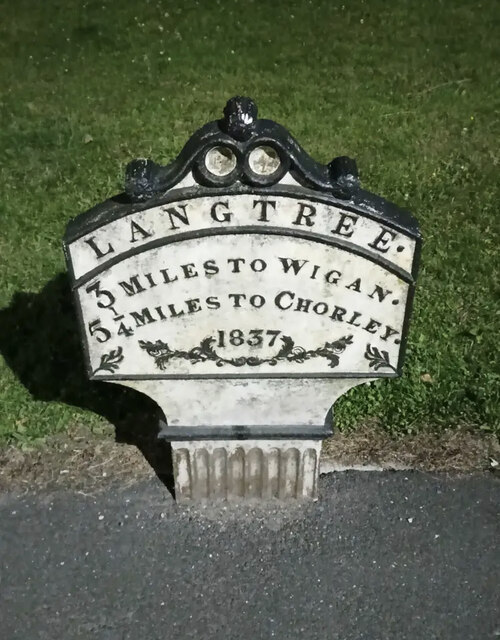
///quitter.bolsters.composts. Near Adlington, Lancashire

Related Wikis

Worthington Lakes

Worthington Lakes is a series of three reservoirs in the north of the borough of Wigan, Greater Manchester (from south to north: Worthington, Arley and...

Worthington, Greater Manchester

Worthington is a civil parish within the Metropolitan Borough of Wigan, in Greater Manchester, England, about four miles (6.4 km) north of Wigan. The parish...

Red Rock railway station

Red Rock railway station stood in Red Rock, a hamlet between Standish and Haigh, originally in Lancashire now within Greater Manchester, England. The railway...

Standish railway station

Standish railway station is a closed railway station in Standish, England, situated where the line bridged Rectory Lane (the B5239). Standish was in the...

Wigan Rural District

Wigan Rural District was an administrative district in Lancashire, England from 1894 to 1974. The rural district comprised an area to the north, but did...

Westhoughton (UK Parliament constituency)

Westhoughton was a parliamentary constituency in Lancashire, England. Centred on the former mining and cotton town of Westhoughton, it returned one Member...

Boar's Head railway station

Boar's Head railway station served the southern part of the village of Standish. == History == The Wigan Branch Railway (WBR) was authorised on 29 May...

St Wilfrid's Church, Standish

The Church of St Wilfrid is in Market Place, Standish, Wigan, Greater Manchester, England. It is an active Anglican parish church in the Diocese of Blackburn...

Nearby Amenities

Located within 500m of 53.589842,-2.6332996
Mini Roundabout
Direction: clockwise
Lat/Long: 53.586073/-2.6374062
Parking
Worthington Lakes
Parking: surface
Lat/Long: 53.5889885/-2.6358958
Parking
Lat/Long: 53.5895107/-2.63581
Turning Loop
Lat/Long: 53.5868352/-2.6308518
Worthington Water Treatment Works
Man Made: water_works
Operator: United Utilities
Lat/Long: 53.5874262/-2.6349002
Parking
Access: customers
Parking: surface
Surface: compacted
Lat/Long: 53.5929728/-2.6343101
Lakeside Cottages
Place: neighbourhood
Lat/Long: 53.5858372/-2.63475
Parking
Access: customers
Parking: surface
Surface: compacted
Lat/Long: 53.5918648/-2.6353079
Bus Stop
Chorley Road
Bus: yes
Naptan AtcoCode: 1800WKH4581
Naptan Bearing: N
Naptan CommonName: Chorley Road
Naptan Indicator: N-bound
Naptan Verified: no
Network: TfGM
Public Transport: platform
Source: naptan;bing;naptan_compare_tool
Lat/Long: 53.5913924/-2.6362537
Bus Stop
Chorley Road
Bus: yes
Naptan AtcoCode: 1800WKH0971
Naptan Bearing: S
Naptan CommonName: Chorley Road
Naptan Indicator: S-bound
Naptan Verified: no
Network: TfGM
Public Transport: platform
Source: naptan;bing;naptan_compare_tool
Lat/Long: 53.591087/-2.6362038
The data included in this document is from www.openstreetmap.org. The data is made available under ODbL.

Have you been to Worthington Reservoir?

Leave your review of Worthington Reservoir below (or comments, questions and feedback).