Blakenham, Great

Settlement in Suffolk Mid Suffolk

England

Blakenham, Great

St Peter's church, Baylham, from the east
St Peter's church, Baylham, from the east Credit: Christopher Hilton

Blakenham is a small village located in the district of Mid Suffolk, within the county of Suffolk, England. Situated approximately 6 miles northwest of Ipswich, it is part of the civil parish of Bramford and Blakenham.

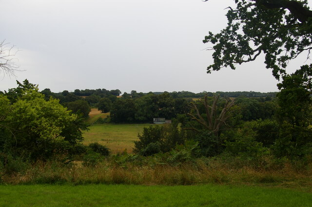
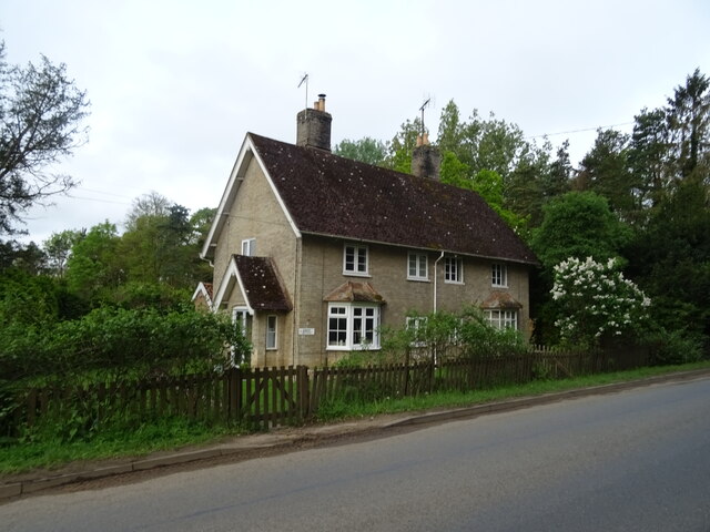
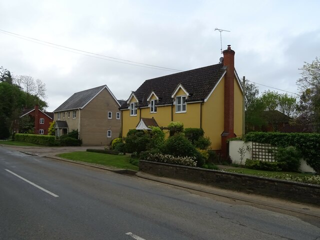
Blakenham is known for its picturesque setting, surrounded by beautiful countryside and farmland. The village itself is characterized by a charming mix of historic cottages and modern houses, reflecting its rich heritage and recent development.

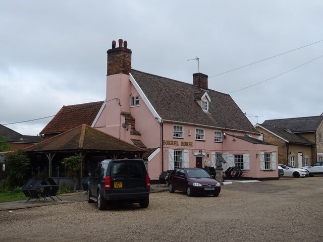
The village is home to a close-knit community, with a population of around 1,200 residents. It offers a range of amenities and services, including a primary school, a village hall, a local pub, and a village green. Additionally, there are several small businesses and a few shops catering to the needs of the residents.

Blakenham is well-connected to the surrounding areas by road. The A14, one of the major trunk roads in the region, passes nearby, providing convenient access to Ipswich, Cambridge, and other towns in East Anglia. The village also benefits from regular bus services, connecting it to neighboring towns and villages.

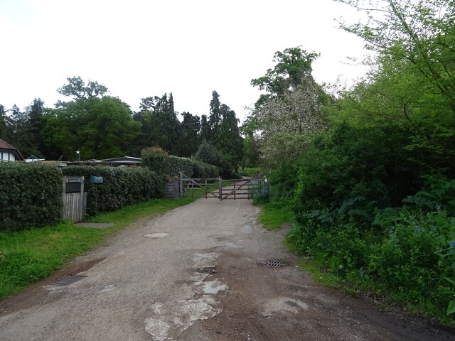
The area surrounding Blakenham is known for its natural beauty and offers opportunities for outdoor activities. There are several walking and cycling routes that allow visitors to explore the idyllic countryside and enjoy the peaceful surroundings.

In summary, Blakenham is a charming village in Suffolk with a strong sense of community and a beautiful rural setting. It provides a peaceful and picturesque place to live, while still offering convenient access to nearby towns and amenities.

If you have any feedback on the listing, please let us know in the comments section below.

Blakenham, Great Images

Images are sourced within 2km of 52.114458/1.0921 or Grid Reference TM1150. Thanks to Geograph Open Source API. All images are credited.

St Peter's church, Baylham, from the east
View southwards out of Baylham churchyard
Barham, St Mary
Barham, St Mary
A14 eastbound approaching the junction for Claydon
Nursery Cottages Beside National Cycle Route 51.
Nursery Cottages
Beside National Cycle Route 51.
Houses on Norwich Road
Track (footpath) into Shrubland Park Off National Cycle Route.
Track (footpath) into Shrubland Park
Off National Cycle Route.
Entering Barham On Norwich Road (National Cycle Route 51).
Entering Barham
On Norwich Road (National Cycle Route 51).
Thatched cottage beside Norwich Road (National Cycle Route 51)
Norwich Road (National Cycle Route 51) Towards Ipswich.
Norwich Road (National Cycle Route 51)
Towards Ipswich.
The Sorrel Horse On Norwich Road (National Cycle Route 51).
The Sorrel Horse
On Norwich Road (National Cycle Route 51).
Sign for the Sorrel Horse
Barham Lodge Gatehouse for Shrubland Park.
Barham Lodge
Gatehouse for Shrubland Park.
Norwich Road (National Cycle Route 51) Towards Ipswich.
Norwich Road (National Cycle Route 51)
Towards Ipswich.
Houses on Norwich Road, Claydon
Norwich Road, Claydon National Cycle Route 51.
Norwich Road, Claydon
National Cycle Route 51.
York Crescent, Claydon
Show me another place!

Blakenham, Great is located at Grid Ref: TM1150 (Lat: 52.114458, Lng: 1.0921)

Administrative County: Suffolk

District: Mid Suffolk

Police Authority: Suffolk

What 3 Words

///tour.fans.mute. Near Claydon, Suffolk

Related Wikis

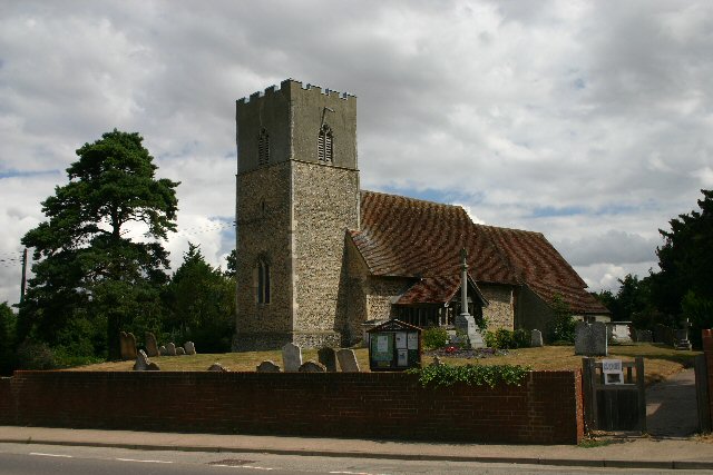
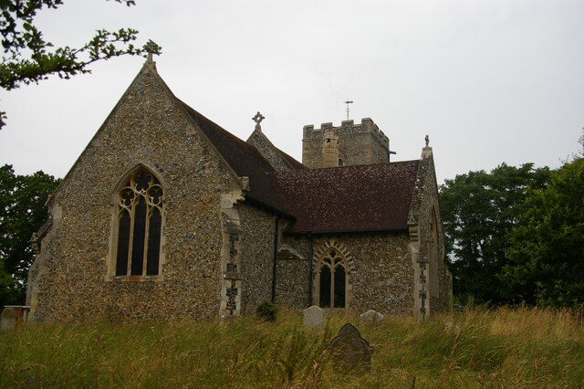
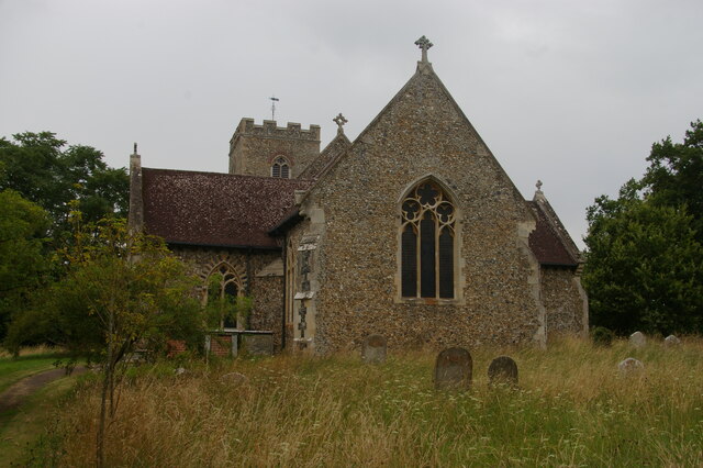
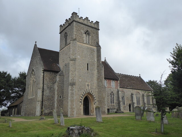
St Mary's Church, Great Blakenham

St Mary's Church is located in the village of Great Blakenham near Ipswich. It is an active Anglican parish church in the deanery of Bosmere, part of the...

Great Blakenham

Great Blakenham is a village and civil parish in the Mid Suffolk district of Suffolk in eastern England located near the town of Ipswich. An energy from...

Claydon railway station (Suffolk)

Claydon railway station was a station in Great Blakenham, Suffolk. It closed to passengers in 1963. The goods facility for Blue Circle Cement, British...
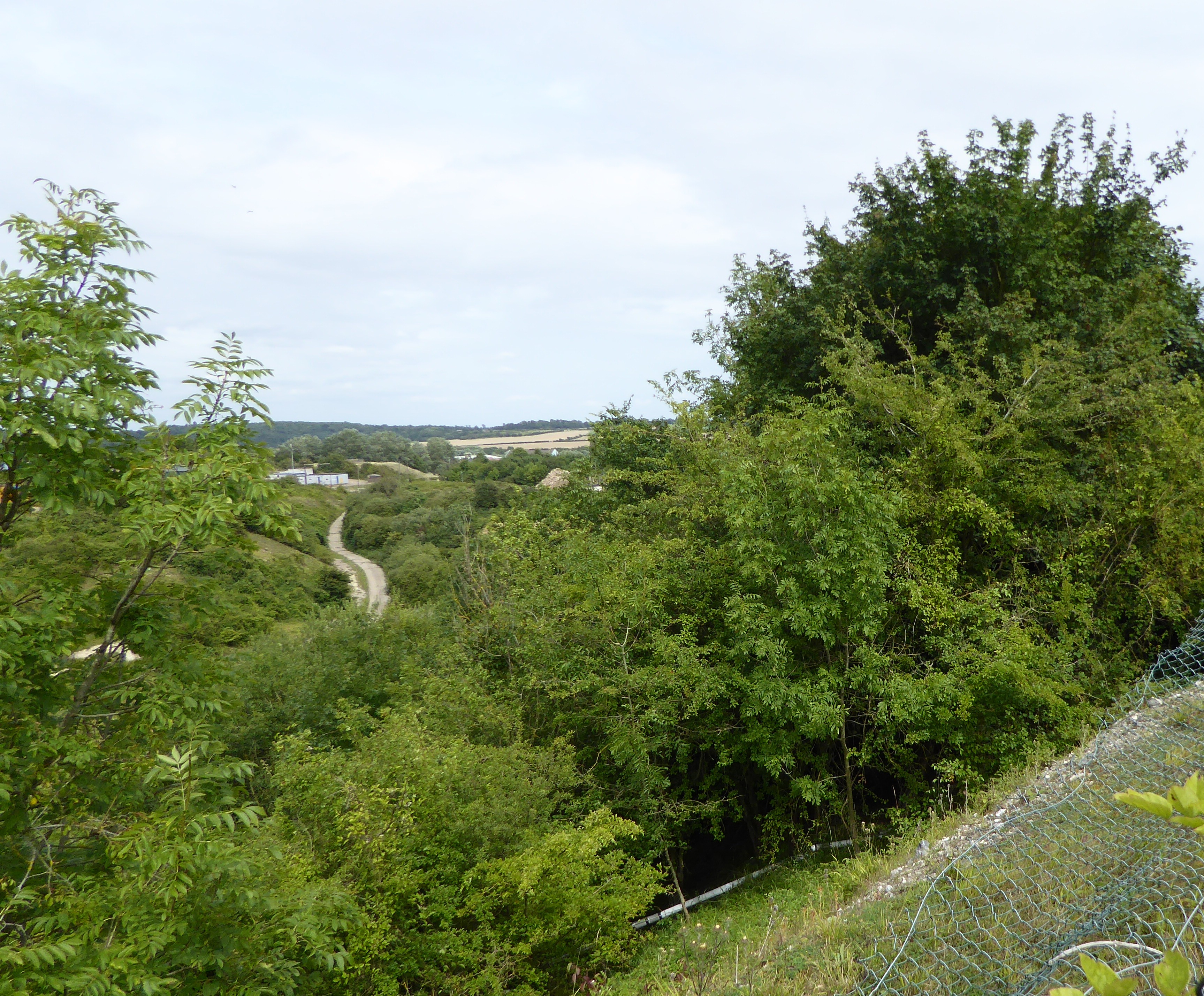
Great Blakenham Pit

Great Blakenham Pit is a 2.2-hectare (5.4-acre) geological Site of Special Scientific Interest south of Great Blakenham in Suffolk. It is a Geological...

Nearby Amenities

Located within 500m of 52.114458,1.0921
Great Blakenham
Place: village
Wikidata: Q2679924
Wikipedia: en:Great Blakenham
Lat/Long: 52.1143138/1.0936225
Bus Stop
Plummers Dell
Local Ref: adj
Naptan AtcoCode: 390040358
Naptan Bearing: SE
Naptan CommonName: Plummers Dell
Naptan Landmark: Plummers Dell
Naptan NaptanCode: sufawpmd
Naptan Street: Gipping Road
Naptan Verified: no
Source: naptan_import
Lat/Long: 52.1116509/1.0969805
Bus Stop
Plummers Dell
Local Ref: opp
Naptan AtcoCode: 390040359
Naptan Bearing: NW
Naptan CommonName: Plummers Dell
Naptan Landmark: Plummers Dell
Naptan NaptanCode: sufawpmg
Naptan Street: Gipping Road
Naptan Verified: no
Source: naptan_import
Lat/Long: 52.111535/1.0969432
Bus Stop
Chequers
Local Ref: adj
Naptan AtcoCode: 390040360
Naptan Bearing: N
Naptan CommonName: Chequers
Naptan Landmark: Chequers
Naptan NaptanCode: sufawpmj
Naptan Street: Stowmarket Road
Naptan Verified: no
Public Transport: platform
Source: naptan_import
Lat/Long: 52.1142945/1.0922114
Bus Stop
Chequers
Local Ref: opp
Naptan AtcoCode: 390040361
Naptan Bearing: S
Naptan CommonName: Chequers
Naptan Landmark: Chequers
Naptan NaptanCode: sufawpmp
Naptan Street: Stowmarket Road
Naptan Verified: no
Public Transport: platform
Source: naptan_import
Lat/Long: 52.1142147/1.0925127
Bus Stop
Woodfield
Local Ref: adj
Naptan AtcoCode: 390040362
Naptan Bearing: N
Naptan CommonName: Woodfield
Naptan Landmark: Woodfield
Naptan NaptanCode: sufawpmt
Naptan Street: Stowmarket Road
Naptan Verified: no
Public Transport: platform
Source: naptan_import
Lat/Long: 52.1184866/1.0894336
Bus Stop
Woodfield
Local Ref: opp
Naptan AtcoCode: 390040363
Naptan Bearing: S
Naptan CommonName: Woodfield
Naptan Landmark: Woodfield
Naptan NaptanCode: sufawpmw
Naptan Street: Stowmarket Road
Naptan Verified: no
Public Transport: platform
Source: naptan_import
Lat/Long: 52.118546/1.0895692
Pub
Chequers
Addr City: Ipswich
Addr Housenumber: 19
Addr Postcode: IP6 0LP
Addr Street: Stowmarket Road
Addr Village: Great Blakenham
Fhrs Id: 1404463
Food: yes
Website: http://www.chequersbaripswich.co.uk
Lat/Long: 52.1148715/1.0916252
Power: pole
Lat/Long: 52.1121571/1.0871341
Power: pole
Lat/Long: 52.1110469/1.0880702
Power: pole
Lat/Long: 52.1157313/1.0950011
Power: pole
Lat/Long: 52.1179235/1.0917502
Power: pole
Lat/Long: 52.1180025/1.0930377
Power: pole
Lat/Long: 52.118154/1.0942688
Power: pole
Lat/Long: 52.1185065/1.0952371
Power: pole
Lat/Long: 52.1172466/1.0936948
Power: pole
Lat/Long: 52.1163687/1.0944512
Fence: yes
Railway: level_crossing
Lat/Long: 52.1179548/1.0944915
Fence: yes
Railway: level_crossing
Lat/Long: 52.1180499/1.0947302
Recycling
Lat/Long: 52.1150423/1.0913578
Railway: switch
Lat/Long: 52.1147558/1.0973775
Railway: buffer_stop
Lat/Long: 52.1179323/1.0948053
Railway: switch
Lat/Long: 52.1181848/1.0944649
Railway: switch
Lat/Long: 52.11849/1.0942748
Recycling
Recycling Glass: yes
Recycling Type: container
Lat/Long: 52.1146228/1.094411
Recycling
Recycling Clothes: yes
Recycling Type: container
Lat/Long: 52.1118293/1.0954007
Barrier: bollard
Lat/Long: 52.1146752/1.0897793
Traffic Signals
Traffic Signals: signal
Traffic Signals Direction: both
Lat/Long: 52.1118061/1.0942024
Crossing
Lat/Long: 52.1122781/1.0946063
Crossing
Lat/Long: 52.1121015/1.0947087
Crossing
Lat/Long: 52.1122514/1.0941435
Barrier: bollard
Lat/Long: 52.1178787/1.0886206
Barrier: bollard
Lat/Long: 52.1147156/1.0899873
Crossing
Lat/Long: 52.1118158/1.094903
Crossing
Lat/Long: 52.1117596/1.0952707
Crossing
Lat/Long: 52.1117785/1.0956938
The data included in this document is from www.openstreetmap.org. The data is made available under ODbL.

Have you been to Blakenham, Great?

Leave your review of Blakenham, Great below (or comments, questions and feedback).