Great Berry
Settlement in Essex Basildon
England
Great Berry

Great Berry is a small village located in the county of Essex in southeastern England. Situated approximately 30 miles east of London, it falls within the borough of Basildon. The village is surrounded by picturesque rural landscapes and is known for its tranquil atmosphere and natural beauty.
Great Berry is primarily a residential area, offering a peaceful retreat from the bustling city life. The village is characterized by a mix of traditional and modern architecture, including charming cottages, spacious family homes, and newer housing developments. It is particularly popular among families and professionals looking for a quiet and safe place to live.
Despite its rural setting, Great Berry benefits from excellent transport links. The nearby A127 road provides easy access to the neighboring towns of Basildon and Wickford, as well as to London and other major cities. Additionally, the village is served by several bus routes, connecting it to the wider region.
Residents of Great Berry enjoy a range of amenities within close proximity. The village has a local primary school, ensuring quality education for young children. Nearby retail parks provide convenient shopping options, while recreational facilities such as parks, sports clubs, and golf courses cater to the active lifestyle of the community.
Overall, Great Berry offers a harmonious blend of countryside living and modern conveniences, making it an attractive place to reside for those seeking a peaceful and well-connected village in Essex.
If you have any feedback on the listing, please let us know in the comments section below.
Great Berry Images
Images are sourced within 2km of 51.569259/0.40766 or Grid Reference TQ6688. Thanks to Geograph Open Source API. All images are credited.


Great Berry is located at Grid Ref: TQ6688 (Lat: 51.569259, Lng: 0.40766)
Administrative County: Essex
District: Basildon
Police Authority: Essex
What 3 Words
///sweep.shells.stars. Near Basildon, Essex
Nearby Locations
Related Wikis

Little Burstead
Little Burstead is a village in Essex, England. It lies 2.25 miles (4 km) south-south-west of Billericay and 4.5 miles (7 km) east-south-east of Brentwood...

Laindon
Laindon is a town and civil parish, which now forms part of the town of Basildon, in the Basildon district, in Essex, England. It is between Basildon and...

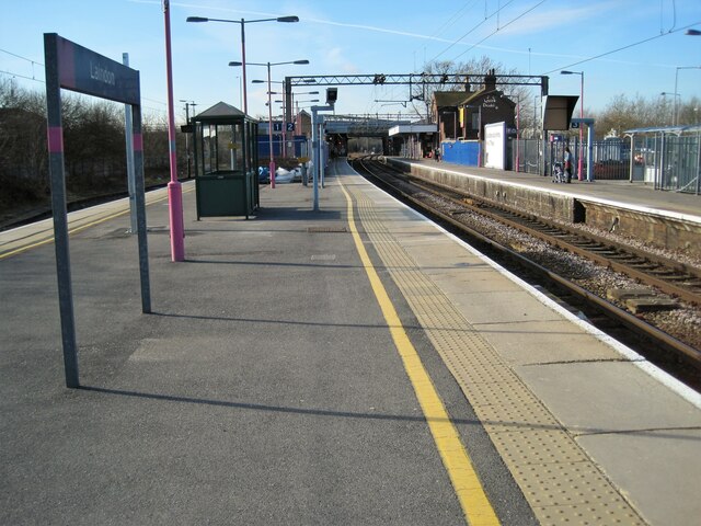
Laindon railway station
Laindon railway station is on the London, Tilbury and Southend line, serving the town of Laindon in Essex, England. It is 22 miles 69 chains (36.8 km)...

Langdon Nature Reserve
Langdon Nature Reserve (also described as Langdon Nature Discovery Park) is a 210 hectare nature reserve west of Basildon in Essex. It is managed by the...

Langdon Hills
Langdon Hills is an area of Basildon in the borough of Basildon in Essex, England. It is located south of Laindon railway station on the London, Tilbury...
Dunton Plotlands
The Dunton Plotlands was an area of small rural plots of land in Dunton Wayletts, southern Essex inhabited from the 1930s to the 1980s.The 'plotlands'...

Dunton Technical Centre
The Dunton Campus (informally Ford Dunton or Dunton) is a major automotive research and development facility located in Dunton Wayletts, Laindon, Essex...
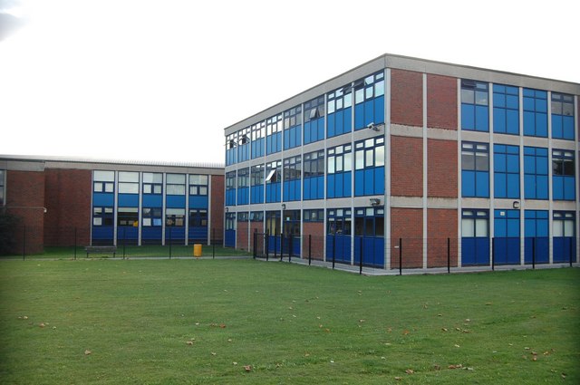
James Hornsby School
The James Hornsby School is a co-educational secondary school located in Laindon, in the Borough of Basildon, Essex, England. It was formed from the merger...
Nearby Amenities
Located within 500m of 51.569259,0.40766Have you been to Great Berry?
Leave your review of Great Berry below (or comments, questions and feedback).