Black Moss Tarn
Lake, Pool, Pond, Freshwater Marsh in Westmorland South Lakeland
England
Black Moss Tarn

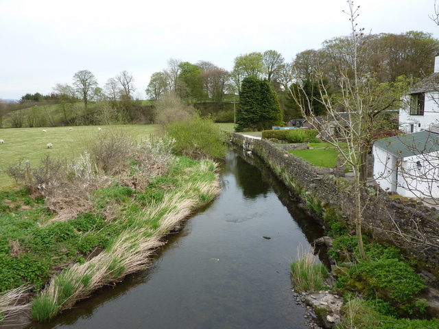
Black Moss Tarn is a picturesque freshwater lake located in the county of Westmorland, England. Situated amidst the serene beauty of the Lake District National Park, it is nestled within a lush landscape of rolling hills and verdant valleys. This small tarn is a hidden gem, often overlooked by tourists, making it an ideal destination for those seeking tranquility and seclusion.
Covering an area of approximately 2 hectares, Black Moss Tarn boasts crystal-clear waters that reflect the surrounding landscape like a mirror. The tarn is fed by natural springs and rainfall, ensuring a constant supply of fresh water. It is home to a diverse range of aquatic plants such as water lilies, reeds, and pondweeds, which thrive in the nutrient-rich environment.
The tarn provides a haven for various species of waterfowl, including mallards, coots, and moorhens, which can often be spotted gliding gracefully across the surface. The tranquil atmosphere is further enhanced by the melodic calls of songbirds that inhabit the surrounding woodland.
For nature enthusiasts, Black Moss Tarn offers a wealth of opportunities for exploration and observation. The tarn is encircled by a footpath that allows visitors to fully appreciate its beauty from every angle. Additionally, the nearby fells and woodlands provide ample hiking trails and picnic spots, allowing visitors to immerse themselves in the breathtaking natural scenery.
Overall, Black Moss Tarn is a hidden gem within the Lake District, offering a serene and unspoiled environment for those seeking solace amidst nature's beauty. Its calm waters, abundant wildlife, and picturesque surroundings make it a perfect destination for a peaceful retreat or a leisurely stroll.
If you have any feedback on the listing, please let us know in the comments section below.
Black Moss Tarn Images
Images are sourced within 2km of 54.367529/-2.6962638 or Grid Reference SD5497. Thanks to Geograph Open Source API. All images are credited.


Black Moss Tarn is located at Grid Ref: SD5497 (Lat: 54.367529, Lng: -2.6962638)
Administrative County: Cumbria
District: South Lakeland
Police Authority: Cumbria
What 3 Words
///obvious.prefer.spinners. Near Burneside, Cumbria
Nearby Locations
Related Wikis
Patton Bridge
Patton Bridge is a small rural hamlet approximately 5 miles from the outskirts of Kendal, Cumbria, England. Its post code region is LA8.
South Westmorland Rural District
South Westmorland was a rural district in Westmorland, England from 1894 to 1974. It saw various boundary changes during its existence, particularly in...

Selside
Selside is a small village in rural Cumbria, England, about 6 miles (9.7 km) north of Kendal, close to the A6 road. It is now in the civil parish of Selside...

Scalthwaiterigg
Scalthwaiterigg is a former civil parish, now in the parish of Skelsmergh and Scalthwaiterigg, in the Westmorland and Furness district, in the ceremonial...

Whitwell and Selside
Whitwell and Selside is a former civil parish, now part of the parish of Selside and Fawcett Forest, in the Westmorland and Furness district, in the ceremonial...
Whinfell
Whinfell is a civil parish in South Lakeland, Cumbria, England. It does not have a parish council but a parish meeting. The parish lies north east of Kendal...
Skelsmergh
Skelsmergh is a small village and former civil parish, now in the parish of Skelsmergh and Scalthwaiterigg, in South Lakeland in rural Cumbria, England...

Docker, Cumbria
Docker is a civil parish in the South Lakeland district of the English county of Cumbria. Docker is 4.3 miles north east of the market town of Kendal....
Nearby Amenities
Located within 500m of 54.367529,-2.6962638Have you been to Black Moss Tarn?
Leave your review of Black Moss Tarn below (or comments, questions and feedback).