Wab Loch

Lake, Pool, Pond, Freshwater Marsh in Orkney

Scotland

Wab Loch

Mirkady Point, Deerness, from the air
Mirkady Point, Deerness, from the air Credit: Mike Pennington

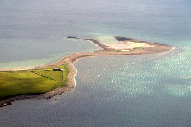
Wab Loch is a picturesque freshwater loch located on the island of Orkney, situated off the northeastern coast of Scotland. This tranquil body of water is nestled amidst rolling green hills and offers visitors a serene and idyllic setting to explore.

Spanning an area of approximately 20 acres, Wab Loch is renowned for its crystal-clear waters and abundant wildlife. The loch is fed by a combination of natural springs and rainfall, ensuring a constant flow of freshwater throughout the year. Its depth varies, with the deepest parts reaching around 20 feet, and it is surrounded by lush vegetation, including reeds and marshland.

The loch is home to a diverse range of flora and fauna, attracting nature enthusiasts from far and wide. Birdwatchers will delight in the numerous species that frequent the area, including grebes, swans, ducks, and various wading birds. The surrounding marshes provide an ideal habitat for water-loving plants such as water lilies and reed beds, which add to the loch's natural beauty.

Visitors to Wab Loch can enjoy a range of activities, including fishing, boating, and nature walks. The loch is known for its healthy population of brown trout, making it a popular spot for anglers seeking a peaceful day on the water. Alternatively, one can simply relax on the shores and soak in the breathtaking scenery.

Overall, Wab Loch is a hidden gem in the Orkney landscape, offering a haven of tranquility and natural beauty. Whether it be for birdwatching, fishing, or simply enjoying the serenity, this stunning freshwater loch is a must-visit for nature lovers and those seeking a peaceful escape.

If you have any feedback on the listing, please let us know in the comments section below.
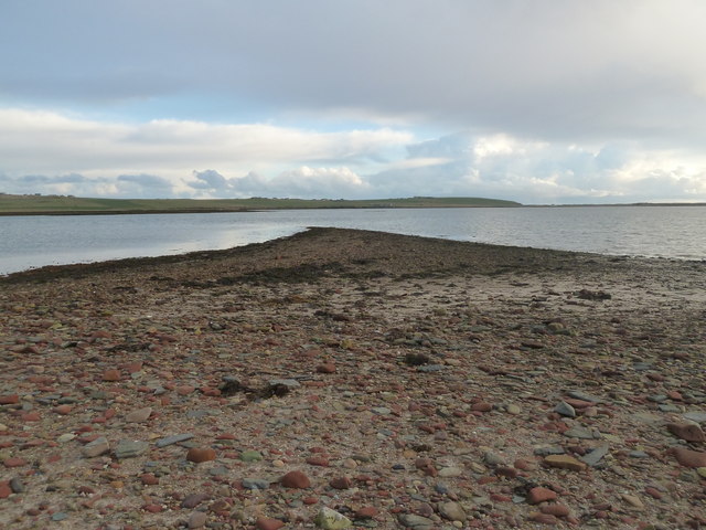
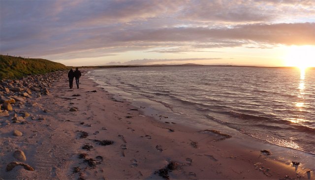
Wab Loch Images

Images are sourced within 2km of 58.938168/-2.7872093 or Grid Reference HY5405. Thanks to Geograph Open Source API. All images are credited.

Mirkady Point, Deerness, from the air
Keigar and Eve's Loch, Deerness, from the air
Old Milestone by the B9051, Halley Road, North Windbreck Stone post by the B9051, in parish of St Andrews and Deerness (Mainland District), North Windbreck, over ditch on banking, East side of road.

Inscription reads:-
: K / 10 : : D / 1¼ :
(To Kirkwall and Deerness)

Surveyed

Milestone Society National ID: OR_KWDN10
Old Milestone by the B9051, Halley Road, North Windbreck
Stone post by the B9051, in parish of St Andrews and Deerness (Mainland District), North Windbreck, over ditch on banking, East side of road. Inscription reads:- : K / 10 : : D / 1¼ : (To Kirkwall and Deerness) Surveyed Milestone Society National ID: OR_KWDN10
Deerness: the village store and post office The village store at Deerness also has a post office. The postbox out front is currently out of action - see <a href="https://www.geograph.org.uk/photo/2610078">HY5605 : Deerness: postbox № KW17 39</a> for a closer look.
Deerness: the village store and post office
The village store at Deerness also has a post office. The postbox out front is currently out of action - see HY5605 : Deerness: postbox № KW17 39 for a closer look.
Deerness: postbox № KW17 39 This postbox is attached to the wall of <a href="https://www.geograph.org.uk/photo/2610076">HY5605 : Deerness: the village store and post office</a> and is currently out of use. The shop assistant told me that a few weeks ago the postman was emptying the box and, as he went to shut the door, it came off in his hand.
Deerness: postbox № KW17 39
This postbox is attached to the wall of HY5605 : Deerness: the village store and post office and is currently out of use. The shop assistant told me that a few weeks ago the postman was emptying the box and, as he went to shut the door, it came off in his hand.
Deerness: red telephone box This well-painted box stands virtually in someone's driveway. The island of Copinsay can be seen in the background.
Deerness: red telephone box
This well-painted box stands virtually in someone's driveway. The island of Copinsay can be seen in the background.
Waiting for tides I have been waiting here for 17 minutes.
Ahead is the smallest portion of a Grid Square imaginable.
I shall get to it somehow - see <a href="https://www.geograph.org.uk/photo/2720649">HY5305 : The Tiniest Place</a>
Waiting for tides
I have been waiting here for 17 minutes. Ahead is the smallest portion of a Grid Square imaginable. I shall get to it somehow - see HY5305 : The Tiniest Place
The Tiniest Place Only by luck did I get onto this, an elusive piece of Mainland Orkney land.
It seemed an anti-climax and I vow to get to Oyster Skerries next year.
I think this is the very last (reasonable) grid square on Orkney Mainland to be 'geographed'.
Well I think so, as <a href="https://www.geograph.org.uk/gridref/HY4222">HY4222</a> might be possible
The Tiniest Place
Only by luck did I get onto this, an elusive piece of Mainland Orkney land. It seemed an anti-climax and I vow to get to Oyster Skerries next year. I think this is the very last (reasonable) grid square on Orkney Mainland to be 'geographed'. Well I think so, as HY4222 might be possible
The Ness of Campston A small, unnamed, but permanent lake near the Point of Od.
The Ness of Campston
A small, unnamed, but permanent lake near the Point of Od.
The Point of Od An odd name, probably of Viking origin.
Even more odd is another nearby <a href="https://www.geograph.org.uk/photo/2723347">HY5306 : Od Points</a>
The Point of Od
An odd name, probably of Viking origin. Even more odd is another nearby HY5306 : Od Points
Od Points On Mirkady Point one looks south and left to Scarf Point and right, here, to the Point of Od.
Oddly, another is nearby <a href="https://www.geograph.org.uk/photo/2720656">HY5404 : The Point of Od</a>
Od Points
On Mirkady Point one looks south and left to Scarf Point and right, here, to the Point of Od. Oddly, another is nearby HY5404 : The Point of Od
Mirkady Herring Curing Station The building is well photographed but its history is not widely known.
Built in 1846 by Mr Groat of Newhall it was used for about 30 years as a Herring Curing Station. It is remarkably intact and now a Cat. B listed building.
More information here <span class="nowrap"><a title="http://canmore.rcahms.gov.uk/en/site/3013/details/mirkady+point+herring+curing+station/" rel="nofollow ugc noopener" href="http://canmore.rcahms.gov.uk/en/site/3013/details/mirkady+point+herring+curing+station/">Link</a><img style="margin-left:2px;" alt="External link" title="External link - shift click to open in new window" src="https://s1.geograph.org.uk/img/external.png" width="10" height="10"/></span> and <span class="nowrap"><a title="http://www.britishlistedbuildings.co.uk/sc-46146-deerness-mirkady-point-mirkady-fishing-st" rel="nofollow ugc noopener" href="http://www.britishlistedbuildings.co.uk/sc-46146-deerness-mirkady-point-mirkady-fishing-st">Link</a><img style="margin-left:2px;" alt="External link" title="External link - shift click to open in new window" src="https://s1.geograph.org.uk/img/external.png" width="10" height="10"/></span>
Mirkady Herring Curing Station
The building is well photographed but its history is not widely known. Built in 1846 by Mr Groat of Newhall it was used for about 30 years as a Herring Curing Station. It is remarkably intact and now a Cat. B listed building. More information here LinkExternal link and LinkExternal link
The Old House, Mikardy Point Late on a summers evening just after sunset the yellow lichen on the roof of the old house at Mikardy Point shows up well against the steely blue sky.
Apparently an old herring curing station.:-
<a title="https://www.geograph.org.uk/photo/2723377" href="https://www.geograph.org.uk/photo/2723377">Link</a>
The Old House, Mikardy Point
Late on a summers evening just after sunset the yellow lichen on the roof of the old house at Mikardy Point shows up well against the steely blue sky. Apparently an old herring curing station.:- Link
Hurnip's Point View Half an hour after sunset and the light is stunning. The old herring station at Mikardy Point seen from Hurnip's Point. Beyond is Wideford Hill above Kirkwall.
Hurnip's Point View
Half an hour after sunset and the light is stunning. The old herring station at Mikardy Point seen from Hurnip's Point. Beyond is Wideford Hill above Kirkwall.
Orcadian Summer Sky Heading towards midnight and the light is moving round to the north - a typical orcadian sky in the summertime - when the weather is fine!
Looking towards Mikardy Point from Braebuster.
Orcadian Summer Sky
Heading towards midnight and the light is moving round to the north - a typical orcadian sky in the summertime - when the weather is fine! Looking towards Mikardy Point from Braebuster.
Halley Beach Sunset Enjoying the late Orcadian evening on Halley Beach, Deerness - the sun is just about to set over Tankerness.
Halley Beach Sunset
Enjoying the late Orcadian evening on Halley Beach, Deerness - the sun is just about to set over Tankerness.
Deerness, Orkney, loch and farmland New Year's Day 2006, Braebuster House and farm steading on the skyline.
Deerness, Orkney, loch and farmland
New Year's Day 2006, Braebuster House and farm steading on the skyline.
Halley Beach, Deerness A north-facing beach with shallow waters in Deerness.  Seals can be seen here frequently, and the clarity of the water is such that they can be seen to be "hanging" in the water.
Halley Beach, Deerness
A north-facing beach with shallow waters in Deerness. Seals can be seen here frequently, and the clarity of the water is such that they can be seen to be "hanging" in the water.
Show me another place!

Wab Loch is located at Grid Ref: HY5405 (Lat: 58.938168, Lng: -2.7872093)

Unitary Authority: Orkney Islands

Police Authority: Highlands and Islands

What 3 Words

///briefing.going.marathons. Near Deerness, Orkney Islands

Nearby Locations

Wab Loch Taing Wab Loch

Related Wikis

St Peter's Pool, Orkney

St Peter's Pool is a bay in the East Mainland of Orkney, Scotland. This bay was the site of significant coastal defences during World War II, when a German...

Deerness

Deerness (, locally , Old Norse: Dyrnes) is a quoad sacra parish (i.e. one created and functioning for ecclesiastical purposes only) and peninsula in Mainland...

Mine Howe

Mine Howe is an Iron Age subterranean man-made chamber dug 6 meters (20 feet) deep inside a large mound. It is located in the Tankerness area of Orkney...

Tankerness

Tankerness is a district in the St Andrews parish in Mainland, Orkney, Scotland. Essentially a peninsula, it is about 13 kilometres (8 mi) south-east of...

Nearby Amenities

Located within 500m of 58.938168,-2.7872093
Power: pole
Lat/Long: 58.9346418/-2.7826739
Power: pole
Lat/Long: 58.9343802/-2.7845389
Power: pole
Lat/Long: 58.934152/-2.7861504
The data included in this document is from www.openstreetmap.org. The data is made available under ODbL.

Have you been to Wab Loch?

Leave your review of Wab Loch below (or comments, questions and feedback).