Little Battery

Lake, Pool, Pond, Freshwater Marsh in Roxburghshire

Scotland

Little Battery

Footbridge across the River Tweed
Footbridge across the River Tweed Credit: Les Hull

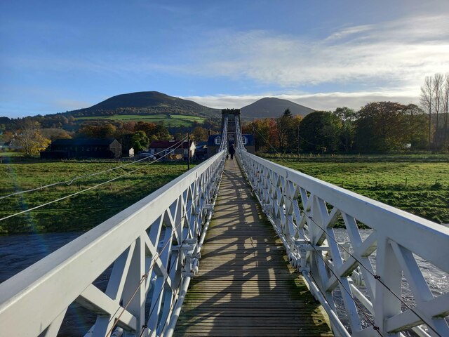
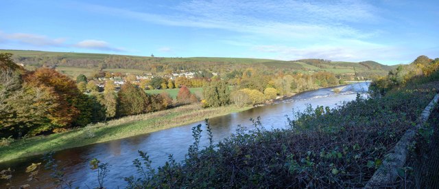
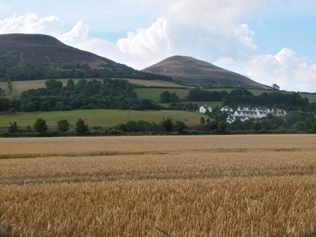
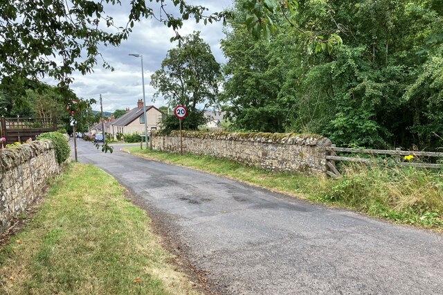
Little Battery is a small, picturesque freshwater marsh located in Roxburghshire, a historic county in the southern part of Scotland. Situated amidst rolling hills and lush greenery, this natural haven is a hidden gem for nature enthusiasts and those seeking tranquility.

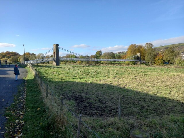
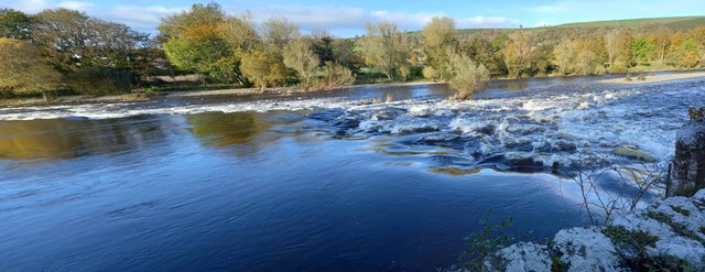
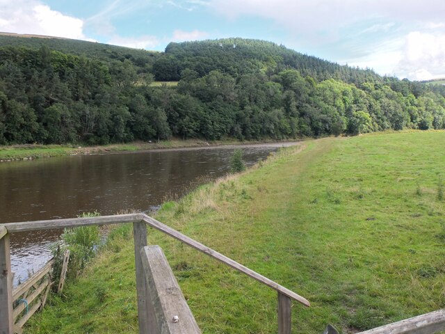
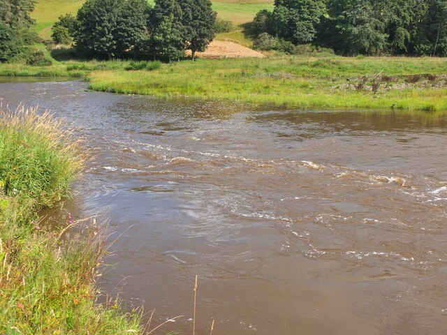
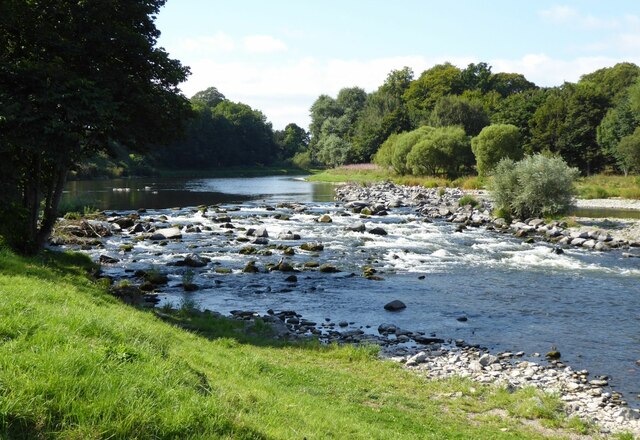
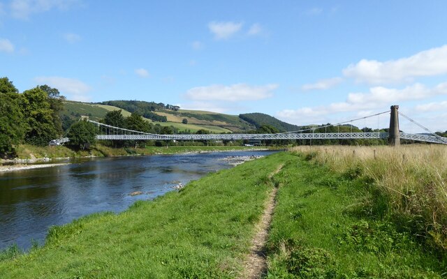
The centerpiece of Little Battery is its enchanting lake, which spans approximately 2 acres. The pristine waters of the lake are fed by a gentle stream that winds its way through the surrounding landscape. The lake is home to a variety of aquatic life, including fish, frogs, and waterfowl, making it a delightful spot for birdwatching and fishing.

Surrounding the lake, there are several pools and ponds that add to the beauty and diversity of the area. These smaller bodies of water house a plethora of plant species, such as water lilies and reeds, providing a rich habitat for insects and amphibians.

The freshwater marsh, adjacent to the lake, is a vital ecosystem that supports a diverse range of plant and animal life. It is characterized by its waterlogged soil, which allows for the growth of unique vegetation, including sedges and rushes. The marsh also acts as a natural filter, purifying the water that flows into the lake.

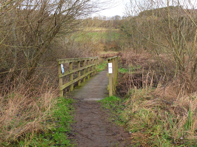
Visitors to Little Battery can enjoy peaceful walks along the well-maintained footpaths that surround the lake, observing the abundant wildlife and taking in the breathtaking scenery. The area is particularly popular during the spring and summer months when the marsh is in full bloom, showcasing an array of vibrant colors and fragrances.

Overall, Little Battery in Roxburghshire is a captivating destination for nature lovers, offering a serene retreat in the heart of the Scottish countryside.

If you have any feedback on the listing, please let us know in the comments section below.

Little Battery Images

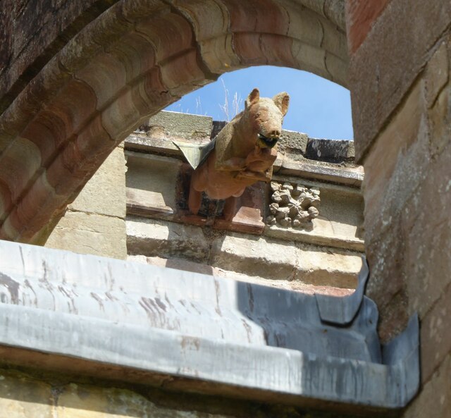
Images are sourced within 2km of 55.603149/-2.7198654 or Grid Reference NT5434. Thanks to Geograph Open Source API. All images are credited.

Footbridge across the River Tweed
Footbridge across the River Tweed Eildon Hill in the background
Footbridge across the River Tweed
Eildon Hill in the background
River Tweed at Melrose Site of a weir which I think might have  been damaged.
River Tweed at Melrose
Site of a weir which I think might have been damaged.
View of River Tweed Village of Gattonside and distant hills.
View of River Tweed
Village of Gattonside and distant hills.
Melrose Rugby Union Ground
Barley field below the Eildon Hills, Melrose A field on The Annay beside the Tweed with Eildon Hill North (L) and Mid Hill (R). The houses are on the eastern fringe of Melrose.
Barley field below the Eildon Hills, Melrose
A field on The Annay beside the Tweed with Eildon Hill North (L) and Mid Hill (R). The houses are on the eastern fringe of Melrose.
The Tweed east of Melrose The Tweed seen from an elevated stile on the riverside path to Newstead.
The Tweed east of Melrose
The Tweed seen from an elevated stile on the riverside path to Newstead.
Yesterday's rain, River Tweed Very heavy showers yesterday have increased the flow and coloured the water with suspended mud, here in a narrowing of the river near Newstead.
Yesterday's rain, River Tweed
Very heavy showers yesterday have increased the flow and coloured the water with suspended mud, here in a narrowing of the river near Newstead.
Main Street, Newstead A village close to the Trimontium Roman site east of Melrose.
Main Street, Newstead
A village close to the Trimontium Roman site east of Melrose.
Melrose Abbey Pig playing a bagpipe, as a gargoyle, viewed under a flying buttress.
Melrose Abbey
Pig playing a bagpipe, as a gargoyle, viewed under a flying buttress.
Derelict weir on River Tweed A lade, just to the left of the image, carried water to the abbey some 500 m to the east.
Derelict weir on River Tweed
A lade, just to the left of the image, carried water to the abbey some 500 m to the east.
Melrose, Gattonside Suspension Footbridge Tolls had to be paid to cross the new bridge over the River Tweed, which joined the communities of Melrose and Gattonside. Constructed in 1826, it is a footbridge with iron-link suspension chains, iron rods as vertical suspenders and a wooden deck.
Melrose, Gattonside Suspension Footbridge
Tolls had to be paid to cross the new bridge over the River Tweed, which joined the communities of Melrose and Gattonside. Constructed in 1826, it is a footbridge with iron-link suspension chains, iron rods as vertical suspenders and a wooden deck.
Main Street, Newstead A bus is having difficulty negotiating the narrow road!
Main Street, Newstead
A bus is having difficulty negotiating the narrow road!
Broomilees Road. Infilled Railway cutting At this point was an over bridge on the Waverley Line, now infilled.


<span class="nowrap"><a title="https://tinyurl.com/e94tw557" rel="nofollow ugc noopener" href="https://tinyurl.com/e94tw557">Link</a><img style="margin-left:2px;" alt="External link" title="External link - shift click to open in new window" src="https://s1.geograph.org.uk/img/external.png" width="10" height="10"/></span>
Broomilees Road. Infilled Railway cutting
At this point was an over bridge on the Waverley Line, now infilled. LinkExternal link
Footbridge near The Eddy A footbridge on the riverside path between Melrose and Newstead.
Footbridge near The Eddy
A footbridge on the riverside path between Melrose and Newstead.
Safe passage below the Melrose By-Pass An underpass with separate routes for pedestrians and livestock under the busy A6091 near Newstead.
Safe passage below the Melrose By-Pass
An underpass with separate routes for pedestrians and livestock under the busy A6091 near Newstead.
Track from Newstead A track joining the old road near the Rhymer's Stone and on the route of the Borders Abbeys Way.
Track from Newstead
A track joining the old road near the Rhymer's Stone and on the route of the Borders Abbeys Way.
A narrow path in Melrose The path connects High Road with Priorswalk.
A narrow path in Melrose
The path connects High Road with Priorswalk.
Show me another place!

Little Battery is located at Grid Ref: NT5434 (Lat: 55.603149, Lng: -2.7198654)

Unitary Authority: The Scottish Borders

Police Authority: The Lothians and Scottish Borders

What 3 Words

///boast.comical.faces. Near Melrose, Scottish Borders

Related Wikis

Harmony Garden, Scottish Borders

The Harmony Garden is the garden of Harmony Hall which is in the town of Melrose, in the Scottish Borders, administered by the National Trust for Scotland...

Greenyards

The Greenyards is a sports ground in Melrose, Scottish Borders. It has been the home of Melrose RFC for rugby union matches and the annual Melrose Sevens...

Melrose Abbey

St Mary's Abbey, Melrose is a partly ruined monastery of the Cistercian order in Melrose, Roxburghshire, in the Scottish Borders. It was founded in 1136...

Priorwood Garden

Priorwood Garden is a garden in Melrose in the Scottish Borders area of Scotland. The garden contains an apple orchard of unusual apple trees. The flower...

Nearby Amenities

Located within 500m of 55.603149,-2.7198654
Melrose Cauld
Canoe: discouraged
Description: metal spikes, unadvised to paddle
Rapids: 4
Waterway: weir
Lat/Long: 55.6020211/-2.726219
Crossing
Crossing: unmarked
Crossing Island: no
Kerb: lowered
Tactile Paving: no
Lat/Long: 55.6005073/-2.7247447
Barrier: bollard
Lat/Long: 55.60224/-2.7228331
Whitewater: egress
Lat/Long: 55.6030469/-2.7238397
Bicycle Parking
Bicycle Parking: stands
Capacity: 4
Covered: no
Lat/Long: 55.5987973/-2.7191663
Access: destination
Barrier: door
Lat/Long: 55.5996784/-2.7181932
Friars Hall
Place: isolated_dwelling
Lat/Long: 55.606672/-2.7162272
Entrance: yes
Lat/Long: 55.5990519/-2.7190363
Bench
Backrest: yes
Lat/Long: 55.6014564/-2.7264547
Bench
Backrest: yes
Lat/Long: 55.6014063/-2.7267109
Bench
Backrest: yes
Lat/Long: 55.6013374/-2.7270287
Board Type: history
Check Date: 2021-10-31
Information: board
Tourism: information
Lat/Long: 55.5999103/-2.7198296
Bench
Covered: yes
Lat/Long: 55.5994774/-2.7208661
Melrose Abbey Visitors Centre
Shop: gift
Lat/Long: 55.5990709/-2.7189963
Check Date: 2021-07-24
Covered: no
Leisure: picnic_table
Lat/Long: 55.6007729/-2.7259844
Check Date: 2022-01-16
Information: board
Tourism: information
Lat/Long: 55.6017448/-2.7258021
Colour: green
Covered: no
Leisure: picnic_table
Material: metal
Lat/Long: 55.6018155/-2.7255913
Driving School
Adventures On Wheels
Note: motorcycle driving school
Lat/Long: 55.6020552/-2.7226635
Historic: memorial
Lat/Long: 55.6004879/-2.7256792
Board Type: sport
Check Date: 2022-01-16
Information: board
Tourism: information
Lat/Long: 55.5988193/-2.7191881
Bicycle Parking
Access: customers
Bicycle Parking: wall_loops
Capacity: 3
Covered: no
Lat/Long: 55.6005901/-2.7194648
Toilets
Lat/Long: 55.5993391/-2.7171759
Addr City: Melrose
Addr Housename: Buccleuch Mews
Addr Housenumber: 4
Addr Street: Abbey Court
Lat/Long: 55.5991221/-2.7204771
Addr City: Melrose
Addr Housename: Buccleuch Mews
Addr Housenumber: 1
Addr Street: Abbey Court
Lat/Long: 55.5991092/-2.7208123
Addr City: Melrose
Addr Housename: Buccleuch Mews
Addr Housenumber: 5
Addr Street: Abbey Court
Lat/Long: 55.5991281/-2.7203232
Addr City: Melrose
Addr Housename: Buccleuch Mews
Addr Housenumber: 7
Addr Street: Abbey Court
Lat/Long: 55.5990804/-2.7201332
Addr City: Melrose
Addr Housename: Buccleuch Mews
Addr Housenumber: 3
Addr Street: Abbey Court
Lat/Long: 55.5991194/-2.7205468
Addr City: Melrose
Addr Housename: Buccleuch Mews
Addr Housenumber: 2
Addr Street: Abbey Court
Lat/Long: 55.5991136/-2.7206983
Addr City: Melrose
Addr Housename: Buccleuch Mews
Addr Housenumber: 6
Addr Street: Abbey Court
Lat/Long: 55.5991324/-2.7202096
Addr City: Melrose
Addr Housename: Lavander Blue
Addr Street: Abbey Court
Lat/Long: 55.5988823/-2.720696
Bench
Lat/Long: 55.6018353/-2.7176594
Generator Method: photovoltaic
Generator Output Electricity: yes
Generator Source: solar
Generator Type: solar_photovoltaic_panel
Power: generator
Lat/Long: 55.6052267/-2.7256179
Bench
Backrest: yes
Material: wood
Seats: 3
Survey Date: 2021-10-31
Lat/Long: 55.5997519/-2.7200423
Post Depot
Melrose Delivery Office
Addr City: Melrose
Addr Housenumber: 10
Addr Postcode: TD6 9LE
Addr Street: Buccleuch Street
Operator: Royal Mail
Operator Type: private
Operator Wikidata: Q638098
Lat/Long: 55.5988007/-2.7203239
Man Made: charge_point
Lat/Long: 55.5987242/-2.7191184
Waste Basket
Lat/Long: 55.6022707/-2.7230042
The data included in this document is from www.openstreetmap.org. The data is made available under ODbL.

Have you been to Little Battery?

Leave your review of Little Battery below (or comments, questions and feedback).