Sealskerry Loch

Lake, Pool, Pond, Freshwater Marsh in Orkney

Scotland

Sealskerry Loch

Rammy Geo, Eday View to the shore with Fersness Farm on the horizon.
Rammy Geo, Eday Credit: Andy Farrington

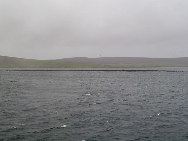
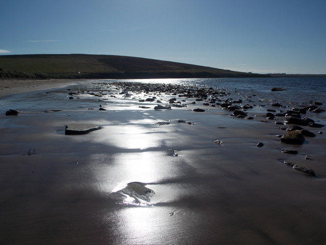
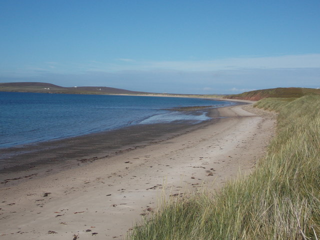
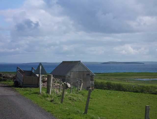
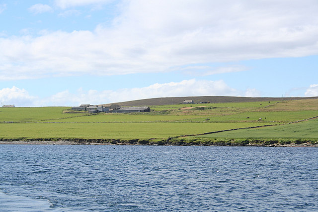
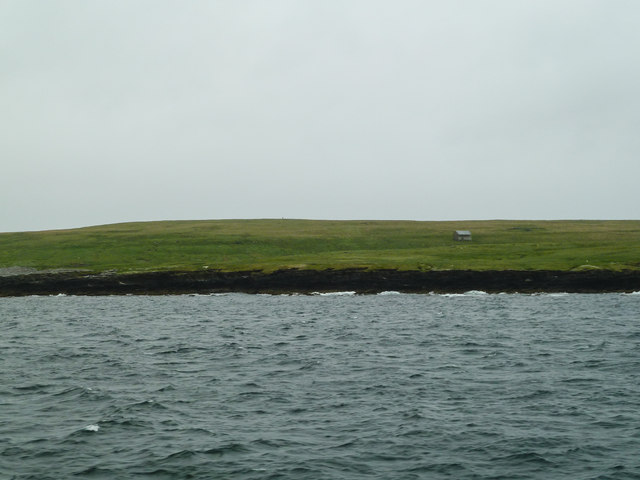
Sealskerry Loch, located in Orkney, Scotland, is a small freshwater loch with a surface area of approximately 5 hectares. Nestled amidst the picturesque landscape, this body of water provides a tranquil haven for both wildlife and visitors alike. The loch is surrounded by rolling hills covered in lush vegetation, creating a breathtaking backdrop.

The water in Sealskerry Loch is crystal clear and supports a diverse ecosystem. It is home to various species of fish, including trout and perch, which thrive in the nutrient-rich waters. The presence of these fish attracts a variety of bird species, making it an ideal spot for birdwatching enthusiasts. Visitors can often spot common waterfowl such as mallards, tufted ducks, and grebes, as well as rarer species like the great northern diver and whooper swan.

Surrounding the loch, a freshwater marsh provides additional habitat for a range of wildlife. The marsh is characterized by its dense vegetation, including reeds and grasses, which serve as ideal nesting sites for birds and shelter for small mammals. It is not uncommon to spot otters, voles, and even occasional red deer venturing to the water's edge.

Sealskerry Loch is a popular destination for outdoor enthusiasts seeking a peaceful retreat. Its serene ambiance, combined with its rich biodiversity, offers a unique experience for nature lovers. Visitors can enjoy leisurely walks along the loch's shoreline, observing the wildlife and taking in the stunning views. Whether you are an avid birder, a keen angler, or simply seeking solace in nature, Sealskerry Loch is a hidden gem in the heart of Orkney.

If you have any feedback on the listing, please let us know in the comments section below.

Sealskerry Loch Images

Images are sourced within 2km of 59.174744/-2.8195491 or Grid Reference HY5332. Thanks to Geograph Open Source API. All images are credited.

Rammy Geo, Eday View to the shore with Fersness Farm on the horizon.
Rammy Geo, Eday
View to the shore with Fersness Farm on the horizon.
Eday Passing West Side on the way to Kirkwall.
Eday
Passing West Side on the way to Kirkwall.
Seal  Skerry View to the skerry with Sealskerry Bay beyond and a wind turbine on Eday on the horizon.
Seal Skerry
View to the skerry with Sealskerry Bay beyond and a wind turbine on Eday on the horizon.
Eday Tidal Generator View of the EMEC Fall of Warness Grid-Connected Tidal Test Site with an export capacity of 4MW.
Eday Tidal Generator
View of the EMEC Fall of Warness Grid-Connected Tidal Test Site with an export capacity of 4MW.
Fersness Hill Parked near gate then walked up moorland to various likely high points on the moorland near man made ditch with Jim Bloomer, Richard Tibbetts and Tricky Speirs.
Name: Fersness Hill
Hill number:12219
Height: 89m / 292ft
Parent (Ma/M):none
Area:23: Orkney Islands
Class:0
Grid ref: HY537327 (est)
Drop: 36m
Col: 53m  HY542321
Fersness Hill
Parked near gate then walked up moorland to various likely high points on the moorland near man made ditch with Jim Bloomer, Richard Tibbetts and Tricky Speirs. Name: Fersness Hill Hill number:12219 Height: 89m / 292ft Parent (Ma/M):none Area:23: Orkney Islands Class:0 Grid ref: HY537327 (est) Drop: 36m Col: 53m HY542321
Ruined Farmstead On Eday
Eday: Sands of Mussetter against the evening sun Looking along this fine sandy beach at 5:45 on a glorious summer's evening, the sun's reflection picking out the gentle undulations of the sand and the random sprinkling of small rocks.
Eday: Sands of Mussetter against the evening sun
Looking along this fine sandy beach at 5:45 on a glorious summer's evening, the sun's reflection picking out the gentle undulations of the sand and the random sprinkling of small rocks.
Eday: Sands of Mussetter This fine sandy beach lines the shore of Fersness Bay, and runs as far as the slight promontory on the right; separated by a rocky area the sands continue as the Sands of Doomy.
Eday: Sands of Mussetter
This fine sandy beach lines the shore of Fersness Bay, and runs as far as the slight promontory on the right; separated by a rocky area the sands continue as the Sands of Doomy.
The west coast of Eday A low but significant cliff. Fersness Farm is on top of the rise behind. A new barn has been built since this image: <a href="https://www.geograph.org.uk/photo/3492747">HY5233 : Rammy Geo, Eday</a>.
The west coast of Eday
A low but significant cliff. Fersness Farm is on top of the rise behind. A new barn has been built since this image: HY5233 : Rammy Geo, Eday.
Tractor at work above the coast of Eday They are a bit dark, but the cliffs of this west side of Eday have clear wavy strata. Fersness Hill rises behind.
Tractor at work above the coast of Eday
They are a bit dark, but the cliffs of this west side of Eday have clear wavy strata. Fersness Hill rises behind.
The west coast of Eday The coastline is very low here. Fersness Hill rises behind.
The west coast of Eday
The coastline is very low here. Fersness Hill rises behind.
Cliffs on the west coast of Eday Dark weathered sandstone strata. Behind is Castlehill on the lower slopes of Fersness Hill.
Cliffs on the west coast of Eday
Dark weathered sandstone strata. Behind is Castlehill on the lower slopes of Fersness Hill.
Part of Seal Skerry A headland on Eday. Sealskerry Bay opens up behind.
Part of Seal Skerry
A headland on Eday. Sealskerry Bay opens up behind.
Seal Skerry An isolated rock off Eday.
Seal Skerry
An isolated rock off Eday.
Farmland at Westside, Eday A minor road runs around the western peninsula of Eday and stops just past the point of Sandybank.
Farmland at Westside, Eday
A minor road runs around the western peninsula of Eday and stops just past the point of Sandybank.
Farm buildings, Westside, Eday Looking along the coast from near the Point of Sandybank.
Farm buildings, Westside, Eday
Looking along the coast from near the Point of Sandybank.
Sands of Mussetter
Sands of Mussetter
Site of Eday Tidal Energy Test Facility At the time of this photograph construction had just started. See <span class="nowrap"><a title="http://www.emec.org.uk/tidal_site.asp" rel="nofollow ugc noopener" href="http://www.emec.org.uk/tidal_site.asp">Link</a><img style="margin-left:2px;" alt="External link" title="External link - shift click to open in new window" src="https://s1.geograph.org.uk/img/external.png" width="10" height="10"/></span>.
Site of Eday Tidal Energy Test Facility
At the time of this photograph construction had just started. See LinkExternal link.
Show me another place!

Sealskerry Loch is located at Grid Ref: HY5332 (Lat: 59.174744, Lng: -2.8195491)

Unitary Authority: Orkney Islands

Police Authority: Highlands and Islands

What 3 Words

///stapled.selection.revealing. Near Backaland, Orkney Islands

Related Wikis

Eday

Eday (, Scots: Aidee) is one of the islands of Orkney, which are located to the north of the Scottish mainland. One of the North Isles, Eday is about 24...

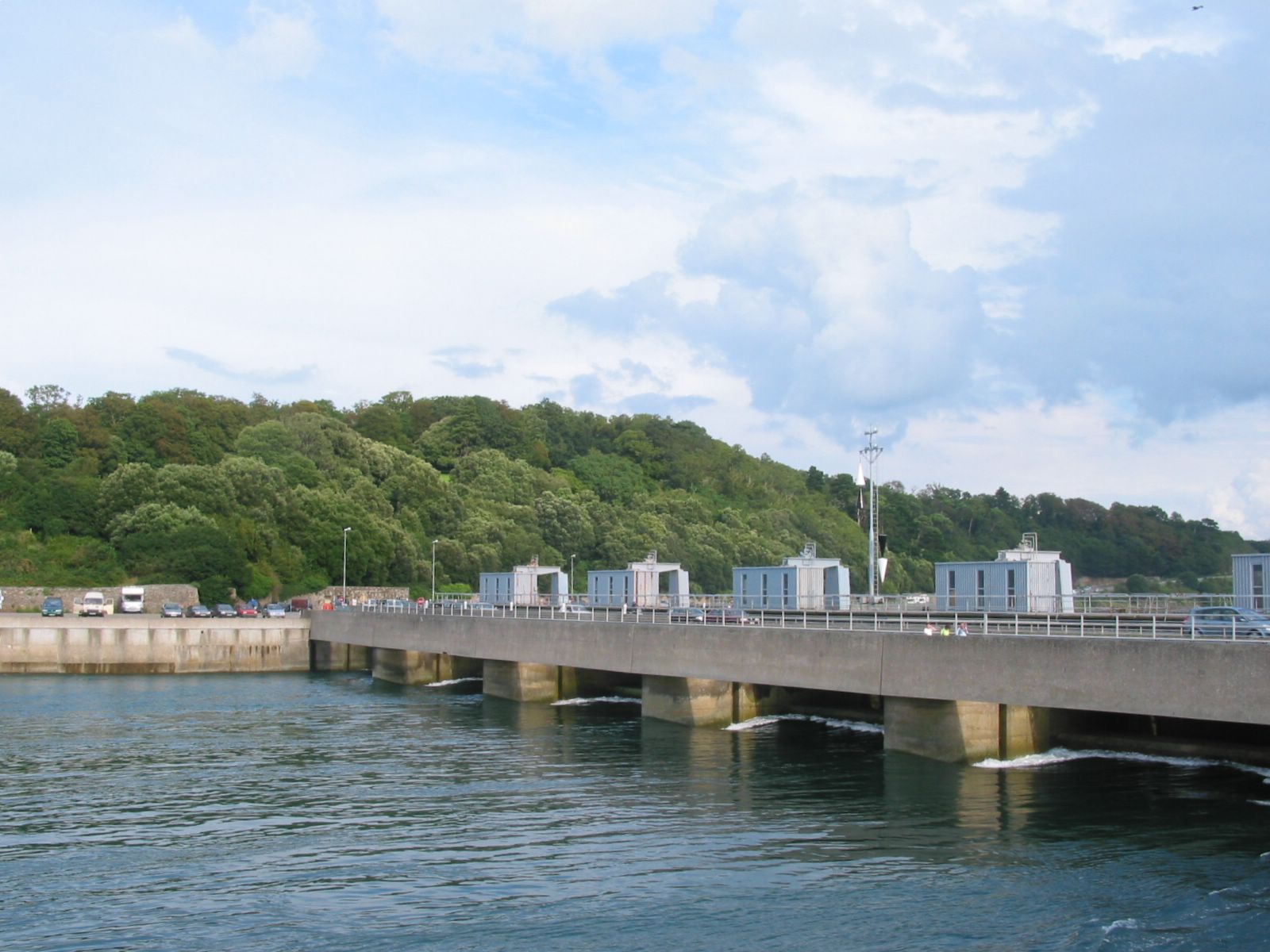
List of tidal power stations

This article lists most power stations that run on tidal power; both tidal range (impoundment via a barrage) and tidal stream (harnessing currents). Since...

Eday Airport

Eday London Airport (IATA: EOI, ICAO: EGED) is located on Eday in Orkney, Scotland. As it is close to the Bay of London it is known locally as just London...
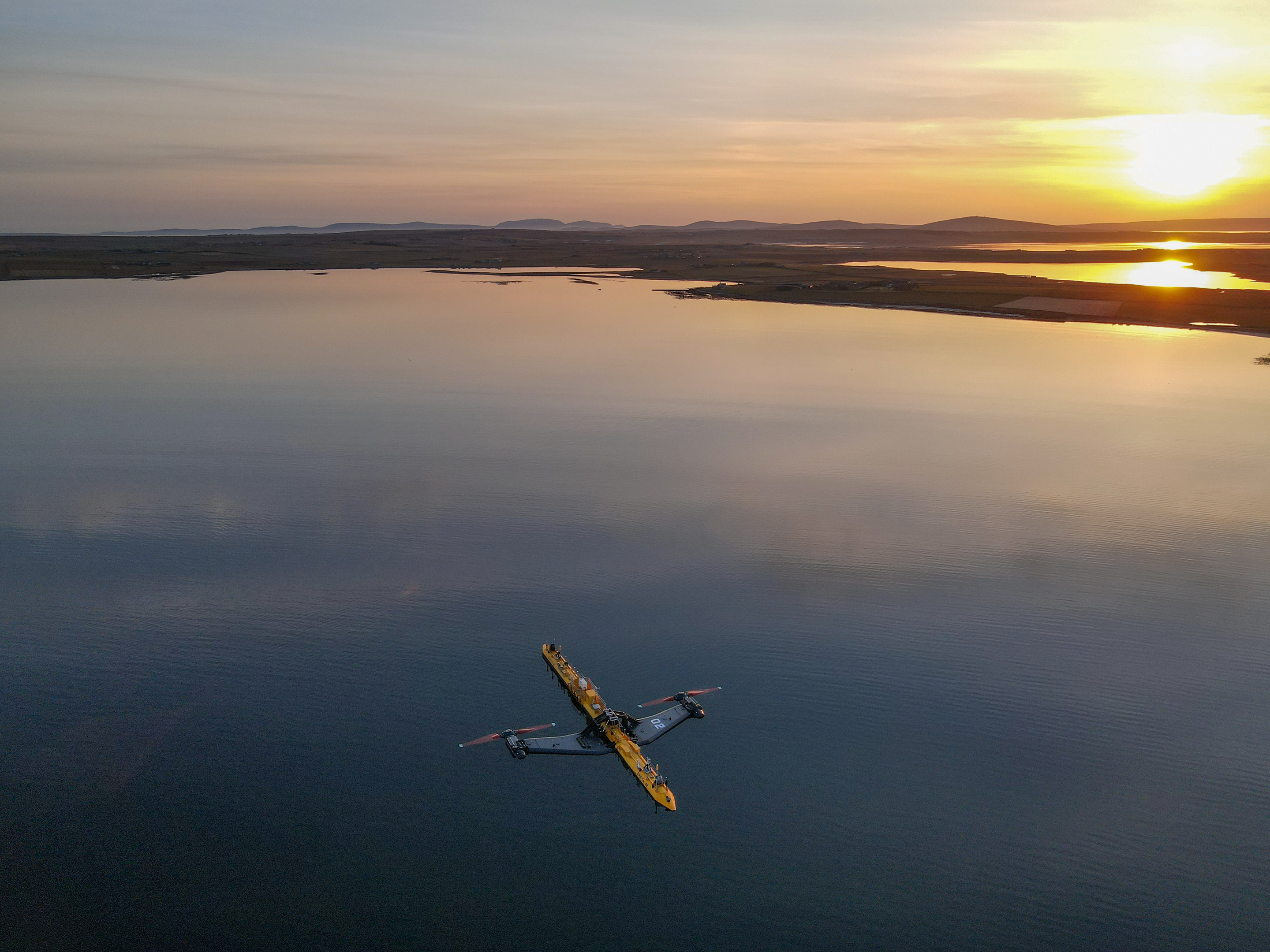
Orbital O2

Orbital Marine Power (formerly Scotrenewables Tidal Power Ltd) is a Scottish renewable energy company focused on the development and global deployment...
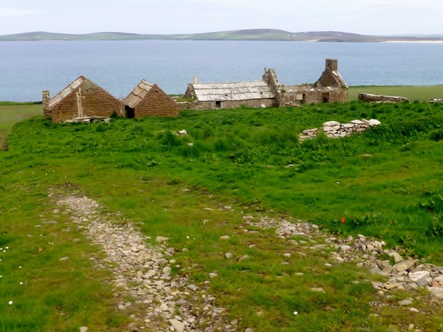
Backaland

Backaland is a settlement on the island of Eday in Orkney, Scotland. The settlement is also within the parish of Eday, and it is located to the south west...

Rusk Holm

Rusk Holm is a small island in the Orkney Islands, near Faray to the west. == History == There is a prehistoric cairn on it . Rusk Holm is also home to...

Faray

Faray (Old Norse: Færey) is a small island in Orkney, Scotland, lying between Eday and Westray. Previously inhabited, the low-lying island is now a successful...

Muckle Green Holm

Muckle Green Holm is an uninhabited island in the North Isles of the Orkney archipelago in Scotland. It is roughly 28 hectares (0.11 sq mi) in extent and...

Nearby Amenities

Located within 500m of 59.174744,-2.8195491
Sealskerry Bay (Selchskery)
Natural: bay
Lat/Long: 59.171191/-2.8181171
West Side
Place: locality
Lat/Long: 59.1786224/-2.8193867
Natural: cave_entrance
Lat/Long: 59.1721176/-2.8239349
Power: pole
Lat/Long: 59.1720402/-2.8126491
Power: pole
Lat/Long: 59.1726016/-2.8136389
Power: pole
Lat/Long: 59.1734145/-2.8151144
Power: pole
Lat/Long: 59.1741327/-2.8164156
Power: pole
Lat/Long: 59.1748563/-2.8177248
Power: pole
Lat/Long: 59.1756312/-2.8191052
Power: pole
Lat/Long: 59.1764792/-2.8194827
Power: pole
Lat/Long: 59.1780494/-2.8201848
Power: pole
Lat/Long: 59.1788513/-2.8205332
The data included in this document is from www.openstreetmap.org. The data is made available under ODbL.

Have you been to Sealskerry Loch?

Leave your review of Sealskerry Loch below (or comments, questions and feedback).