Lammerloch Reservoir

Lake, Pool, Pond, Freshwater Marsh in East Lothian

Scotland

Lammerloch Reservoir

High up on the Moor The view east from near the summit of Lammer Law. In the distance some of the many wind turbines of Crystal Rig windfarm can be seen. Along with the Fallago Rig windfarm (not seen here) there are probably upwards of 100 turbines seen from Lammer Law summit.
Another 17 turbines are going to be built on the ground between the turbines and my position, at Newlands Hill with the tallest being 200m at the tips.:-
<span class="nowrap"><a title="https://www.newlandshillwindenergyhub.com/" rel="nofollow ugc noopener" href="https://www.newlandshillwindenergyhub.com/">Link</a><img style="margin-left:2px;" alt="External link" title="External link - shift click to open in new window" src="https://s1.geograph.org.uk/img/external.png" width="10" height="10"/></span>
High up on the Moor Credit: Adam Ward

Lammerloch Reservoir is a freshwater body located in East Lothian, Scotland. Situated amidst picturesque surroundings, this reservoir is a popular destination for nature enthusiasts and outdoor enthusiasts alike.

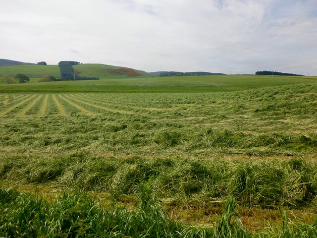
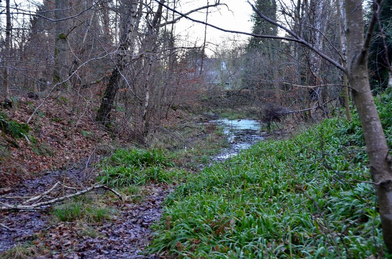
Covering an area of approximately 10 hectares, Lammerloch Reservoir is classified as a lake due to its size and depth. It serves as a vital water source for the local community and plays a crucial role in maintaining the ecological balance of the region. The reservoir is fed by various streams and natural springs, ensuring a constant flow of fresh water.

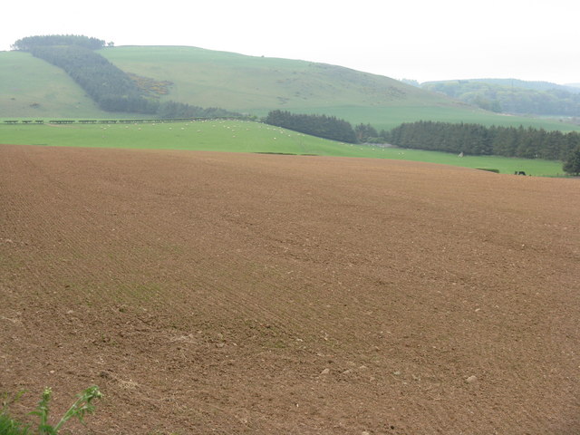
The reservoir is home to a diverse range of flora and fauna. The surrounding area is characterized by lush greenery and is a haven for birdwatchers, with numerous species of waterfowl and migratory birds frequenting the area. Some of the commonly spotted birds include ducks, herons, and swans.

Lammerloch Reservoir also provides a habitat for several fish species, making it a popular spot for fishing enthusiasts. Common fish species found in the reservoir include trout, perch, and pike. Fishing permits can be obtained from the local authorities to ensure sustainable practices are followed.

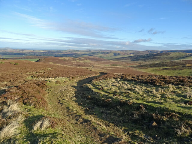
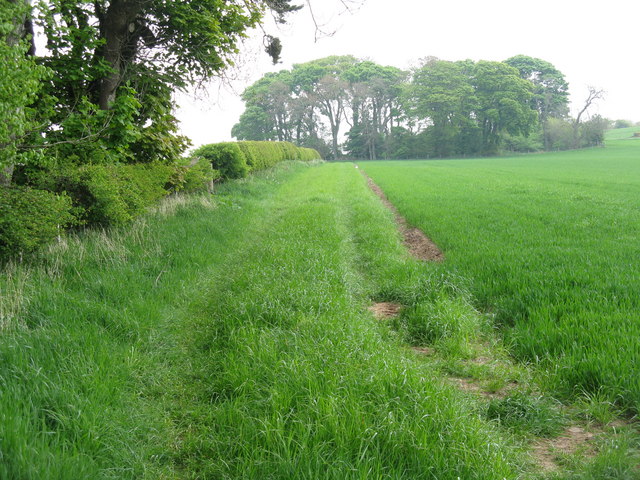
The reservoir is also a great place for recreational activities such as walking, picnicking, and photography. There are well-maintained paths and picnic areas around the reservoir, allowing visitors to enjoy the scenic beauty of the surroundings.

Overall, Lammerloch Reservoir is a tranquil and scenic freshwater body that offers a range of recreational opportunities while serving as an important ecological resource for the local community.

If you have any feedback on the listing, please let us know in the comments section below.

Lammerloch Reservoir Images

Images are sourced within 2km of 55.861834/-2.7792527 or Grid Reference NT5163. Thanks to Geograph Open Source API. All images are credited.

High up on the Moor The view east from near the summit of Lammer Law. In the distance some of the many wind turbines of Crystal Rig windfarm can be seen. Along with the Fallago Rig windfarm (not seen here) there are probably upwards of 100 turbines seen from Lammer Law summit.
Another 17 turbines are going to be built on the ground between the turbines and my position, at Newlands Hill with the tallest being 200m at the tips.:-
<span class="nowrap"><a title="https://www.newlandshillwindenergyhub.com/" rel="nofollow ugc noopener" href="https://www.newlandshillwindenergyhub.com/">Link</a><img style="margin-left:2px;" alt="External link" title="External link - shift click to open in new window" src="https://s1.geograph.org.uk/img/external.png" width="10" height="10"/></span>
High up on the Moor
The view east from near the summit of Lammer Law. In the distance some of the many wind turbines of Crystal Rig windfarm can be seen. Along with the Fallago Rig windfarm (not seen here) there are probably upwards of 100 turbines seen from Lammer Law summit. Another 17 turbines are going to be built on the ground between the turbines and my position, at Newlands Hill with the tallest being 200m at the tips.:- LinkExternal link
Track Bend, Lammermuirs A rough path coming directly from Lammer Law summit joins the track at this bend. Looking northeast to the countryside south of Gifford.
Track Bend, Lammermuirs
A rough path coming directly from Lammer Law summit joins the track at this bend. Looking northeast to the countryside south of Gifford.
Benign Winter Lammermuirs This track traverses the Lammermuirs from Blinkbonny near Gifford to Carfraemill at the A68/A69 junction, becoming a surfaced road from Tollishill. Very different conditions to Richard's picture in 2021 taken from almost the same location at the same time of year - you can just see the snow covered gorse:-
<a title="https://www.geograph.org.uk/photo/6739558" href="https://www.geograph.org.uk/photo/6739558">Link</a>
Benign Winter Lammermuirs
This track traverses the Lammermuirs from Blinkbonny near Gifford to Carfraemill at the A68/A69 junction, becoming a surfaced road from Tollishill. Very different conditions to Richard's picture in 2021 taken from almost the same location at the same time of year - you can just see the snow covered gorse:- Link
Mown grass, Leehouses
Stobshiel Mains Lovely detail in the Stobshiel Mains farm sign on the public road nearby.
Stobshiel Mains
Lovely detail in the Stobshiel Mains farm sign on the public road nearby.
Farmland at Aikeyside
Aikeyside farm Looking south, with Aikeyside Hill and Ker Law in the distance.
Aikeyside farm
Looking south, with Aikeyside Hill and Ker Law in the distance.
Field headland, hedge and group of trees Looking east from near Aikeyside.
Field headland, hedge and group of trees
Looking east from near Aikeyside.
Path leading to the Summit of Lammer Law The large summit cairn can be seen in the distance.
Path leading to the Summit of Lammer Law
The large summit cairn can be seen in the distance.
Lammer Law Trig Point and Cairn Not quite the highest point of the Lammermuir Hills, that distinction belongs to Meikle Says Law (8 metres higher). However it is certainly the best known summit in the Lammermuir Hills.
Lammer Law Trig Point and Cairn
Not quite the highest point of the Lammermuir Hills, that distinction belongs to Meikle Says Law (8 metres higher). However it is certainly the best known summit in the Lammermuir Hills.
Fingerpost,  Kidlaw A freshly painted East Lothian County Council fingerpost at the foot of the Lammermuir Hills.
Fingerpost, Kidlaw
A freshly painted East Lothian County Council fingerpost at the foot of the Lammermuir Hills.
Fingerpost,  Kidlaw Freshly painted
Fingerpost, Kidlaw
Freshly painted
Rural East Lothian : Skedbush Road-end (South)
East Lothian Landscape : The Junction Tree
Rural East Lothian : Terrace Of Houses, Long Newton
Rural East Lothian : Main Street, Long Newton
Rural East Lothian : Long Newton Farm
East Lothian Farm Signs : Long Newton Look at the cow's head. That snout looks more like a dog!
East Lothian Farm Signs : Long Newton
Look at the cow's head. That snout looks more like a dog!
Show me another place!

Lammerloch Reservoir is located at Grid Ref: NT5163 (Lat: 55.861834, Lng: -2.7792527)

Unitary Authority: East Lothian

Police Authority: The Lothians and Scottish Borders

What 3 Words

///congested.wonderfully.horns. Near Pencaitland, East Lothian

Related Wikis

Humbie railway station

Humbie railway station served the civil parish of Humbie, East Lothian, Scotland, from 1901 to 1933 on the Macmerry Branch. == History == The station was...

Hopes Reservoir

Hopes Reservoir is a small reservoir in East Lothian, Scotland, in the Lammermuir Hills. It is located in the parish of Yester, 6 km (3.7 mi) south of...

Lammermuir Hills

The Lammermuirs are a range of hills in southern Scotland, forming a natural boundary between East Lothian and the Borders. The name "Lammermuir" comes...

Yester House

Yester House is an early 18th-century mansion near Gifford in East Lothian, Scotland. It was the home of the Hay family, later Marquesses of Tweeddale...

Yester Chapel

Yester Chapel is situated on the estate of Yester House, at the south-east edge of the village of Gifford in East Lothian, Scotland. The chapel is situated...

Gifford Town Hall

Gifford Town Hall is a municipal building in The Square, Gifford, East Lothian, Scotland. The structure, which is used as a community events venue, is...

Gifford, East Lothian

Gifford is a village in the parish of Yester in East Lothian, Scotland. It lies approximately 4 miles (6.4 km) south of Haddington and 25 miles (40 km...

Gifford railway station

Gifford railway station served the village of Gifford, East Lothian, Scotland, from 1901 to 1933 on the Macmerry Branch. == History == The station was...

Nearby Amenities

Located within 500m of 55.861834,-2.7792527
The data included in this document is from www.openstreetmap.org. The data is made available under ODbL.

Have you been to Lammerloch Reservoir?

Leave your review of Lammerloch Reservoir below (or comments, questions and feedback).