Brimble Pit Pool

Lake, Pool, Pond, Freshwater Marsh in Somerset Mendip

England

Brimble Pit Pool

Direction Sign - Signpost on Plummer's Lane near Priddy Located on the northwest side of the crossroads on the B3135 Plummer's Lane northwest of the village. Priddy parish. 4 arms and pyramid finial. The fingerpost was restored by Mendip Hills AONB Fund about 2005. See also <a title="https://www.geograph.org.uk/photo/4148499" href="https://www.geograph.org.uk/photo/4148499">Link</a>.

Milestone Society National ID: SO_ST5151
Direction Sign - Signpost on Plummer's Lane near Priddy Credit: N Gillett

Brimble Pit Pool, located in Somerset, England, is a picturesque freshwater marsh that offers a serene and tranquil retreat for nature enthusiasts. This beautiful pool, also known as a lake or pond, covers an area of approximately 2 hectares and is nestled amidst rolling hills and verdant landscapes.

The pool is surrounded by lush vegetation, including reeds, grasses, and water lilies, creating a vibrant and diverse ecosystem. It is home to a wide range of aquatic plants and animals, making it a haven for wildlife enthusiasts and birdwatchers. The tranquil waters of Brimble Pit Pool provide a perfect habitat for various species of ducks, geese, and swans, which can often be spotted gracefully gliding across the surface.

The pool itself is fed by a natural spring, ensuring a constant supply of fresh, clean water throughout the year. The water is crystal clear, allowing visitors to observe the diverse underwater flora and fauna. Fishing is also a popular activity at Brimble Pit Pool, as it is home to a variety of fish species, including carp, roach, and perch.

Visitors to Brimble Pit Pool can enjoy a leisurely stroll along the well-maintained pathways that surround the pool, offering breathtaking views of the surrounding countryside. The pool is easily accessible and is a popular destination for both locals and tourists seeking a peaceful escape from the hustle and bustle of everyday life.

Overall, Brimble Pit Pool in Somerset is a true gem, offering a serene and idyllic setting for nature lovers to relax and reconnect with the natural world. Its diverse ecosystem, abundant wildlife, and stunning scenery make it a must-visit destination for anyone seeking a tranquil and immersive nature experience.

If you have any feedback on the listing, please let us know in the comments section below.

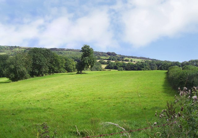
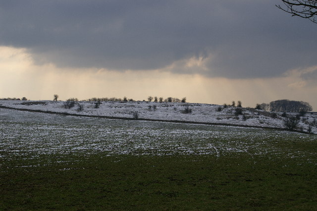
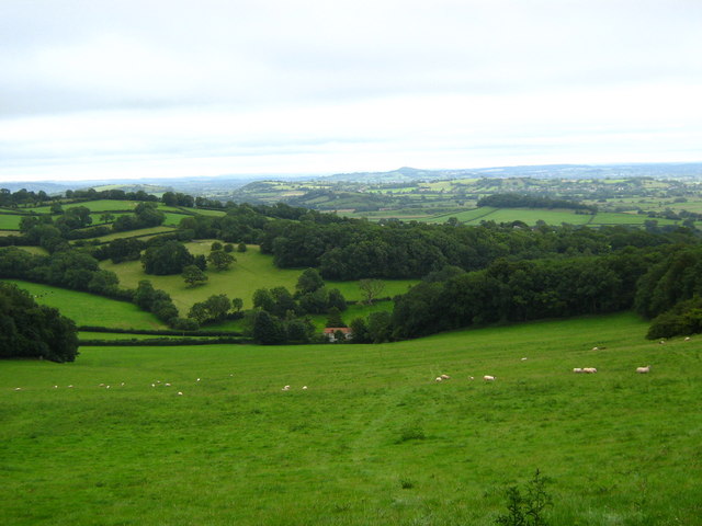
Brimble Pit Pool Images

Images are sourced within 2km of 51.254395/-2.7061435 or Grid Reference ST5050. Thanks to Geograph Open Source API. All images are credited.

Direction Sign - Signpost on Plummer's Lane near Priddy Located on the northwest side of the crossroads on the B3135 Plummer's Lane northwest of the village. Priddy parish. 4 arms and pyramid finial. The fingerpost was restored by Mendip Hills AONB Fund about 2005. See also <a title="https://www.geograph.org.uk/photo/4148499" href="https://www.geograph.org.uk/photo/4148499">Link</a>.

Milestone Society National ID: SO_ST5151
Direction Sign - Signpost on Plummer's Lane near Priddy
Located on the northwest side of the crossroads on the B3135 Plummer's Lane northwest of the village. Priddy parish. 4 arms and pyramid finial. The fingerpost was restored by Mendip Hills AONB Fund about 2005. See also Link. Milestone Society National ID: SO_ST5151
Direction sign - Signpost on Wells Road, Pincross Located on a grass triangle in the centre of the junction of Wells Road and Pelting Drove at Pincross. Priddy parish. 3 arms and pyramid finial. The fingerpost was restored by Mendip Hills AONB Fund about 2005. See also <a title="https://www.geograph.org.uk/photo/4906947" href="https://www.geograph.org.uk/photo/4906947">Link</a> , <a title="https://www.geograph.org.uk/photo/5894928" href="https://www.geograph.org.uk/photo/5894928">Link</a> and <a title="https://www.geograph.org.uk/photo/6041183" href="https://www.geograph.org.uk/photo/6041183">Link</a>.

Milestone Society National ID: SO_ST5250
Direction sign - Signpost on Wells Road, Pincross
Located on a grass triangle in the centre of the junction of Wells Road and Pelting Drove at Pincross. Priddy parish. 3 arms and pyramid finial. The fingerpost was restored by Mendip Hills AONB Fund about 2005. See also Link , Link and Link. Milestone Society National ID: SO_ST5250
Priddy : Plummer's Lane B3135 Looking along Plummer's Lane.
Priddy : Plummer's Lane B3135
Looking along Plummer's Lane.
Mendip Edge Scenery On the south west slope of the Mendip Hills near Rodney Stoke.
Mendip Edge Scenery
On the south west slope of the Mendip Hills near Rodney Stoke.
Gunge tank, Broadway Hill Taken from close to the same spot as <a href="https://www.geograph.org.uk/photo/1879227">ST4949 : On Broadway Hill</a>, this is reminiscent of the "Poets Cornered" tub of gunk that Peter Cook, Dudley Moore and guest inevitably ended up in, in "Not Only ... But Also". Nevertheless, an important source of liquid for livestock on what is going to be a very hot weekend, and positioned so that animals in adjoining fields can enjoy a chat with their bevvy. Below is The Hollow, leading into Westbury-Sub-Mendip.
Gunge tank, Broadway Hill
Taken from close to the same spot as ST4949 : On Broadway Hill, this is reminiscent of the "Poets Cornered" tub of gunk that Peter Cook, Dudley Moore and guest inevitably ended up in, in "Not Only ... But Also". Nevertheless, an important source of liquid for livestock on what is going to be a very hot weekend, and positioned so that animals in adjoining fields can enjoy a chat with their bevvy. Below is The Hollow, leading into Westbury-Sub-Mendip.
On Broadway Hill Footpath WS 13/17 descends along a track, crossing into <a href="https://www.geograph.org.uk/gridref/ST5049">ST5049</a> on its way to Old Ditch.
On Broadway Hill
Footpath WS 13/17 descends along a track, crossing into ST5049 on its way to Old Ditch.
Tractor on Broadway Lane Not actually blocking footpath WS 13/17, as might appear, as the lane widens here. In the background is Old Ditch Farmhouse on Lynch Lane.
Tractor on Broadway Lane
Not actually blocking footpath WS 13/17, as might appear, as the lane widens here. In the background is Old Ditch Farmhouse on Lynch Lane.
Old Ditch Farmhouse The farmhouse may be originally C17 <span class="nowrap"><a title="http://webapp1.somerset.gov.uk/her/details.asp?prn=21993" rel="nofollow ugc noopener" href="http://webapp1.somerset.gov.uk/her/details.asp?prn=21993">Link</a><img style="margin-left:2px;" alt="External link" title="External link - shift click to open in new window" src="https://s1.geograph.org.uk/img/external.png" width="10" height="10"/></span> . On the immediate right is the farm cottage. Seen from Broadway Lane.
Old Ditch Farmhouse
The farmhouse may be originally C17 LinkExternal link . On the immediate right is the farm cottage. Seen from Broadway Lane.
Old Ditch Farm Another view of <a href="https://www.geograph.org.uk/photo/1879669">ST4949 : Old Ditch Farmhouse</a>, surrounded by its farm buildings <span class="nowrap"><a title="http://webapp1.somerset.gov.uk/her/details.asp?prn=21993" rel="nofollow ugc noopener" href="http://webapp1.somerset.gov.uk/her/details.asp?prn=21993">Link</a><img style="margin-left:2px;" alt="External link" title="External link - shift click to open in new window" src="https://s1.geograph.org.uk/img/external.png" width="10" height="10"/></span> . Behind are the slopes of the Mendips.
Old Ditch Farm
Another view of ST4949 : Old Ditch Farmhouse, surrounded by its farm buildings LinkExternal link . Behind are the slopes of the Mendips.
Priddy church
Priddy church
Above Westbury-sub-Mendip, Somerset Looking down upon the Somerset Levels, from the Mendip southern escarpment. There is a quarry just to the left (limestone?).
Above Westbury-sub-Mendip, Somerset
Looking down upon the Somerset Levels, from the Mendip southern escarpment. There is a quarry just to the left (limestone?).
Sheep hurdles at Priddy, Mendip Hills, Somerset The notice on the side of the stack reads as follows (typographical error faithfully reproduced!).
"These hurdles are a symbolic reconstruction of the collection which were stored here to form the pens for the sheep fair which moved from Wells to Priddy in 1348 at the outbreak of the Black Death.
The fair is now held annually on the nearest Wednesday to the original date of 21th August."
Sheep hurdles at Priddy, Mendip Hills, Somerset
The notice on the side of the stack reads as follows (typographical error faithfully reproduced!). "These hurdles are a symbolic reconstruction of the collection which were stored here to form the pens for the sheep fair which moved from Wells to Priddy in 1348 at the outbreak of the Black Death. The fair is now held annually on the nearest Wednesday to the original date of 21th August."
Releasing homing pigeons near Priddy
Mendip Quarry Weighbridge and Quarry above Westbury Sub Mendip. The Mendips have loads of quarries, particularly at the (sacrificial) eastern end.
Mendip Quarry
Weighbridge and Quarry above Westbury Sub Mendip. The Mendips have loads of quarries, particularly at the (sacrificial) eastern end.
Tumuli on the Mendips on a snowy day
Tumuli Tumuli on the Mendip Hills
Tumuli
Tumuli on the Mendip Hills
Remains of a barn The remains of the building marked on the 1:50000 OS map, possibly a barn, sits in a field in the Mendips currently grazed by cows.
Remains of a barn
The remains of the building marked on the 1:50000 OS map, possibly a barn, sits in a field in the Mendips currently grazed by cows.
Old whitewashed cottage at Priddy This stone extension blends in well with the old cottage on the edge of Priddy Green.
Old whitewashed cottage at Priddy
This stone extension blends in well with the old cottage on the edge of Priddy Green.
Show me another place!

Brimble Pit Pool is located at Grid Ref: ST5050 (Lat: 51.254395, Lng: -2.7061435)

Administrative County: Somerset

District: Mendip

Police Authority: Avon and Somerset

What 3 Words

///sandpaper.joyously.corrode. Near Draycott, Somerset

Nearby Locations

Brimble Pit Pool

Related Wikis

Brimble Pit and Cross Swallet Basins

Brimble Pit and Cross Swallet Basins (grid reference ST512505) is a 154.3 hectare (381.3 acre) geological Site of Special Scientific Interest between Wookey...

Westbury Camp

Westbury Camp is a univallate Iron Age hill fort in the Mendip Hills in Somerset, England. The hill fort is situated in the parish of Rodney Stoke, approximately...

Rodney Stoke SSSI

Rodney Stoke (grid reference ST492507) is a 69.6 hectare (172.0 acre) biological Site of Special Scientific Interest, just north of the village of Rodney...

Priddy

Priddy is a village in Somerset, England in the Mendip Hills, close to East Harptree and 4 miles (6 km) north-west of Wells. It is in the local government...

Nearby Amenities

Located within 500m of 51.254395,-2.7061435
Barrier: stile
Material: wood
Source: survey;gps
Stile: stepover
Lat/Long: 51.2581197/-2.7060829
The data included in this document is from www.openstreetmap.org. The data is made available under ODbL.

Have you been to Brimble Pit Pool?

Leave your review of Brimble Pit Pool below (or comments, questions and feedback).